
Gifford Pinchot National Forest is a National Forest located in southern Washington, managed by the United States Forest Service. With an area of 1.32 million acres (5300 km2), it extends 116 km (72 mi) along the western slopes of Cascade Range from Mount Rainier National Park to the Columbia River. The forest straddles the crest of the South Cascades of Washington State, spread out over broad, old growth forests, high mountain meadows, several glaciers, and numerous volcanic peaks. The forest's highest point is at 12,276 ft (3,742 m) at the top of Mount Adams, the second tallest volcano in the state after Rainier. Often found abbreviated GPNF on maps and in texts, it includes the 110,000-acre (450 km2) Mount St. Helens National Volcanic Monument, established by Congress in 1982.

The George Washington and Jefferson National Forests is an administrative entity combining two U.S. National Forests into one of the largest areas of public land in the Eastern United States. The forests cover 1.8 million acres (2,800 sq mi) of land in the Appalachian Mountains of Virginia, West Virginia, and Kentucky. Approximately 1 million acres (1,600 sq mi) of the forest are remote and undeveloped and 139,461 acres (218 sq mi) have been designated as wilderness areas, which prohibits future development.

The Mount Hood National Forest is a U.S. National Forest in the U.S. state of Oregon, located 62 miles (100 km) east of the city of Portland and the northern Willamette River valley. The Forest extends south from the Columbia River Gorge across more than 60 miles (97 km) of forested mountains, lakes and streams to the Olallie Scenic Area, a high lake basin under the slopes of Mount Jefferson. The Forest includes and is named after Mount Hood, a stratovolcano and the highest mountain in the state.

The Shawnee National Forest is a United States National Forest located in the Ozark and Shawnee Hills of Southern Illinois, United States. Administered by the U.S.D.A. Forest Service, it consists of approximately 289,000 acres (1,100 km²) of federally managed lands. In descending order of land area it is located in parts of Pope, Jackson, Union, Hardin, Alexander, Saline, Gallatin, Johnson, and Massac counties. Forest headquarters are located in Harrisburg, Illinois. There are local ranger district offices in Jonesboro and Vienna. The Shawnee National Forest is also the single largest publicly owned body of land in the state of Illinois. It is considered part of Southern Illinois, and is south of the St. Louis, Missouri, and Metro East areas, in area code 618. Portions of it are in the far south area of Illinois known as Little Egypt. Cities in or near the area are Carbondale, Illinois, Marion, Illinois, and Cairo, Illinois.

Mark Twain National Forest (MTNF) is a U.S. National Forest located in the southern half of Missouri, composed of nine disconnected parcels. MTNF was established on September 11, 1939. It is named for author Mark Twain, a Missouri native. The MTNF covers 3,068,800 acres (12,419 km2) of which 1,506,100 acres (6,095 km2) is public owned, 78,000 acres (320 km2) of which are Wilderness, and National Scenic River area. MTNF spans 29 counties and represents 11% of all forested land in Missouri. MTNF's nine tracts are divided into six distinct ranger districts: Ava-Cassville-Willow Springs, Eleven Point, Houston-Rolla, Cedar Creek, Poplar Bluff, Potosi-Fredericktown, and the Salem. Its headquarters are in Rolla, Missouri.

The Gila National Forest is a United States National Forest in New Mexico. Established in 1905, it now covers approximately 2,710,659 acres (10,969.65 km2), making it the sixth largest National Forest in the continental United States. The Forest administration also manage the part of the Apache National Forest in New Mexico which covers 614,202 acres for a total of 3.3 million acres managed by the Gila National Forest. Within the forest, the Gila Wilderness was established in 1924 as the US's first designated wilderness. The Aldo Leopold Wilderness and Blue Range Wilderness are also found within its borders. The Blue Range Primitive Area lies within Arizona in the neighboring Apache National Forest.
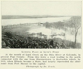
Lusk's Ferry was a place where pioneers crossed the Ohio River from Kentucky into Illinois. Some sources say that Golconda, Illinois was once called "Lusk's Ferry". Others say that the name properly refers to the place across the River, in Livingston County, Kentucky.
Lusk Creek is a creek located in southeastern Illinois. It is a tributary of the Ohio River, which it joins at Golconda.

Lusk Creek Canyon is the name of a 906 acres (367 ha) canyon located within the Lusk Creek Wilderness Area of the Shawnee National Forest in Pope County, Illinois. The area is a large gorge formed by the erosion of Pennsylvanian sandstone around a large horseshoe bend in the creek. It contains plants such as fan leafed clubmoss, cinnamon fern, royal fern as well as ten endangered or threatened plant species. It was designated a National Natural Landmark in 1980.

According to the California Protected Areas Database (CPAD), in the state of California, United States, there are over 14,000 inventoried protected areas administered by public agencies and non-profits. In addition, there are private conservation areas and other easements. They include almost one-third of California's scenic coastline, including coastal wetlands, estuaries, beaches, and dune systems. The California State Parks system alone has 270 units and covers 1.3 million acres (5,300 km2), with over 280 miles (450 km) of coastline, 625 miles (1,006 km) of lake and river frontage, nearly 18,000 campsites, and 3,000 miles (5,000 km) of hiking, biking, and equestrian trails.
Clear Creek is a southern Illinois watercourse that rises in Jackson County and Union County, and discharges into the Mississippi River in Alexander County.
The Bald Knob Wilderness is a 5,973-acre (24.2 km²) parcel of land listed as a Wilderness Area of the United States. It is, by acreage, the second largest wilderness area located within the U.S. state of Illinois. It is located within the Shawnee National Forest in northwestern Union County, Illinois.

The Clear Springs Wilderness is a 4,730-acre (19.1 km2) parcel of land listed as a Wilderness Area of the United States. Adjacent to it is the LaRue-Pine Hills Research Natural Area, a National Natural Landmark noted for a large and diverse population of snakes.

The Panther Den Wilderness is a 1,195-acre (4.84 km2) parcel of land listed as a Wilderness Area of the United States. It is located within the Shawnee National Forest in Union County in the U.S. state of Illinois. Panther Den Wilderness is the smallest of eight Wilderness areas in Illinois. The other seven are Bald Knob Wilderness, Bay Creek Wilderness, Burden Falls Wilderness, Clear Springs Wilderness, Crab Orchard Wilderness, Garden of the Gods, and Lusk Creek Wilderness. All Illinois Wilderness areas are located in Southern Illinois.
The Bay Creek Wilderness is a 2,866-acre (11.60 km2) parcel of land listed as a Wilderness Area of the United States. It is located within the Shawnee National Forest in Pope County, Illinois. The nearest town of any size is Eddyville.

The Garden of the Gods Wilderness is a 3,318-acre (13.43 km2) parcel of land listed as a Wilderness Area of the United States. It is located within the Shawnee National Forest in Hardin, Pope, Saline, and Gallatin counties in the U.S. state of Illinois. The nearest town of any size is Equality.
The Crab Orchard Wilderness is a 4,050-acre (16.4 km2) parcel of land listed as a Wilderness Area of the United States. It is located within the Crab Orchard National Wildlife Refuge in Williamson, Union, and Jackson counties in Illinois.
The River to River Trail is a 160 mile (256 km)-long hiking trail that serves Shawnee National Forest in far southern Illinois. The trail is used by both equestrians and hikers. About half is on off-road trails. Its eastern terminus has historically been Battery Rock, overlooking the Ohio River but now generally Elizabethtown, Illinois is used as the eastern terminus. The western terminus is in Grand Tower, Illinois, at the Mississippi River. Sections of the River to River Trail form part of the Southern Section of the American Discovery Trail.
One Horse Gap is a forest preserve managed by the United States Forest Service, located in the Shawnee National Forest outside Herod, Illinois. It contains a short loop trail named "the gap trail," a narrow section in the bluffs that is only wide enough for one horse to pass through at a time. The trail provides access to Big Grand Pierre Creek, One Horse Gap Lake, War Bluff, and the River to River Trail.
