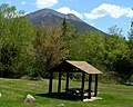
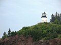
This list includes 35 state parks, public reserved lands, and state historic sites in the U.S. state of Maine. They are operated by the Maine Department of Conservation, with the exceptions of Baxter State Park, which is operated by the Baxter State Park Authority, and Peacock Beach, which is under local management.
Name | County | Town | Area [1] | Estab- lished | River / lake / other | Image | Remarks | |
---|---|---|---|---|---|---|---|---|
acres | ha | |||||||
Bald Mountain | Franklin | 1,873 | 758 | |||||
Bigelow Preserve | Franklin, Somerset | 35,000 | 14,000 | |||||
Bradley | Penobscot | 9,113 | 3,688 | |||||
Chains of Ponds | Franklin | 1,119 | 453 | |||||
Chamberlain Lake | Piscataquis | 10,290 | 4,160 | |||||
Cutler Coast | Washington | 12,238 | 4,953 | |||||
Day's Academy | Piscataquis | 7,309 | 2,958 | |||||
Dead River | Somerset | 7,031 | 2,845 | |||||
Deboullie | Aroostook | 21,871 | 8,851 | |||||
Dodge Point | Lincoln | 548 | 222 | |||||
Donnell Pond | Hancock | 15,391 | 6,229 | |||||
Duck Lake | Hancock, Washington | 25,220 | 10,210 | |||||
Eagle Lake | Aroostook | 24,416 | 9,881 | |||||
Four Ponds | Franklin | 6,018 | 2,435 | |||||
Gero Island | Piscataquis | 4,051 | 1,639 | |||||
Great Heath | Washington | 6,207 | 2,512 | |||||
Holeb | Somerset | 20,155 | 8,156 | |||||
Kennebec Highlands | Franklin, Kennebec | 6,076 | 2,459 | |||||
Little Moose | Piscataquis | 15,055 | 6,093 | |||||
Machias River Corridor | Washington | 10,026 | 4,057 | |||||
Mahoosuc | Oxford | 31,807 | 12,872 | |||||
Moosehead Lake | Piscataquis | 14,500 | 5,900 | ![]() | ||||
Mount Abram | Franklin | 6,214 | 2,515 | |||||
Nahmakanta | Piscataquis | 43,966 | 17,792 | |||||
Pineland | Cumberland | 646 | 261 | |||||
Richardson | Oxford | 22,728 | 9,198 | |||||
Rocky Lake | Washington | 11,150 | 4,510 | |||||
Round Pond | Aroostook | 20,349 | 8,235 | |||||
Salmon Brook Lake Bog | Aroostook | 1,857 | 752 | |||||
Scraggly Lake | Penobscot | 9,092 | 3,679 | |||||
Scopan | Aroostook | 20,135 | 8,148 | |||||
Seboeis Unit | Penobscot, Piscataquis | 21,369 | 8,648 | |||||
Seboomook | Somerset | 41,500 | 16,800 | |||||
Telos | Aroostook | 22,962 | 9,292 | |||||
Tumbledown | Franklin | 10,555 | 4,271 | ![]() | ||||
Wassataquoik | Penobscot | 2,099 | 849 |
The protected areas of the United States are managed by an array of different federal, state, tribal and local level authorities and receive widely varying levels of protection. Some areas are managed as wilderness, while others are operated with acceptable commercial exploitation. As of 2020, the 36,283 protected areas covered 1,118,917 km2 (432,016 sq mi), or 12 percent of the land area of the United States. This is also one-tenth of the protected land area of the world. The U.S. also had a total of 787 National Marine Protected Areas, covering an additional 3,210,908 km2 (1,239,739 sq mi), or 37 percent of the total marine area of the United States.
The New York State Office of Parks, Recreation and Historic Preservation (NYS OPRHP) is a state agency within the New York State Executive Department charged with the operation of state parks and historic sites within the U.S. state of New York. As of 2014, the NYS OPRHP manages nearly 335,000 acres of public lands and facilities, including 180 state parks and 35 historic sites, that are visited by over 62 million visitors each year.
Baxter State Park is a large wilderness area permanently preserved as a state park in Northeast Piscataquis, Piscataquis County in north-central Maine, United States. It is in the North Maine Woods region and borders the Katahdin Woods and Waters National Monument on the east.
Mount Blue State Park is a public recreation area covering 7,489 acres (3,031 ha) in the town of Weld, Franklin County, Maine. The state park's bifurcated land includes acreage on the west shore of Webb Lake as well as Mount Blue and other peaks to the east of the lake. The park is connected by road with the 10,555-acre (4,271 ha) Tumbledown Public Lands, the site of Little Jackson Mountain, Tumbledown Mountain, and Tumbledown Pond, an alpine lake near the top of Tumbledown and Little Jackson mountains. The park and public lands are managed by the Maine Department of Agriculture, Conservation and Forestry.
The New York State Department of Environmental Conservation is a department of New York state government. The department guides and regulates the conservation, improvement, and protection of New York's natural resources; manages Forest Preserve lands in the Adirondack and Catskill parks, state forest lands, and wildlife management areas; regulates sport fishing, hunting and trapping; and enforces the state's environmental laws and regulations. Its regulations are compiled in Title 6 of the New York Codes, Rules and Regulations. It was founded in 1970, replacing the Conservation Department. and is headed by Basil Seggos.
In the state of New Jersey, the New Jersey Division of Parks and Forestry is an administrative division of the New Jersey Department of Environmental Protection. In its most visible role, the Division is directly responsible for the management and operation of New Jersey's public park system which includes 42 state parks, 11 state forests, 3 recreation areas, and more than 50 historic sites and districts. However, its duties also include protecting state and private lands from wildfire, managing forests, educating the public about environmental stewardship and natural resources, as well as growing trees to maintain and restore forests in rural and urban areas, and to preserve the diversity of the trees within the forests.
Tasmania Parks and Wildlife Service is the government body responsible for protected areas of Tasmania on public land, such as national parks, historic sites and regional reserves. Historically it has also had responsibility for managing wildlife, including game.
The Hawaiʻi Department of Land and Natural Resources (DLNR) is a part of the Hawaiʻi state government dedicated to managing, administering, and exercising control over public lands, water resources and streams, ocean waters, coastal areas, minerals, and other natural resources of the State of Hawaiʻi. The mission of the Hawaiʻi Department of Land and Natural Resources is to "enhance, protect, conserve and manage Hawaiʻi's unique and limited natural, cultural and historic resources held in public trust for current and future generations of the people of Hawaiʻi nei, and its visitors, in partnership with others from the public and private sectors." The organization oversees over 1.3 million acres of land, beaches, and coastal waters and 750 miles of coastal land.
Two Lights State Park is a public recreation area occupying 41 acres (17 ha) of headland on Cape Elizabeth, Maine, that offers views of Casco Bay and the Atlantic Ocean. The state park, which opened in 1961, is named after the twin Cape Elizabeth Lights, although there are no lighthouses in the park itself. In addition to rocky headlands, the park includes the remains of a World War II–era seacoast battery bunker and a fire control tower. It is managed by the Maine Department of Agriculture, Conservation and Forestry.
Cobscook Bay State Park is a public recreation area occupying 888 acres (359 ha) on the western shore of Cobscook Bay in Washington County, Maine. The park offers a view of dramatically changing tides that on average can rise to 24 feet (7.3 m) high with some reaching as high as 28 feet (8.5 m). The name Cobscook is a Maliseet-Passamaquoddy word for boiling tides. The state park is located on Whiting Bay approximately 6 miles (9.7 km) south of Dennysville and 6 miles (9.7 km) north of Whiting. It is managed by the Maine Department of Agriculture, Conservation and Forestry.
Wolfe's Neck Woods State Park is a public recreation area located on Casco Bay on the southeastern side of Freeport, Maine. The state park occupies 244 acres (99 ha) on a narrow peninsula, Wolfe's Neck, that runs between Casco Bay and the Harraseeket River. It includes white pine and hemlock forests, salt marsh estuary, and rocky shore. The park is managed by the Maine Department of Agriculture, Conservation and Forestry.
Grafton Notch State Park is a public recreation area in Grafton Township, Oxford County, Maine. The state park occupies 3,129 acres (1,266 ha) surrounding Grafton Notch, the mountain pass between Old Speck Mountain and Baldpate Mountain. The park is abutted by the eastern and western sections of the Mahoosuc Public Reserved Land, which total 31,807 acres (12,872 ha). The park is managed by the Department of Agriculture, Conservation and Forestry.
Aroostook State Park is public recreation area within the southern municipal boundary of the city of Presque Isle in Aroostook County, Maine. The state park's 898 acres (363 ha) encompass Quaggy Jo Mountain and sit adjacent to Echo Lake. "Quaggy Jo" is an altered version of the mountain's Native American name, "Qua Qua Jo", which means "twin-peaked."
Moose Point State Park is a day-use public recreation area overlooking Penobscot Bay in Searsport, Maine, located off U.S. Route 1 near the Belfast town line. The state park features panoramic views, hiking trails, tidal pools, and picnicking facilities.
Fort Point State Park is a public recreation area that overlooks Penobscot Bay from the easternmost tip of Cape Jellison in the town of Stockton Springs, Maine. The state park's 156 acres (63 ha) feature the Fort Point Light and the site of historic Fort Pownall. The park offers hiking trails, picnicking, and fishing.
Rangeley Lake State Park is a public recreation area occupying 870 acres (350 ha) on the southern shore of Rangeley Lake in Franklin County, Maine. The state park is located partly in the town of Rangeley and partly in Rangeley Plantation. It is managed by the Maine Department of Agriculture, Conservation and Forestry.
Popham Beach State Park is a public recreation area covering 605 acres (245 ha) on the Atlantic Ocean in the town of Phippsburg, Sagadahoc County, Maine. It is the state's highest volume day use State Park. The state park occupies a dynamic shoreline landscape that has created a peninsula between the mouth of the Morse River and the Atkins Bay portion of the Kennebec River. The park is managed by the Maine Department of Agriculture, Conservation and Forestry.
Lamoine State Park is a public recreation area occupying 55 acres (22 ha) on the shore of Frenchman's Bay in the town of Lamoine, Maine. The state park offers broad views of the mountains on Mount Desert Island, the narrow Eastern Bay portion of Frenchman Bay, and Lamoine's working waterfront. It is managed by the Maine Department of Agriculture, Conservation and Forestry.
The South Dakota Department of Game, Fish, and Parks (GFP) is the U.S. State of South Dakota's State Agency charged with the management of the state's public recreational and outdoor resources. The GFP manages the 13 State Parks and 43 State Recreation Areas within the South Dakota State Parks System, totaling over 96,000 acres of public lands. The agency manages the hunting of game and the state's fisheries, manages several wildlife management areas and game production areas to restore or establish habitat for a variety of species. The agency conducts public outdoor education programs, typically focusing on hunting and boating safety. The department issues hunting and fishing licenses along with issuance of boat registrations. The agency is also charged with enforcement of fish and game laws, including invasive species regulations. The agency is headquartered in Pierre, South Dakota.