Casco, Maine

Last updated

Casco, Maine
Cumberland County Maine incorporated and unincorporated areas Casco highlighted.svg
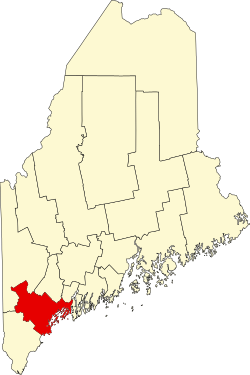
Location in Cumberland County and the state of Maine.
Coordinates: 44°00′24″N70°31′22″W / 44.00667°N 70.52278°W / 44.00667; -70.52278 (North Casco)
Country Flag of the United States.svg United States
State Flag of Maine.svg Maine
County Cumberland
Incorporated1841
Villages Casco
Cook Mills
Crescent Lake
Pike Corner
South Casco
Area
[1]
  Total38.01 sq mi (98.45 km2)
  Land31.24 sq mi (80.91 km2)
  Water6.77 sq mi (17.53 km2)
Elevation
545 ft (166 m)
Population
 (2020)
  Total3,646
  Density117/sq mi (45.1/km2)
Time zone UTC−5 (Eastern (EST))
  Summer (DST) UTC−4 (EDT)
ZIP Code
04015
Area code 207
FIPS code 23-11125
GNIS feature ID0582395
Website www.cascomaine.org

Casco is a town in Cumberland County, Maine, United States. Casco is included in the Lewiston-Auburn, Maine metropolitan New England city and town area. The population was 3,646 at the 2020 census. [2] Casco includes the villages of Casco, South Casco and Cook Mills. The town borders the east shore of Sebago Lake, and is home to part of Sebago Lake State Park. Casco is part of the Portland South Portland Biddeford, Maine metropolitan statistical area. Casco is just under 30 miles (48 km) from downtown Portland.

Contents

Casco is the home of "Casco Days", an annual community fair which takes place in Casco Days Park, always on the last Saturday in July. [3]

History

On January 30, 1767, Raymondtown Plantation was granted by the Massachusetts General Court to Capt. William Raymond of Beverly, Massachusetts, and his company of soldiers for their service with Sir William Phipps in the 1690 Battle of Quebec. It replaced a 1735 grant called Beverly-Canada (now Weare, New Hampshire) which was ruled invalid in 1741 because of a prior claim by the heirs of John Mason. In 1803, Raymondtown Plantation was incorporated as Raymond. The town of Naples was created with land taken in 1838, the same year the western half of Raymond petitioned the legislature to be set off as a township because of its geographical separation behind Rattlesnake Mountain. The petition failed, but three years later another was accepted. On March 18, 1841, Casco was incorporated as a town. [4]

Historical population
CensusPop.Note
1850 1,046
1860 1,1166.7%
1870 998−10.6%
1880 908−9.0%
1890 844−7.0%
1900 783−7.2%
1910 688−12.1%
1920 685−0.4%
1930 7134.1%
1940 89024.8%
1950 881−1.0%
1960 9477.5%
1970 1,25632.6%
1980 2,24378.6%
1990 3,01834.6%
2000 3,46914.9%
2010 3,7427.9%
2020 3,646−2.6%
U.S. Decennial Census [5]

Farmers found the surface of the town uneven, its hard and rocky soil "tolerably productive." Outlets of ponds, however, provided Casco with good sites for water powered mills. The town had four sawmills, four gristmills, a shook mill, a barrel stave mill, four shingle factories, a carriage factory and a tannery. In 1832, the Cumberland and Oxford Canal made Sebago Lake a direct trade route to Portland. Steamboat travel commenced on the waterways in the 1840s, carrying tourists and freight. [6] In 1938, Sebago Lake State Park was established, one of the state's five original state parks. [7]

Geography

According to the United States Census Bureau, the town has a total area of 38.01 square miles (98.45 km2), of which 31.24 square miles (80.91 km2) is land and 6.77 square miles (17.53 km2) is water. [1] Casco is drained by the Crooked River and Songo River.

The town is crossed by U.S. Route 302 and state routes 11, 85 and 121. It is bordered by the town of Raymond to the southeast, Naples and Otisfield to the northwest, and Poland to the northeast. The village of Casco, a census-designated place, is located along Route 121 near the northern corner of town. South Casco is located along US 302 between Sebago Lake and Thomas Pond in the southeast corner of the town, and Cook Mills is located along Route 11 near the western border of the town.

Demographics

Steamer Longfellow on the Songo River in 1912 Steamer Longfellow, Songo River, Sebago Lake, ME.jpg
Steamer Longfellow on the Songo River in 1912

2010 census

As of the census [8] of 2010, there were 3,742 people, 1,554 households, and 1,041 families living in the town. The population density was 119.8 inhabitants per square mile (46.3/km2). There were 2,944 housing units at an average density of 94.2 per square mile (36.4/km2). The racial makeup of the town was 97.0% White, 0.7% African American, 0.3% Native American, 0.3% Asian, 0.2% from other races, and 1.5% from two or more races. Hispanic or Latino of any race were 1.2% of the population.

There were 1,554 households, of which 29.7% had children under the age of 18 living with them, 51.4% were married couples living together, 10.6% had a female householder with no husband present, 5.0% had a male householder with no wife present, and 33.0% were non-families. 25.0% of all households were made up of individuals, and 11.5% had someone living alone who was 65 years of age or older. The average household size was 2.41 and the average family size was 2.82.

The median age in the town was 42.6 years. 21.5% of residents were under the age of 18; 6.3% were between the ages of 18 and 24; 25.9% were from 25 to 44; 31.8% were from 45 to 64; and 14.7% were 65 years of age or older. The gender makeup of the town was 49.4% male and 50.6% female.

2000 census

As of the census [9] of 2000, there were 3,469 people, 1,327 households, and 958 families living in the town. The population density was 110.9 inhabitants per square mile (42.8/km2). There were 1,958 housing units at an average density of 62.6 per square mile (24.2/km2). The racial makeup of the town was 97.95% White, 0.29% African American, 0.37% Native American, 0.52% Asian, 0.12% from other races, and 0.75% from two or more races. Hispanic or Latino of any race were 0.52% of the population.

There were 1,327 households, out of which 34.1% had children under the age of 18 living with them, 58.3% were married couples living together, 10.4% had a female householder with no husband present, and 27.8% were non-families. 20.4% of all households were made up of individuals, and 6.8% had someone living alone who was 65 years of age or older. The average household size was 2.58 and the average family size was 2.96.

Sebago Lake c. 1915 A Corner in Sebago Lake, South Casco, ME.jpg
Sebago Lake c.1915

In the town, the population was spread out, with 25.2% under the age of 18, 6.5% from 18 to 24, 32.1% from 25 to 44, 24.7% from 45 to 64, and 11.4% who were 65 years of age or older. The median age was 38 years. For every 100 females, there were 97.7 males. For every 100 females age 18 and over, there were 94.3 males.

The median income for a household in the town was $41,629, and the median income for a family was $49,500. Males had a median income of $31,679 versus $25,306 for females. The per capita income for the town was $19,306. About 5.3% of families and 8.1% of the population were below the poverty line, including 8.5% of those under age 18 and 9.8% of those age 65 or over.

Transportation

Casco is home to several important roads, both locally and nationally.

Sites of interest

Notable people

Related Research Articles

<span class="mw-page-title-main">Cumberland County, Maine</span> County in Maine, United States

Cumberland County is a county in the U.S. state of Maine. As of the 2020 census, the population was 303,069, making it the most populous county in Maine. Its county seat is Portland. Cumberland County was founded in 1760 from a portion of York County, Province of Massachusetts Bay, and named for William, Duke of Cumberland, a son of King George II. Cumberland County has the deepest and second-largest body of water in the state, Sebago Lake, which supplies tap water to most of the county. The county is the state's economic and industrial center, having the resources of the Port of Portland, the Maine Mall, and having corporate headquarters of major companies such as Fairchild Semiconductor, IDEXX Laboratories, Unum, and TD Bank. Cumberland County is part of the Portland–South Portland, ME Metropolitan Statistical Area.

<span class="mw-page-title-main">Baldwin, Maine</span> Town in the state of Maine, United States

Baldwin is a town in Cumberland County, Maine, United States. The population was 1,520 at the 2020 census. It is part of the Portland–South Portland–Biddeford, Maine, metropolitan statistical area.

<span class="mw-page-title-main">Frye Island, Maine</span> Town in Maine, United States

Frye Island is an island town in Cumberland County, Maine, United States. Located in Sebago Lake, the island is accessed via a public car ferry from Raymond Neck, or by private boat. All residents of the resort town are seasonal. The majority of property owners hail from New England area states however there are many other states also represented on the island. Frye Island is vacant from November through April, and the ferry does not operate during that time due to thick ice blocking its route during the winter. It is part of the Portland–South Portland–Biddeford, Maine Metropolitan Statistical Area. The town had a population of 32 at the 2020 census.

<span class="mw-page-title-main">Gray, Maine</span> Town in the state of Maine, United States

Gray is a town in Cumberland County, Maine, United States. The population was 8,269 at the 2020 census. It is part of the Portland–South Portland–Biddeford, Maine metropolitan statistical area. and included in the Lewiston-Auburn, Maine metropolitan New England city and town area. Gray is located at the intersection of state Routes 4, 26, 100, 115, 202 and the Maine Turnpike exit 63 midway between the state's two largest cities, Portland and Lewiston. The town includes frontage on Little Sebago Lake, Crystal Lake, and Forest Lake.

<span class="mw-page-title-main">Harrison, Maine</span> Town in the state of Maine, United States

Harrison is a town in Cumberland County, Maine, United States. Harrison is included in the Lewiston-Auburn, Maine metropolitan New England city and town area. The population was 2,447 at the 2020 census. A historic resort area, Harrison straddles Long Lake and Crystal Lake. It is part of the Portland–South Portland–Biddeford, Maine metropolitan statistical area.

<span class="mw-page-title-main">Naples, Maine</span> Town in the United States

Naples is a town in Cumberland County, Maine, United States. It is part of the Portland–South Portland–Biddeford, Maine metropolitan statistical area. The population was 3,925 at the 2020 census, and it is home to part of Sebago Lake State Park. Naples is a resort area.

<span class="mw-page-title-main">North Windham, Maine</span> Census-designated place in Maine, United States

North Windham is a census-designated place (CDP) within the town of Windham in Cumberland County, Maine, United States. The population was 4,904 at the 2010 census. It is part of the Portland–South Portland–Biddeford, Maine Metropolitan Statistical Area.

<span class="mw-page-title-main">Raymond, Maine</span> Town in the state of Maine, United States

Raymond is a town in Cumberland County, Maine, United States. Raymond is included in the Lewiston-Auburn, Maine metropolitan New England city and town area. The population was 4,536 at the 2020 census. It is a summer recreation area and is part of the Portland–South Portland–Biddeford, Maine metropolitan statistical area. Raymond Neck is the landing for the ferry to the town of Frye Island in Sebago Lake. The Raymond school system is currently affiliated with the Windham school system in a district known as RSU 14.

<span class="mw-page-title-main">Sebago, Maine</span> Town in Maine, United States

Sebago is a town in Cumberland County, Maine, United States. The population was 1,911 at the 2020 census. It is part of the Portland–South Portland–Biddeford, Maine metropolitan statistical area.

<span class="mw-page-title-main">Standish, Maine</span> Town in the state of Maine, United States

Standish is a town in Cumberland County, Maine, United States. The population was 10,244 at the 2020 census. It includes the villages of Standish Corner, Sebago Lake Village and Steep Falls, and the localities known as Richville, Elmwood, Standish Neck and Two Trails. Standish is part of the Portland-South Portland-Biddeford, Maine metropolitan statistical area.

<span class="mw-page-title-main">Westbrook, Maine</span> City in Maine, United States

Westbrook is a city in Cumberland County, Maine, United States and a suburb of Portland. The population was 20,400 at the 2020 census, making it the fastest-growing city in Maine between 2010 and 2020. It is part of the Portland–South Portland–Biddeford, Maine metropolitan statistical area.

<span class="mw-page-title-main">Windham, Maine</span> Town in the state of Maine, United States

Windham is a town in Cumberland County, Maine, United States. The population was 18,434 at the 2020 census. It includes the villages of South Windham and North Windham. It is part of the Portland–South Portland–Biddeford, Maine Metropolitan Statistical Area.

<span class="mw-page-title-main">Canton, Maine</span> Town in the state of Maine, United States

Canton is a town in Oxford County, Maine, United States. Canton is included in the Lewiston-Auburn, Maine metropolitan New England city and town area. The population was 1,125 at the 2020 census. Located beside Lake Anasagunticook, Canton is a summer recreational area.

<span class="mw-page-title-main">Denmark, Maine</span> Town in the state of Maine, United States

Denmark is a town in Oxford County, Maine, United States. The population was 1,197 at the 2020 census. A number of ponds and lakes are located within the town.

<span class="mw-page-title-main">Hiram, Maine</span> Town in the state of Maine, United States

Hiram is a town in Oxford County, Maine, United States. The population was 1,609 at the 2020 census. It includes the villages of Hiram, East Hiram, South Hiram and Durgintown. Located among the rugged and unspoiled Western Maine Mountains, Hiram is part of the Portland-South Portland-Biddeford, Maine metropolitan New England city and town area.

Otisfield is a town in Oxford County, Maine, United States. Otisfield is included in the Lewiston-Auburn, Maine metropolitan New England city and town area. The population was 1,853 at the 2020 census. Otisfield is a summer recreation area and home to Seeds of Peace Camp and Camp Arcadia.

<span class="mw-page-title-main">Waterboro, Maine</span> Town in Maine, United States

Waterboro is a town in York County, Maine, United States. The population was 7,936 at the 2020 census. It is part of the Portland–South Portland–Biddeford, Maine metropolitan statistical area.

<span class="mw-page-title-main">Sebago Lake</span> Second-largest lake in Maine

Sebago Lake (Sih-Bay-Goh) is the deepest and second-largest lake in the U.S. state of Maine. The lake is 316 feet (96 m) deep at its deepest point, with a mean depth of 101 feet (31 m). It is possible that Sebago is the deepest lake wholly contained within the entire New England region, although some sources say that Vermont's Lake Willoughby is slightly deeper. Along with Lake Champlain, Sebago is one of the only lakes in the area that does not consistently freeze solid during the winter months, with total ice cover only occurring for a short period of time every few winters. Sebago covers about 45 square miles (117 km2) in surface area, has a length of 14 miles (23 km) and has a shoreline length of roughly 105 miles (169 km). The surface is around 270 feet (82 m) above sea level, so the deep bottom is below the present sea level. It is in Cumberland County, and bordered by the towns of Casco, Naples, Raymond, Sebago, Standish and Windham. The seasonally occupied town of Frye Island is on an island in the lake. Sebago Lake and the surrounding area is known for its erratic and sudden changes in weather during all seasons, likely due to its proximity to the Atlantic Ocean and to Mt. Washington, a very notorious extreme weather hotspot. The name comes from the Abenaki sobagoo, meaning "it is the sea" or "it resembles the sea".

<span class="mw-page-title-main">Bridgton, Maine</span> Town in Maine, United States 04009

Bridgton is a town in Cumberland County, Maine, United States. The population was 5,418 at the 2020 census. A resort area in Maine's Lakes Region, Bridgton is home to Bridgton Academy, a private preparatory school, and the Four on the Fourth Road Race.

<span class="mw-page-title-main">Gorham, Maine</span> Town in the state of Maine, United States

Gorham is a town in Cumberland County, Maine, United States. The population was 18,336 at the 2020 United States Census. In addition to its urban village center known as Gorham Village or simply "the Village," the town encompasses a number of smaller, unincorporated villages and hamlets with distinct historical identities, including South Gorham, West Gorham, Little Falls, White Rock, and North Gorham. Gorham is home to one of the three campuses of the University of Southern Maine. In 2013, Gorham was voted second-best town in Maine after Hampden by a financial website.

References

  1. 1 2 "US Gazetteer files 2010". United States Census Bureau . Retrieved December 16, 2012.
  2. "Census - Geography Profile: Casco town, Cumberland County, Maine" . Retrieved January 15, 2022.
  3. "Casco Days". Casco Days.
  4. Coolidge, Austin J.; John B. Mansfield (1859). A History and Description of New England. Boston, Massachusetts: A.J. Coolidge. p.  87. coolidge mansfield history description new england 1859.
  5. "Census of Population and Housing". Census.gov. Retrieved June 4, 2015.
  6. "George J. Varney, "History of Raymond, Maine" (1886)". Archived from the original on July 13, 2014. Retrieved April 7, 2008.
  7. "History of Raymond".
  8. "U.S. Census website". United States Census Bureau . Retrieved December 16, 2012.
  9. "U.S. Census website". United States Census Bureau . Retrieved January 31, 2008.
  10. Moyer, Liz. "America's Priciest Summer Camps". Forbes.