Gray (CDP), Maine

Last updated
Gray, Maine
Cumberland County Maine incorporated and unincorporated areas Gray (CDP) highlighted.svg
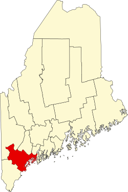
Location in Cumberland County and the state of Maine.
Coordinates: 43°53′6″N70°19′50″W / 43.88500°N 70.33056°W / 43.88500; -70.33056 Coordinates: 43°53′6″N70°19′50″W / 43.88500°N 70.33056°W / 43.88500; -70.33056
Country United States
State Maine
County Cumberland
Town Gray
Area
[1]
  Total2.94 sq mi (7.60 km2)
  Land2.94 sq mi (7.60 km2)
  Water0.00 sq mi (0.00 km2)
Elevation
301 ft (92 m)
Population
 (2020)
  Total887
  Density302.21/sq mi (116.68/km2)
Time zone UTC-5 (Eastern (EST))
  Summer (DST) UTC-4 (EDT)
Area code(s) 207
FIPS code 23-28835

Gray is a census-designated place (CDP) within the town of Gray, in Cumberland County, Maine, United States. The population was 884 at the 2010 census., [2] comprising 11.4% of the town's population of 7,761.

Contents

Gray (CDP) consists largely of the center of the Town of Gray known as Gray Village. It is part of the Portland South Portland Biddeford, Maine Metropolitan Statistical Area.

Geography

Gray is located at 43°53′6″N70°19′50″W / 43.88500°N 70.33056°W / 43.88500; -70.33056 . According to the United States Census Bureau, the CDP has a total area of 2.9 square miles (7.6 km2), all land. [3]

Demographics

Historical population
CensusPop.
2020 887
U.S. Decennial Census [4]

Related Research Articles

Brunswick Station, Maine Census-designated place in Maine, United States

Brunswick Station was a census-designated place (CDP) within the town of Brunswick in Cumberland County, Maine, United States. The population was 578 at the 2010 census. It consists of area that was part of the former Naval Air Station Brunswick and was part of the Portland–South Portland–Biddeford, Maine Metropolitan Statistical Area. The 2020 census shows it as part of the Brunswick CDP.

Cumberland Center, Maine Census-designated place in Maine, United States

Cumberland Center is a census-designated place (CDP) within the town of Cumberland in Cumberland County, Maine, United States. The population was 2,499 at the 2010 census. It is part of the Portland – South Portland – Biddeford, Maine, Metropolitan Statistical Area.

Falmouth Foreside, Maine Census-designated place in Maine, United States

Falmouth Foreside is a census-designated place (CDP) within the town of Falmouth in Cumberland County, Maine, in the United States. As of the 2010 census, the CDP population was 1,511. It is part of the Portland–South Portland–Biddeford, Maine Metropolitan Statistical Area.

North Windham, Maine Census-designated place in Maine, United States

North Windham is a census-designated place (CDP) within the town of Windham in Cumberland County, Maine, United States. The population was 4,904 at the 2010 census. It is part of the Portland–South Portland–Biddeford, Maine Metropolitan Statistical Area.

Oak Hill, Maine Census-designated place in Maine, United States

Oak Hill is a census-designated place (CDP) in the town of Scarborough in Cumberland County, Maine, United States. Prior to the 2020 census, the CDP was known as Scarborough. The population was 4,403 at the 2010 census. It is part of the Portland–South Portland–Biddeford, Maine Metropolitan Statistical Area.

Kennebunk (CDP), Maine Census-designated place in Maine, United States

Kennebunk is a census-designated place (CDP) comprising the central village in the town of Kennebunk in York County, Maine, United States. The population was 5,214 at the 2010 census, out of a total town population of 10,798. It is part of the Portland–South Portland–Biddeford, Maine Metropolitan Statistical Area.

North Berwick (CDP), Maine Census-designated place in Maine, United States

North Berwick is a census-designated place (CDP) consisting of the primary settlement in the town of North Berwick in York County, Maine, United States. The population was 1,615 at the 2010 census, out of a total town population of 4,576. It is part of the Portland–South Portland–Biddeford, Maine Metropolitan Statistical Area.

Steep Falls, Maine Census-designated place in Maine, United States

Steep Falls is a census-designated place (CDP) in the town of Standish in Cumberland County, Maine, United States. The population was 1,139 at the 2010 census. It is part of the Portland–South Portland–Biddeford, Maine Metropolitan Statistical Area. The town is part of Maine School Administrative District #6, which includes Bonny Eagle Middle and High Schools.

South Windham, Maine Census-designated place in Maine, United States

South Windham is a census-designated place (CDP) in the town of Windham in Cumberland County, Maine, United States. The population of the CDP was 1,374 at the 2010 census. Prior to 2010, South Windham was part of the Little Falls-South Windham census-designated place.

Bridgton (CDP), Maine Census-designated place in Maine, United States

Bridgton is a census-designated place (CDP) in the town of Bridgton in Cumberland County, Maine, United States. The population was 2,071 at the 2010 census. It is part of the Portland–South Portland–Biddeford, Maine Metropolitan Statistical Area.

Brunswick (CDP), Maine Census-designated place in Maine, United States

Brunswick is a census-designated place (CDP) in the town of Brunswick in Cumberland County, Maine, United States. The population was 15,175 at the 2010 census. It is part of the Portland–South Portland–Biddeford, Maine Metropolitan Statistical Area.

Freeport (CDP), Maine Census-designated place in Maine, United States

Freeport is a census-designated place (CDP) in the town of Freeport in Cumberland County, Maine, United States. The population was 1,485 at the 2010 census. It is part of the Portland–South Portland–Biddeford, Maine Metropolitan Statistical Area.

Gorham (CDP), Maine Census-designated place in Maine, United States

Gorham is a census-designated place (CDP) in the town of Gorham, in Cumberland County, Maine, United States. The population was 6,882 at the 2010 census. It is part of the Portland–South Portland–Biddeford, Maine Metropolitan Statistical Area.

Yarmouth (CDP), Maine Census-designated place in Maine, United States

Yarmouth is a census-designated place (CDP) in the town of Yarmouth in Cumberland County, Maine, United States. The population was 5,869 at the 2010 census. It is part of the Portland–South Portland–Biddeford, Maine Metropolitan Statistical Area.

Casco (CDP), Maine Census-designated place in Maine, United States

Casco is a census-designated place (CDP) in the town of Casco in Cumberland County, Maine, United States. The population of the CDP was 587 at the 2010 census. It is part of the Portland–South Portland–Biddeford, Maine Metropolitan Statistical Area.

Falmouth (CDP), Maine Census-designated place in Maine, United States

Falmouth is a census-designated place (CDP) within the town of Falmouth in Cumberland County, Maine, United States. The population was 1,855 at the 2010 census. It is part of the Portland–South Portland–Biddeford, Maine Metropolitan Statistical Area.

Little Falls, Maine Census-designated place in Maine, United States

Little Falls is a census-designated place (CDP) in the town of Gorham in Cumberland County, Maine, United States. The population of the CDP was 708 at the 2010 census. Prior to 2010, Little Falls was part of the Little Falls-South Windham census-designated place.

Littlejohn Island, Maine Census-designated place in Maine, United States

Littlejohn Island is an island and census-designated place (CDP) in the town of Yarmouth in Cumberland County, Maine, United States. The population of the CDP was 118 at the 2010 census.

Naples (CDP), Maine Census-designated place in Maine, United States

Naples is a census-designated place (CDP) in the town of Naples in Cumberland County, Maine, United States. The population of the CDP was 428 at the 2010 census.

Standish (CDP), Maine Census-designated place in Maine, United States

Standish, known locally as Standish Corner, is a census-designated place (CDP) in the town of Standish in Cumberland County, Maine, United States. The population was 469 at the 2010 census. It is part of the Portland–South Portland–Biddeford, Maine Metropolitan Statistical Area.

References

  1. "2020 U.S. Gazetteer Files". United States Census Bureau. Retrieved April 8, 2022.
  2. "Profile of General Population and Housing Characteristics: 2010 Demographic Profile Data (DP-1): Gray CDP, Maine". United States Census Bureau . Retrieved June 13, 2012.
  3. "Geographic Identifiers: 2010 Demographic Profile Data (G001): Gray CDP, Maine". United States Census Bureau . Retrieved June 13, 2012.
  4. "Census of Population and Housing". Census.gov. Retrieved June 4, 2016.