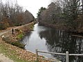
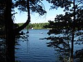
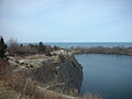
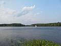
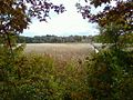
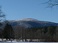
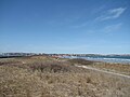
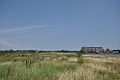
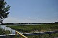
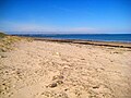
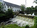
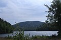
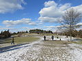
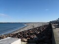
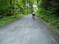
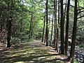
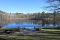
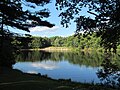
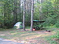
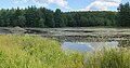
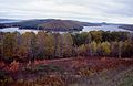
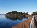
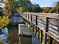
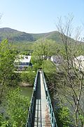
Name County Area [ 2] Estab- River / lake / other Image Remarks acres ha Alewife Brook Reservation Middlesex 42°23′48″N 71°8′38″W / 42.39667°N 71.14389°W / 42.39667; -71.14389 (Alewife Brook Reservation ) 136 acres 55 ha 1900 Little Pond, Little River, Alewife Brook A major portion of the Alewife Reservation is designated wetland. The Reservation is located at the end of the Minuteman Bike Path in Arlington Beaver Brook Reservation Middlesex 42°23′26″N 71°11′52″W / 42.39056°N 71.19778°W / 42.39056; -71.19778 (Beaver Brook Reservation ) 303 acres 123 ha 1893 The park includes a cascading waterfall and a wading pool. Belle Isle Marsh Reservation Suffolk 42°23′21″N 70°59′21″W / 42.38917°N 70.98917°W / 42.38917; -70.98917 (Belle Isle Marsh Reservation ) 188 acres 76 ha 1978 Belle Isle Marsh The reservation includes landscaped pathways, benches, and an observation tower. A portion of the Boston Harborwalk runs through the reservation. Blue Hills Reservation Norfolk 42°12′40″N 71°7′40″W / 42.21111°N 71.12778°W / 42.21111; -71.12778 (Blue Hills Reservation ) 6,165 acres 2,495 ha 1893 Houghton's Pond , Ponkapoag Pond The reservation has the distinction of being the largest conservation land within a major metropolitan area. Breakheart Reservation Essex , Middlesex 42°29′21″N 71°2′23″W / 42.48917°N 71.03972°W / 42.48917; -71.03972 (Breakheart Reservation ) 652 acres 264 ha 1934 Silver Lake, Pearce Lake, Saugus River The reservation is hardwood forest principally used for birding, fishing and hiking. Bristol Blake State Reservation Norfolk 42°6′28.6″N 71°19′5″W / 42.107944°N 71.31806°W / 42.107944; -71.31806 (Bristol Blake State Reservation ) 140 acres 57 ha 1959 [ 3] Kingfisher Pond, Stony Brook Pond, Teal Marsh Adjacent to Stony Brook Wildlife Sanctuary Charles River Reservation Suffolk , Middlesex 42°21′20″N 71°6′56″W / 42.35556°N 71.11556°W / 42.35556; -71.11556 (Charles River Reservation ) 863 acres 349 ha 1910 Charles River Includes Charles River Dam , Charles River Basin and Esplanade, John F. Kennedy Park, and Teddy Ebersol's Red Sox Fields. Covers Charles River below Watertown Dam ; see also Upper Charles River Reservation Chestnut Hill Reservation Suffolk 42°20′7″N 71°9′29″W / 42.33528°N 71.15806°W / 42.33528; -71.15806 (Chestnut Hill Reservation ) 1 acre 0.40 ha 1870 Chestnut Hill Reservoir The Chestnut Hill Reservoir Historic District is considered a nineteenth-century masterpiece of engineering, urban planning and landscape design. Cutler Park Reservation Norfolk 42°16′16″N 71°11′45″W / 42.27111°N 71.19583°W / 42.27111; -71.19583 (Cutler Park Reservation ) 739 acres 299 ha 1962 Charles River It contains the largest remaining fresh water marsh on the middle Charles, and includes a boardwalk through a cattail marsh out onto an island. Dorchester Shores Reservation Suffolk 42°17′50″N 71°2′44″W / 42.29722°N 71.04556°W / 42.29722; -71.04556 (Dorchester Shores Reservation ) 44 acres 18 ha 1962 Neponset River The reservation comprises two beaches and a park. Elm Bank Reservation Norfolk 42°16′34″N 71°18′9″W / 42.27611°N 71.30250°W / 42.27611; -71.30250 (Elm Bank Reservation ) 175 acres 71 ha 1996 Charles River Benjamin Pierce Cheney 's property, now run by Massachusetts Horticultural Society Fort Phoenix State Reservation Bristol 41°37′27″N 70°53′56″W / 41.62417°N 70.89889°W / 41.62417; -70.89889 (Fort Phoenix State Reservation ) 1 acre 0.40 ha Atlantic Ocean Revolutionary War fort; 1/2 mile of Buzzards Bay beachfront Hammond Pond Reservation Middlesex 42°19′30″N 71°10′36″W / 42.32500°N 71.17667°W / 42.32500; -71.17667 (Hammond Pond Reservation ) 59 acres 24 ha 1968 Hemlock Gorge Reservation Middlesex 42°18′52″N 71°13′35″W / 42.31444°N 71.22639°W / 42.31444; -71.22639 (Hemlock Gorge Reservation ) 16 acres 6.5 ha 1895 Charles River Horseneck Beach State Reservation Bristol 41°30′28″N 71°2′55″W / 41.50778°N 71.04861°W / 41.50778; -71.04861 (Horseneck Beach State Reservation ) 815 acres 330 ha 1956 Popular for its two-mile (3 km) long sandy beach on the shore of Buzzards Bay . Also camping, fishing and a salt marsh. Lynn Shore Reservation Essex 22 acres 8.9 ha Jug End State Reservation and Wildlife Management Area Berkshire 1,191 acres 482 ha 1994 Middlesex Fells Reservation Middlesex 2,283 acres 924 ha 1893 Bellevue and Spot Ponds Mount Everett State Reservation Berkshire 2,492 acres 1,008 ha 1908 Guilder Pond Mount Greylock State Reservation Berkshire 12,455 acres 5,040 ha 1898 Mount Sugarloaf State Reservation Franklin 533 acres 216 ha 1907 Mount Tom State Reservation Hampden 1,967 acres 796 ha 1902 Myles Standish Monument State Reservation Plymouth 30 acres 12 ha 1920 A 120-foot (37 m) tower with 125 steps that overlooks Plymouth Harbor and Duxbury Beach. Mystic River Reservation Middlesex 359 acres 145 ha 1893 Mystic Lakes ; Mystic River Nahant Beach Reservation Essex 67 acres 27 ha Atlantic Ocean Nantasket Beach Reservation Plymouth 39 acres 16 ha Nasketucket Bay State Reservation Plymouth 210 acres 85 ha 1999 Neponset River Reservation Suffolk 1,880 acres 760 ha Pope John Paul II Park Reservation Suffolk 66 acres 27 ha 2001 Neponset River Estuary Reclaimed former landfill and commercial area Purgatory Chasm State Reservation Worcester 100 acres 40 ha 1919 The Chasm was created when glacial meltwater from a burst ice dam ripped out blocks of bedrock at the end of the last Ice Age (14,000 years ago). Quincy Quarries Reservation Norfolk 22 acres 8.9 ha 1985 Quincy Shores Reservation Norfolk 87 acres 35 ha 1899 Revere Beach Reservation Suffolk 84 acres 34 ha 1896 Rumney Marsh Reservation Essex , Suffolk 815 acres 330 ha 1992 Saugus River ; Pines River Salisbury Beach State Reservation Essex 355 acres 144 ha 1931 The park's main feature is its 3.8-mile (6.1 km) -long beach, one of the most popular in the Commonwealth. Sandy Point State Reservation Essex 134 acres 54 ha Scusset Beach State Reservation Barnstable 459 acres 186 ha 1957 On Cape Cod Bay at the east end of the Cape Cod Canal , a popular swimming and camping area. Stony Brook Reservation Suffolk 616 acres 249 ha 1894 Turtle Pond Upper Charles River Reservation Middlesex , Norfolk , Suffolk 863 acres 349 ha Charles River Covers Charles River between Watertown Dam and Riverdale Park, West Roxbury ; see also Charles River Reservation Wachusett Mountain State Reservation Worcester 2,288 acres 926 ha 1899 Walden Pond State Reservation Middlesex 335 acres 136 ha 1922 Walden Pond Weymouth Back River Reservation Norfolk 35 acres 14 ha Site of Stodder's Neck and Abigail Adams Park Wilson Mountain Reservation Norfolk 215 acres 87 ha 1995 Winthrop Shore Reservation Suffolk 18 acres 7.3 ha 1900 Atlantic Ocean