Land of Providence

Last updated
Land of Providence
Open Space Reserve
Country United States
State Massachusetts
Location Main Street, Holyoke, Massachusetts
Founded 2009
Management The Trustees of Reservations
Area 25 acres (100,000 m2)
Website:

Land of Providence is a 25-acre (100,000 m2) open space reservation located in the Ingleside neighborhood of Holyoke, Massachusetts, on the banks of the Connecticut River. The property was previously owned by the Sisters of Providence. In 2009 it was donated to The Trustees of Reservations and is now used for farming by the local organization Nuestras Raices, which allows local residents farm the land and raise livestock. [1]

Ingleside, Holyoke, Massachusetts Neighborhood of Holyoke in Massachusetts, United States

Ingleside is a neighborhood in Holyoke, Massachusetts located to the south of the city center, approximately 2 miles from downtown. The neighborhood features access to the Connecticut River through the Sue Ellen Panitch River Center and the Land of Providence reservation. Ingleside is also home to the Holyoke Mall, the Nuestras Raices farm, the Sisters of Providence of Holyoke, the Providence Behavioral Health Hospital, and several recreational and historical venues.

Holyoke, Massachusetts City in Massachusetts, United States

Holyoke is a city in Hampden County, Massachusetts, United States, that lies between the western bank of the Connecticut River and the Mount Tom Range. As of the 2010 census, the city had a population of 39,880. As of 2017, the estimated population was 40,341. Sitting 8 miles (13 km) north of Springfield, Holyoke is part of the Springfield Metropolitan Area, one of the two distinct metropolitan areas in Massachusetts.

Connecticut River river in the New England region of the United States

The Connecticut River is the longest river in the New England region of the United States, flowing roughly southward for 406 miles (653 km) through four states. It rises at the U.S. border with Quebec, Canada, and discharges at Long Island Sound. Its watershed encompasses five U.S. states and one Canadian province, 11,260 square miles (29,200 km2) via 148 tributaries, 38 of which are major rivers. It produces 70% of Long Island Sound's fresh water, discharging at 19,600 cubic feet (560 m3) per second.

Contents

History

The Trustees of Reservations were given this piece of land by the Sisters of Providence in June 2009. With this gift, The Trustees of Reservations committed to serving as long-term stewards of the river and land, carrying out the legacy of the Sisters of Providence, supporting Nuestras Raices, and providing outdoor opportunities for community members.

The Trustees of Reservations

The Trustees of Reservations is a non-profit land conservation and historic preservation organization dedicated to preserving natural and historical places in the Commonwealth of Massachusetts. It is the oldest regional land trust in the world and as of 2016 has 125,000 dues-paying members. In addition to land stewardship, the organization is also active in conservation partnerships, community supported agriculture (CSA), environmental and conservation education, community preservation and development, and green building. The Trustees of Reservations own title to 116 properties on 27,000 acres (11,000 ha) in Massachusetts, all of which are open to the public; it maintains conservation restrictions on 200 more properties. Properties include historic mansions, estates, and gardens; woodland preserves; waterfalls; mountain peaks; wetlands and riverways; coastal bluffs, beaches, and barrier islands; farmland and CSA projects; and archaeological sites.

Sisters of Providence of Holyoke religious congregation of Catholic sisters in Massachusetts, United States

The Sisters of Providence of Holyoke, Massachusetts, are a congregation of Roman Catholic religious sisters founded in 1892.

Programs at Land of Providence

Programs held at the Land of Providence include the Holyoke Boys & Girls Club environmental education program, farm intern stewardship apprenticeships, Holyoke Youth Conservation Corps, winter snowshoe treks, public and private tours, kayak yours, yoga as well as public workshops on topics such as: worm composting, container gardening, greenhouse assembly, and rain barrel setup.

Boys & Girls Clubs of America organization

Boys & Girls Clubs of America (BGCA) is a national organization of local chapters which provide after-school programs for young people. The organization, which holds a congressional charter under Title 36 of the United States Code, has its headquarters in Atlanta, with regional offices in Chicago, Dallas, Atlanta, New York City and Los Angeles. BGCA is tax-exempt and partially funded by the federal government.

Youth Conservation Corps

The Youth Conservation Corps(YCC) is a summer youth work program in federally managed lands. The National Park Service, US Forest Service, US Fish and Wildlife Service and Bureau of Land Management employ teens each summer to participate in the YCC. The YCC has introduced young Americans to conservation opportunities in public lands since the program was created in 1970. In the late seventies and early eighties the program included a grant-in-aid component that funded state and local YCC projects nationwide. This element fell to 1982 budget cuts, but several states continued the effort with their own funds. Some employees currently working in land management agencies were introduced to their profession through the YCC.

Greenhouse building in which plants are grown

A greenhouse is a structure with walls and roof made chiefly of transparent material, such as glass, in which plants requiring regulated climatic conditions are grown. These structures range in size from small sheds to industrial-sized buildings. A miniature greenhouse is known as a cold frame. The interior of a greenhouse exposed to sunlight becomes significantly warmer than the external ambient temperature, protecting its contents in cold weather.

Visiting

Land of Providence is open from April 1 through November 30 daily, sunrise to sunset. It can be accessed from either Route 5 in Holyoke or from Jones Ferry Road in Holyoke. Restrooms near the property are available seasonally only.

This property is open for birdwatching, cross-country skiing or snowshoeing (in season), picnicking, and moderate hiking. Dog walking or bicycle use on the property is strictly prohibited. Public transportation is available.

Birdwatching hobby

Birdwatching, or birding, is a form of wildlife observation in which the observation of birds is a recreational activity or citizen science. It can be done with the naked eye, through a visual enhancement device like binoculars and telescopes, by listening for bird sounds, or by watching public webcams.

Cross-country skiing form of snow skiing

Cross-country skiing is a form of skiing where skiers rely on their own locomotion to move across snow-covered terrain, rather than using ski lifts or other forms of assistance. Cross-country skiing is widely practiced as a sport and recreational activity; however, some still use it as a means of transportation. Variants of cross-country skiing are adapted to a range of terrain which spans unimproved, sometimes mountainous terrain to groomed courses that are specifically designed for the sport.

Hiking walking as a hobby, sport, or leisure activity

Hiking is the preferred term, in Canada and the United States, for a long, vigorous walk, usually on trails (footpaths), in the countryside, while the word walking is used for shorter, particularly urban walks. On the other hand, in the United Kingdom, and the Republic of Ireland, the word "walking" is acceptable to describe all forms of walking, whether it is a walk in the park or backpacking in the Alps. The word hiking is also often used in the UK, along with rambling, hillwalking, and fell walking. The term bushwalking is endemic to Australia, having been adopted by the Sydney Bush Walkers club in 1927. In New Zealand a long, vigorous walk or hike is called tramping. It is a popular activity with numerous hiking organizations worldwide, and studies suggest that all forms of walking have health benefits.

Related Research Articles

Francis William Bird Park

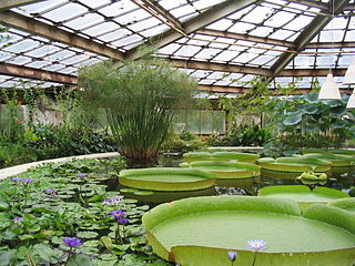
Francis William Bird Park is an 89-acre landscaped and waterscaped park located in Walpole, Massachusetts. The Trustees of Reservations owns and maintains the park. Features include over 3 miles (4.8 km) of walking and bicycle paths that wind through the park, traversing streams across granite bridges and passing through rolling lawns punctuated with mature shade trees, groves, and ponds.

Brooks Woodland Preserve

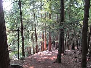
The Brooks Woodland Preserve is a 558-acre (226 ha) open space preserve located in Petersham, Massachusetts. The property, named after industrialist and dipolomat James Willson Brooks, is managed by the land conservation non-profit organization The Trustees of Reservations and offers 13 miles (21 km) of trails and primitive woods roads available for hiking, horseback riding, and cross country skiing. Second growth forest, overgrown farm fields, granite ledges, historic stone walls, creeks, and rolling hills characterize the preserve.

Peaked Mountain Protected landscape in Massachusetts

Peaked Mountain is a nature reserve located in Monson, Massachusetts. The property is approximately 2,000 acres (8.1 km2) and is owned by The Trustees of Reservations, a non-profit conservation organization. The principal landowners of its western slope, Leonard and Roslyn Harrington and Richard Elliott, have long permitted the public to hike through their properties to the summit. Concerned about the mountain's future, they sought the assistance of The Trustees of Reservations in developing a long-term strategy for protecting the mountain and securing public access after their lifetimes.

Mount Tom Range mountain

The Mount Tom Range is a traprock mountain range located in the Connecticut River Valley of Massachusetts. It is part of the Metacomet Ridge that extends from Long Island Sound near New Haven, Connecticut, north through the Connecticut River Valley of Massachusetts to nearly the Vermont border. A popular outdoor recreation resource, the range is known for its continuous west facing cliffs and its rugged, scenic character. It is also notable for its unique microclimate ecosystems and rare plant communities, as well as significant historic sites, such as the ruins of the 18th century Eyrie House located on Mount Nonotuck.

Royalston Falls

Royalston Falls is a 50 foot (15 m) waterfall and granite gorge located in Royalston, Massachusetts along Falls Brook, a tributary of the Tully River which in turn is a tributary of the Millers River. The falls are part of a 217-acre (88 ha) open space preserve acquired in 1951 by the land conservation non-profit organization The Trustees of Reservations. The 22-mile (35 km) Tully Trail and the 110-mile (180 km) Metacomet-Monadnock Trail, a National Recreation Trail, pass through the property.

Dinosaur Footprints Reservation

Dinosaur Footprints in Holyoke, Massachusetts, USA is an 8-acre (3 ha) wilderness reservation purchased for the public in 1935 by The Trustees of Reservations. The Reservation is currently being managed with the assistance from the Massachusetts Department of Conservation and Recreation (DCR). The fossil and plant resources on the adjacent Holyoke Gas and Electric (HG&E) riverfront property are being managed cooperatively by The Trustees, Mass DCR, and HG&E.

Glendale Falls is a waterfall and the name of an open space preserve in Middlefield, Massachusetts owned and managed by the Trustees of Reservations. The falls, fed by the waters of Glendale Brook are one of the longest waterfall runs in Massachusetts.

Elliott Laurel

Elliott Laurel is a 33-acre (13 ha) open space preserve located in Phillipston, Massachusetts. The property, notable for its extensive stands of mountain laurel, is managed by the land conservation non-profit organization The Trustees of Reservations. Elliott Laurel also contains woodlands, ledges, boulders, and a hayfield.

Fork Factory Brook

Fork Factory Brook is a 135-acre historic site, open space reserve, and agricultural reserve located in Medfield, Massachusetts. The reserve, managed by the land conservation non-profit organization The Trustees of Reservations, is notable for its wetlands, ledges, 300-year-old hayfields, and ruins of a 19th-century pitchfork mill for which the property is named. Fork Factory Brook offers 1.5 miles (2.4 km) of trails and former woods roads available for hiking, horseback riding, mountain biking, and cross country skiing. The property is a spur link in the 200-mile (320 km) Bay Circuit Trail system and is part of a larger area of protected open space including the abutting Rocky Woods preserve, also managed by The Trustees of Reservations.

Jacobs Hill

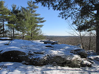
Jacobs Hill is a 173-acre (70 ha) open space preserve in Royalston, Massachusetts acquired in 1975 by the land conservation non-profit organization The Trustees of Reservations. The preserve includes scenic vistas, ledges, woodlands, a northern bog, and Spirit Falls, a 30 foot (9.1 m) waterfall. The 22-mile (35 km) Tully Trail passes through the property. Views from the ledges include the Berkshires as well as nearby Long Pond and the Tully River Valley, Tully Mountain, and Mount Grace.

Little Tom Mountain is a 73-acre (300,000 m2) nature preserve in Holyoke, Massachusetts and is managed by the Trustees of Reservations. The land was purchased in 2002 by a joint effort of the Trustees of Reservations, U.S. Fish and Wildlife Service, the Department of Conservation and Recreation, and the Holyoke Boys & Girls Club from the holders of the former Mt. Tom Ski area. It is not yet open to the public due to a nearby quarry operation, but expects to be open by 2012.

North Common Meadow

North Common Meadow is a 25-acre (10 ha) open space preserve in the town of Petersham, Massachusetts. The property, part of a larger, contiguous area of protected open space including Harvard Forest and The Trustees of Reservations' Brooks Woodland Preserve, is maintained as grassland in keeping with the town's rural character.

Swift River Reservation Protected landscape in Massachusetts

The Swift River Reservation is a 439-acre (178 ha) open space preserve located in Petersham, Massachusetts, United States. The property, named after the East Branch of the Swift River, is managed by the land conservation non-profit organization The Trustees of Reservations and offers 7 miles (11 km) of trails available for hiking, horseback riding, mountain biking, and cross country skiing. Ledges, river corridor, woodlands, scenic vistas, and wetlands characterize the preserve.

Cormier Woods

Cormier Woods is a 175-acre (71 ha) open space preserve and historic 18th-century farm complex in Uxbridge, Massachusetts, USA, within the Blackstone River Valley National Heritage Corridor. The property is named for James Cormier, the former owner of the property. It was acquired in 2008 by the land conservation non-profit organization The Trustees of Reservations.

Cedariver

Cedariver, formerly known as The Baker Reservation, is a 55-acre (22 ha) open space preserve located on the Charles River in Millis, Massachusetts. The property, acquired in 2004 by the land conservation non-profit organization The Trustees of Reservations, includes farm fields, woodlots, and 1-mile (1.6 km) of river frontage.

Noon Hill (reservation)

Noon Hill is a 204-acre (83 ha) open space preserve located in Medfield, Massachusetts and centered on 370-foot (110 m) Noon Hill, a prominent summit and scenic vista. It is managed by the land conservation non-profit organization The Trustees of Reservations and offers 4.5 miles (7.2 km) of trails available for hiking, horseback riding, mountain biking, and cross country skiing. Oak-hickory forest, wetlands, vernal pools, steep ravines, boulders, and rocky ledges characterize the preserve. Noon Hill is a link in the 200-mile (320 km) Bay Circuit Trail. Holt Pond, a constructed mill pond, is located on the property.

Rocky Woods Protected landscape in Massachusetts

Rocky Woods is a 491-acre (199 ha) open space preserve located in Medfield, Massachusetts. The preserve, managed by the land conservation non-profit organization The Trustees of Reservations, is notable for its rugged terrain. Rocky Woods offers 6.5 miles (10.5 km) of trails and former woods roads available for hiking, horseback riding, mountain biking, dog walking, catch and release fishing, snowshoeing and cross country skiing. Rocky Woods is a spur link in the 200-mile (320 km) Bay Circuit Trail system. The preserve is part of a larger area of protected open space including the abutting Fork Factory Brook preserve, also managed by The Trustees of Reservations.

Notchview

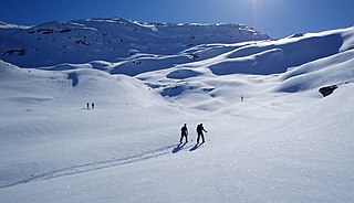
Notchview is a 3,100-acre (13 km2) conservation property located on Massachusetts Route 9 in Windsor, Massachusetts in eastern Berkshire County, Massachusetts, United States. It is currently managed by the Trustees of Reservations.

References

Coordinates: 42°10′05″N72°37′52″W / 42.168°N 72.631°W / 42.168; -72.631

Geographic coordinate system Coordinate system

A geographic coordinate system is a coordinate system that enables every location on Earth to be specified by a set of numbers, letters or symbols. The coordinates are often chosen such that one of the numbers represents a vertical position and two or three of the numbers represent a horizontal position; alternatively, a geographic position may be expressed in a combined three-dimensional Cartesian vector. A common choice of coordinates is latitude, longitude and elevation. To specify a location on a plane requires a map projection.