| Massasoit State Park | |
|---|---|
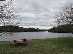
 Middle Pond | |
 Massasoit State Park Location in Massachusetts  Massasoit State Park Massasoit State Park (the United States) | |
| Location | Taunton, Massachusetts, United States |
| Coordinates | 41°52′04″N70°59′24″W / 41.86778°N 70.99000°W [1] |
| Area | 1,207 acres (488 ha) [2] |
| Elevation | 39 ft (12 m) [1] |
| Administered by | Massachusetts Department of Conservation and Recreation |
| Website | Official website |
Massasoit State Park is a public recreation area located on the southeast side of the city of Taunton, Massachusetts, with some parklands spilling into the adjacent town of Lakeville. The state park encompasses more than 1200 heavily wooded acres that include six lakes and ponds (Lake Rico, Furnace Pond, King's Pond, Middle Pond, Little Bearhole Pond, and Big Bearhole Pond) and numerous cranberry bogs. [3]