
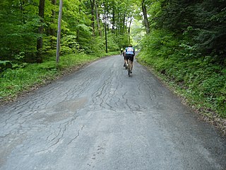
Mount Greylock State Reservation is public recreation and nature preservation area on and around Mount Greylock, the highest point in the U.S. state of Massachusetts. The park covers some 12,000 acres (4,900 ha) in the towns of Lanesborough, North Adams, Adams, Cheshire, Williamstown and New Ashford, Massachusetts. It was created in 1898 as Massachusetts' first public land for the purpose of forest preservation.

Mount Washington State Forest is a 4,619-acre (1,869 ha) state forest in the Mount Washington, Massachusetts. The forest conjoins with New York state and the state of Connecticut in the southern Taconic Mountains of the southwestern Berkshire region of Massachusetts. In addition to offering recreational and scenic opportunities, the forest lies adajacent to Bash Bish Falls State Park. It is managed by the Massachusetts Department of Conservation and Recreation.

Wells State Park is a public recreation area located off Route 49 in the town of Sturbridge, Massachusetts. The state park includes frontage on Walker Pond and the scenic metamorphic rock cliff face of Carpenter Rocks. Terrain is rugged with ledges interspersed between wetlands. Woodlands are of the oak-hickory forest and northern hardwood forest types with groves of eastern white pine. The park is managed by the Massachusetts Department of Conservation and Recreation.
Chicopee Memorial State Park is a public recreation area covering 562 acres (227 ha) in the Burnett Road neighborhood of the city of Chicopee, Massachusetts. The state park is located directly southeast of Westover Air Reserve Base, which is visible from some parts of the park. It is managed by the Department of Conservation and Recreation.
Beartown State Forest is a publicly owned forest with recreational features located in the towns of Great Barrington, Monterey, Lee, and Tyringham, Massachusetts. The state forest's more than 10,000 acres (4,000 ha) include 198 acres (80 ha) of recreational parkland. It is managed by the Massachusetts Department of Conservation and Recreation.
Breakheart Reservation is a public recreation area covering 652 acres (264 ha) in the towns of Saugus and Wakefield, Massachusetts. The reservation features a hardwood forest, two freshwater lakes, a winding stretch of the Saugus River, and scenic views of Boston and rural New England from rocky hilltops. The park is managed by the Massachusetts Department of Conservation and Recreation.

Callahan State Park is a public recreation area covering 958 acres (388 ha) mostly in Framingham and Marlborough, Massachusetts, with a small section in the adjoining town of Southborough. The state park is managed by the Department of Conservation and Recreation.
Manuel F. Correllus State Forest is a Massachusetts state forest located on Martha's Vineyard. The forest borders Martha's Vineyard Airport on three sides and is chiefly in the towns of West Tisbury and Edgartown. The forest is managed by the Department of Conservation and Recreation.

Leominster State Forest is a publicly owned forest with recreational features covering 4,246 acres (1,718 ha) in the Massachusetts towns of Leominster, Fitchburg, Princeton, Sterling, and Westminster. The state forest encompasses an extensive trail system, numerous small ponds, and the Crow Hills. Plants such as mountain laurel are common as is an abundance of wildlife. The forest is headquarters for Massachusetts Bureau of Forest Fire Control District 8 and is managed by the Department of Conservation and Recreation.

October Mountain State Forest is a 16,460-acre (6,660 ha) forest and recreational preserve located primarily in the town of Washington with adjoining parcels in Becket, Lee, and Lenox. It is the largest state forest in Massachusetts and is managed by the Massachusetts Department of Conservation and Recreation.
The D.A.R. State Forest is a publicly owned forest with recreational features located mostly in the town of Goshen with some spillage into neighboring Ashfield, Massachusetts. Activities center around Upper and Lower Highland Lakes. The state forest encompasses 1,728 acres (699 ha) and is managed by the Department of Conservation and Recreation.

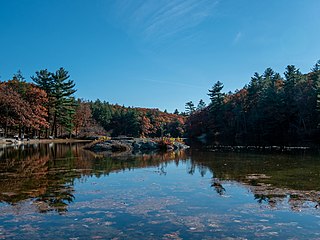
Tolland State Forest is a publicly owned forest with recreational features covering 4,415 acres (1,787 ha) in the towns of Otis, Tolland, Blandford and Sandisfield in the southern Berkshire Hills of Massachusetts. The state forest centers on the 1,065-acre (431 ha) Otis Reservoir, the largest body of water for recreational use in western Massachusetts. The forest is managed by the Department of Conservation and Recreation.

Willard Brook State Forest is a publicly owned forest with recreational features located in the towns of Ashby and Townsend, Massachusetts. The forest's fast-running brook and tree stands of a classic New England nature give it a character more in line with that of the forests found farther west in the state. It is managed by the Department of Conservation and Recreation.

Pearl Hill State Park is a 1,000-acre (400 ha) Massachusetts state park located in the town of Townsend about 50 miles (80 km) from Boston. The park lies adjacent to Willard Brook State Forest and is managed by the Department of Conservation and Recreation (DCR).
Kenneth Dubuque Memorial State Forest is a Massachusetts state forest in the northern Berkshire Hills in the towns of Hawley, Plainfield, and Savoy. The forest is managed by the Department of Conservation and Recreation (DCR). In 1985, the forest was named in memory of Kenneth M. Dubuque, a former employee of the Department of Environmental Management.

Harold Parker State Forest is a publicly owned forest with recreational features encompassing more than 3,300 acres (1,300 ha) in the towns of Andover, North Andover, North Reading, and Middleton, Massachusetts. Ponds, swamps, rolling hills, glacial erratics and rocky outcroppings can be found in the state forest, which features more than 35 miles (56 km) of backwoods roads and trails as well as remnants of 18th-century farming and milling operations. It is managed by the Massachusetts Department of Conservation and Recreation.

Pittsfield State Forest is an 11,000-acre (4,500 ha) Massachusetts state forest located in the town of Pittsfield and managed by the Department of Conservation and Recreation. The forest is the location of Berry Pond, which sitting atop Berry Mountain at an elevation of 2,150 feet (660 m) is the highest natural body of water in the state.
Georgetown-Rowley State Forest is a 1,112-acre (450 ha) Massachusetts state forest located primarily in the towns of Georgetown and Rowley with a small spillage into the town of Boxford. The forest straddles Interstate 95 and abuts Willowdale State Forest at its southeastern edge. The forest is managed by the Massachusetts Department of Conservation and Recreation.

Chester-Blandford State Forest is a publicly owned forest with recreational features located in the two towns for which it is named, Chester and Blandford, Massachusetts. The state forest includes remnants of small mining operations and the 60-foot cascade at Sanderson Brook Falls. It is managed by the Department of Conservation and Recreation.

Upton State Forest is a publicly owned forest with recreational features primarily located in the town of Upton, Massachusetts, with smaller sections in the towns of Hopkinton and Westborough. The state forest encompasses nearly 2,800 acres (1,100 ha) of publicly accessible lands and includes the last remaining Civilian Conservation Corps (CCC) camp in Massachusetts, built in Rustic style. The CCC campground was listed on the National Register of Historic Places in 2014.

