Oxbow National Wildlife Refuge

Last updated
Oxbow National Wildlife Refuge
IUCN category IV (habitat/species management area)
Nashua River, Oxbow National Wildlife Refuge, Harvard MA.jpg
Nashua River
Usa edcp relief location map.png
Red pog.svg
Map of the United States
Location Middlesex County, Worcester County, Massachusetts, United States
Nearest city Harvard, Massachusetts
Coordinates 42°29′50″N71°37′23″W / 42.49722°N 71.62306°W / 42.49722; -71.62306 Coordinates: 42°29′50″N71°37′23″W / 42.49722°N 71.62306°W / 42.49722; -71.62306
Area1,667 acres (6.75 km2)
Established1974
Governing body U.S. Fish and Wildlife Service
Website Oxbow National Wildlife Refuge

Oxbow National Wildlife Refuge is a property of the United States National Wildlife Refuge (NWR) system located in Middlesex and Worcester counties in Massachusetts. It was founded in 1974.

United States Federal republic in North America

The United States of America (USA), commonly known as the United States or America, is a country comprising 50 states, a federal district, five major self-governing territories, and various possessions. At 3.8 million square miles, the United States is the world's third or fourth largest country by total area and is slightly smaller than the entire continent of Europe's 3.9 million square miles. With a population of over 327 million people, the U.S. is the third most populous country. The capital is Washington, D.C., and the most populous city is New York City. Most of the country is located contiguously in North America between Canada and Mexico.

National Wildlife Refuge type of federal conservation area in the United States

National Wildlife RefugeSystem is a designation for certain protected areas of the United States managed by the United States Fish and Wildlife Service. The National Wildlife Refuge System is the system of public lands and waters set aside to conserve America's fish, wildlife, and plants. Since President Theodore Roosevelt designated Florida's Pelican Island National Wildlife Refuge as the first wildlife refuge in 1903, the system has grown to over 562 national wildlife refuges and 38 wetland management districts encompassing more than 150,000,000 acres (607,028 km2).

Middlesex County, Massachusetts County in the United States

Middlesex County is a county in the Commonwealth of Massachusetts, in the United States. As of 2018, the estimated population was 1,614,714, making it the 22nd most populous county in the United States, and the most populous county in both Massachusetts and New England. As part of the 2010 national census, the Commonwealth's mean center of population for that year was geo-centered in Middlesex County, in the town of Natick at. Middlesex County is included in the Census Bureau’s Boston–Cambridge–Newton, MA–NH Metropolitan Statistical Area.

Contents

Description

The Refuge is located in north-central Massachusetts, approximately 35 miles (56 km) northwest of Boston, Massachusetts. The Refuge lies within the towns of Ayer and Shirley in Middlesex County and the towns of Harvard and Lancaster in Worcester County. The Refuge consists of approximately 1,667 acres (6.75 km2) of upland, southern New England floodplain forest, and wetland communities along nearly 8 miles (13 km) of the Nashua River corridor.

Massachusetts State of the United States of America

Massachusetts, officially the Commonwealth of Massachusetts, is the most populous state in the New England region of the northeastern United States. It borders on the Atlantic Ocean to the east, the states of Connecticut and Rhode Island to the south, New Hampshire and Vermont to the north, and New York to the west. The state is named after the Massachusett tribe, which once inhabited the east side of the area, and is one of the original thirteen states. The capital of Massachusetts is Boston, which is also the most populous city in New England. Over 80% of Massachusetts's population lives in the Greater Boston metropolitan area, a region influential upon American history, academia, and industry. Originally dependent on agriculture, fishing and trade, Massachusetts was transformed into a manufacturing center during the Industrial Revolution. During the 20th century, Massachusetts's economy shifted from manufacturing to services. Modern Massachusetts is a global leader in biotechnology, engineering, higher education, finance, and maritime trade.

Ayer, Massachusetts Town in Massachusetts, United States

Ayer is a town in Middlesex County, Massachusetts, United States. Originally part of Groton, it was incorporated February 14, 1871, and became a major commercial railroad junction. The town was home to Camp Stevens, a training camp for Massachusetts volunteers during the American Civil War. Later, Fort Devens was established by the federal government to train New England soldiers for World War I. Fort Devens is a major influence on the area, although it is considerably smaller than when it was first closed in the mid-1990s. The town's population was 7,427 at the 2010 census.

Shirley, Massachusetts Town in Massachusetts, United States

Shirley is a town in Middlesex County, Massachusetts, United States. It is approximately thirty miles west-northwest of Boston. The population was 7,211 at the 2010 census. The town has a well-preserved historic New England town center.

Origins

Oxbow National Wildlife Refuge was formed by three land transfers from the U.S. Army's Fort Devens military installation, and a recent purchase of private land in Harvard. Two of the transfers from the Army (May 1974 and February 1988) formed the original 711-acre (2.88 km2) portion of the Refuge located south of Massachusetts Route 2. The third Army transfer occurred in May 1999, and added the 836-acre (3.38 km2) portion of the Refuge that is located north of Route 2. Finally, approximately 120 acres (0.49 km2) were added to the Refuge in April, 2001, with the acquisition of the former Watt Farm property along Still River Depot Road in Harvard.

Fort Devens U.S. military installation in Middlesex and Worcester counties, Massachusetts, United States

Fort Devens is an active United States Army military installation in the towns of Ayer and Shirley, in Middlesex County and Harvard in Worcester County in the U.S. state of Massachusetts. It was named after jurist and Civil War general Charles Devens. The nearby Devens Reserve Forces Training Area is located in Lancaster. Although closed in 1996, the fort was reopened the next day as the Devens Reserve Forces Training Area. The name reverted to Fort Devens in May 2007.

Massachusetts Route 2 highway in Massachusetts

Route 2 is a major east–west state highway in Massachusetts. Along with Route 9 and U.S. Route 20 to the south, these highways are the main alternatives to the Massachusetts Turnpike/I-90 toll highway. Route 2 runs the entire length of the northern tier of Massachusetts, beginning at the New York border, where it connects with New York State Route 2, and ending near Boston Common in Boston.

Wildlife and habitat

The primary purpose for which the Refuge was created is its "...particular value in carrying out the national migratory bird management program."

The Refuge's interspersion of wetland, forested upland and old field habitats is ideally suited for this purpose. The Refuge supports a diverse mix of migratory birds including waterfowl, wading birds, raptors, shorebirds, passerines, as well as resident mammals, reptiles, amphibians, fish and invertebrates. The extensive and regionally significant wetlands occurring on and adjacent to the Oxbow Refuge, including their associated tributary drainages and headwaters, have been listed as a priority for protection under both the North American Waterfowl Management Plan and the Emergency Wetlands Resources Act of 1986. The portion of the Oxbow NWR south of Route 2 lies within the 12,900-acre Central Nashua River Valley Area of Critical Environmental Concern (ACEC) designated by the Massachusetts Secretary of Environmental Affairs, and the portions of the Refuge north of Route 2 are included in the Squannassit ACEC due to the unique environmental characteristics and values of these wildlife habitats.

Nashua River river in the United States of America

The Nashua River, 37.5 miles (60.4 km) long, is a tributary of the Merrimack River in Massachusetts and New Hampshire in the United States. It is formed in eastern Worcester County, Massachusetts, by junction of its north and south branches near Lancaster, and flows generally north-northeast past Groton to join the Merrimack at Nashua, New Hampshire. The Nashua River Watershed occupies a major portion of north-central Massachusetts and a much smaller portion of southern New Hampshire.

The Massachusetts Area of Critical Environmental Concern (ACEC) Program is a list of state-designated places within the Commonwealth that receive special attention due to their natural and cultural resources. The program was established in 1975 and includes a list of thirty ACECs covering over 268,000 acres in seventy six communities throughout the state. The ACEC Program is administered by the Department of Conservation and Recreation (DCR) on behalf of the Secretary of Energy and Environmental Affairs.

The Massachusetts Executive Office of Energy and Environmental Affairs (EOEEA) is a Cabinet level agency under the Governor of Massachusetts. EOEEA is responsible for promoting efficient energy use throughout the Commonwealth while protecting and preserving Massachusetts' natural environment.

Friends group

The Refuge has an active friends group, The Friends of the Oxbow National Wildlife Refuge, which helps notify people about U.S. Fish & Wildlife Service activities in the Refuge, and also sponsors its own activities in and around the Refuge.

Related Research Articles

Bald Knob National Wildlife Refuge

The Bald Knob National Wildlife Refuge is a 15,022 acres (60.79 km2) (2014) wildlife refuge located in White County, Arkansas about two miles south of the town of Bald Knob. The refuge is managed by the United States Fish and Wildlife Service. The refuge features large numbers of migratory waterfowl and bald eagles during the winter months.

Shiawassee National Wildlife Refuge

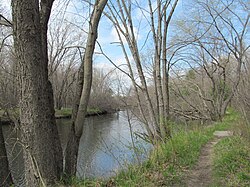
The Shiawassee National Wildlife Refuge is a 9,870.35 acres (39.9439 km2) National Wildlife Refuge in Saginaw County managed by the United States Fish and Wildlife Service. It is located in the central portion of the lower peninsula of the U.S. state of Michigan, approximately 25 miles (40 km) south of the Saginaw Bay in Lake Huron and five miles (8 km) south of the city of Saginaw in the county's Spaulding and James townships. It was established in 1953 to provide habitat for migratory waterfowl.

Wheeler National Wildlife Refuge

The Wheeler National Wildlife Refuge is a 35,000 acre (142 km2) National Wildlife Refuge located along the Tennessee River near Decatur, Alabama. Named after Major General Joseph Wheeler, it was established to provide a habitat for wintering and migrating birds in the eastern United States.

Bombay Hook National Wildlife Refuge

The Bombay Hook National Wildlife Refuge is a 15,978 acres (64.66 km2) National Wildlife Refuge located along the eastern coast of Kent County, Delaware, United States, on Delaware Bay. It was established on March 16, 1937 as a refuge and breeding ground for migratory and wintering waterfowl along the Atlantic Flyway. The Refuge was purchased from local land owners with federal duck stamp funds.

Klamath Basin National Wildlife Refuge Complex

The Klamath Basin National Wildlife Refuge Complex is a wildlife preserve operated by the United States Fish and Wildlife Service in the Klamath Basin of southern Oregon and northern California near Klamath Falls, Oregon. It consists of Bear Valley, Klamath Marsh and Upper Klamath National Wildlife Refuge (NWR) in southern Oregon and Lower Klamath, Tule Lake, and Clear Lake NWR in northern California.

Sam D. Hamilton Noxubee National Wildlife Refuge

Sam D. Hamilton Noxubee National Wildlife Refuge is a 48,000 acres (190 km2) National Wildlife Refuge located in the U.S. state of Mississippi, in Noxubee, Oktibbeha, and Winston Counties. The refuge serves as a resting and feeding area for migratory birds and as example of proper land stewardship. Also, the refuge extensively manages land for the endangered red-cockaded woodpecker.

Erie National Wildlife Refuge

The Erie National Wildlife Refuge is an 8,777-acre (3,552 ha) National Wildlife Refuge located in Crawford County, Pennsylvania. Named after the Erie tribe, it was established to provide waterfowl and other migratory birds with nesting, feeding, brooding, and resting habitat.

Tualatin River National Wildlife Refuge

The Tualatin River National Wildlife Refuge is a 1,856 acres (751 ha) wetlands and lowlands sanctuary in the northwestern part of the U.S. state of Oregon. Established in 1992 and opened to the public in 2006, it is managed by the United States Fish and Wildlife Service. Located in southeastern Washington County, 15 miles (24 km) southwest of Portland, the refuge is bordered by Sherwood, Tualatin and Tigard. A newer area, extending into northern Yamhill County, is located further west near the city of Gaston surrounding the former Wapato Lake.

Rydell National Wildlife Refuge

The Rydell National Wildlife Refuge is an 2,120-acre (9 km2) National Wildlife Refuge in northwestern Minnesota, located in Woodside Township, Polk County, just west of Erskine in northwestern Minnesota. It was established in 1992, and receives more than 7,800 visitors each year. The refuge is a combination of maple/basswood/oak forest, wetlands, tallgrass prairie and bogs.

Glacial Ridge National Wildlife Refuge

Glacial Ridge National Wildlife Refuge was created on October 12, 2004, the 545th National Wildlife Refuge in the United States. Its creation was the result of cooperation between at least 30 agencies or governmental entities. The creation of the refuge was spearheaded by The Nature Conservancy, and the initial endowment of 2,300 acres (9.3 km2) of land was donated by the Conservancy. In light of its planned final size of 37,756 acres (153 km2), it is described by the US Fish and Wildlife Service as "the largest tallgrass prairie and wetland restoration project in U.S. history."

Nomans Land Island National Wildlife Refuge

The Nomans Land Island Wildlife Refuge is a United States National Wildlife Refuge located on Nomans Land, a 640-acre (2.6 km2) island off the coast of Martha's Vineyard in Massachusetts. It is part of the town of Chilmark, in Dukes County. The Island is 1.6 miles (2.6 km) long east to west, and about 1 mile (1.6 km) north to south. Nomans Land Island was used for aerial gunnery by the U.S. Navy from 1942 to 1996. The United States Fish and Wildlife Service has managed an "overlay" refuge on the Eastern third of the Island under a Joint Management Agreement between the Department of the Interior and Department of the Navy since 1975. Following an extensive surface clearance of ordnance in 1997 and 1998, the Island was transferred to the United States Fish and Wildlife Service to become Nomans Land Island National Wildlife Refuge. It was established ". .. for use as an inviolate sanctuary, or for any other management purpose, for migratory birds" under the Migratory Bird Conservation Act.
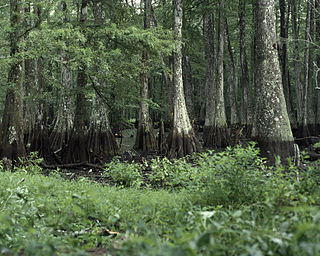
Catahoula National Wildlife Refuge

Catahoula National Wildlife Refuge, located in east central Louisiana, United States, 12 miles (19 km) east of Jena, was established in 1958 as a wintering area for migratory waterfowl. The refuge contains 25,162 acres (101.83 km2) divided into two units. The 6,671-acre (27 km2) Headquarters Unit borders nine miles (14 km) of the northeast shore of Catahoula Lake, a 26,000-acre (110 km2) natural wetland renowned for its large concentrations of migratory waterfowl. The 18,491-acre (74.83 km2) Bushley Bayou Unit, located 8 miles (13 km) west of Jonesville, was established May 16, 2001. This acquisition was made possible through a partnership agreement between The Conservation Fund, American Electric Power, and the Fish and Wildlife Service. The habitat found at the refuge is primarily lowland hardwood forest subject to seasonal backwater flooding from the Ouachita, and Red Rivers.

Upper Ouachita National Wildlife Refuge

Upper Ouachita National Wildlife Refuge was established in 1978 and is located Union and Morehouse Parishes in northern Louisiana.

The San Luis National Wildlife Refuge Complex is located in the northern San Joaquin Valley, within Merced County and Stanislaus County of California. The complex, with four federal National Wildlife Refuges, is managed by the U.S Fish & Wildlife Service.

Sonny Bono Salton Sea National Wildlife Refuge

The Sonny Bono Salton Sea National Wildlife Refuge is located 40 miles (64 km) north of the Mexican border at the southern end of the Salton Sea in California's Imperial Valley. Situated along the Pacific Flyway, the Refuge is the only one of its kind, located 227 feet (69 m) below sea level. Because of its southern latitude, elevation and location in the Colorado Desert, the Refuge experiences some of the highest temperatures in the nation. Daily temperatures from May to October generally exceed 100 °F with temperatures of 116°–120 °F recorded yearly.

Aroostook National Wildlife Refuge

Aroostook National Wildlife Refuge is located on part of the former Loring Air Force Base, in Aroostook County, Maine. It was established in 1998, when 4,700 acres (19 km2) were transferred from the United States Air Force to the United States Fish and Wildlife Service. This refuge also administers some 2,400 acres (970 ha) of wetland conservation easements throughout Aroostook County. It is close to the state park where visitors hike for particular seasons. In a portion of Maine where the landscape is dominated by agricultural crops such as potatoes and broccoli, Aroostook National Wildlife Refuge protects valuable wildlife habitat. The variety of habitat types attracts a diversity of wildlife species.

Moosehorn National Wildlife Refuge

Moosehorn National Wildlife Refuge is one of the northernmost National Wildlife Refuges in the Atlantic Flyway, a migratory route that follows the eastern coast of North America. The refuge provides important feeding and nesting habitat for many bird species, including waterfowl, wading birds, shorebirds, upland game birds, songbirds, and birds of prey.

Hamden Slough National Wildlife Refuge

Hamden Slough National Wildlife Refuge is a National Wildlife Refuge of the United States in Minnesota. Eastern hardwood forests stretching from the Atlantic seaboard give way to the western prairie at the area, in Audubon Township, near Audubon, Minnesota. Prior to settlement, its diverse vegetation was attractive to wildlife: waterfowl, upland birds, bison, wolves, and other prairie wildlife. When fully restored, the refuge will provide the largest contiguous block of wetland prairie habitat in the region, encompassing nearly 6,000 acres (24 km2).

Kern National Wildlife Refuge

Kern National Wildlife Refuge is a 1,249-acre (5.05 km2) protected area located in the southern portion of California's San Joaquin Valley, 20 miles west of the city of Delano. Situated on the southern margin of what was once the largest freshwater wetland complex in the western United States, Kern National Wildlife Refuge provides optimum wintering habitat for migratory birds with an emphasis on waterfowl and water birds.

Kulm Wetland Management District

Located in south-central North Dakota, Kulm Wetland Management District was established in 1971. Located in the Prairie Pothole Region of North America, Kulm Wetland Management District provides breeding, nesting, and brood rearing areas for many species of waterfowl and other migratory birds. The District currently manages 201 waterfowl production areas that total 45,683 acres (184.87 km2), 3 national wildlife refuges that are easement refuges, and 120,000 acres (490 km2) of wetland and grassland easements. The District's headquarters is in Kulm, North Dakota.

References

PD-icon.svg This article incorporates  public domain material from websites or documents ofthe United States Fish and Wildlife Service .