Monomoy National Wildlife Refuge

Last updated
Monomoy Island National Wildlife Refuge
IUCN category IV (habitat/species management area)
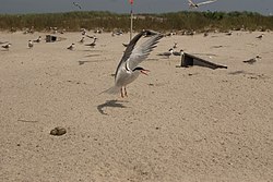
Tern at monomoy.jpg
Tern at Monomoy
Usa edcp relief location map.png
Red pog.svg
Map of the United States
Location Barnstable County, Massachusetts, United States
Nearest city Chatham, Massachusetts
Coordinates 41°33′0″N70°0′0″W / 41.55000°N 70.00000°W / 41.55000; -70.00000
Area7,604 acres (30.77 km2)
Established1944
Governing body U.S. Fish and Wildlife Service
Website Monomoy National Wildlife Refuge

Monomoy Island National Wildlife Refuge is a federal wildlife refuge located on Monomoy Island in Massachusetts.

The island was taken over by the US government just before World War II and established as a National Wildlife Refuge in 1944. The island was also home to the Monomoy Island Gunnery Range from 1944 until 1951. [1] The refuge's goal is to provide habitat for migratory birds. The size of the refuge is 7,604 acres (31 km2) with varied habitats of oceans, salt and freshwater marshes, dunes, freshwater ponds, and some historic manmade structures, such as the Monomoy Point Light and keeper's quarters (decommissioned but open to the public). Part of the refuge is the Monomoy Wilderness. [2]

Map of Monomoy National Wildlife Refuge area Monomoy Island USA map.jpg
Map of Monomoy National Wildlife Refuge area

Related Research Articles

<span class="mw-page-title-main">National Wildlife Refuge</span> United States protected area designation

National Wildlife RefugeSystem (NWRS) is a system of protected areas of the United States managed by the United States Fish and Wildlife Service (FWS), an agency within the Department of the Interior. The National Wildlife Refuge System is the system of public lands and waters set aside to conserve America's fish, wildlife, and plants. Since President Theodore Roosevelt designated Florida's Pelican Island National Wildlife Refuge as the first wildlife refuge in 1903, the system has grown to over 568 national wildlife refuges and 38 wetland management districts encompassing about 856,000,000 acres (3,464,109 km2).

<span class="mw-page-title-main">Monomoy Island</span>

Monomoy Island is an 8-mile-long (13-kilometre) spit of sand extending southwest from Chatham, Cape Cod off the Massachusetts mainland. Because of shifting sands and water levels, it is often connected to the mainland, and at other times is separated from it. It is home to the Monomoy National Wildlife Refuge. It is referred to in the 1691 Massachusetts Charter as Cape Mallabar, also spelled Cape Malabar.

<span class="mw-page-title-main">Lower Klamath National Wildlife Refuge</span> Wildlife refuge and National Historic Landmark in northern California, United States

The Lower Klamath National Wildlife Refuge is a National Wildlife Refuge of the United States on the border between California and Oregon. It is operated by the United States Fish and Wildlife Service. The refuge was designated a National Historic Landmark on October 16, 1965.

<span class="mw-page-title-main">Okefenokee National Wildlife Refuge</span> Nature center in Folkston, Georgia, USA

The Okefenokee National Wildlife Refuge is a 402,000‑acre (1,627 km2) National Wildlife Refuge located in Charlton, Ware, and Clinch Counties of Georgia, and Baker County in Florida, United States. The refuge is administered from offices in Folkston, Georgia. The refuge was established in 1937 to protect a majority of the 438,000 acre (1,772 km2) Okefenokee Swamp. The name "Okefenokee" is a Native American word meaning "trembling earth."

<span class="mw-page-title-main">St. Marks National Wildlife Refuge</span> United States National Wildlife Refuge in Florida

St. Marks National Wildlife Refuge, in Wakulla County, Florida, is one of the oldest wildlife refuges in the United States. Established in 1931 as a wintering ground for migratory birds, it encompasses 68,000 acres (280 km2) spread between Wakulla, Jefferson, and Taylor Counties in the state of Florida.

<span class="mw-page-title-main">J. N. "Ding" Darling National Wildlife Refuge</span> United States National Wildlife Refuge in Florida

The J. N. "Ding" Darling National Wildlife Refuge is part of the United States National Wildlife Refuge System, located in southwestern Florida on Sanibel Island in the Gulf of Mexico. "Ding" Darling Wildlife Society (DDWS), a non-profit Friends of the Refuge organization, supports environmental education and services at the J.N. "Ding" Darling National Wildlife Refuge. It is named after the cartoonist Jay Norwood "Ding" Darling.

<span class="mw-page-title-main">Hobe Sound National Wildlife Refuge</span> United States National Wildlife Refuge in Florida

The Hobe Sound National Wildlife Refuge, a part of the United States National Wildlife Refuge System, is a refuge on Jupiter Island in Florida. Its official name as of 2019 is the Nathaniel P. Reed Hobe Sound National Wildlife Refuge. Part of the refuge is inside the town of Jupiter Island, while the rest is in the unincorporated areas of Martin County. The 1,035-acre (4.19 km2) refuge was established in 1969, to protect the loggerhead and green sea turtles. It is administered as part of the Arthur R. Marshall Loxahatchee National Wildlife Refuge.

<span class="mw-page-title-main">Seal Island National Wildlife Refuge</span>

Seal Island National Wildlife Refuge is a 1-mile long (1.6 km) island off the coast of Maine, United States near Matinicus Island that is part of the Maine Coastal Islands National Wildlife Refuge. During any given summer season, over 100 species of birds are observed by researchers on the island. It is home to colonies of many types of seabirds, including Atlantic puffins, double-crested cormorants, razorbills, Leach's storm petrels, eiders, and black guillemots. Seal Island is the last refuge for the dwindling great cormorant population in the Gulf of Maine, with 35 pairs in 2018. A policy of eliminating predatory gulls preceded the recolonization of the island by a large mixed band of Arctic terns and common terns.

The Oregon Coast National Wildlife Refuge Complex consists of six National Wildlife Refuges along the Oregon Coast. It provides wilderness protection to thousands of small islands, rocks, reefs, headlands, marshes, and bays totaling 371 acres spanning 320 miles (515 km) of Oregon's coastline. The areas are all managed by the United States Fish and Wildlife Service.

<span class="mw-page-title-main">Oregon Islands National Wildlife Refuge</span>

Oregon Islands National Wildlife Refuge is a U.S. National Wildlife Refuge off the southwestern Oregon Coast. It is one of six National Wildlife Refuges comprising the Oregon Coast National Wildlife Refuge Complex. The Oregon Islands provides wilderness protection to 1,853 small islands, rocks, and reefs plus two headlands, totaling 371 acres (150 ha) spanning 1,083 acres (438 ha) of Oregon's coastline from the Oregon–California border to Tillamook Head. There are sites in six of the seven coastal counties of Oregon. From north to south they are Clatsop, Tillamook, Lincoln, Lane, Coos, and Curry counties. The area is managed by the United States Fish and Wildlife Service.

<span class="mw-page-title-main">Hart Mountain National Antelope Refuge</span> National Wildlife Refuge in Oregon, U.S.

Hart Mountain National Antelope Refuge is a National Wildlife Refuge on Hart Mountain in southeastern Oregon, which protects more than 422 square miles (1,090 km2) and more than 300 species of wildlife, including pronghorn, bighorn sheep, mule deer, sage grouse, and Great Basin redband trout. The refuge, created in 1936 as a range for remnant herds of pronghorn, spans habitats ranging from high desert to shallow playa lakes, and is among the largest wildlife habitats containing no domestic livestock.

<span class="mw-page-title-main">Willapa National Wildlife Refuge</span>

Willapa National Wildlife Refuge is a National Wildlife Refuge located on the shores of Willapa Bay in Washington, United States. It comprises 11,000 acres (45 km2) of sand dunes, sand beaches, mudflats, grasslands, saltwater and freshwater marshes, and coniferous forest. The refuge includes Long Island with stands of old growth Western red cedar and hemlock.

The Monomoy Wilderness is a 3,244-acre (13 km2) wilderness area south of Cape Cod in the U.S. state of Massachusetts. It is located within the Monomoy National Wildlife Refuge and is administered by the US Fish & Wildlife Service. Severe winter storms isolated Monomoy Point from the mainland in 1958 and, 20 years later, separated North Monomoy Island from South Monomoy Island. Sand dunes on the eastern shore of the islands give way to salt marsh and then to mudflats on the western shore. The ecosystem is a perfect habitat for migratory birds.

<span class="mw-page-title-main">Nomans Land Island National Wildlife Refuge</span>

The Nomans Land Island Wildlife Refuge is a United States National Wildlife Refuge located on Nomans Land, a 640-acre (2.6 km2) island off the coast of Martha's Vineyard in Massachusetts. It is part of the town of Chilmark, in Dukes County. The Island is 1.6 miles (2.6 km) long east to west, and about 1 mile (1.6 km) north to south. Nomans Land Island was used for aerial gunnery by the U.S. Navy from 1942 to 1996. The United States Fish and Wildlife Service has managed an "overlay" refuge on the Eastern third of the Island under a Joint Management Agreement between the Department of the Interior and Department of the Navy since 1975. Following an extensive surface clearance of ordnance in 1997 and 1998, the Island was transferred to the United States Fish and Wildlife Service to become Nomans Land Island National Wildlife Refuge. It was established ". .. for use as an inviolate sanctuary, or for any other management purpose, for migratory birds" under the Migratory Bird Conservation Act.

<span class="mw-page-title-main">Occoquan Bay National Wildlife Refuge</span> United States National Wildlife Refuge in Virginia

The Occoquan Bay National Wildlife Refuge is a National Wildlife Refuge located where the Occoquan River meets the Potomac River in Woodbridge, Virginia, United States between Belmont Bay and Occoquan Bay. The 644-acre (2.61 km2) site, about half of which is wetlands, was a popular tourist spot known as Dawson Beach until the 1940s, after which it was used for military research by the U.S. Army's Harry Diamond Laboratories from the 1960s to the 1990s. When the land was purchased from the military, it was temporarily called the Marumsco National Wildlife Refuge. The refuge was formally established and renamed in 1998, and is now managed by the United States Fish and Wildlife Service as part of the Potomac River National Wildlife Refuge Complex.

<span class="mw-page-title-main">Lacassine National Wildlife Refuge</span> Wildlife refuge in Louisiana

Lacassine National Wildlife Refuge is located in Cameron and Evangeline Parishes in southwestern Louisiana, was established in 1937 by Executive Order No. 7780 as "a refuge and breeding ground for migratory birds and other wildlife." The refuge is nearly 35,000 acres (140 km2) in size, including 653 acres (2.64 km2) leased from the Cameron Parish School Board. The Evangeline Parish unit is called Duralde Prairie and is currently being developed. It is located south of the city of Eunice.

<span class="mw-page-title-main">San Juan Islands National Wildlife Refuge</span> Wildlife refuge in Washington, US

The San Juan Islands National Wildlife Refuge is in the San Juan Islands of the Salish Sea, north of Puget Sound, in the State of Washington. Created in 1976, it comprises 83 small, uninhabited islands, scattered throughout the San Juans, with a combined area of approximately 454 acres (1.84 km2). The Refuge is managed by the U.S. Fish and Wildlife Service as one of six in the Washington Maritime National Wildlife Refuge Complex.

Green Bay National Wildlife Refuge is a National Wildlife Refuge of the United States located in the state of Wisconsin. It includes five all or part of six islands in Lake Michigan: Hog Island, Plum Island, Pilot Island, part of St. Martin Island and Rocky Island. Additionally it includes part of Detroit Island. The islands are near Washington Island off the tip of the Door Peninsula of Wisconsin and the Garden Peninsula of Michigan.

The Wisconsin Islands Wilderness is a 29-acre (12 ha) wilderness area located in Door County in northeastern Wisconsin. It is one of the smallest wilderness areas in the United States. Managed by the U.S. Fish & Wildlife Service, the wilderness area is composed of three islands in Lake Michigan.

Washington Maritime National Wildlife Refuge Complex is an administrative grouping of six National Wildlife Refuges in Washington, managed by the United States Fish and Wildlife Service. It includes:

References

  1. "Monomoy Island Army/Air Force Gunnery Range" (PDF). United States Army Corps of Engineers. September 1995. Archived from the original (PDF) on 2 January 2014. Retrieved 25 July 2020.
  2. Monomoy Wilderness Archived 2012-10-01 at the Wayback Machine - Wilderness.net

PD-icon.svg This article incorporates public domain material from websites or documents of the United States Fish and Wildlife Service .