
The Midstate Trail is a scenic footpath which runs 92 miles (148 km) through Worcester County, Massachusetts, from the Rhode Island border to the New Hampshire border, approximately 45 miles (72 km) west of Boston. The trail is considered highly accessible, scenic, and remarkably rural despite its proximity to urban Boston. The trail includes the summits of Mount Wachusett and Mount Watatic, as well as many interesting geologic, historic, and natural features.

Bartholomew's Cobble is a 329-acre (1.33 km2) National Natural Landmark, open space preserve, agricultural preserve, and bio-reserve located in southwest Massachusetts in the village of Ashley Falls abutting Canaan, Connecticut. The preserve contains over 800 plant species, including North America's greatest diversity of ferns and the greatest overall biodiversity in Berkshire County, Massachusetts; it also contains Massachusetts' highest populations of ground nesting bobolinks. It was declared a National Natural Landmark in October 1971

Chapel Brook of Franklin County, Massachusetts is a tributary of the South River and the name of a 173-acre (70 ha) open space preserve located along the brook. The brook, est. 3.79 mi (6 km) long, is located in southeast Ashfield and southwest Conway. It drains into Poland Brook, thence into the South River, the Deerfield River, the Connecticut River, and Long Island Sound. The Chapel Brook reservation, managed by the non-profit conservation organization The Trustees of Reservations, is located in Ashfield and contains Chapel Falls, a series of three waterfalls on Chapel Brook, measuring 10 feet, 15 feet and 20 feet high; and Pony Mountain est. 1,400 feet, a 100-foot (30 m) open granite cliff face and popular recreational rock climbing site.

The Brooks Woodland Preserve is a 558-acre (226 ha) open space preserve located in Petersham, Massachusetts. The property, named after industrialist and diplomat James Wilson Brooks, is managed by the land conservation non-profit organization The Trustees of Reservations and offers 13 miles (21 km) of trails and primitive woods roads available for hiking, horseback riding, and cross country skiing. Second growth forest, overgrown farm fields, granite ledges, historic stone walls, creeks, and rolling hills characterize the preserve.
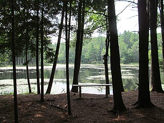
Peaked Mountain is a nature reserve located in Monson, Massachusetts. The property is approximately 2,000 acres (8.1 km2) and is owned by The Trustees of Reservations, a non-profit conservation organization. The principal landowners of its western slope, Leonard and Roslyn Harrington and Richard Elliott, have long permitted the public to hike through their properties to the summit. Concerned about the mountain's future, they sought the assistance of The Trustees of Reservations in developing a long-term strategy for protecting the mountain and securing public access after their lifetimes.
Tyringham Cobble is a 206-acre (83 ha) open space reservation located in Tyringham, Massachusetts on 411 m (1,348 ft) Cobble Hill in The Berkshires. It is managed by The Trustees of Reservations, a non-profit conservation organization, and is notable for its scenic views over the rural landscape of Tyringham Valley from rocky ledges and open fields. The reservation consists of the hill and surrounding agricultural and pasture land. In 2008, part of the 2,175 mile (3,500 km) Appalachian Trail was routed over the summit ledges.

The Robert Frost Trail is a 47-mile (76 km) long footpath that passes through the eastern Connecticut River Valley of Massachusetts. The trail runs from the Connecticut River in South Hadley, Massachusetts to Ruggles Pond in Wendell State Forest, through both Hampshire and Franklin County and includes a number of scenic features such as the Holyoke Range, Mount Orient, Puffer's Pond, and Mount Toby. The trail is named after the poet Robert Frost, who lived and taught in the area from 1916 to 1938.

Royalston Falls is a 50 foot (15 m) waterfall and granite gorge located in Royalston, Massachusetts along Falls Brook, a tributary of the Tully River which in turn is a tributary of the Millers River. The falls are part of a 217-acre (88 ha) open space preserve acquired in 1951 by the land conservation non-profit organization The Trustees of Reservations. The 22-mile (35 km) Tully Trail and the 110-mile (180 km) Metacomet-Monadnock Trail, a National Recreation Trail, pass through the property.
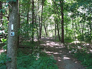
The Bay Circuit Trail and Greenway or Bay Circuit is a Massachusetts rail trail and greenway connecting the outlying suburbs of Boston from Plum Island in Newburyport to Kingston Bay in Duxbury, a distance of 200 miles (320 km).

Bear's Den is a 6-acre (24,000 m2) nature reserve in New Salem, Massachusetts. The reservation is close to the Quabbin Reservoir and is owned by the Trustees of Reservations.
Bridge Island Meadows is an 80-acre (320,000 m2) nature reserve owned by The Trustees of Reservations on the floodplains of the upper Charles River in Millis, Massachusetts. The property was a 1974 gift from Dr. and Mrs. John D. Constable to the Trustees of Reservations. The property is surrounded by wetlands, and is only accessible by boat.
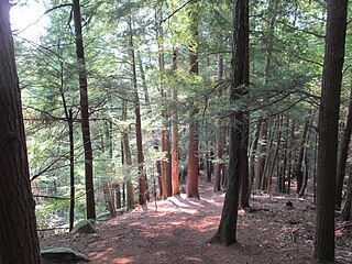
Jacobs Hill is a 173-acre (70 ha) open space preserve in Royalston, Massachusetts acquired in 1975 by the land conservation non-profit organization The Trustees of Reservations. The preserve includes scenic vistas, ledges, woodlands, a northern bog, and Spirit Falls, a 30 foot (9.1 m) waterfall. The 22-mile (35 km) Tully Trail passes through the property. Views from the ledges include the Berkshires as well as nearby Long Pond and the Tully River Valley, Tully Mountain, and Mount Grace.
Little Tom Mountain is a 73-acre (300,000 m2) nature preserve in Holyoke, Massachusetts and is managed by the Trustees of Reservations. The land was purchased in 2002 by a joint effort of the Trustees of Reservations, U.S. Fish and Wildlife Service, the Department of Conservation and Recreation, and the Holyoke Boys & Girls Club from the holders of the former Mt. Tom Ski area. The Trustees and the Holyoke Boys and Girls Club have a cooperative management approach of the area and run an environmental education program together.
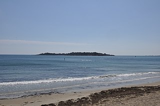
The Misery Islands are an 87-acre (350,000 m2) nature reserve established in 1935 in Salem Sound close to the Salem Harbor in Salem, Massachusetts. It is managed by the Trustees of Reservations. The islands are a part of the city of Salem, although they are much closer to the city of Beverly, in whose aquatic territory they lie.

The Rock House Reservation is a 196-acre (79 ha) open space preserve located in West Brookfield, Massachusetts. The property, acquired in 1993 by the land conservation non-profit organization The Trustees of Reservations, is named for a natural rock shelter once used as a winter camp by Native Americans. Its location near two, long Native American footpaths suggests that it may also have been a trail camp and meeting place.

Quinebaug Woods is a 36-acre (15 ha) open space preserve located in Holland, Massachusetts. The property, acquired in 2001 by the land conservation non-profit organization The Trustees of Reservations, is named for the Quinebaug River, which runs through the reservation.

North Common Meadow is a 25-acre (10 ha) open space preserve in the town of Petersham, Massachusetts. The property, part of a larger, contiguous area of protected open space including Harvard Forest and The Trustees of Reservations' Brooks Woodland Preserve, is maintained as grassland in keeping with the town's rural character.

The Swift River Reservation is a 439-acre (178 ha) open space preserve located in Petersham, Massachusetts, United States. The property, named after the East Branch of the Swift River, is managed by the land conservation non-profit organization The Trustees of Reservations and offers 7 miles (11 km) of trails available for hiking, horseback riding, mountain biking, and cross country skiing. Ledges, river corridor, woodlands, scenic vistas, and wetlands characterize the preserve.
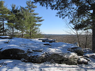
Noon Hill is a 204-acre (83 ha) open space preserve located in Medfield, Massachusetts and centered on 370-foot (110 m) Noon Hill, a prominent summit and scenic vista. It is managed by the land conservation non-profit organization The Trustees of Reservations and offers 4.5 miles (7.2 km) of trails available for hiking, horseback riding, mountain biking, and cross country skiing. Oak-hickory forest, wetlands, vernal pools, steep ravines, boulders, and rocky ledges characterize the preserve. Noon Hill is a link in the 200-mile (320 km) Bay Circuit Trail. Holt Pond, a constructed mill pond, is located on the property.

Notchview is a 3,100-acre (13 km2) conservation property located on Massachusetts Route 9 in Windsor, Massachusetts in eastern Berkshire County, Massachusetts, United States. It is currently managed by the Trustees of Reservations.


