The Boston Post Road was a system of mail-delivery routes between New York City and Boston, Massachusetts, that evolved into one of the first major highways in the United States.

Uxbridge is a town in Worcester County, Massachusetts, United States, first colonized in 1662 and incorporated in 1727. It was originally part of the town of Mendon, and named for the Earl of Uxbridge. The town is located 36 mi (58 km) southwest of Boston and 15 mi (24 km) south-southeast of Worcester, at the midpoint of the Blackstone Valley National Historic Park. The historical society notes that Uxbridge is the "Heart of The Blackstone Valley" and is also known as "the Cradle of the Industrial Revolution". Uxbridge was a prominent Textile center in the American Industrial Revolution. Two Quakers served as national leaders in the American anti-slavery movement. Uxbridge "weaves a tapestry of early America".

Route 146 is a 20.99-mile (33.78 km) north-south expressway in the U.S. state of Massachusetts, maintained by the Massachusetts Department of Transportation (MassDOT). Spanning approximately 21 miles (34 km) along a south–north axis, it is a continuation of Route 146 in Rhode Island, which splits from I-95 in Providence. The southern terminus within Massachusetts exists in Millville, where the expressway enters the state from North Smithfield, Rhode Island. Among several local roads, Route 146 intersects with the Massachusetts Turnpike (I-90) in Millbury and I-290 in Worcester before arriving at its northern terminus at the intersection of several surface streets in downtown Worcester. Most of the route is a freeway, except for a short section near the boundary between Millbury and Sutton where there is driveway access and at-grade crossings.

The Southern New England Railway was a project of the Grand Trunk Railway (GT) to build a railroad from the GT-owned Central Vermont Railway at Palmer, Massachusetts south and east to the all-weather port of Providence, Rhode Island. Much grading and construction, including many large concrete supports, was carried out, but the project was not completed.

The New York and New England Railroad (NY&NE) was a railroad connecting southern New York State with Hartford, Connecticut; Providence, Rhode Island; and Boston, Massachusetts. It operated under that name from 1873 to 1893. Prior to 1873 it was known as the Boston, Hartford and Erie Railroad, which had been formed from several smaller railroads that dated back to 1846. After a bankruptcy in 1893, the NY&NE was reorganized and briefly operated as the New England Railroad before being leased to the competing New York, New Haven and Hartford Railroad in 1898.

Route 146 is a 16.24-mile (26.14 km) north-south expressway in the U.S. state of Rhode Island, maintained by the Rhode Island Department of Transportation (RIDOT). Spanning approximately 16 miles (26 km) along a northwest–southeast axis, it links the cities of Providence, Woonsocket, and Worcester, Massachusetts.

The Franklin/Foxboro Line is part of the MBTA Commuter Rail system. It runs from Boston's South Station in a southwesterly direction toward Franklin, Massachusetts. Most trains use the Northeast Corridor before splitting off onto the namesake Franklin Branch at Readville, though some trains use the Dorchester Branch to reach Readville. Most weekday trains, and all weekend trains, bypass Hyde Park.

The Blackstone Canal was a waterway linking Worcester, Massachusetts, to Providence, Rhode Island through the Blackstone Valley via a series of locks and canals during the early 19th century. Construction was started in 1825, and the canal opened three years later. Following the opening of the Boston and Providence Railroad in 1835, the canal struggled for business. It was ultimately replaced by the Providence and Worcester Railroad, which completed a parallel line in 1847. The canal shut down in 1848. Several segments of the canal are preserved, with the canal alignment and remains listed on the National Register of Historic Places.

Air Line State Park Trail is a rail trail and linear state park located in Connecticut. The trail is divided into sections designated South, North a piece of the East Coast Greenway, and the Thompson addition. An additional 3.6-mile spur to Colchester is sometimes designated as part of the Air Line trail. At the Massachusetts state line, the trail connects to the Southern New England Trunkline Trail, a 22-mile-long trail to Franklin, MA built on the same right-of-way. Since 2018, the town of Portland, CT has also maintained a 2.3-mile portion of the Air Line trail, connecting to the southern end of the state park at the town line with East Hampton.

Route 122 is a 67.15-mile-long (108.07 km) southeast-northwest state highway in Massachusetts that is a continuation of Rhode Island Route 122. The highway is signed as south–north.
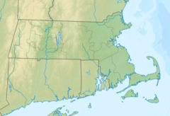
Route 98 is a 3.87-mile-long (6.23 km) southwest-northeast numbered highway in central Massachusetts. The highways southern terminus is a continuation of Rhode Island Route 98 in Uxbridge and the northern terminus is at Route 146A in Uxbridge.
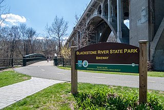
The Blackstone River Greenway is a partially completed 48-mile (77 km) paved rail trail defining the course of the East Coast Greenway through the Blackstone Valley from Worcester, Massachusetts to Providence, Rhode Island in the United States.
The Blackstone River and Canal Heritage State Park is a part of the state park system of the Commonwealth of Massachusetts, managed by the Massachusetts Department of Conservation and Recreation (DCR). This 1,000-acre (4.0 km2) park "recalls the role of canals in transporting raw materials and manufactured goods between emerging industrial centers." The Blackstone River and Canal Heritage State Park at Uxbridge, Massachusetts, is the midpoint of the Blackstone River Valley National Heritage Corridor of the National Park System. The Blackstone River and Valley is where the industrial revolution was born in America. The southern entrance to this state park is the site of the historic Stanley Woolen Mill, currently being redeveloped for commercial and tourism. The Native American Nipmuc name for the village here was "Wacentug", translated as "bend in the river".
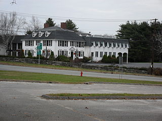
The Hon. Bazaleel Taft House is a historic house at 240 South Main Street in Uxbridge, Massachusetts. The oldest portion of this now-large house was built c. 1780-90 by Bazaleel Taft, and is a fine regional example of late Georgian architecture. The house was adapted for use as a restaurant in the 1960s, which has since closed. The house was listed on the National Register of Historic Places in 1983.

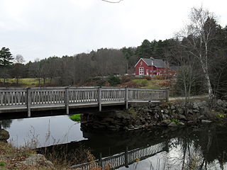
West Hill Dam Reserve is a United States Army Corps of Engineers flood control project with a recreational park and wildlife management area located at Uxbridge, Massachusetts. The West Hill Dam Project was completed in June 1961. It is located on the West River, one of the branches of the Blackstone River which flows from Worcester, MA to Providence, RI. The West River originates in Grafton, Massachusetts, at Cider Mill Pond and Silver Lake, near Upton, Massachusetts, and the Upton State Forest. The dam is unusual in that it isn't filled unless there is a flood. West Hill Dam was built after devastating floods during the 1950s; it is intended to protect the Blackstone Valley from future destructive flooding. The cities and towns downriver from Uxbridge, including Millville, Blackstone, Woonsocket, North Smithfield, Cumberland, Lincoln, Central Falls, Pawtucket and Providence, Rhode Island, suffered extensive flooding from the Blackstone during Hurricane Diane in 1955. Hurricane Donna tested this new dam in 1960 as the eyewall passed over. The West Hill Dam is located in the Blackstone River Valley National Heritage Corridor near the Blackstone River and Canal Heritage State Park. Park rangers provide visitor assistance and offer scheduled interpretative programs. Fishing, hunting, and wildlife viewing opportunities are available year-round. The park has a recreation area, 34 picnic sites, one playground, a swimming area and five miles of hiking trails. However, access to the park from West Hill Road is currently blocked as of 2021 because of landowner disagreements. West Hill Dam is also the field office for the Charles River Natural Valley Storage Area. It consists of scattered wetlands in the upper and middle Charles River watershed, between the towns of Bellingham and Needham. The wetlands provide flood storage area, fisheries, wildlife management, and recreation. The Charles River is the well-known watercourse that flows into Boston Harbor.
The history of Uxbridge, Massachusetts, founded in 1727, may be divided into its prehistory, its colonial history and its modern industrial history. Uxbridge is located on the Massachusetts-Rhode Island state line, and became a center of the earliest industrialized region in the United States.

The Southbridge and Blackstone Railroad was a railroad company that was the precursor to the Willimantic, Connecticut–Blackstone, Massachusetts line of the New York, New Haven and Hartford Railroad (NYNH&H). It was chartered in 1849 to build a line from Southbridge, Massachusetts, to Blackstone. In 1853, with construction underway, it was merged into the Boston and New York Central Railroad (B&NYC). The B&NYC used the charter of the East Thompson Railroad, another of its constituent lines, to alter the routing: west of East Thompson, Connecticut, the merged line continued southwest to Mechanicsville, Connecticut, where it met the Norwich and Worcester Railroad. The Mechanicsville–Blackstone line opened in 1854.

Blackstone station was a railroad station in Blackstone, Massachusetts. Opened in 1847, it was a stop for Providence–Worcester service until 1960, and Boston commuter service until 1966.

The Turners Falls branch was a railway line in Franklin County, Massachusetts, in the United States. It ran 9 miles (14 km) from a junction with the Shelburne Falls Extension at South Deerfield, Massachusetts, to Turners Falls, Massachusetts. It was originally built in 1868 by the New Haven and Northampton Railroad, later part of the New York, New Haven and Hartford Railroad. The Boston and Maine Railroad, which had its own branch to Turners Falls, acquired the Turners Falls branch from the New Haven in 1947 and abandoned its own line. The B&M subsequently abandoned the branch in 1985. Part of it is now the Canalside Rail Trail.

The Turners Falls branch was a railway line in Franklin County, Massachusetts, in the United States. It ran 3 miles (4.8 km) from a junction with the Fitchburg route east of Greenfield, Massachusetts, to Turners Falls, Massachusetts. It was originally built in 1868 by the Vermont and Massachusetts Railroad, later part of the Boston and Maine Railroad. The B&M acquired the New Haven's Turners Falls branch in 1947 and abandoned its own line. Part of the abandoned line is now the Canalside Rail Trail.