Upper Peoria Lake

Last updated
Upper Peoria Lake
Upper Peoria Lake Peoria Heights tower 20231021 0757.jpg
View of Upper Peoria Lake from the Peoria Heights water tower observation deck
USA Illinois relief location map.svg
Red pog.svg
Upper Peoria Lake
Usa edcp relief location map.png
Red pog.svg
Upper Peoria Lake
Location Peoria / Woodford / Tazewell counties, Illinois, US
Coordinates 40°48′24″N89°33′4″W / 40.80667°N 89.55111°W / 40.80667; -89.55111
Primary inflows Illinois River
Primary outflows Illinois River
Basin  countriesUnited States
Surface area6,256.7 hectares (15,461 acres)

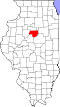
Upper Peoria Lake is a section of the Illinois River primarily between Peoria County and Woodford County, Illinois, United States. The lake runs from South Rome to Peoria Heights, with Spring Bay and the Detweiller Marina area of Peoria near the middle. Just north of Peoria Heights, it empties through a narrow part of the Illinois River into the smaller Peoria Lake, sometimes called Lower Peoria Lake, at approximately river mile 166.5. [1]

Contents

Geology

The Upper Peoria Lake originated during the Woodfordian substage of the Wisconsin glaciation. [1] [2] It is part of the Bloomington moraine. [2] Upper Peoria Lake is a remnant of old Glacial Lake Illinois, which formed behind the moraine. [2]

Due to the flat stream bed, the water moves slowly, allowing sediment to settle at the bottom. [2]

Restoration

Since 1903, the lake has lost approximately 68% of its original volume and the average depth has been reduced from 8.1 ft (2.5 m) to 2.6 ft (0.79 m). [3] Sedimentation and the soft bottom of the lake are not conducive for aquatic plants, which attract waterfowl. [3]

In July 1990, the Peoria Lake Habitat Rehabilitation and Enhancement Project, a joint project between the U.S. Army Corps of Engineers, U.S. Fish and Wildlife Service, and Illinois Department of Natural Resources, worked on the northernmost end of the Upper Peoria Lake. [3] This project achieved:

Fauna

Pollution has been a significant factor in decreasing levels of wildlife. [4] [5] [6]

Fish

Several species of fish are listed by the Illinois Department of Natural Resources for Upper Peoria Lake. [7]

Fish species in Upper Peoria Lake

Species

Rank

Bluegill Excellent
Channel catfish Excellent
Crappie Good
Flathead catfish Very Good
Largemouth bass Excellent
Sauger Excellent
Smallmouth bass Improving
Walleye Excellent

Waterfowl

Upper Peoria Lake is a notable wildlife refuge for migrating waterfowl. [8]

Recreation

The lake is currently a regional tourist attraction and is used for practice of many watersports.

Several public lands border the Peoria Lake, [9] including:

Other notable landmarks include:

Related Research Articles

<span class="mw-page-title-main">Illinois River</span> Illinois tributary of the Mississippi River in the United States

The Illinois River is a principal tributary of the Mississippi River and is approximately 273 miles (439 km) long. Located in the U.S. state of Illinois, the river has a drainage basin of 28,756.6 square miles (74,479 km2). The Illinois River begins with the confluence of the Des Plaines and Kankakee rivers in the Chicago metropolitan area, and it generally flows to the southwest across Illinois, until it empties into the Mississippi near Grafton, Illinois. Its drainage basin extends into southeastern Wisconsin, northwestern Indiana, and a very small area of southwestern Michigan in addition to central Illinois. Along its shores are several river ports, including Peoria, Illinois. Historic recreation areas on the river include Starved Rock and the internationally important wetlands of the Emiquon Complex and Dixon Waterfowl Refuge.

<span class="mw-page-title-main">Maumee River</span> River in Indiana and Ohio, United States

The Maumee River is a river running in the United States Midwest from northeastern Indiana into northwestern Ohio and Lake Erie. It is formed at the confluence of the St. Joseph and St. Marys rivers, where Fort Wayne, Indiana has developed, and meanders northeastwardly for 137 miles (220 km) through an agricultural region of glacial moraines before flowing into the Maumee Bay of Lake Erie. The city of Toledo is located at the mouth of the Maumee. The Maumee was designated an Ohio State Scenic River on July 18, 1974. The Maumee watershed is Ohio's breadbasket; it is two-thirds farmland, mostly corn and soybeans. It is the largest watershed of any of the rivers feeding the Great Lakes, and supplies five percent of Lake Erie's water.

<span class="mw-page-title-main">Fox River (Green Bay tributary)</span> River in Wisconsin, United States

The Fox River is a river in eastern Wisconsin in the Great Lakes region of the United States. It is the principal tributary of Green Bay, and via the Bay, the largest tributary of Lake Michigan. The city of Green Bay, one of the first European settlements in the interior of North America, is on the river at its mouth on lower Green Bay.

<span class="mw-page-title-main">Carson River</span> River in Nevada, United States

The Carson River is a northwestern Nevada river that empties into the Carson Sink, an endorheic basin. The main stem of the river is 131 miles (211 km) long although the addition of the East Fork makes the total length 205 miles (330 km), traversing five counties: Alpine County in California and Douglas, Storey, Lyon, and Churchill Counties in Nevada, as well as the Consolidated Municipality of Carson City, Nevada. The river is named for Kit Carson, who guided John C. Frémont's expedition westward up the Carson Valley and across Carson Pass in winter, 1844. The river made the National Priorities List (NPL) on October 30, 1990 as the Carson River Mercury Superfund site (CRMS) due to investigations that showed trace amounts of mercury in the wildlife and watershed sediments.

<span class="mw-page-title-main">Kankakee River</span> River in Indiana and Illinois, United States

The Kankakee River is a tributary of the Illinois River, approximately 133 miles (214 km) long, in the Central Corn Belt Plains of northwestern Indiana and northeastern Illinois in the United States. At one time, the river drained one of the largest wetlands in North America and furnished a significant portage between the Great Lakes and the Mississippi River. Significantly altered from its original channel, it flows through a primarily rural farming region of reclaimed cropland, south of Lake Michigan.

<span class="mw-page-title-main">Driftless Area</span> Geological region in the Midwestern United States

The Driftless Area, also known as Bluff Country, the Blufflands, the Paleozoic Plateau, and the Coulee Region, is a topographical and cultural region in the Midwestern United States that comprises southwestern Wisconsin, southeastern Minnesota, northeastern Iowa, and the extreme northwestern corner of Illinois. The Driftless Area is a USDA Level III Ecoregion: Ecoregion 52. The Driftless Area takes up a large portion of the Upper Midwest forest–savanna transition.

<span class="mw-page-title-main">Fort Peck Lake</span> Reservoir in Montana

Fort Peck Lake, or Lake Fort Peck, is a major reservoir in Montana, formed by the Fort Peck Dam on the Missouri River. The lake lies in the eastern prairie region of Montana approximately 140 miles (230 km) east of Great Falls and 120 miles (190 km) north of Billings, reaching into portions of six counties.

<span class="mw-page-title-main">Flathead Lake</span> Lake in Montana, United States

Flathead Lake is a large natural lake in northwest Montana, United States.

<span class="mw-page-title-main">Arapaho National Wildlife Refuge</span>

The Arapaho National Wildlife Refuge is a United States National Wildlife Refuge located in north-central Colorado. It is one of over 560 national wildlife refuges which manages and protects natural resources for future generations. The refuge is located in North Park in central Jackson County south of the town of Walden. The refuge was established in 1967 to furnish waterfowl with a suitable place to nest and rear their young. It was created in part to offset losses of nesting habitat in the prairie wetland region of the Midwest. It is located in the valley of the Illinois River, a tributary of the North Platte River. It is administered by the United States Fish and Wildlife Service.

<span class="mw-page-title-main">Peoria Lake</span>

Peoria Lake, sometimes called Lower Peoria Lake, is a section of the Illinois River between Peoria in Peoria County, Illinois and East Peoria in Tazewell County, Illinois. The oldest section of Peoria, the largest city on the river, lies at its shores. From a modern perspective, the lake runs from just south of the McClugage Bridge to the Murray Baker Bridge. The larger Upper Peoria Lake flows into the lake on its north side, at approximately river mile 166.5.

<span class="mw-page-title-main">Upper Mississippi River</span> Upstream portion of the Mississippi river

The Upper Mississippi River is the portion of the Mississippi River upstream of St. Louis, Missouri, United States, at the confluence of its main tributary, the Missouri River.

<span class="mw-page-title-main">Horicon Marsh</span> National State Wildlife Area, Dodge and Fond du Lac counties, Wisconsin

Horicon Marsh is a marsh located in northern Dodge and southern Fond du Lac counties of Wisconsin. It is the site of both a national and a state wildlife refuge. The silted-up glacial lake is the largest freshwater cattail marsh in the United States.

Anderson Lake State Fish and Wildlife Area is an Illinois state park on 2,247 acres (909 ha) in Fulton County, Illinois, United States. A small part at the southern end extends into Schuyler County. Anderson Lake is located in the area.

<span class="mw-page-title-main">Sanganois State Fish and Wildlife Area</span> State park in Illinois, USA

Sanganois State Fish and Wildlife Area is an Illinois state park on 10,360 acres (4,190 ha) in Cass, Schuyler, and Mason County, Illinois, United States.

<span class="mw-page-title-main">Spring Lake State Fish and Wildlife Area</span> State park in Illinois, USA

Spring Lake State Fish and Wildlife Area is an Illinois state park on 2,032 acres (822 ha) in Tazewell County, Illinois, United States.

Woodford State Fish and Wildlife Area is an Illinois state park on 2,900 acres (1,200 ha) of area Woodford County, Illinois, United States. Most of this protected area is over the Goose Lake and Upper Peoria Lake sections of the Illinois River.

<span class="mw-page-title-main">Banner Marsh State Fish and Wildlife Area</span> State park in Illinois, United States

Banner Marsh State Fish and Wildlife Area is an Illinois state park covering 4,363 acres (1,766 ha) in Fulton County, Illinois, United States.

<span class="mw-page-title-main">Saskatchewan River Delta</span> Inland river delta in Western Canada

Anderson Lake is a freshwater lake located in Fulton County, Illinois. It is 12.5 mi (20.1 km) southwest of Havana, Illinois.

<span class="mw-page-title-main">Powerton Lake State Fish and Wildlife Area</span> State park in Illinois, USA

Powerton Lake State Fish and Wildlife Area is a 1,426-acre (577 ha) area of semi-protected habitat on the Illinois River southwest of to the city of Pekin, Illinois within Tazewell County in the U.S. state of Illinois. The parcel is a cooling reservoir owned by NRG Energy, an electric power generating firm, and is operated by the Illinois Department of Natural Resources (IDNR). The lake is used for fishing, with an emphasis on blue catfish. In addition, IDNR states that approximately 60% of the cooling pond is used for duck and goose hunting during legal hunting seasons. The remaining 40% of the pond is maintained as a waterfowl refuge on a year-round basis.

References

  1. 1 2 US Army Corps of Engineers, Rock Island District (1990-07-01). "Peoria Lake Enhancement" (PDF). Retrieved 2023-10-13.
  2. 1 2 3 4 Bevenour, Donald E.; Emmons, Kevin M.; Hobbs, Martin (2007). "The Physical Geography of the Illinois River Valley Near Peoria: An Updated Self-Conducted Field Trip using EcoCaches and GPS Technology" (PDF). Retrieved 2023-10-13.
  3. 1 2 3 "Peoria Lake". ArcGIS StoryMaps. 2023-05-30. Retrieved 2023-10-14.
  4. Baker, Frank Collins (1926). Richardson, Robert E. (ed.). "Changes in the Bottom Fauna of the Illinois River Due to Pollutional Causes". Ecology. 7 (2): 229–230. doi:10.2307/1928948. ISSN   0012-9658.
  5. Mathis, B. J.; Cummings, T. F. (1973). "Selected Metals in Sediments, Water, and Biota in the Illinois River". Journal (Water Pollution Control Federation). 45 (7): 1573–1583. ISSN   0043-1303.
  6. Wisely, W. H.; Klassen, Clarence W. (1938). "The Pollution and Natural Purification of Illinois River below Peoria". Sewage Works Journal. 10 (3): 569–595. ISSN   0096-9362.
  7. "Lake Profile --". www.ifishillinois.org. Retrieved 2023-10-08.
  8. Bellrose, Frank C. (1954). "The Value of Waterfowl Refuges in Illinois". The Journal of Wildlife Management. 18 (2): 160–169. doi:10.2307/3797710. ISSN   0022-541X.
  9. "River Pool -- Illinois - Peoria". www.ifishillinois.org. Retrieved 2023-10-13.