Peoria Heights, Illinois

Last updated

Peoria Heights
Peoria Heights - Water Tower 1970.jpg
Tower Park water tower, 1970
Peoria County Illinois Incorporated and Unincorporated areas Peoria Heights Highlighted.svg
Location of Peoria Heights in Peoria County, Illinois.
Illinois in United States (US48).svg
Location of Illinois in the United States
Coordinates: 40°44′48″N89°34′12″W / 40.74667°N 89.57000°W / 40.74667; -89.57000 [1]
Country United States
State Illinois
Counties Peoria, Woodford, Tazewell [2]
Township Richwoods, Spring Bay, Fondulac
Area
[3]
  Total2.87 sq mi (7.44 km2)
  Land2.49 sq mi (6.46 km2)
  Water0.38 sq mi (0.98 km2)
Elevation
[1]
784 ft (239 m)
Population
 (2020)
  Total5,908
  Density2,369.84/sq mi (915.16/km2)
Time zone UTC-6 (CST)
  Summer (DST) UTC-5 (CDT)
ZIP Code(s)
61616
Area code 309
FIPS code 17-59026
GNIS feature ID2399652 [1]
Wikimedia CommonsPeoria Heights, Illinois
Website www.peoriaheights.org/home

Peoria Heights is a village lying in Peoria County in the U.S. state of Illinois. The population was 6,156 at the 2010 census, down from 6,635 in 2000. Peoria Heights is a suburb of Peoria, is sometimes referred to as Uptown, and is surrounded by the city except for its eastern boundary on Peoria Lake, a relatively wider section of the Illinois River. It is part of the Peoria, Illinois Metropolitan Statistical Area.

Contents

Geography

According to the 2010 census, Peoria Heights has a total area of 6.969 square miles (18.05 km2), of which 2.65 square miles (6.86 km2) (or 38.03%) is land and 4.319 square miles (11.19 km2) (or 61.97%) is water. [4] That most of the village is water is due to the fact that most of Upper Peoria Lake lies within its boundaries; [5] this can be seen on official state maps. [6]

Topographically, the village can be roughly divided into three zones. The Illinois River floodplain, the bluff, and the plateau. While its eastern border is fairly regular with the river's edge, the rest of its municipal border, with Peoria, is quite irregular and convoluted. [7]

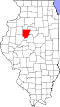
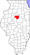
According to the Census Bureau records through 2007, Peoria Heights lies in three counties (Peoria, Woodford, and Tazewell). [2] While neither Tazewell nor Woodford counties consider Peoria Heights to be within their jurisdiction, [8] [9] the state of Illinois does show that across Peoria Lake from the rest of the village, a small, uninhabited[ citation needed ] area exists both within Peoria Heights and Woodford County. However, the Census Bureau claim that Peoria Heights is also within Tazewell County is unsupported by any state, county, or municipal websites.

History

The area was developed by white settlers in 1898, under the name Prospect Heights Land Company. [10] When it was incorporated, it was called Prospect Heights. Three years later, they changed it to Peoria Heights to avoid confusion with the Prospect Heights community near Chicago. [10]

The Prospect Heights Hotel hosted a Hungarian orchestra that played every night as the house band. The hotel burned down in the summer of 1894. [11]

The village celebrated its centennial in 1998. [12]

Landmarks

The village is perhaps most noteworthy for its Grand View Drive, a residential street on top of the bluff overlooking the Illinois River with many elegant homes and a country club. The road also has several panoramic look-outs of the river and beyond into Tazewell and Woodford counties as well as a park with a children's playground, picnic area, and baseball diamond. Teddy Roosevelt purportedly called the street the "World's Most Beautiful Drive" when he visited the Peoria area in October 1910; WMBD, a local radio and TV station, gets its call letters from Roosevelt's expression. [13]

The town is also recognized by its distinct, red water tower. [14] One can ascend the tower in an elevator and survey a sizable portion of Peoria, Tazewell, and Woodford counties from three observational decks. The tower has a 6 ft. wooden woodpecker on the side. [15] The tower forms the nucleus of Peoria Heights Tower Park. Tower Park is a centerpiece of the community which underwent sweeping and controversial renovations in 2002, costing the Village nearly $800,000. The nearby downtown business area includes upscale restaurants and shops. In addition to this water tower there is another modern tower on Toledo Avenue colored white with the Peoria Heights logo; it was formerly painted a distinctive Red, White, and Blue (the school district colors).

A bronze sculpture of Lincoln's head by Gutzon Borglum is near the Village Hall within Tower Park. [12] [16]

On and below the bluff, there are several parks and recreational areas. Forest Park Nature Center is a nature reserve on the bluff containing several miles of trails of varying difficulty and the village's only native prairie restoration site. [17] The Pimiteoui Trail links up Forest Park Nature Center's visitor center with Grandview Drive. Bielfeldt Park is a more traditional park with sports fields, a paved trail, children's playground, and picnic area. The southern terminus of Grandview also sports a park with swings, slide, and pavilion. The Rock Island Greenway has a section through Peoria Heights. [18]

The Duryea Motor Wagon Company once had a production facility nearby (the reason for the aforementioned visit by Teddy Roosevelt). [19] The town was also the site of a brewery for Pabst Blue Ribbon from 1934 to 1982. [11] The closing of the Pabst brewery in 1982 had a severe impact on the local economy and population, from which the community has never completely recovered. [15] The Peoria City mass transit company, CityLink, offers a History Trolley, which starts its tour in the Prospect Commercial Sector.

The Peoria Heights Public Library is located off Glen and is not far from Grandview Drive or Downtown Peoria Heights.

Government and politics

The Village of Peoria Heights is a home rule municipality governed by a Village Board of Trustees form of government. The mayor and the village clerk are each elected at large to a four-year term. The Mayor appoints the Village Treasurer. The Mayor is the Chief Executive Officer of the Village and presides over meetings of the Village Board. With the approval of the Village Board, the Mayor appoints non-elected Village officials. The Village Clerk is the recording officer of the Village, and is responsible for attending all meetings of the Village Board and keeping records of the proceedings. Village Board meetings are the first and third Tuesday of each month. [20]

The Village Board is the legislative body for the village, and consists of six trustees elected for a four-year term. Their terms are staggered, so that half are elected every two years. Members may be elected for an indefinite number of terms. The Village Board formulates policy and enacts local laws, usually in the form of resolutions and ordinances. The Village Board is directly responsible to the citizens of Peoria Heights. [20]

Peoria Heights has a history of non-national political parties. The "Village Party" and the "People's Party" were once prominent in local elections. Today the "Village Party" is defunct and the "People's Party" has lost in the last four elections to Independent candidates.

Emergency Services

Peoria Heights has stand alone Fire and Police Services. The fire department is a volunteer on call service. As of December 2014, EMS services are provided by Advanced Medical Transport. [21]

Schools

History

Demographics

Historical population
CensusPop.Note
1900 309
1910 58288.3%
1920 1,11190.9%
1930 3,279195.1%
1940 4,37633.5%
1950 5,42524.0%
1960 7,06430.2%
1970 7,94312.4%
1980 7,453−6.2%
1990 6,930−7.0%
2000 6,635−4.3%
2010 6,156−7.2%
2020 5,908−4.0%
U.S. Decennial Census [22]

As of the census [23] of 2000, there were 6,635 people, 3,122 households, and 1,657 families residing in the village. The population density was 2,509.0 inhabitants per square mile (968.7/km2). There were 3,331 housing units at an average density of 1,259.6 per square mile (486.3/km2). The racial makeup of the village was 92.89% White, 3.45% African American, 0.32% Native American, 1.07% Asian, 1.06% from other races, and 1.22% from two or more races. Hispanic or Latino of any race were 1.90% of the population.

There were 3,122 households, out of which 22.0% had children under the age of 18 living with them, 39.5% were married couples living together, 9.7% had a female householder with no husband present, and 46.9% were non-families. 39.2% of all households were made up of individuals, and 12.4% had someone living alone who was 65 years of age or older. The average household size was 2.10 and the average family size was 2.82.

In the village, the population was spread out, with 20.3% under the age of 18, 9.4% from 18 to 24, 31.6% from 25 to 44, 22.8% from 45 to 64, and 16.0% who were 65 years of age or older. The median age was 38 years. For every 100 females, there were 93.9 males. For every 100 females age 18 and over, there were 90.6 males.

The median income for a household in the village was $32,161, and the median income for a family was $42,545. Males had a median income of $33,408 versus $22,000 for females. The per capita income for the village was $20,999. About 6.7% of families and 8.8% of the population were below the poverty line, including 8.3% of those under age 18 and 6.6% of those age 65 or over.

Transportation

CityLink provides bus service on Routes 2, 12, and 14 connecting Peoria Heights to destinations throughout the Peoria area. [24]

Related Research Articles

<span class="mw-page-title-main">Woodford County, Illinois</span> County in Illinois, United States

Woodford County is a county located in the state of Illinois. The 2020 United States Census listed its population at 38,467. Its county seat is Eureka. Woodford County is part of the Peoria, IL, Metropolitan Statistical Area. Its name comes from General William Woodford, an officer of the American Revolutionary War who served at the brutal military encampment at Valley Forge, Pennsylvania.

<span class="mw-page-title-main">Tazewell County, Illinois</span> County in Illinois, United States

Tazewell County is a county in the U.S. state of Illinois. According to the 2020 census, it had a population of 131,343. Its county seat and largest city is Pekin. It is pronounced with a short "a", to rhyme with "razz" rather than "raze."

<span class="mw-page-title-main">Peoria County, Illinois</span> County in Illinois, United States

Peoria County is located in the U.S. state of Illinois. The 2020 United States Census listed its population at 181,830. Its county seat is Peoria. Peoria County is part of the Peoria, IL Metropolitan Statistical Area.

<span class="mw-page-title-main">Wheeling, Illinois</span> Village in Illinois, United States

Wheeling is a village in Cook and Lake counties in the U.S. state of Illinois. A suburb of Chicago, it is primarily in Cook County, approximately 23 mi (37 km) northwest of downtown Chicago. Per the 2020 census, the population was 39,137. Wheeling is named for Wheeling, West Virginia.

<span class="mw-page-title-main">Manito, Illinois</span> Village in Illinois, United States

Manito is a village in Mason County, Illinois, United States. The population was 1,552 at the 2020 census, down from 1,642 in 2010. On March 31, 2023, an EFU tornado struck northwest of the village.

<span class="mw-page-title-main">Peoria, Illinois</span> City in Illinois, United States

Peoria is a city in and county seat of Peoria County, Illinois, United States. Located on the Illinois River, the city had a population of 113,150 as of the 2020 census. It is the principal city of the Peoria metropolitan area in Central Illinois, consisting of the counties of Fulton, Marshall, Peoria, Stark, Tazewell, and Woodford, which had a population of 402,391 in 2020.

<span class="mw-page-title-main">Creve Coeur, Illinois</span> Village in Illinois, United States

Creve Coeur is a village in Groveland Township, Tazewell County, Illinois, United States. As of the 2020 census, the village population was 4,934. Creve Coeur is a suburb of Peoria and is part of the Peoria, Illinois Metropolitan Statistical Area.

<span class="mw-page-title-main">Deer Creek, Illinois</span> Village in Illinois, United States

Deer Creek is a village in Tazewell and Woodford counties in the U.S. state of Illinois. The population was 667 at the 2020 census. Deer Creek is part of the Peoria, Illinois Metropolitan Statistical Area.

<span class="mw-page-title-main">East Peoria, Illinois</span> City in Illinois, United States

East Peoria is a city in Tazewell County, Illinois, United States. The population was 22,484 at the 2020 census. East Peoria is a suburb of Peoria and is part of the Peoria, Illinois Metropolitan Statistical Area, located across the Illinois River from downtown Peoria. It is home to many Caterpillar Inc. facilities.

<span class="mw-page-title-main">Hopedale, Illinois</span> Village in Illinois, United States

Hopedale is a village in Tazewell County, Illinois, United States. The population was 865 at the 2010 census. It is part of the Peoria, Illinois Metropolitan Statistical Area. The town is also home to a small number of restaurants, general stores, parks, and the Hopedale Medical Complex.

<span class="mw-page-title-main">North Pekin, Illinois</span> Village in Illinois, United States

North Pekin is a village in Tazewell County, Illinois, United States. The population was 1,573 at the 2010 census. North Pekin is a suburb of Peoria and is part of the Peoria, Illinois Metropolitan Statistical Area.

<span class="mw-page-title-main">Washington, Illinois</span> City in Illinois, United States

Washington is a city in Tazewell County, Illinois, United States. Washington is on U.S. Route 24 and Illinois Route 8, northeast of East Peoria. The population was 16,071 at the 2020 census, a 48.2% percent increase over 2000. It is a suburb of Peoria and is part of the Peoria Metropolitan Statistical Area.

<span class="mw-page-title-main">Congerville, Illinois</span> Village in Illinois, United States

Congerville is a village in Woodford County, Illinois, United States. The population was 474 as of the 2010 census, up from 466 in 2000. Congerville is part of the Peoria, Illinois Metropolitan Statistical Area.

<span class="mw-page-title-main">Germantown Hills, Illinois</span> Village in Illinois, United States

Germantown Hills is a village in Woodford County, Illinois, approximately 8 miles (13 km) northeast of Peoria. Germantown Hills is the only incorporated community in Worth Township. As of the 2010 census, the village had a total population of 3,438. Largely an agricultural community until its incorporation in 1954, Germantown Hills is now a growing bedroom community in the Peoria Metropolitan Area.

<span class="mw-page-title-main">Kappa, Illinois</span> Village in Illinois, United States

Kappa is a village in Woodford County, Illinois, United States. The population was 227 at the 2010 census, up from 170 in 2000. It is part of the Peoria, Illinois Metropolitan Statistical Area.

<span class="mw-page-title-main">Panola, Illinois</span> Village in Illinois, United States

Panola is a village in Woodford County, Illinois, United States. The population was 45 at the 2010 census. It is part of the Peoria, Illinois Metropolitan Statistical Area.

<span class="mw-page-title-main">Grandview Heights, Ohio</span> City in Ohio, United States

Grandview Heights, or simply Grandview, is a city in Franklin County, Ohio, United States. The population was 8,085 at the 2020 census.

<span class="mw-page-title-main">Marble Cliff, Ohio</span> Village in Ohio, United States

Marble Cliff is a village in Franklin County, Ohio, United States. The population was 634 at the 2020 census.

<span class="mw-page-title-main">Grandview Drive</span> United States historic place

Grandview Drive is a two and a half mile scenic road with adjacent park areas through Peoria and Peoria Heights, Illinois. Major portions of the road give a view of the Illinois River and its valley as well as clear views of some of the most prestigious and historic homes in the area. Houses along Grandview Drive are among the best known in the city; the residential area on the west of Grandview Drive, opposite the river, was added to the National Register of Historic Places as an historic district in 1996. A large amount of land on the valley side of Grandview Drive is owned by the Peoria Park District and is undeveloped except for park benches.

<span class="mw-page-title-main">Peoria, Illinois, metropolitan area</span> Geographic area around Peoria, Illinois

The Peoria Metropolitan Statistical Area, as defined by the United States Census Bureau, is an area consisting of six counties in Central Illinois, anchored by the city of Peoria. As of the 2020 census, the area had a population of 402,391. The City of Peoria, according to the 2020 US Census Bureau, has 113,150 people.

References

  1. 1 2 3 U.S. Geological Survey Geographic Names Information System: Peoria Heights, Illinois
  2. 1 2 "Subcounty population estimates: Illinois 2000–2007". United States Census Bureau, Population Division. March 18, 2009. Archived from the original (CSV) on September 26, 2008. Retrieved April 4, 2009. Peoria Heights population total (line 925): 6252 people; Richwoods Township, Peoria County, Illinois (line 5788): 6153 people; Fondulac Township, Tazewell County (line 6577): 0 people; Spring Bay Township, Woodford County (line 7280): 99 people.
  3. "2020 U.S. Gazetteer Files". United States Census Bureau. Retrieved March 15, 2022.
  4. "G001 - Geographic Identifiers - 2010 Census Summary File 1". United States Census Bureau. Archived from the original on February 13, 2020. Retrieved December 25, 2015.
  5. Bartels, DeWayne (March 23, 2011). "Locating the area that is 'East Peoria Heights'". East Peoria Times-Courier. Peoria, Illinois: GateHouse Media. Retrieved March 25, 2011.
  6. Peoria Heights map
  7. The Village of Peoria Heights. Map
  8. Communities Archived 2012-03-20 at the Wayback Machine . Woodford-county.org. Retrieved on 2011-03-28.
  9. Tazewell County Home Page. Tazewell.com. Retrieved on 2011-03-28.
  10. 1 2 "History". VILLAGE of PEORIA HEIGHTS. Retrieved November 26, 2023.
  11. 1 2 "Heights Life". Peoria Heights Chamber of Commerce. Retrieved November 26, 2023.
  12. 1 2 "Peoria Heights". The Ronald Reagan Trail. Retrieved November 26, 2023.
  13. Baietto, Michael E. (August 25, 1995). "National Register of Historic Places Inventory/Nomination: Grand View Drive" (PDF). NRHP. National Park Service: 25–26. Archived from the original (PDF) on December 3, 2007. Retrieved December 9, 2011.
  14. Peoria Heights Chamber of Commerce About Us Archived 2011-07-15 at the Wayback Machine . Peoriaheightschamber.com. Retrieved on 2011-03-28.
  15. 1 2 Cody, Tom (April 27, 2023). "It's Happening in the Heights". Peoria Magazine. Retrieved November 26, 2023.
  16. "Tower Park". VILLAGE of PEORIA HEIGHTS. Retrieved November 26, 2023.
  17. Peoria Heights Chamber of Commerce Community Archived 2011-07-15 at the Wayback Machine . Peoriaheightschamber.com (1969-03-17). Retrieved on 2011-03-28.
  18. "Peoria Heights". Illinois River Road. Retrieved November 26, 2023.
  19. Peoria Heights Chamber of Commerce Duryea Auto History Archived 2011-07-15 at the Wayback Machine . Peoriaheightschamber.com. Retrieved on 2011-03-28.
  20. 1 2 Village of Peoria Heights. Village of Peoria Heights. Retrieved on 2011-03-28.
  21. "Peoria Heights switches to ambulance service | WEEK News 25 - News, Sports, Weather - Peoria, Illinois | Top Stories". Archived from the original on November 15, 2016. Retrieved November 14, 2016.
  22. "Census of Population and Housing". Census.gov. Retrieved June 4, 2015.
  23. "U.S. Census website". United States Census Bureau . Retrieved January 31, 2008.
  24. "Schedules & Routes" . Retrieved January 27, 2024.