Mapleton, Illinois

Last updated

Mapleton
Mapleton sign 20231022 0202.jpg
Mapleton sign from US Route 24
Peoria County Illinois Incorporated and Unincorporated areas Mapleton Highlighted.svg
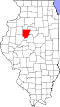
Location of Mapleton in Peoria County, Illinois.
Illinois in United States (US48).svg
Location of Illinois in the United States
Coordinates: 40°34′22″N89°43′42″W / 40.57278°N 89.72833°W / 40.57278; -89.72833
CountryUnited States
StateIllinois
County Peoria
Area
[1]
  Total0.89 sq mi (2.29 km2)
  Land0.89 sq mi (2.29 km2)
  Water0.00 sq mi (0.00 km2)
Population
 (2020)
  Total261
  Density294.92/sq mi (113.82/km2)
Time zone UTC-6 (CST)
  Summer (DST) UTC-5 (CDT)
ZIP Code(s)
61547
Area code 309
FIPS code 17-46643
Wikimedia CommonsMapleton, Illinois
Website www.mapletonillinois.com

Mapleton is a small village in Peoria County, Illinois, United States. The population was 227 at the 2000 census. Mapleton is part of the Peoria, Illinois Metropolitan Statistical Area. There are four different plants in Mapleton, all located along U.S. Route 24: an Evonik chemical plant, a Lonza Group plant, a Caterpillar Inc. foundry, and an Ingredion facility; together, the large industrial complex forms one of Mapleton's (and the wider Peoria area's) most significant employers and a good source of skilled employees and good jobs.

Contents

Geography

Mapleton is located at 40°34′22″N89°43′42″W / 40.572758°N 89.728249°W / 40.572758; -89.728249 . [2]

According to the 2010 census, Mapleton has a total area of 0.91 square miles (2.36 km2), all land. [3]

Demographics

Historical population
CensusPop.Note
1880 135
1960 309
1970 281−9.1%
1980 255−9.3%
1990 216−15.3%
2000 2275.1%
2010 27018.9%
2020 261−3.3%
U.S. Decennial Census [4]

As of the census [5] of 2000, there were 227 people, 100 households, and 57 families residing in the village. The population density was 316.1 inhabitants per square mile (122.0/km2). There were 111 housing units at an average density of 154.6 per square mile (59.7/km2). The racial makeup of the village was 96.92% White, 1.32% Native American, and 1.76% from two or more races.

There were 100 households, out of which 21.0% had children under the age of 18 living with them, 51.0% were married couples living together, 3.0% had a female householder with no husband present, and 43.0% were non-families. 36.0% of all households were made up of individuals, and 18.0% had someone living alone who was 65 years of age or older. The average household size was 2.27 and the average family size was 3.07.

In the village, the population was spread out, with 16.3% under the age of 18, 11.0% from 18 to 24, 30.0% from 25 to 44, 27.8% from 45 to 64, and 15.0% who were 65 years of age or older. The median age was 41 years. For every 100 females, there were 122.5 males. For every 100 females age 18 and over, there were 118.4 males.

The median income for a household in the village was $45,357, and the median income for a family was $63,750. Males had a median income of $35,208 versus $19,423 for females. The per capita income for the village was $22,728. About 3.3% of families and 6.6% of the population were below the poverty line, including none of those under the age of 18 or 65 or over.

Related Research Articles

<span class="mw-page-title-main">Hooppole, Illinois</span> Village in Illinois, United States

Hooppole is a village in Henry County, Illinois, United States. The population was 204 at the 2010 census, up from 162 in 2000. As of 2018, the population has grown to an estimated 236.

<span class="mw-page-title-main">La Rose, Illinois</span> Village in Illinois, United States

La Rose is a village in Bell Plain Township, Marshall County, Illinois, United States. The population was 98 at the 2020 census, down from 144 in 2010. It is part of the Peoria Metropolitan Statistical Area.

<span class="mw-page-title-main">Bartonville, Illinois</span> Village in Illinois, United States

Bartonville is a village in Peoria County, Illinois, United States. The population was 6,471 at the 2010 census. Bartonville is a suburb of Peoria and is part of the Peoria, Illinois Metropolitan Statistical Area.

<span class="mw-page-title-main">Bellevue, Illinois</span> Village in Illinois, United States

Bellevue is a village in Peoria County, Illinois, United States. The population was 1,978 at the 2010 census. Bellevue is a suburb of Peoria and is part of the Peoria, Illinois Metropolitan Statistical Area.

<span class="mw-page-title-main">Brimfield, Illinois</span> Village in Illinois, United States

Brimfield is a village in Peoria County, Illinois, United States.

<span class="mw-page-title-main">Norwood, Illinois</span> Village in Illinois, United States

Norwood is a village in Peoria County, Illinois, United States. The population was 478 at the 2010 census. Norwood, just outside Peoria, is part of the Peoria, Illinois Metropolitan Statistical Area.

<span class="mw-page-title-main">Princeville, Illinois</span> Village in Illinois, United States

Princeville is a village in Peoria County, Illinois, United States. The population was 1,738 at the 2010 census, up from 1,621 in 2000. It is part of the Peoria, Illinois Metropolitan Statistical Area.

Rome is a census-designated place (CDP) in Medina Township, Peoria County, Illinois, United States. The population of the CDP was 1,738 at the 2010 census. Rome is part of the Peoria, Illinois Metropolitan Statistical Area.

<span class="mw-page-title-main">West Peoria, Illinois</span> City in Illinois, United States

West Peoria is a city in Peoria County, Illinois, United States. The population was 4,458 at the 2010 census. West Peoria is a suburb of Peoria and is part of the Peoria, Illinois Metropolitan Statistical Area.

<span class="mw-page-title-main">Thayer, Illinois</span> Village in Illinois, United States

Thayer is a village in Sangamon County, Illinois, United States. The population was 693 at the 2010 census. It is part of the Springfield, Illinois Metropolitan Statistical Area.

<span class="mw-page-title-main">Williamsville, Illinois</span> Village in Illinois, United States

Williamsville is a village in Sangamon County, Illinois, United States. The population was 1,476 at the 2010 census, and 1,491 at a 2018 estimate. It is part of the Springfield, Illinois Metropolitan Statistical Area. The village is named after Springfield merchant and banker John Williams

<span class="mw-page-title-main">Creve Coeur, Illinois</span> Village in Illinois, United States

Creve Coeur is a village in Groveland Township, Tazewell County, Illinois, United States. As of the 2020 census, the village population was 4,934. Creve Coeur is a suburb of Peoria and is part of the Peoria, Illinois Metropolitan Statistical Area.

<span class="mw-page-title-main">Coleta, Illinois</span> Village in Illinois, United States

Coleta is a village in Whiteside County, Illinois, United States. The population was 164 at the 2010 census, up from 155 in 2000.

<span class="mw-page-title-main">Bay View Gardens, Illinois</span> Village in Illinois, United States

Bay View Gardens is a village in Woodford County, Illinois, United States. The population was 378 at the 2010 census, up from 366 in 2000. The village is part of the Peoria, Illinois Metropolitan Statistical Area.

<span class="mw-page-title-main">Panola, Illinois</span> Village in Illinois, United States

Panola is a village in Woodford County, Illinois, United States. The population was 45 at the 2010 census. It is part of the Peoria, Illinois Metropolitan Statistical Area.

<span class="mw-page-title-main">Secor, Illinois</span> Village in Illinois, United States

Secor is a village in Clayton Township, Woodford County, Illinois, United States. The population was 373 at the 2010 census. It is part of the Peoria, Illinois Metropolitan Statistical Area. Secor is located just off U.S. Route 24 between El Paso and Eureka.

<span class="mw-page-title-main">Lambert, Missouri</span> Inactive Village in Missouri, United States

Lambert is an inactive village in Scott County, Missouri, United States. The population was 48 at the 2020 census.

<span class="mw-page-title-main">Mapleton, Pennsylvania</span> Borough in Pennsylvania, United States

Mapleton is a borough in Huntingdon County, Pennsylvania, United States. The population was 441 at the 2010 census. It is located on the Juniata River, which is a tributary of the Susquehanna River.

<span class="mw-page-title-main">Fall River, Wisconsin</span> Village in Wisconsin, United States

Fall River is a village in Columbia County, Wisconsin, United States, along the North Fork of the Crawfish River. The population was 1,712 at the 2010 census. It is part of the Madison Metropolitan Statistical Area.

<span class="mw-page-title-main">Rockdale, Wisconsin</span> Village in Wisconsin, United States

Rockdale is a village in Dane County, Wisconsin, United States. The population was 207 at the 2020 census, making it the smallest incorporated municipality in Dane County. The village is split in half by the Koshkonong Creek. It is part of the Madison Metropolitan Statistical Area.

References

  1. "2020 U.S. Gazetteer Files". United States Census Bureau. Retrieved March 15, 2022.
  2. "US Gazetteer files: 2010, 2000, and 1990". United States Census Bureau. February 12, 2011. Retrieved April 23, 2011.
  3. "G001 - Geographic Identifiers - 2010 Census Summary File 1". United States Census Bureau. Archived from the original on February 13, 2020. Retrieved October 26, 2015.
  4. "Census of Population and Housing". Census.gov. Retrieved June 4, 2015.
  5. "U.S. Census website". United States Census Bureau . Retrieved January 31, 2008.