Kingston Mines, Illinois

Last updated

Kingston Mines
Kingston Mines, IL post office and city hall.jpg
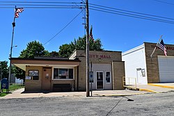
Kingston Mines post office and city hall
Peoria County Illinois Incorporated and Unincorporated areas Kingston Mines Highlighted.svg
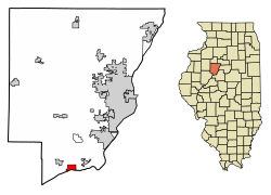
Location of Kingston Mines in Peoria County, Illinois.
Illinois in United States (US48).svg
Location of Illinois in the United States
Coordinates: 40°33′29″N89°46′19″W / 40.55806°N 89.77194°W / 40.55806; -89.77194
CountryUnited States
StateIllinois
County Peoria
Area
[1]
  Total1.58 sq mi (4.11 km2)
  Land1.44 sq mi (3.74 km2)
  Water0.14 sq mi (0.37 km2)
Population
 (2020)
  Total266
  Density184.21/sq mi (71.11/km2)
Time zone UTC-6 (CST)
  Summer (DST) UTC-5 (CDT)
ZIP Code(s)
61539
Area code 309
FIPS code 17-40091
Wikimedia CommonsKingston Mines, Illinois
Website villageofkingstonmines.org

Kingston Mines is a village in Peoria County, Illinois, United States. The population was 259 at the 2000 census. It is part of the Peoria, Illinois Metropolitan Statistical Area. Located on the Illinois River, it was a shipping port, loading coal from the nearby mines (the largest nearby mine was called Kingston). [2] [3]

Contents

History

In the early 20th century, an archeological site of an indigenous village on the north shore of Kingston Lake, Illinois River was destroyed by the Kingston Lake Gravel Company. [4] [5] [6] The Peoria Academy of Science performed some fieldwork in the 1930s. [4]

The original post office and village hall were constructed circa 1880. These facilities were rebuilt in 1953. [7]

Geography

Kingston Mines is located at 40°33′29″N89°46′19″W / 40.55806°N 89.77194°W / 40.55806; -89.77194 . [8] It is located in the southwestern corner of Timber Township, mostly within the bounds of quarter sections 25 and 26. [9]

According to the 2010 census, Kingston Mines has a total area of 1.528 square miles (3.96 km2), of which 1.38 square miles (3.57 km2) (or 90.31%) is land and 0.148 square miles (0.38 km2) (or 9.69%) is water. [10]

Demographics

Historical population
CensusPop.Note
1900 509
1910 492−3.3%
1920 360−26.8%
1930 326−9.4%
1940 39019.6%
1950 4043.6%
1960 375−7.2%
1970 3801.3%
1980 340−10.5%
1990 293−13.8%
2000 259−11.6%
2010 30216.6%
2020 266−11.9%
U.S. Decennial Census [11]

As of the census [12] of 2000, there were 259 people, 98 households, and 68 families residing in the village. The population density was 193.2 inhabitants per square mile (74.6/km2). There were 105 housing units at an average density of 78.3 per square mile (30.2/km2). The racial makeup of the village was 95.75% White, 2.32% from other races, and 1.93% from two or more races. Hispanic or Latino of any race were 3.09% of the population.

There were 98 households, out of which 29.6% had children under the age of 18 living with them, 56.1% were married couples living together, 11.2% had a female householder with no husband present, and 29.6% were non-families. 26.5% of all households were made up of individuals, and 14.3% had someone living alone who was 65 years of age or older. The average household size was 2.64 and the average family size was 3.20.

In the village, the population was spread out, with 23.2% under the age of 18, 12.4% from 18 to 24, 27.4% from 25 to 44, 21.2% from 45 to 64, and 15.8% who were 65 years of age or older. The median age was 35 years. For every 100 females, there were 105.6 males. For every 100 females age 18 and over, there were 101.0 males.

The median income for a household in the village was $31,250, and the median income for a family was $45,556. Males had a median income of $26,000 versus $21,875 for females. The per capita income for the village was $14,908. About 2.9% of families and 5.2% of the population were below the poverty line, including 7.8% of those under the age of eighteen and none of those 65 or over.

Point of interest

Kingston Mines Park has a covered pavilion, covered bandstand, basketball court, and baseball diamond. [13] There is also a veteran's memorial. [14] [15]

Related Research Articles

<span class="mw-page-title-main">Tazewell County, Illinois</span> County in Illinois, United States

Tazewell County is a county in the U.S. state of Illinois. According to the 2020 census, it had a population of 131,343. Its county seat and largest city is Pekin. It is pronounced with a short "a", to rhyme with "razz" rather than "raze."

<span class="mw-page-title-main">Peoria County, Illinois</span> County in Illinois, United States

Peoria County is located in the U.S. state of Illinois. The 2020 United States Census listed its population at 181,830. Its county seat is Peoria. Peoria County is part of the Peoria, IL Metropolitan Statistical Area.

<span class="mw-page-title-main">Arlington, Illinois</span> Village in Illinois, United States

Arlington is a village in Bureau County, Illinois, United States. The population was 169 at the 2020 census. It is part of the Ottawa Micropolitan Statistical Area, located east of the Quad Cities, north of Peoria and Galesburg, west of LaSalle and Peru, and southwest of Rockford and Chicago.

<span class="mw-page-title-main">Banner, Illinois</span> Village in Illinois, United States

Banner is a village in Fulton County, Illinois, United States. The population was 189 at the 2010 census, up from 149 at the 2000 census.

<span class="mw-page-title-main">Liverpool, Illinois</span> Village in Illinois, United States

Liverpool is a village in Fulton County, Illinois, United States. The population was 129 at the 2010 census.

<span class="mw-page-title-main">New Burnside, Illinois</span> Village in Illinois, United States

New Burnside is a village in Johnson County, Illinois, United States. The population was 211 at the 2010 census.

<span class="mw-page-title-main">Varna, Illinois</span> Village in Illinois, United States

Varna is a village in Marshall County, Illinois, United States. The population was 375 at the 2020 census. It is part of the Peoria Metropolitan Statistical Area.

<span class="mw-page-title-main">Bartonville, Illinois</span> Village in Illinois, United States

Bartonville is a village in Peoria County, Illinois, United States. The population was 6,471 at the 2010 census. Bartonville is a suburb of Peoria and is part of the Peoria, Illinois Metropolitan Statistical Area.

<span class="mw-page-title-main">Bellevue, Illinois</span> Village in Illinois, United States

Bellevue is a village in Peoria County, Illinois, United States. The population was 1,978 at the 2010 census. Bellevue is a suburb of Peoria and is part of the Peoria, Illinois Metropolitan Statistical Area.

<span class="mw-page-title-main">Brimfield, Illinois</span> Village in Illinois, United States

Brimfield is a village in Peoria County, Illinois, United States.

<span class="mw-page-title-main">Hanna City, Illinois</span> Village in Illinois, United States

Hanna City is a village in Peoria County, Illinois, United States. The population was 1,225 at the 2010 census. Hanna City is part of the Peoria Metropolitan Statistical Area.

<span class="mw-page-title-main">Mapleton, Illinois</span> Village in Illinois, United States

Mapleton is a small village in Peoria County, Illinois, United States. The population was 227 at the 2000 census. Mapleton is part of the Peoria, Illinois Metropolitan Statistical Area. There are four different plants in Mapleton, all located along U.S. Route 24: an Evonik chemical plant, a Lonza Group plant, a Caterpillar Inc. foundry, and an Ingredion facility; together, the large industrial complex forms one of Mapleton's most significant employers and a good source of skilled employees and good jobs.

<span class="mw-page-title-main">Norwood, Illinois</span> Village in Illinois, United States

Norwood is a village in Peoria County, Illinois, United States. The population was 478 at the 2010 census. Norwood, just outside Peoria, is part of the Peoria, Illinois Metropolitan Statistical Area.

<span class="mw-page-title-main">Peoria Heights, Illinois</span> Village in Illinois, United States

Peoria Heights is a village lying in Peoria County in the U.S. state of Illinois. The population was 6,156 at the 2010 census, down from 6,635 in 2000. Peoria Heights is a suburb of Peoria, is sometimes referred to as Uptown, and is surrounded by the city except for its eastern boundary on Peoria Lake, a relatively wider section of the Illinois River. It is part of the Peoria, Illinois Metropolitan Statistical Area.

<span class="mw-page-title-main">West Peoria, Illinois</span> City in Illinois, United States

West Peoria is a city in Peoria County, Illinois, United States. The population was 4,458 at the 2010 census. West Peoria is a suburb of Peoria and is part of the Peoria, Illinois Metropolitan Statistical Area.

<span class="mw-page-title-main">La Fayette, Illinois</span> Village in Illinois, United States

La Fayette is a village in Stark County, Illinois. It is located south of Kewanee off Route 78 on Route 17|IL-17. The population was 223 at the 2010 census, down from 227 in 2000. It is part of the Peoria, Illinois Metropolitan Statistical Area. Once a prominent strip coal mine and farming village with; a general store, high school(until 1970), hotel, bank, grain elevator, train depot, and many other features and amenities. Once the coal mines shut down and railroad was removed in the early 1980s, it slowly became a low income and high poverty village with many people moving away and it eventually diminished to the hollow shell of what it once was.

<span class="mw-page-title-main">Creve Coeur, Illinois</span> Village in Illinois, United States

Creve Coeur is a village in Groveland Township, Tazewell County, Illinois, United States. As of the 2020 census, the village population was 4,934. Creve Coeur is a suburb of Peoria and is part of the Peoria, Illinois Metropolitan Statistical Area.

<span class="mw-page-title-main">Morton, Illinois</span> Village in Illinois, United States

Morton is a village in Tazewell County, Illinois, United States. The population was 17,117 at the 2024 census. Morton is a suburb of Peoria, located southeast of Peoria, and is part of the Peoria Metropolitan Statistical Area. The community holds a yearly Morton Pumpkin Festival for a week every September, and claims that "82 percent of the world's canned pumpkin is produced in Morton", earning it the designation "Pumpkin Capital of the World". This nickname might not be lived up to because the institution of the Libby's pumpkin factory, the source of the surplus pumpkin, is facing financial troubles due to the pandemic and other external variables.

<span class="mw-page-title-main">North Pekin, Illinois</span> Village in Illinois, United States

North Pekin is a village in Tazewell County, Illinois, United States. The population was 1,573 at the 2010 census. North Pekin is a suburb of Peoria and is part of the Peoria, Illinois Metropolitan Statistical Area.

<span class="mw-page-title-main">Kappa, Illinois</span> Village in Illinois, United States

Kappa is a village in Woodford County, Illinois, United States. The population was 227 at the 2010 census, up from 170 in 2000. It is part of the Peoria, Illinois Metropolitan Statistical Area.

References

  1. "2020 U.S. Gazetteer Files". United States Census Bureau. Retrieved March 15, 2022.
  2. Leyland, Marilyn J. (April 2021). "A History Underground". Peoria Magazine.
  3. Lynn, Greg (March 28, 2012). "A History Underground". Peoria Magazine. Retrieved October 13, 2023.
  4. 1 2 Buis, A. R. (1944). "The Prehistoric Villages and Camp Sites of the Peoria Lake Area". Journal of the Illinois State Archaeological Society. 1 (3): 9–15. ISSN   2469-2824.
  5. Simpson, A. M. (1951). "The Kingston Village Site". Journal of the Illinois State Archaeological Society. 2 (2/3): 63–79. ISSN   2469-2824.
  6. Poehls, R. L. (1944). "Kingston Lake Site Burials". Journal of the Illinois State Archaeological Society. 1 (4): 36–38. ISSN   2469-2824.
  7. https://glasfordil.com/wp-content/uploads/2021/11/1868-to-1968-history-in-its-entirety.pdf
  8. "US Gazetteer files: 2010, 2000, and 1990". United States Census Bureau. February 12, 2011. Retrieved April 23, 2011.
  9. "Timber Township". data-peoriacountygis.opendata.arcgis.com. Retrieved October 14, 2023.
  10. "G001 - Geographic Identifiers - 2010 Census Summary File 1". United States Census Bureau. Archived from the original on February 13, 2020. Retrieved August 4, 2015.
  11. "Census of Population and Housing". Census.gov. Retrieved June 4, 2015.
  12. "U.S. Census website". United States Census Bureau . Retrieved January 31, 2008.
  13. "Kingston Mines Park". Village of Kingston Mines, IL. Retrieved October 13, 2023.
  14. "Veterans' Affairs Director Names Glasford Resident as State of Illinois' March "Veteran of the Month"". www.illinois.gov. March 27, 2009. Retrieved October 13, 2023.
  15. "Annual listing of upcoming Memorial Day events". Peoria Journal Star. May 24, 2014. Retrieved October 13, 2023.