
Peoria County is a county in the U.S. state of Illinois. The 2010 United States Census listed its population at 186,494. Its county seat is Peoria.
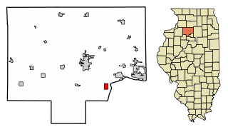
Bureau Junction, usually called Bureau, is a village in Bureau County, Illinois, United States. The population was 322 at the 2010 census. The village name is shown as both "Bureau Junction" and "Bureau" on federal maps, and is commonly called "Bureau", including by phone companies and the United States Post Office. It is part of the Ottawa–Streator Micropolitan Statistical Area. Bureau Junction was the point where the Rock Island Line railroad's branch line to Peoria split. Track west and south of Bureau is operated by Iowa Interstate, while tracks east to Chicago were formerly operated by CSX but are currently leased to Iowa Interstate.

Gilman is a city in Douglas Township, Iroquois County, Illinois, United States. The population was 1,814 at the 2010 census.

Galesburg is a city in Knox County, Illinois, United States. The city is 45 miles (72 km) northwest of Peoria. As of the 2010 census, the city population was 32,195. It is the county seat of Knox County and the principal city of the Galesburg Micropolitan Statistical Area, which includes all of Knox and Warren counties.

Chatsworth is an incorporated town in Livingston County, Illinois, United States. The population was 1,205 at the 2010 census.
Gridley is a village in McLean County, Illinois, United States. The population consisted of 1,432 people at the end of the 2010 census. It is part of the Bloomington–Normal Metropolitan Statistical Area.

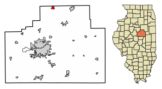
Dunlap, located on Illinois 91, is a small village in Peoria County Illinois, United States. Its population was 1,386 people as of the 2010 census. Dunlap is part of the Peoria metropolitan area and growth in the city of Peoria is extending towards the village. There are only a handful of businesses in the village's 16 blocks.

Peoria is the county seat of Peoria County, Illinois, and the largest city on the Illinois River. As of the 2010 census, the city had a population of 115,007, making it the eighth-most populated in Illinois, the second-largest city in Central Illinois after the state capital, Springfield, and the third largest outside the Chicago metropolitan area. It is the principal city of the Peoria Metropolitan Statistical Area in Central Illinois, consisting of the counties of Marshall, Peoria, Stark, Tazewell, and Woodford, which had a population of 373,590 in 2011. The Peoria Metro Area is the third largest MSA in Illinois after Chicago and Metro East.

The Illinois Terminal Railroad Company, known as the Illinois Traction System until 1937, was a heavy duty interurban electric railroad with extensive passenger and freight business in central and southern Illinois from 1896 to 1982. When Depression era Illinois Traction was in financial distress and had to reorganize, the Illinois Terminal name was adopted to reflect the line's primary money making role as a freight interchange link to major steam railroads at its terminal ends, Peoria, Danville, and St. Louis. Interurban passenger service slowly was reduced, and it ended in 1956. Freight operation continued but was hobbled by tight street running in some towns requiring very sharp radius turns. In 1956, ITC was absorbed by a consortium of connecting railroads.

The Rock Island Trail State Park is a 26-mile (42 km) long public rail trail in the west-central region of the U.S. state of Illinois. It was designated a National Recreation Trail in 2003.
The Keokuk Junction Railway Co., is a Class III railroad in the U.S. states of Illinois and Iowa. It is a subsidiary of Pioneer Railcorp.

The Tazewell & Peoria Railroad (T&P) is a short-line railroad, running entirely in Peoria County and Tazewell County, Illinois, and formed by Genesee & Wyoming Inc. to lease the assets of the century-old Peoria and Pekin Union Railway (P&PU), which is owned by Union Pacific, Norfolk Southern and Canadian National. It switches close to 100,000 cars per year and has about 142 miles of track.
Glover is an unincorporated community in Champaign County, Illinois, United States. Glover is located on U.S. Route 150 near the eastern border of St. Joseph.There are no buildings in Glover. There used to be a tower at the Junction of the Chicago and Eastern Illinois, Peoria and Eastern, and the Illinois Terminal railroads. The Peoria and Eastern and the Illinois Terminal have been removed. Houses nearby belong to St Joseph, Illinois.

Edwards is an unincorporated community in Peoria County, Illinois, United States. Edwards is located on Illinois Route 8 northwest of downtown Peoria. Edwards has a post office with ZIP Code 61528; the Post Office is now located on Dubois Road just south of Interstate 74 exit 82, 2.1 miles (3.4 km) north of the original Edwards.

Alta is an unincorporated community on the northwest border of Peoria in Peoria County, Illinois, United States. Alta is 8 miles (13 km) north-northwest of downtown Peoria. The decommissioned Illinois State Route 174 runs through Alta, and the Rock Island Trail begins in Alta.

Allentown is an unincorporated community in Tazewell County, Illinois, United States. Allentown is in the Tremont Township, though it is much closer to Mackinaw than to Tremont. Allentown is 2.5 miles (4.0 km) northwest of Mackinaw and 6 miles (9.7 km) northeast of Tremont.
Bishop is an unincorporated community in Forest City Township, Mason County, Illinois, United States. Bishop is 3 miles (4.8 km) west-southwest of Forest City.
Eden is an unincorporated community in Randolph County, Illinois, United States. Eden is located at the junction of Illinois Route 153 and Illinois Route 154, 1.9 miles (3.1 km) east of Sparta.
Kickapoo is an unincorporated community in Kickapoo Township, Peoria County, Illinois, United States. Kickapoo is located on U.S. Route 150, 10.8 miles (17.4 km) northwest of downtown Peoria.

Peoria is an unincorporated community in Linn County, in the U.S. state of Oregon. It is on the right bank of the Willamette River at river mile 141 between Eugene and Corvallis. For statistical purposes, the United States Census Bureau has defined Peoria as a census-designated place (CDP). The census definition of the area may not precisely correspond to local understanding of the area with the same name. Lacking stores and services, it is a cluster of houses plus a county park along Peoria Road, about 10 miles (16 km) south of Oregon Route 34. As of the 2010 Census, the population was 94.


