Medina Township, Peoria County, Illinois

Last updated

Medina Township
Township
Map highlighting Medina Township, Peoria County, Illinois.svg
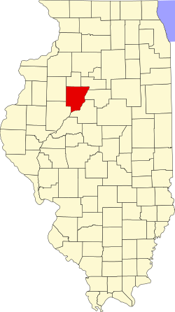
Location in Peoria County
Map of Illinois highlighting Peoria County.svg
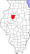
Peoria County's location in Illinois
Country United States
State Illinois
County Peoria
EstablishedNovember 6, 1849
Area
  Total
29.78 sq mi (77.1 km2)
  Land26.86 sq mi (69.6 km2)
  Water2.92 sq mi (7.6 km2)  9.81%
Population
 (2010)
  Estimate 
(2016) [1]
12,542
  Density467.7/sq mi (180.6/km2)
Time zone UTC-6 (CST)
  Summer (DST) UTC-5 (CDT)
FIPS code 17-143-48099

Medina Township is located north of Peoria, in Peoria County, Illinois, and in the Illinois River Valley (West of the river itself). As of the 2010 census, its population was 12,564 and it contained 4,993 housing units. [2]

Contents

Medina Township changed its name from Franklin Township on an unknown date, but most likely in 1850.

Headquartered in Mossville, it is served by two school districts: Illinois Valley Central School District #321, and Dunlap School District #323. [3]

Geography

According to the 2010 census, the township has a total area of 29.78 square miles (77.1 km2), of which 26.86 square miles (69.6 km2) (or 90.19%) is land and 2.92 square miles (7.6 km2) (or 9.81%) is water. [2]

Demographics

Historical population
CensusPop.Note
2016 (est.)12,542 [1]
U.S. Decennial Census [4]

Related Research Articles

<span class="mw-page-title-main">Tazewell County, Illinois</span> County in Illinois, United States

Tazewell County is located in the U.S. state of Illinois. According to the 2020 census, it had a population of 131,343. Its county seat and largest city is Pekin. It is pronounced with a short "a", to rhyme with "razz" rather than "raze."

<span class="mw-page-title-main">Peoria County, Illinois</span> County in Illinois, United States

Peoria County is located in the U.S. state of Illinois. The 2020 United States Census listed its population at 181,830. Its county seat is Peoria. Peoria County is part of the Peoria metropolitan area.

<span class="mw-page-title-main">Kingston Mines, Illinois</span> Village in Illinois, United States

Kingston Mines is a village in Peoria County, Illinois, United States. The population was 259 at the 2000 census. It is part of the Peoria, Illinois Metropolitan Statistical Area. Located on the Illinois River, it was a shipping port, loading coal from the nearby mines.

Rome is a census-designated place (CDP) in Medina Township, Peoria County, Illinois, United States. The population of the CDP was 1,738 at the 2010 census. Rome is part of the Peoria, Illinois Metropolitan Statistical Area.

<span class="mw-page-title-main">Kankakee Township, Kankakee County, Illinois</span> Township in Illinois, United States

Kankakee Township is one of seventeen townships in Kankakee County, Illinois, United States. As of the 2010 census, its population was 27,558 and it contained 11,219 housing units. This township has the smallest area in the county, but is second largest in population.

<span class="mw-page-title-main">Groveland Township, Tazewell County, Illinois</span> Township in Illinois, United States

Groveland Township is located in Tazewell County, Illinois. As of the 2010 census, its population was 19,526 and it contained 8,441 housing units.

<span class="mw-page-title-main">Morton Township, Tazewell County, Illinois</span> Township in Illinois, United States

Morton Township is located in Tazewell County, Illinois, at T25N R3W. It is traversed by Interstate Routes 74 and 155, about 15 km (10 mi) southeast of Peoria, Illinois.

<span class="mw-page-title-main">Danvers Township, McLean County, Illinois</span> Township in Illinois, United States

Danvers Township is located in McLean County, Illinois. As of the 2010 census, its population was 1,925 and it contained 757 housing units.

<span class="mw-page-title-main">Chillicothe Township, Peoria County, Illinois</span> Township in Illinois, United States

Chillicothe Township is located in Peoria County, Illinois, United States. As of the 2010 census, its population was 8,364 and it contained 3,694 housing units.

<span class="mw-page-title-main">Elmwood Township, Peoria County, Illinois</span> Township in Illinois, United States

Elmwood Township is located in Peoria County, Illinois, United States. As of the 2010 census, its population was 2,598 and it contained 1,094 housing units.

<span class="mw-page-title-main">Hallock Township, Peoria County, Illinois</span> Township in Illinois, United States

Hallock Township is located in Peoria County, Illinois, United States. As of the 2010 census, its population was 1,600 and it contained 619 housing units. The current supervisor Kevin Peterson has served in this position since 1994.

<span class="mw-page-title-main">Hollis Township, Peoria County, Illinois</span> Township in Illinois, United States

Hollis Township is located in Peoria County, Illinois. As of the 2010 census, its population was 1,881 and it contained 768 housing units. The village of Mapleton is the only incorporated town in the township.

<span class="mw-page-title-main">Jubilee Township, Peoria County, Illinois</span> Township in Illinois, United States

Jubilee Township is located in Peoria County, Illinois. As of the 2010 census, its population was 1,695 and it contained 601 housing units.

<span class="mw-page-title-main">Logan Township, Peoria County, Illinois</span> Township in Illinois, United States

Logan Township is located in Peoria County, Illinois. As of the 2010 census, its population was 3,192 and it contained 1,390 housing units.

<span class="mw-page-title-main">Princeville Township, Peoria County, Illinois</span> Township in Illinois, United States

Princeville Township is located in Peoria County, Illinois. As of the 2010 census, its population was 1,628 and it contained 674 housing units. The township shares a border with Stark County to the North. It also borders Millbrook Township to the West, Akron Township to the East, and the Jubilee Township to the South.

<span class="mw-page-title-main">Richwoods Township, Peoria County, Illinois</span> Township in Illinois, United States

Richwoods Township is located in Peoria County, Illinois. The geographic designation is Township 9 North, Range 8 East of the Fourth Principal Meridian. As of the 2010 census, its population was 6,089 and it contained 3,048 housing units. The majority of its area is the village of Peoria Heights, Illinois.

<span class="mw-page-title-main">Timber Township, Peoria County, Illinois</span> Township in Illinois, United States

Timber Township is located in Peoria County, Illinois. As of the 2010 census, its population was 2,511 and it contained 1,077 housing units.

<span class="mw-page-title-main">Trivoli Township, Peoria County, Illinois</span> Township in Illinois, United States

Trivoli Township is located in Peoria County, Illinois. As of the 2010 census, its population was 1,021 and it contained 447 housing units.

<span class="mw-page-title-main">Haw Creek Township, Knox County, Illinois</span> Township in Illinois, United States

Haw Creek Township is one of twenty-one townships in Knox County, Illinois, USA. As of the 2010 census, its population was 461 and it contained 193 housing units. Its name was changed from Ohio township on June 8, 1853.

<span class="mw-page-title-main">Maquon Township, Knox County, Illinois</span> Township in Illinois, United States

Maquon Township is one of twenty-one townships in Knox County, Illinois, USA. As of the 2010 census, its population was 556 and it contained 269 housing units.

References

  1. 1 2 "Population and Housing Unit Estimates" . Retrieved June 9, 2017.
  2. 1 2 "Population, Housing Units, Area, and Density: 2010 - County -- County Subdivision and Place -- 2010 Census Summary File 1". United States Census. Archived from the original on February 12, 2020. Retrieved May 28, 2013.
  3. "2020 CENSUS - SCHOOL DISTRICT REFERENCE MAP: Peoria County, IL" (PDF). U.S. Census Bureau . Retrieved October 30, 2024. - Text list
  4. "Census of Population and Housing". Census.gov. Retrieved June 4, 2016.

40°49′47″N89°34′57″W / 40.829855°N 089.582605°W / 40.829855; -089.582605