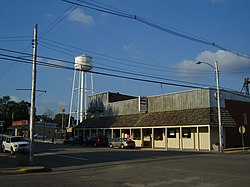
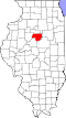
Washburn, Illinois

Last updated
Washburn, Illinois
Washburn-Il-08.JPG
Jefferson Street, Washburn
Woodford County Illinois Incorporated and Unincorporated areas Washburn Highlighted.svg
Location in Woodford County, Illinois
Usa edcp location map.svg
Red pog.svg
Washburn
Location in the United States
Coordinates: 40°55.2′N89°17.5′W / 40.9200°N 89.2917°W / 40.9200; -89.2917 Coordinates: 40°55.2′N89°17.5′W / 40.9200°N 89.2917°W / 40.9200; -89.2917
CountryUnited States
StateIllinois
Counties Marshall, Woodford
Townships Cazenovia, Richland
Area
[1]
  Total0.72 sq mi (1.86 km2)
  Land0.72 sq mi (1.86 km2)
  Water0.00 sq mi (0.00 km2)
Elevation
681 ft (208 m)
Population
 (2020) [2]
  Total1,032
  Density1,433.33/sq mi (553.55/km2)
Time zone UTC-6 (CST)
  Summer (DST) UTC-5 (CDT)
ZIP code
61570
Area code 309
FIPS code 17-79007
Wikimedia CommonsWashburn, Illinois
Website washburnil.com

Washburn is a village mostly in Woodford County, with a small northerly portion in Marshall County, Illinois, United States. The population was 1,032 at the 2020 census. [2] It is part of the Peoria Metropolitan Statistical Area.

Contents

Geography

Washburn is an agricultural community in north-central Illinois. It is located in northern Woodford County at 40°55.2′N89°17.5′W / 40.9200°N 89.2917°W / 40.9200; -89.2917 (40.9174,-89.2915), [3] with a small portion extending north into Marshall County. Illinois Route 89 forms the main north–south road through Washburn as Jefferson Street; it leads southwest 10 miles (16 km) to Metamora and northeast 9 miles (14 km) to Varna. Downtown Peoria is 25 miles (40 km) to the southwest.

According to the U.S. Census Bureau, Washburn has a total area of 0.72 square miles (1.86 km2), all land. [1] Snag Creek flows through the village, running west to the Illinois River near Chillicothe.

Demographics

Historical population
CensusPop.Note
1870 272
1880 45065.4%
1890 59832.9%
1900 70317.6%
1910 77710.5%
1920 8306.8%
1930 8542.9%
1940 9379.7%
1950 9996.6%
1960 1,0646.5%
1970 1,17310.2%
1980 1,2062.8%
1990 1,075−10.9%
2000 1,1476.7%
2010 1,1550.7%
2020 1,032−10.6%
U.S. Decennial Census [4]

As of the census [5] of 2000, there were 1,147 people, 436 households, and 309 families residing in the village. The population density was 1,576.6 inhabitants per square mile (608.7/km2). There were 476 housing units at an average density of 654.3 per square mile (252.6/km2). The racial makeup of the village was 97.38% White, 0.17% African American, 0.09% Native American, 0.17% Asian, 0.35% from other races, and 1.83% from two or more races. Hispanic or Latino of any race were 0.70% of the population.

There were 436 households, out of which 34.2% had children under the age of 18 living with them, 60.8% were married couples living together, 6.4% had a female householder with no husband present, and 28.9% were non-families. 25.2% of all households were made up of individuals, and 13.5% had someone living alone who was 65 years of age or older. The average household size was 2.63 and the average family size was 3.16.

In the village, the population was spread out, with 27.7% under the age of 18, 10.0% from 18 to 24, 28.4% from 25 to 44, 18.3% from 45 to 64, and 15.5% who were 65 years of age or older. The median age was 35 years. For every 100 females, there were 99.1 males. For every 100 females age 18 and over, there were 94.1 males.

The median income for a household in the village was $44,167, and the median income for a family was $50,385. Males had a median income of $35,096 versus $22,188 for females. The per capita income for the village was $17,619. About 4.8% of families and 8.4% of the population were below the poverty line, including 14.9% of those under age 18 and 8.1% of those age 65 or over.

Notable people

Related Research Articles

<span class="mw-page-title-main">Tazewell County, Illinois</span> County in Illinois, United States

Tazewell County is a county in the U.S. state of Illinois. According to the 2010 census, it had a population of 135,394. Its county seat and largest city is Pekin. It is pronounced with a short "a", to rhyme with "razz" rather than "raze."

<span class="mw-page-title-main">Marshall County, Illinois</span> County in Illinois, United States

Marshall County is a county located in the U.S. state of Illinois. According to the 2010 census, it had a population of 12,640. Its county seat is Lacon.

<span class="mw-page-title-main">La Rose, Illinois</span> Village in Illinois, United States

La Rose is a village in Bell Plain Township, Marshall County, Illinois, United States. The population was 98 at the 2020 census, down from 144 in 2010. It is part of the Peoria Metropolitan Statistical Area.

<span class="mw-page-title-main">Bartonville, Illinois</span> Village in Illinois, United States

Bartonville is a village in Peoria County, Illinois, United States. The population was 6,471 at the 2010 census. Bartonville is a suburb of Peoria and is part of the Peoria, Illinois Metropolitan Statistical Area.

<span class="mw-page-title-main">Bellevue, Illinois</span> Village in Illinois, United States

Bellevue is a village in Peoria County, Illinois, United States. The population was 1,978 at the 2010 census. Bellevue is a suburb of Peoria and is part of the Peoria, Illinois Metropolitan Statistical Area.

<span class="mw-page-title-main">Kingston Mines, Illinois</span> Village in Illinois, United States

Kingston Mines is a village in Peoria County, Illinois, United States. The population was 259 at the 2000 census. It is part of the Peoria, Illinois Metropolitan Statistical Area. Located on the Illinois River, it was a shipping port, loading coal from the nearby mines.

<span class="mw-page-title-main">Mapleton, Illinois</span> Village in Illinois, United States

Mapleton is a small village in Peoria County, Illinois, United States. The population was 227 at the 2000 census. Mapleton is part of the Peoria, Illinois Metropolitan Statistical Area. There are four different plants in Mapleton, all located along U.S. Route 24: an Evonik chemical plant, a Lonza Group plant, a Caterpillar Inc. foundry, and an Ingredion facility; together, the large industrial complex forms one of Mapleton's most significant employers and a good source of skilled employees and good jobs.

<span class="mw-page-title-main">Norwood, Illinois</span> Village in Illinois, United States

Norwood is a village in Peoria County, Illinois, United States. The population was 478 at the 2010 census. Norwood, just outside Peoria, is part of the Peoria, Illinois Metropolitan Statistical Area.

<span class="mw-page-title-main">Peoria Heights, Illinois</span> Village in Illinois, United States

Peoria Heights is a village lying almost entirely in Peoria County in the U.S. state of Illinois. The population was 6,156 at the 2010 census, down from 6,635 in 2000. Peoria Heights is a suburb of Peoria, is sometimes referred to as Uptown, and is surrounded by the city except for its eastern boundary on Peoria Lake, a relatively wider section of the Illinois River. It is part of the Peoria, Illinois Metropolitan Statistical Area.

<span class="mw-page-title-main">Wyoming, Illinois</span> City in Illinois, United States

Wyoming is a city in Stark County, Illinois, United States. The population was 1,429 at the 2010 census, up from 1,424 in 2000. It is the headquarters of the Rock Island Trail State Park. Wyoming is part of the Peoria, Illinois Metropolitan Statistical Area. The former CB&Q Railroad depot in town is the Rock Island Trail State Park's headquarters.

<span class="mw-page-title-main">Armington, Illinois</span> Village in Illinois, United States

Armington is a village in Tazewell County, Illinois, United States. The population was 368 at the 2000 census. It is part of the Peoria, Illinois Metropolitan Statistical Area.

<span class="mw-page-title-main">Creve Coeur, Illinois</span> Village in Illinois, United States

Creve Coeur is a village in Groveland Township, Tazewell County, Illinois, United States. As of the 2020 census, the village population was 4,934. Creve Coeur is a suburb of Peoria and is part of the Peoria, Illinois Metropolitan Statistical Area.

<span class="mw-page-title-main">Goodfield, Illinois</span> Village in central Illinois, USA

Goodfield is a village in Tazewell and Woodford counties in Illinois. The population was 860 at the 2010 census, up from 686 at the 2000 census. Goodfield is part of the Peoria, Illinois, Metropolitan Statistical Area.

<span class="mw-page-title-main">Bay View Gardens, Illinois</span> Village in Illinois, United States

Bay View Gardens is a village in Woodford County, Illinois, United States. The population was 378 at the 2010 census, up from 366 in 2000. The village is part of the Peoria, Illinois Metropolitan Statistical Area.

<span class="mw-page-title-main">Congerville, Illinois</span> Village in Illinois, United States

Congerville is a village in Woodford County, Illinois, United States. The population was 474 as of the 2010 census, up from 466 in 2000. Congerville is part of the Peoria, Illinois Metropolitan Statistical Area.

<span class="mw-page-title-main">Germantown Hills, Illinois</span> Village in Illinois, United States

Germantown Hills is a village in Woodford County, Illinois, approximately 8 miles (13 km) northeast of Peoria. Germantown Hills is the only incorporated community in Worth Township. As of the 2010 census, the village had a total population of 3,438. Largely an agricultural community until its incorporation in 1954, Germantown Hills is now a growing bedroom community in the Peoria Metropolitan Area.

<span class="mw-page-title-main">Kappa, Illinois</span> Village in Illinois, United States

Kappa is a village in Woodford County, Illinois, United States. The population was 227 at the 2010 census, up from 170 in 2000. It is part of the Peoria, Illinois Metropolitan Statistical Area.

<span class="mw-page-title-main">Metamora, Illinois</span> Village in Illinois, United States

Metamora is a village in Metamora Township, Woodford County, Illinois, United States. The population was 3,636 at the 2010 census. Metamora is a growing suburb of Peoria and is part of the Peoria, Illinois Metropolitan Statistical Area.

<span class="mw-page-title-main">Panola, Illinois</span> Village in Illinois, United States

Panola is a village in Woodford County, Illinois, United States. The population was 45 at the 2010 census. It is part of the Peoria, Illinois Metropolitan Statistical Area.

<span class="mw-page-title-main">Secor, Illinois</span> Village in Illinois, United States

Secor is a village in Clayton Township, Woodford County, Illinois, United States. The population was 373 at the 2010 census. It is part of the Peoria, Illinois Metropolitan Statistical Area. Secor is located just off U.S. Route 24 between El Paso and Eureka.

References

  1. 1 2 "2022 U.S. Gazetteer Files: Illinois". United States Census Bureau. Retrieved February 28, 2023.
  2. 1 2 "P1. Race – Washburn village, Illinois: 2020 DEC Redistricting Data (PL 94-171)". U.S. Census Bureau. Retrieved February 28, 2023.
  3. "US Gazetteer files: 2010, 2000, and 1990". United States Census Bureau. 2011-02-12. Retrieved 2011-04-23.
  4. "Census of Population and Housing". Census.gov. Retrieved June 4, 2015.
  5. "U.S. Census website". United States Census Bureau . Retrieved 2008-01-31.
  6. "Bob Barnes". Baseball Reference.com.
  7. "This Day in History: October 08, 1869: Frank Duryea, winner of the first American 'horseless carriage' race, is born". History.com.
  8. Congress, United States (1917). Official Congressional Directory. Vol. 65. p. 24.
  9. "George H. Lesch, 84, Ex-Chief of Colgate". The New York Times (obituary). September 28, 1994.