Peoria County is located in the U.S. state of Illinois. The 2020 United States Census listed its population at 181,830. Its county seat is Peoria. Peoria County is part of the Peoria metropolitan area.

Peoria is a city in and county seat of Peoria County, Illinois, United States. Located on the Illinois River, the city had a population of 113,150 as of the 2020 census, making it the eighth-most populous city in Illinois. It is the principal city of the Peoria metropolitan area in Central Illinois, consisting of the counties of Fulton, Marshall, Peoria, Stark, Tazewell, and Woodford which had a population of 402,391 in 2020.

Peoria Heights is a village lying in Peoria County in the U.S. state of Illinois. The population was 6,156 at the 2010 census, down from 6,635 in 2000. Peoria Heights is a suburb of Peoria, is sometimes referred to as Uptown, and is surrounded by the city except for its eastern boundary on Peoria Lake, a relatively wider section of the Illinois River. It is part of the Peoria, Illinois Metropolitan Statistical Area.
Grandview or Grand View may refer to:

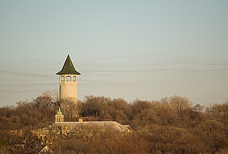
Prospect Park is a historic neighborhood within the University community of the U.S. city of Minneapolis, Minnesota. The area is bounded by the Mississippi River to the south, the City of Saint Paul, Minnesota to the east, the Burlington Northern railroad yard to the north, and the Stadium Village commercial district of the University of Minnesota to the west. The neighborhood is composed of several districts which include the East River Road area. The 1913 Prospect Park Water Tower is a landmark and neighborhood icon.

Chestnut Hill is a wealthy New England village located six miles (10 km) west of downtown Boston, Massachusetts, United States. It is best known for being home to Boston College and a section of the Boston Marathon route. Like all Massachusetts villages, Chestnut Hill is not an incorporated municipal entity. It is located partially in Brookline in Norfolk County; partially in the city of Boston in Suffolk County, and partially in the city of Newton in Middlesex County. Chestnut Hill's borders are defined by the 02467 ZIP Code. The name refers to several small hills that overlook the 135-acre Chestnut Hill Reservoir rather than one particular hill.

WMBD-TV is a television station in Peoria, Illinois, United States, affiliated with CBS. It is owned by Nexstar Media Group, which provides certain services to Bloomington-licensed Fox affiliate WYZZ-TV under a local marketing agreement (LMA) with Cunningham Broadcasting. The two stations share studios on North University Street in Peoria, with a secondary studio and news bureau on East Lincoln Street in Bloomington. WMBD-TV's transmitter is located on Pinecrest Drive in East Peoria, a section of Groveland Township, Tazewell County.

Lydia Moss Bradley was a wealthy bank president and philanthropist notable for her philanthropic works. She founded Bradley Polytechnic Institute in Peoria, Illinois, in 1897.

Upper Peoria Lake is a section of the Illinois River primarily between Peoria County and Woodford County, Illinois, United States. The lake runs from South Rome to Peoria Heights, with Spring Bay and the Detweiller Marina area of Peoria near the middle. Just north of Peoria Heights, it empties through a narrow part of the Illinois River into the smaller Peoria Lake, sometimes called Lower Peoria Lake, at approximately river mile 166.5.

Madison Theatre is a historic theater in Peoria, Illinois, United States that opened on October 16, 1920, as a silent picture theatre.

Prospect Lefferts Gardens is a residential neighborhood in the Flatbush area of the New York City borough of Brooklyn. The community is bounded by Empire Boulevard to the north, Clarkson Avenue to the south, New York Avenue to the east, and Ocean Avenue/Prospect Park to the west. Prospect Lefferts Gardens was designated a New York City Landmark area in 1979 and called the Prospect Lefferts Gardens Historic District.

WMBD is a commercial AM radio station. It is the oldest station in the Peoria, Illinois, area. It broadcasts a news/talk format and is owned by Duke Wright with the license held by Midwest Communications, Inc. The radio studios and offices are on Fulton Street in Peoria. The WMBD transmitter site is located on County Road 2100 East in Groveland Township, Illinois. The station is powered at 5,000 watts, with a directional signal. By day, a two-tower array is used, switching to a four-tower array at night to avoid causing interference with other stations.

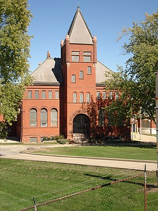
Peoria Waterworks is a building complex built in 1890 for the Peoria, Illinois water system.

Springdale Cemetery is a historic, non-sectarian, active cemetery in the United States city of Peoria, Illinois. It was chartered in 1855, received its first interment in 1857. Almost 78,000 individuals are buried at the cemetery. It contains a public mausoleum and 15 private mausoleums.

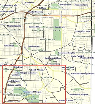
Lakewood Heights is a primarily Black neighborhood in southeast Atlanta. It is bounded by:
Peoria Heights Community Unit District 325 is the unit school district of Peoria Heights and an adjacent area of Peoria along Illinois Route 29 and the Illinois River to the north, all in Peoria County, Illinois. It has one high school — Peoria Heights High School — and one grade school, both the same site.

The YWCA Building in Peoria, Illinois was built in 1928. It was designed by Hewitt, Emerson & Gregg. The building was listed on the National Register of Historic Places in 2007. It sits at 301 Northeast Jefferson Avenue, at the north corner with Fayette Street in downtown Peoria.

The Grand View Lookout Tower is a fire lookout in Kaibab National Forest near the South Rim of the Grand Canyon. The 80-foot (24 m) tall steel tower was built in the 1930s. Its observation cabin measures 7 feet (2.1 m) square. A small cabin is included in the designated area.


