List of Wildlife Management Areas in Mississippi

Last updated

There are 54 areas with over a thousand square miles of land under management of the Mississippi Department of Wildlife, Fisheries, and Parks and operated as Wildlife Management Areas (WMAs) [1] in six regions: [2]

Contents

List of Wildlife Management Areas

NameCounty or countiesAreaDescriptionRegion
Bienville Wildlife Management Area Scott County 26,136 acresBienville, Tallahalla; and Caney Creek WMAs are all located within Bienville National Forest. Closest town is Morton.Southwest Region
Black Prairie Wildlife Management Area Lowndes County 5,673 acresNearest town: Brooksville East-central Region
Calhoun County Wildlife Management Area Calhoun County 10,900 acresNearest city: Calhoun City Northwest Region
Canal Section Wildlife Management Area Itawamba County and Monroe County 26,000 acresNearest city: Fulton Northeast Region
Canemount Wildlife Management Area Claiborne County 3,587 acresNear the Mississippi River Southwest Region
Caney Creek Wildlife Management Area Smith County and Scott County 28,000 acresNearest city: Forest Southwest Region
Caston Creek Wildlife Management Area Amite County and Franklin County 29,875 acresNearest city: Meadville Southwest Region
Charles Ray Nix Wildlife Management Area Panola County 4,000 acresNearest city: Sardis Northwest Region
Charlie Capps Wildlife Management Area Bolivar County 600 acresNearest city: Rosedale Delta Region
Chickasaw Wildlife Management Area Chickasaw County 27,259 acresNearest city: Houston Northeast Region
Chickasawhay Wildlife Management Area Jones County 30,000 acresNearest city: Laurel Southeast Region
Choctaw Wildlife Management Area Choctaw County and Winston County 24,314 acresNearest city: Ackerman East-central Region
Copiah County Wildlife Management Area Copiah County 6,810 acresNearest city: Hazlehurst Southwest Region
George P. Cossar State Park 650 acresThe WMA is situated on Enid Lake that holds the world record crappie being caught. [3]
Divide Section Wildlife Management Area Tishomingo County and Prentiss County 15,337 acresLocated in the northeast corner of the state the WMA lies on both sides of the Tennessee-Tombigbee Waterway (TTW) stretching from the Yellow Creek arm of Pickwick Lake on the Tennessee River, southward to Bay Springs Lake.Northeast Region
Graham Lake Waterfowl Wildlife Management Area Lafayette County 1,400 acresLocated on the extreme southeast corner of Sardis Lake with Holly Springs National Forest to the east.Northwest Region
Hell Creek Wildlife Management Area Union County and Tippah County 2,284 acresNortheast Region
Howard Miller Wildlife Management Area Issaquena County 2,420 acresDelta Region
John Bell Williams Wildlife Management Area Itawamba County (10%) and Prentiss County (90%)3,135 acresEstablished in 1973 and located four miles east of Marietta.Northeast Region
John W Starr Wildlife Management Area Oktibbeha County and Winston County 8,244 acresNearest city: Starkville. The addition of a MSU Hunting and Trapping Permit is also required. [4] East-central Region
Lake George Wildlife Management Area Yazoo County 8,383 acresLake George became a WMA in 1990. Nearest city: Holly Bluff Delta Region
Leaf River Wildlife Management Area Perry County 42,000 acresNear Wiggins Southeast Region
Leroy Percy Wildlife Management Area Washington County 1,642 acres6 miles west of Hollandale Delta Region
Little Biloxi Wildlife Management Area Stone County and Harrison County 14,540 acresNear McHenry.Southeast Region
Mahannah Wildlife Management AreaIssaquena County and Warren County 12,675 acresNear Redwood Delta Region
Malmaison Wildlife Management Area Grenada County, Carroll County, and Leflore County 9,696 acresNear Greenwood Northwest Region
Marion County Wildlife Management Area Marion County 7,200 acresNear Columbia Southwest Region
Mason Creek Wildlife Management Area Greene County 28,000 acresNear Laurel Southeast Region
Muscadine Farms Wildlife Management AreaWashington County3,046 acresNear Greenville Delta Region
Nanih Waiya Wildlife Management Area Neshoba County and Winston County 7,655 acresNear Philadelphia East-central Region
Natchez State Park Wildlife Management Area Adams County 2,261 acresSouthwest Region
Okatibbee Wildlife Management Area Lauderdale County and Kemper County 6,883 acresThe land for the WMA was purchased in the 1960s and Okatibbee Lake was formed in 1968 and the fragmented WMA established around the lake since 1969. American alligators were re-established in the 1970s and Bald eagles in 1992. The WMA is Near Collinsville. [5] -
O’Keefe Wildlife Management Area Quitman County 6,239 acresNear Lambert the property was purchased in 2001 from the Mississippi Department of Corrections. 1,535 acres are dedicated to various wetlands. [6] Delta Region
Old River Wildlife Management AreaPearl River County14,764 acresThe WMA is located near Poplarville.Southeast Region
Pascagoula River Wildlife Management Area George County and Jackson County 36,549 acresThe WMA is located near Lucedale and consists of the Upper unit and the Lower unit.Southeast Region
Pearl River Wildlife Management Area Madison County 6,925 acresThe WMA is located near Canton.Southwest Region
Red Creek Wildlife Management Area Stone, George and Jackson Counties22,789 acresLocated near Wiggins Southeast Region
Riverfront Wildlife Management Area Bolivar County.1,214 acres [7] Delta Region
Sandy Creek Wildlife Management Area Adams County and Franklin County 16,407 acresLocation near Natchez Southwest Region
Sardis Waterfowl Wildlife Management Area Lafayette County 3,700 acresLocated near Oxford along Sardis Lake.Northwest Region
Shipland Wildlife Management AreaIssaquena County3,642Located near Mayersville Delta Region
Sky Lake Wildlife Management Area Humphreys County and Leflore County 4,306 acresLocated near Belzoni Delta Region
Stoneville Wildlife Management AreaWashington County2,500 acresLocated near Leland Delta Region
Sunflower Wildlife Management Area Sharkey County 58,480 acresLocated near Rolling Fork Delta Region
Tallahala Wildlife Management Area Scott County, Newton County, Smith County, and Jasper County 28,120 acresLocated near Montrose Southwest Region
Theodore A. Mars Jr. Wildlife Management Area Pearl River County 896 acresLocated near Poplarville Southeast Region
Trim Cane Wildlife Management Area Oktibbeha County 891 acresLocated near Starkville East-central Region
Tuscumbia Wildlife Management Area Alcorn County 2,436 acresLocated near Corinth Northeast Region
Twin Oaks Wildlife Management Area Sharkey County 5,847 acresLocated near Rolling Fork, forty miles north of Vicksburg.Delta Region
Upper Sardis Wildlife Management Area Lafayette County 42,274 acresLocated east of Oxford within Holly Springs National Forest Northwest Region
Ward Bayou Wildlife Management Area Jackson County 13,234 acresLocated near Moss Point Southeast Region
William C. (Billy) Deviney Wildlife Management Area1,203 acresDelta Region
Wolf River Wildlife Management Area Lamar County and Pearl River County 10,881 acresLocated near Poplarville Southeast Region
Yockanookany Wildlife Management Area Attala County 2,379 acresLocated near McCool East-central Region

Chronic Wasting Disease

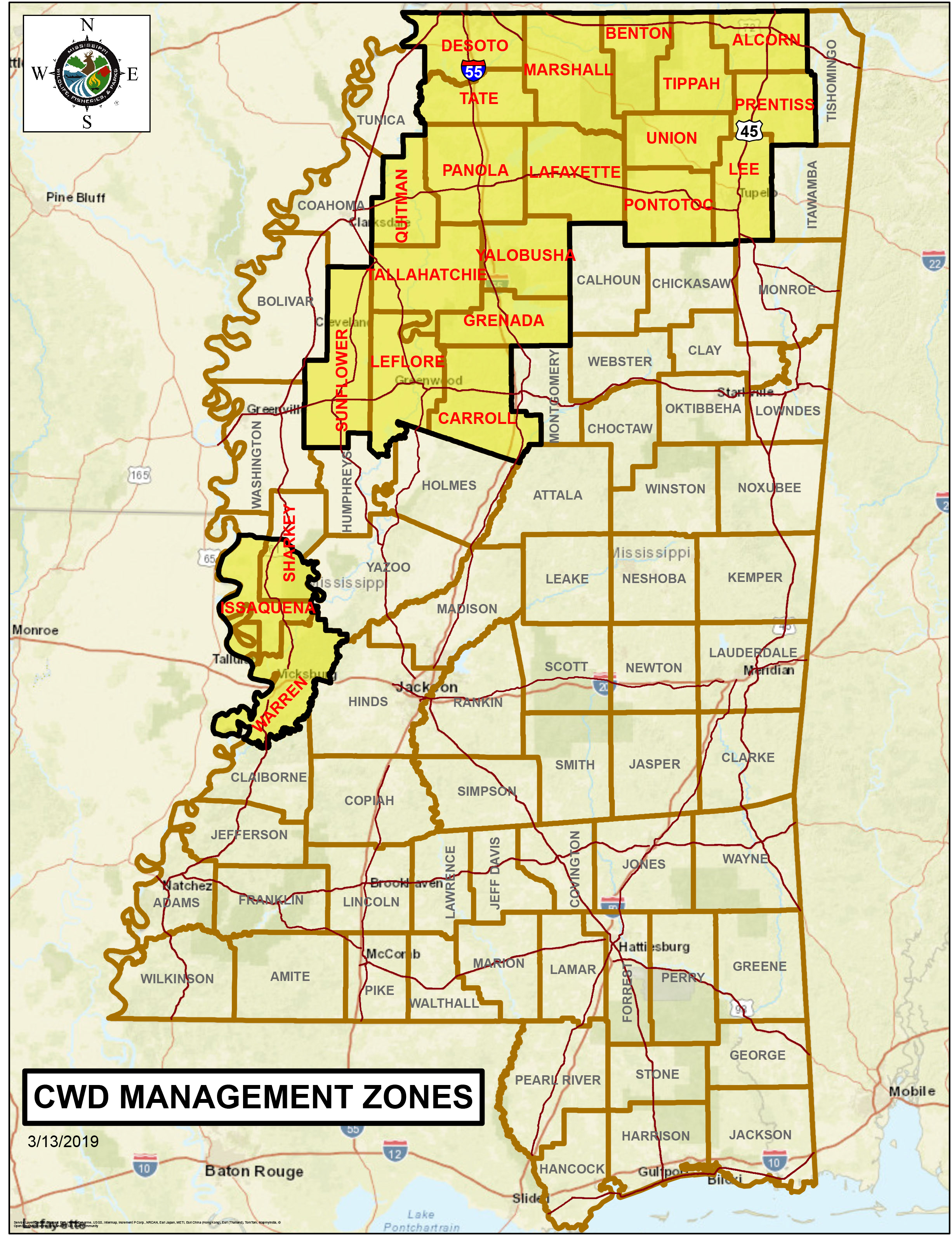
Chronic Wasting Disease has been discovered in Alcorn, Benton, Carroll, DeSoto, Lafayette, Leflore, Grenada, Issaquena, Lee, Marshall, Panola, Pontotoc, Prentiss, Quitman, the southern half of Sharkey, Sunflower, Tallahatchie, Tate, Tippah, Union, Warren, and Yalobusha, counties. [8] [9] [10]

Related Research Articles

<span class="mw-page-title-main">Jackson County, Minnesota</span> County in Minnesota, United States

Jackson County is a county in the U.S. state of Minnesota. As of the 2020 census, the population was 9,989. Its county seat is Jackson.

<span class="mw-page-title-main">Cottonwood County, Minnesota</span> County in Minnesota, United States

Cottonwood County is a county in the U.S. state of Minnesota. As of the 2020 census, the population was 11,517. Its county seat is Windom.

<span class="mw-page-title-main">Ashley County, Arkansas</span> County in Arkansas, United States

Ashley County is a rural South Arkansas county with a culture, economy, and history based on timber and agriculture. Created as Arkansas's 52nd county on November 30, 1848, Ashley County has seven incorporated municipalities, including Hamburg, the county seat and Crossett, the most populous city. The county is also the site of numerous unincorporated communities and ghost towns. The county is named for Chester Ashley, a prominent lawyer in the Arkansas Territory and U.S. senator from the state from 1844 to 1848.

<span class="mw-page-title-main">Chronic wasting disease</span> Prion disease affecting the deer family

Chronic wasting disease (CWD), sometimes called zombie deer disease, is a transmissible spongiform encephalopathy (TSE) affecting deer. TSEs are a family of diseases thought to be caused by misfolded proteins called prions and include similar diseases such as BSE in cattle, Creutzfeldt-Jakob disease (CJD) in humans and scrapie in sheep. In the United States, CWD affects mule deer, white-tailed deer, red deer, sika deer, elk, caribou, and moose. Natural infection causing CWD affects members of the deer family. Experimental transmission of CWD to other species such as squirrel monkeys and genetically modified mice has been shown.

<span class="mw-page-title-main">Ross Barnett Reservoir</span> Reservoir in Mississippi, U.S.

The Ross Barnett Reservoir, often called the Rez, is a reservoir of the Pearl River between Madison and Rankin counties in the U.S. state of Mississippi. The 33,000-acre (130 km2) lake serves as the state's largest drinking water resource, and is managed by the Pearl River Valley Water Supply District. The lake features 105 miles (169 km) of shoreline impounded on the south by a 3.5-mile (5.6 km) man-made dam and spillway. The western shore is bounded by the historic Natchez Trace Parkway.

<span class="mw-page-title-main">Driftless Area</span> Geological region in the Midwestern United States

The Driftless Area, also known as Bluff Country, the Blufflands, the Paleozoic Plateau, and the Coulee Region, is a topographical and cultural region in the Midwestern United States that comprises southwestern Wisconsin, southeastern Minnesota, northeastern Iowa, and the extreme northwestern corner of Illinois. The Driftless Area is a USDA Level III Ecoregion: Ecoregion 52. The Driftless Area takes up a large portion of the Upper Midwest forest–savanna transition.

<span class="mw-page-title-main">Mississippi Sound</span> Wide body of water, connecting two larger bodies of water along Mississippi and Alabama, US

The Mississippi Sound is a sound along the Gulf Coast of the United States. It runs east-west along the southern coasts of Mississippi and Alabama, from Waveland, Mississippi, to the Dauphin Island Bridge, a distance of about 90 miles (145 km). The sound is separated from the Gulf on its southern side by the Mississippi–Alabama barrier islands: Cat, Ship, Horn, West Petit Bois, Petit Bois, and Dauphin. Ship, Horn, West Petit Bois and Petit Bois Islands are part of the National Park Service's Gulf Islands National Seashore. Those islands separate the sound from the Gulf of Mexico. The sediment of the islands was created partly by the ancient Mississippi River when the St. Bernard Lobe of the Mississippi Delta was active over two thousand years ago. The expansion of the St. Bernard subdelta slowly isolated the Mississippi Sound from ocean dynamics of the open Gulf of Mexico.

<span class="mw-page-title-main">Pascagoula River</span> River in southeastern Mississippi, US

The Pascagoula River is a river, about 80 miles (130 km) long, in southeastern Mississippi in the United States. The river drains an area of about 8,800 square miles (23,000 km²) and flows into Mississippi Sound of the Gulf of Mexico. The Pascagoula River Basin is managed by the Pat Harrison Waterway District.

<span class="mw-page-title-main">Tennessee Wildlife Resources Agency</span> Conservation agency in the United States

The Tennessee Wildlife Resources Agency (TWRA) is an independent state agency of the state of Tennessee with the mission of managing the state's fish and wildlife and their habitats, as well as responsibility for all wildlife-related law enforcement activities. The agency also has responsibility for fostering the safe use of the state's waters through a program of law enforcement, education, and access.

WMPR is a radio station broadcasting a variety format. WMPR is a community station which specializes in gospel and blues but also features other forms of music as well as several community-oriented talk shows. Licensed to Jackson, Mississippi, United States, the station serves the Jackson area. The station is currently owned by J.C. Maxwell Broadcasting Group, Inc.

<span class="mw-page-title-main">Rocky Mountain elk</span> Subspecies of deer

The Rocky Mountain elk is a subspecies of elk found in the Rocky Mountains and adjacent ranges of Western North America.

The Atchafalaya National Wildlife Refuge is located about 30 miles (48 km) west of Baton Rouge, Louisiana, and one mile (1.6 km) east of Krotz Springs, Louisiana, lies just east of the Atchafalaya River. In 1988 under the administration of Governor Foster the "Atchafalaya Basin Master Plan" was implemented that combined the 11,780-acre (4,770 ha) Sherburne Wildlife Management Area (WMA), the 15,220-acre (6,160 ha) Atchafalaya National Wildlife Refuge, and the 17,000-acre (6,900 ha) U.S. Army Corps of Engineers' Bayou Des Ourses into the Sherburne Complex Wildlife Management Area.

<span class="mw-page-title-main">Laurel Lake Wildlife Management Area</span>

Laurel Lake Wildlife Management Area is located between Dingess and Lenore in Mingo County, West Virginia. Located on 12,856 acres (5,203 ha) of steep terrain with narrow valleys and ridgetops, the WMA contains second growth mixed hardwoods and hemlock with thick understory of mountain laurel and rhododendron.

<span class="mw-page-title-main">Wildlife management area</span> Protected area that prioritizes wildlife conservation and may allow for recreational use

A wildlife management area (WMA) is a protected area set aside for the conservation of wildlife and for recreational activities involving wildlife.

Loggy Bayou is a 17.3-mile-long (27.8 km) stream in northwestern Louisiana which connects Lake Bistineau with the Red River. Bistineau is the reservoir of Dorcheat Bayou, which flows 115 miles (185 km) southward from Nevada County, Arkansas, into Webster Parish. Loggy Bayou flows through south Bossier Parish, west of Ringgold, in a southerly direction through Bienville Parish, and into Red River Parish, where north of Coushatta it joins the Red River, a tributary of the Mississippi. At East Point, LA, the river has a mean annual discharge of 1,960 cubic feet per second.

Pass a Loutre Wildlife Management Area (WMA) is a 66,000-acre (270 km2) protected wetland in Plaquemines Parish, Louisiana, United States. The WMA is located due south and bordering the 48,000 acre Delta National Wildlife Refuge, accessible only by air or boat, contains the Pass A L'Outre Lighthouse, and Port Eads is within the boundary.

The Sherburne Complex is a joint land management venture of the U.S. Fish and Wildlife Service, the Louisiana Department of Wildlife and Fisheries (LDWF), and the U.S. Army Corps of Engineers that began in 1983. The area consists of 44,000 acres (180 km2), and is managed by the Louisiana Department of Wildlife and Fisheries. The complex is located in the Morganza Flood way system of the Atchafalaya Basin about 30 miles (48 km) west of Baton Rouge, Louisiana and actually extends a little south of the I-10 Atchafalaya Basin Bridge at Whiskey Bay, Louisiana. The bridge crosses the Whiskey Bay Pilot Channel. Located on the graveled LA 975, the west boundary is on the east side of the Atchafalaya River with the east boundary being the East Protection Levee. The complex stretches just north of old highway 190, and a short distance to the south of I-10. The nearest town is Krotz Springs to the north off US 190.

Pomme de Terre Wildlife Management Area, also referred to as Pomme de Terre WMA, is a 6,434 acres (2,604 ha) protected area located in Avoyelles Parish, Louisiana owned and managed by the Louisiana Department of Wildlife and Fisheries (LDWF).

J. C. "Sonny" Gilbert Wildlife Management Area is a 7,524-acre (3,045 ha) wildlife management area in Catahoula, Parish, Louisiana, owned by the Louisiana Department of Wildlife and Fisheries. It is located 6 miles (9.7 km) miles west of Sicily Island. The area contains the 17 ft (5.2 m) high Rock Falls, one of the tallest waterfalls in the state.

References

  1. Mississippi WMAs- Retrieved 2019-02-23
  2. WMA regions- Retrieved 2019-02-23
  3. Can our bass, crappie records be broken?: The Clarion-Ledger (by Brian Broom, May 26, 2017)- Retrieved 2019-02-22
  4. MSU hunting requirement- Retrieved 2019-02-23
  5. Okatibbee Wildlife Management Area- Retrieved 2019-02-23
  6. Ducks Unlimited: Mississippi: O'Keefe Wildlife Management Area Wetlands Enhancement Project- Retrieved 2019-02-23
  7. Riverfront WMA- Retrieved 2019-02-23
  8. "CWD Management Zones" . Retrieved 29 July 2019.
  9. "Second deer found with chronic wasting disease in Mississippi". WVTM 13 News. 19 Oct 2018. Retrieved 29 July 2019.
  10. Broom, Brian (27 Nov 2018). "Additional case of chronic wasting disease confirmed in Mississippi". Clarion Ledger. Retrieved 29 July 2019.