Collinsville, Mississippi

Last updated
Collinsville, Mississippi
Collinsville Welcome Sign.jpg
Collinsville Welcome Sign
Lauderdale County Mississippi Incorporated and Unincorporated areas Collinsville Highlighted.svg
Location of Collinsville, Mississippi
Coordinates: 32°29′16″N88°50′39″W / 32.48778°N 88.84417°W / 32.48778; -88.84417
Country United States
State Mississippi
County Lauderdale
Area
[1]
  Total14.28 sq mi (36.97 km2)
  Land14.25 sq mi (36.90 km2)
  Water0.03 sq mi (0.07 km2)
Elevation
463 ft (141 m)
Population
 (2020)
  Total1,984
  Density139.24/sq mi (53.76/km2)
Time zone UTC-6 (Central (CST))
  Summer (DST) UTC-5 (CDT)
ZIP code
39325
Area code 601
FIPS code 28-15180
GNIS feature ID0668706

Collinsville is an unincorporated community and census-designated place (CDP) in Lauderdale County, Mississippi, United States. The population was 1,984 at the 2020 census. [2]

Contents

Geography

Collinsville is located in northwestern Lauderdale County at 32°29′16″N88°50′39″W / 32.48778°N 88.84417°W / 32.48778; -88.84417 (32.487906, -88.844205). [3] Mississippi Highway 19 passes through the community, leading southeast 13 miles (21 km) to Meridian, the county seat, and northwest 26 miles (42 km) to Philadelphia.

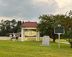
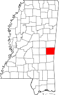
According to the United States Census Bureau, the CDP has a total area of 14.3 square miles (37.0 km2), of which 0.03 square miles (0.07 km2), or 0.18%, are water. [4] The town and Highway 19 lie on a low ridge separating Suqualena Creek to the west and Twitley Branch to the east, both of which are tributaries of Okatibbee Creek and part of the Chickasawhay/Pascagoula River watershed. Okatibbee Dam, forming 5.9-square-mile (15 km2) Okatibbee Lake, is at the eastern edge of the Collinsville CDP.

Demographics

Historical population
CensusPop.Note
2020 1,984
U.S. Decennial Census [5]
Collinsville racial composition as of 2020 [6]
(NH = Non-Hispanic) [lower-alpha 1]
RaceNumberPercentage
White (NH)1,53277.22%
Black or African American (NH)30315.27%
Asian (NH)140.71%
Pacific Islander (NH)20.1%
Some Other Race (NH)40.2%
Mixed/Multi-Racial (NH)592.97%
Hispanic or Latino 703.53%
Total1,984

As of the 2020 United States census, there were 1,984 people, 724 households, and 503 families residing in the CDP.

As of the census [8] of 2000, there were 1,823 people, 701 households, and 541 families residing in the CDP. The population density was 115.7 inhabitants per square mile (44.7/km2). There were 739 housing units at an average density of 46.9 units per square mile (18.1 units/km2). The racial makeup of the CDP was 86.56% White, 12.51% African American, 0.38% Asian, and 0.55% from two or more races. Hispanic or Latino of any race were 1.32% of the population.

There were 701 households, out of which 39.2% had children under the age of 18 living with them, 63.9% were married couples living together, 10.3% had a female householder with no husband present, and 22.8% were non-families. 21.4% of all households were made up of individuals, and 9.7% had someone living alone who was 65 years of age or older. The average household size was 2.60 and the average family size was 3.03.

In the CDP the population was spread out, with 26.8% under the age of 18, 6.4% from 18 to 24, 31.2% from 25 to 44, 23.3% from 45 to 64, and 12.4% who were 65 years of age or older. The median age was 36 years. For every 100 females there were 100.1 males. For every 100 females age 18 and over, there were 91.9 males.

The median income for a household in the CDP was $33,476, and the median income for a family was $41,714. Males had a median income of $31,779 versus $21,957 for females. The per capita income for the CDP was $17,184. About 5.4% of families and 8.9% of the population were below the poverty line, including 7.2% of those under age 18 and 20.5% of those age 65 or over.

Notable people

Related Research Articles

<span class="mw-page-title-main">Moose Pass, Alaska</span> Census-designated place in Alaska, United States

Moose Pass is a census-designated place (CDP) in Kenai Peninsula Borough, Alaska, United States. The population was 219 at the 2010 census, up from 206 in 2000.

<span class="mw-page-title-main">Westview, Florida</span> Census-designated place in Florida

Westview is a census-designated place (CDP) in Miami-Dade County, Florida, United States. It is part of the Miami metropolitan area of South Florida. The population was 9,923 at the 2020 census.

<span class="mw-page-title-main">Lawai, Hawaii</span> Census-designated place in Hawaii, United States

Lāwaʻi is a census-designated place (CDP) in Kauaʻi County in the U.S. state of Hawaiʻi. The population was 2,578 at the 2020 census, up from 1,984 at the 2000 census.

<span class="mw-page-title-main">Channel Lake, Illinois</span> Census-designated place in Illinois, United States

Channel Lake is an unincorporated community and census-designated place (CDP) in Antioch Township, Lake County, Illinois, United States. Per the 2020 census, the population was 1,581.

Fox Lake Hills is an unincorporated community and census-designated place (CDP) in Lake Villa Township, Lake County, Illinois, United States. Per the 2020 census, the population was 2,684.

Pistakee Highlands is a census-designated place (CDP) in McHenry County, Illinois, United States. It consists primarily of an unincorporated area of McHenry County adjoining Pistakee Bay, within the McHenry post office, and is located just northeast of Johnsburg. Per the 2020 census, the population was 3,237.

<span class="mw-page-title-main">Fairmont, Illinois</span> Place in Illinois, United States

Fairmont is an unincorporated community and census-designated place (CDP) in Will County, Illinois, United States. The population was 2,389 at the 2020 census.

<span class="mw-page-title-main">Preston Heights, Illinois</span> Place in Illinois, United States

Preston Heights is an unincorporated community and census-designated place (CDP) in Will County, Illinois, United States. As of the 2020 census, the CDP population was 2,898.

<span class="mw-page-title-main">Benton Heights, Michigan</span> Census-designated place & unincorporated community in Michigan, United States

Benton Heights is an unincorporated community in Berrien County in the U.S. state of Michigan. It is also a census-designated place (CDP) for statistical purposes without any legal status as an incorporated municipality. Per the 2020 Census, the population was 3,652. The community is a part of Benton Charter Township and is adjacent to the city of Benton Harbor.

<span class="mw-page-title-main">Big Point, Mississippi</span> Census-designated place in Mississippi, United States

Big Point is an unincorporated community and census-designated place (CDP) in Jackson County, Mississippi, United States. It is part of the Pascagoula, Mississippi Metropolitan Statistical Area. Per the 2020 Census, the population was 618.

<span class="mw-page-title-main">Helena, Mississippi</span> Census-designated place in Mississippi, United States

Helena is an unincorporated community and census-designated place (CDP) in Jackson County, Mississippi, United States. It is part of the Moss Point Metropolitan Statistical Area. Per the 2020 Census, the population was 983.

<span class="mw-page-title-main">Meridian Station, Mississippi</span> Census-designated place in Mississippi, United States

Meridian Station is a census-designated place (CDP) in Lauderdale County, Mississippi, United States, corresponding to the residential portions of Naval Air Station Meridian. The population was 1,090 at the 2010 census.

<span class="mw-page-title-main">Redwater, Mississippi</span> Census-designated place in Mississippi, United States

Redwater is a census-designated place (CDP) in Leake County, Mississippi, United States. It is one of the eight communities of the Mississippi Band of Choctaw Indians Reservation, and the population is 61% Choctaw. The population was 633 at the 2010 census, up from 409 at the 2000 census.

<span class="mw-page-title-main">Standing Pine, Mississippi</span> Census-designated place in Mississippi, United States

Standing Pine is a census-designated place (CDP) in Leake County, Mississippi, United States. It is one of the eight communities of the Mississippi Band of Choctaw Indians Reservation, and the population is 94% Choctaw. The total population of the CDP was 517 at the 2020 census.

<span class="mw-page-title-main">Tucker, Mississippi</span> CDP in Mississippi, United States

Tucker is a census-designated place (CDP) in Neshoba County, Mississippi. It is one of the eight communities of the Mississippi Band of Choctaw Indians Reservation and the population is 93% Choctaw. The population was 642 at the 2020 census.

<span class="mw-page-title-main">Nellieburg, Mississippi</span> Census-designated place in Mississippi, United States

Nellieburg is an unincorporated community and census-designated place (CDP) in Lauderdale County, Mississippi, United States. The population was 1,316 at the 2020 census. It is a suburb of Meridian.

<span class="mw-page-title-main">Conehatta, Mississippi</span> CDP in Mississippi, United States

Conehatta is a census-designated place (CDP) in Newton County, Mississippi. The population was 997 at the 2000 census. It is one of the eight communities included in the Mississippi Band of Choctaw Indians Reservation and the population is 76% Choctaw.

West Elmira is a suburban census-designated place (CDP) in Chemung County, New York, United States. The population was 4,967 at the 2010 census. It is adjacent to the city of Elmira on its west side. West Elmira is in the southwest part of the town of Elmira. It is part of the Elmira Metropolitan Statistical Area.

<span class="mw-page-title-main">Bogue Chitto, Mississippi</span> Census-designated place in Mississippi, United States

Bogue Chitto is a census-designated place (CDP) situated in Kemper and Neshoba counties, Mississippi. The population was 864 at the 2020 census. It is part of the Mississippi Band of Choctaw Indians Reservation and the population is 93% Choctaw.

<span class="mw-page-title-main">Canton Valley, Connecticut</span> Census-designated place in Connecticut, United States

Canton Valley is a village and census-designated place (CDP) in the town of Canton in Hartford County, Connecticut, United States. The population was 1,580 at the 2010 census. As of the 2017 census the population was 1,489.

References

  1. Note: the US Census treats Hispanic/Latino as an ethnic category. This table excludes Latinos from the racial categories and assigns them to a separate category. Hispanics/Latinos can be of any race. [7]
  1. "2020 U.S. Gazetteer Files". United States Census Bureau. Retrieved July 24, 2022.
  2. "Total Population: 2010 Census DEC Summary File 1 (P1), Collinsville CDP, Mississippi". data.census.gov. U.S. Census Bureau. Retrieved March 31, 2020.
  3. "US Gazetteer files: 2010, 2000, and 1990". United States Census Bureau. 2011-02-12. Retrieved 2011-04-23.
  4. "U.S. Gazetteer Files: 2019: Places: Mississippi". U.S. Census Bureau Geography Division. Retrieved March 31, 2020.
  5. "Census of Population and Housing". Census.gov. Retrieved June 4, 2016.
  6. "Explore Census Data". data.census.gov. Retrieved 2022-06-01.
  7. "About the Hispanic Population and its Origin". www.census.gov. Retrieved 18 May 2022.
  8. "U.S. Census website". United States Census Bureau . Retrieved 2008-01-31.
  9. Hurst, Jason (June 13, 2008). "Cohen Adds Burroughs To Bulldog Coaching Staff". WJTV News. Archived from the original on February 22, 2014. Retrieved February 17, 2014.
  10. "COLLINS, Ross Alexander, (1880 - 1968)". Biographical Directory of the United States Congress. Retrieved February 17, 2014.
  11. "Austin Davis named Offensive Coordinator at Auburn". Auburn Tigers. Retrieved 24 December 2021.
  12. "Winifred H. Farrar". Meridian Star. November 14, 2010.
  13. "Jimmy Ruffin Biography". Oldies.com. Retrieved February 17, 2014.