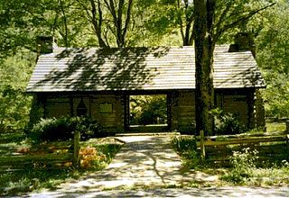
J.P. Coleman State Park is a state park in the U.S. state of Mississippi. It is located approximately 10 miles (16 km) north of Iuka off Mississippi Highway 25, on the banks of the Tennessee River and Pickwick Lake. The park is named for James P. Coleman, a former governor of Mississippi.

Legion State Park is public recreation area located on the north edge of the city of Louisville, Mississippi, and adjacent to Tombigbee National Forest. As Legion State Park Historic District, the state park entered the National Register of Historic Places in 1998. It is managed by the Mississippi Department of Wildlife, Fisheries and Parks.

George P. Cossar State Park is a state park in the U.S. state of Mississippi located on the shores of Enid Lake approximately 7 miles (11 km) north of Oakland off Mississippi Highway 32. The park is named for George Payne Cossar, Sr., a prominent Mississippi attorney in the 20th century.

Tombigbee State Park is a public recreation area located off Mississippi Highway 6 approximately 5 miles (8.0 km) east of Tupelo, Mississippi. The state park surrounds 90-acre (36 ha) Lake Lee and is named for the nearby Tombigbee River.
Lake Lowndes State Park is a public recreation area in the U.S. state of Mississippi located off Mississippi Highway 69 approximately 9 miles (14 km) southeast of Columbus, Mississippi.

Trace State Park is a public recreation area located off Mississippi Highway 6, approximately 7 miles (11 km) east of Pontotoc and 7 miles (11 km) west of Tupelo in the U.S. state of Mississippi. The state park surrounds 565-acre (229 ha) Trace Lake and is named for the nearby Natchez Trace trail. Famed frontiersman Davy Crockett once lived within the area bounded by the park.

Wall Doxey State Park is a public recreation area located off Mississippi Highway 7, seven miles (11 km) south of Holly Springs, Mississippi. The state park is centered on 60-acre (24 ha) Spring Lake.

Percy Quin State Park is a public recreation area located off Interstate 55, approximately 7 miles (11 km) southwest of McComb, Mississippi. The state park surrounds 490-acre (200 ha) Lake Tangipahoa, an impoundment of the Tangipahoa River.
John W. Kyle State Park is a state park in the U.S. state of Mississippi. It is located off Mississippi Highway 315 on Sardis Reservoir approximately 9 miles (14 km) east of Sardis. It is named after John W. Kyle, a former Mississippi state senator and a former U.S. Representative from Mississippi.

Leroy Percy State Park is a public recreation area located off Mississippi Highway 12 approximately 5 miles (8.0 km) west of Hollandale, Mississippi. It is the state's oldest state park, its construction having begun with the arrival of the Civilian Conservation Corps in 1934. It is named after LeRoy Percy, a former U.S. Senator from Mississippi.

Paul B. Johnson State Park is a public recreation area on the shores of Geiger Lake, located off U.S. Highway 49 in McLaurin, Mississippi, approximately 10 miles (16 km) south of Hattiesburg. The state park is named after Paul B. Johnson, the forty-sixth governor of Mississippi.

LeFleur's Bluff State Park is a public recreation area located on the banks of the Pearl River off Interstate 55 within the city limits of Jackson, Mississippi. The state park is home to a 50-acre (20 ha) lake, a 9-hole golf course, and the Mississippi Museum of Natural Science.

Roosevelt State Park is a public recreation area located off Interstate 20 on the southwest side of Morton, Mississippi. The state park surrounds 150-acre (61 ha) Shadow Lake at the western edge of Bienville National Forest, between Jackson and Meridian. It is managed by the Mississippi Department of Wildlife, Fisheries and Parks.
Golden Memorial State Park is a state park in the U.S. state of Mississippi located off Mississippi Highway 492 approximately 3 miles (4.8 km) east of Walnut Grove.

Clarkco State Park is a state park in the U.S. state of Mississippi located off Mississippi Highway 145 approximately 5 miles (8.0 km) north of Quitman.
Natchez State Park is a state park in the U.S. state of Mississippi. It is located off U.S. Highway 61 near Stanton, approximately 11 miles (18 km) northeast of its namesake, Natchez.
Shepard State Park is a state park in the U.S. state of Mississippi. It is located off U.S. Highway 90 on the south side of Gautier. The city has had responsibility for the park's management since 2013.
Buccaneer State Park is a state park in the U.S. state of Mississippi. It is located off U.S. Highway 90 and Beach Boulevard, straddling the line between Waveland and Clermont Harbor. The park sits on the Gulf of Mexico and was entirely rebuilt after all its buildings were destroyed by Hurricane Katrina in 2005.

Grenada Lake is a reservoir on the Yalobusha River in the U.S. state of Mississippi. It is one of four flood control lakes in North Mississippi constructed by the U.S. Army Corps of Engineers. Grenada Lake was constructed to help control flooding along the Yazoo River Basin. The dam is located on the Yalobusha River approximately 3 miles (5 km) northeast of Grenada, Mississippi.

Montgomery Bell State Park is a Tennessee state park in Burns, Tennessee, United States. The park covers 3,782 acres (1,531 ha) and its official elevation is 758 feet (231 m). However, due to the dissected wooded terrain typical of the Nashville Basin, actual elevations range from 580 feet to 860 feet. The park is open for year-round recreation including boating, hiking, camping, fishing and golf. Montgomery Bell State Park was built during the Great Depression by members of the Works Progress Administration and Civilian Conservation Corps as Montgomery Bell Recreational Demonstration Area. Named for iron industrialist Montgomery Bell, the park is known as the birthplace of the Cumberland Presbyterian Church.


