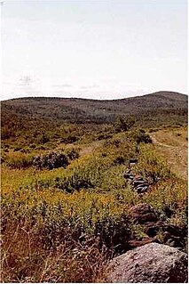
Rowe is a town in Franklin County, Massachusetts, United States. The population was 424 at the 2020 census.

Ashby is a town in Middlesex County, Massachusetts, United States. The population was 3,193 at the 2020 census, which makes it the least populous municipality in Middlesex County. The Town of Ashby is primarily a bedroom community consisting almost entirely of single family homes and a limited number of businesses.
Merrill Township is a civil township of Newaygo County in the U.S. state of Michigan. The population was 590 at the 2000 census.

Lempster is a town in Sullivan County, New Hampshire, United States. The population was 1,118 at the 2020 census. Settlements include the town center and the village of East Lempster.

Hubbard Brook Experimental Forest is an area of land in the towns of Woodstock, Ellsworth and Thornton in the White Mountains of New Hampshire that functions as an outdoor laboratory for ecological studies. It was initially established in 1955 by the United States Forest Service for the study of the relationship between forest cover and water quality and supply.

The Millers River is a 52.1-mile-long (83.8 km) river in northern Massachusetts, originating in Ashburnham and joining the Connecticut River just downstream from Millers Falls, Massachusetts. Sections of the river are used for whitewater kayaking, and a section upriver is popular with flatwater racers, and the river is known locally as a good place for pike fishing.

The Monadnock-Sunapee Greenway (MSG) is a 50-mile (80 km) hiking trail that traverses the highlands of southern New Hampshire from Mount Monadnock in Jaffrey to Mount Sunapee in Newbury. Located approximately 27 miles (43 km) from the city of Concord, New Hampshire, the trail traverses a rural, heavily glaciated and metamorphic upland studded with lakes, heath barrens, the rocky summits of several monadnocks, and dense woodland of the northern hardwood forest type. The trail is maintained primarily through the efforts of the Monadnock-Sunapee Greenway Trail Club.

Chapel Brook of Franklin County, Massachusetts is a tributary of the South River and the name of a 173-acre (70 ha) open space preserve located along the brook. The brook, est. 3.79 mi (6 km) long, is located in southeast Ashfield and southwest Conway. It drains into Poland Brook, thence into the South River, the Deerfield River, the Connecticut River, and Long Island Sound. The Chapel Brook reservation, managed by the non-profit conservation organization The Trustees of Reservations, is located in Ashfield and contains Chapel Falls, a series of three waterfalls on Chapel Brook, measuring 10 feet, 15 feet and 20 feet high; and Pony Mountain est. 1,400 feet, a 100-foot (30 m) open granite cliff face and popular recreational rock climbing site.

The Brooks Woodland Preserve is a 558-acre (226 ha) open space preserve located in Petersham, Massachusetts. The property, named after industrialist and diplomat James Wilson Brooks, is managed by the land conservation non-profit organization The Trustees of Reservations and offers 13 miles (21 km) of trails and primitive woods roads available for hiking, horseback riding, and cross country skiing. Second growth forest, overgrown farm fields, granite ledges, historic stone walls, creeks, and rolling hills characterize the preserve.

Royalston Falls is a 50 foot (15 m) waterfall and granite gorge located in Royalston, Massachusetts along Falls Brook, a tributary of the Tully River which in turn is a tributary of the Millers River. The falls are part of a 217-acre (88 ha) open space preserve acquired in 1951 by the land conservation non-profit organization The Trustees of Reservations. The 22-mile (35 km) Tully Trail and the 110-mile (180 km) Metacomet-Monadnock Trail, a National Recreation Trail, pass through the property.

Mount Major is a mountain located in Alton, New Hampshire, south of Lake Winnipesaukee and northeast of Straightback Mountain in the Belknap Range.

The Swift River Reservation is a 439-acre (178 ha) open space preserve located in Petersham, Massachusetts, United States. The property, named after the East Branch of the Swift River, is managed by the land conservation non-profit organization The Trustees of Reservations and offers 7 miles (11 km) of trails available for hiking, horseback riding, mountain biking, and cross country skiing. Ledges, river corridor, woodlands, scenic vistas, and wetlands characterize the preserve.

Castle Hill is the site of an Iron Age univailate hillfort located in the civil parish of Burley in the New Forest national park in Hampshire, England. Its single rampart and ditch earthworks enclose approximately five acres of land and is in reasonable condition for the most part, although it is cut through by tracks leading to local houses. Parts of the interior are marshy and much of it is overgrown with oak, silver birch, holly and bracken. The bank is at its highest on the eastern side, as the west side slopes steeply away. Hampshire treasures lists the site as a Scheduled Ancient Monument. According to legend, the hill apparently was once the home to a local dragon, duly slain by a knight from the nearby village of Brook; and thus the local pub at Brook bears the name of the Green Dragon.

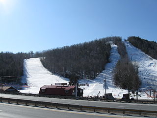
Whaleback is a ski area located in Enfield, New Hampshire, United States. In 2013, after several bankruptcies over previous decades, it was bought by operated by a non-profit organization called the Upper Valley Snow Sports Foundation.

The Follett Stone Arch Bridge Historic District encompasses a group of four stone arch bridges in southwestern Townshend, Vermont. All four bridges were built by James Otis Follett, a local self-taught mason, between 1894 and 1910, and represent the single greatest concentration of surviving bridges he built. The district was listed on the National Register of Historic Places in 1976.
Abbott State Forest is a 35-acre (14 ha) protected area located in Concord, New Hampshire, on the west side of Lake View Drive. It is bordered to the east, across Lake View Drive, by Penacook Lake water supply land. Abbott State Forest was reported to be producing white spruce seed in 1982.
The Chandler Reservation is a 1,524-acre (617 ha) protected area owned by the town of Warner, New Hampshire, United States. The 400-acre (160 ha) Harriman Chandler State Forest borders it to the southwest. The reservation covers the northern end of the Mink Hills, with elevations ranging from 500 feet (150 m) above sea level in the north to 1,750 feet (530 m) on the crest of the range.
Mascoma State Forest is an area of forested land in Canaan in Grafton County, New Hampshire, on the west side of the Mascoma River. As of 2007, the tract covers 216 acres (87 ha). The forest borders the 900-acre Bear Pond Natural Area. Mascoma State Forest is managed by the state of New Hampshire Division of Forests and Lands.
Corbin Park is a private game preserve in New Hampshire. It contains land in Croydon, Cornish, Plainfield, and Grantham. It occupies somewhere between 24,000 and 26,000 acres of land and was started in 1889 by businessman Austin Corbin. The park is known today for its secrecy.
Sweetwater Lake State Park is a Colorado State Park in Garfield County, Colorado in the United States, approximately 18 miles (29 km) north of the town of Dotsero. The park contains 488 acres (197 ha) and is located within the White River National Forest in the Flat Tops Wilderness Area. The park is unique in that it is the first state park in the nation to be created from land owned by the United States Forest Service. Governor Jared Polis announced the creation of the park, Colorado's 43rd, on October 20, 2021.


