Croydon, New Hampshire

Last updated

Croydon, New Hampshire
CroydonVillageNH.jpg
Croydon town center: Town Hall on left, First Congregational Church on right
Sullivan County New Hampshire incorporated and unincorporated areas Croydon highlighted.svg
Location in Sullivan County and the state of New Hampshire.
Coordinates: 43°27′02″N72°09′47″W / 43.45056°N 72.16306°W / 43.45056; -72.16306
Country United States
State New Hampshire
County Sullivan
Incorporated 1763
Villages
  • Croydon
  • Croydon Flat
Government
   Select Board
  • Amie Freak, Chair
  • Susan Kimball
  • Edward Spiker
  • Kimberlee Burkhamer
  • Carl Newton
Area
[1]
  Total
37.5 sq mi (97.2 km2)
  Land36.8 sq mi (95.2 km2)
  Water0.77 sq mi (2.0 km2)  2.07%
Elevation
892 ft (272 m)
Population
 (2020)
  Total
801
  Density22/sq mi (8.4/km2)
Time zone UTC-5 (Eastern)
  Summer (DST) UTC-4 (Eastern)
ZIP code
03773
Area code 603
FIPS code 33-16340
GNIS feature ID0873572
Website croydon-nh.com

Croydon is a town in Sullivan County, New Hampshire, United States. The population was 801 at the 2020 census. [2]

Contents

History

Incorporated in 1763, the town takes its name from Croydon, a suburb of London, England. [3]

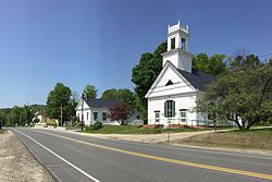
Croydon was home to Ruel Durkee, a powerful 19th century political boss in the state. The town of "Coniston" in the 1906 best-selling novel of the same name, by American author Winston Churchill, is based on Croydon, and Durkee was portrayed as "Jethro Bass". The local Coniston General Store is named after the novel, [4] [5] as are YMCA Camp Coniston and Lake Coniston in the eastern part of the town. [6]
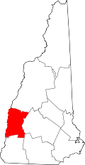
Geography

According to the United States Census Bureau, the town has a total area of 37.5 square miles (97.2 km2), of which 36.8 square miles (95.2 km2) are land and 0.77 square miles (2.0 km2) are water, comprising 2.07% of the town. [1] The highest point in town is Croydon Peak, at 2,760 feet (840 m) above sea level near the northwestern corner of the town. The North Branch Sugar River flows southward through the east-central part of the town. Croydon lies fully within the Connecticut River watershed. [7]

Croydon is home to Corbin Park, one of the largest private game reserves in New England. The 24,000-acre (9,700 ha) fenced-in expanse of woodlands and mountainous terrain features bison, European boar and elk and extends into neighboring towns. [8]

Adjacent municipalities

Demographics

Historical population
CensusPop.Note
1790 537
1800 98483.2%
1810 864−12.2%
1820 1,06022.7%
1830 1,057−0.3%
1840 956−9.6%
1850 861−9.9%
1860 755−12.3%
1870 652−13.6%
1880 608−6.7%
1890 512−15.8%
1900 372−27.3%
1910 324−12.9%
1920 230−29.0%
1930 26917.0%
1940 31216.0%
1950 34911.9%
1960 312−10.6%
1970 39626.9%
1980 45715.4%
1990 62737.2%
2000 6615.4%
2010 76415.6%
2020 8014.8%
U.S. Decennial Census [9]

As of the census [10] of 2000, there were 661 people, 264 households, and 194 families living in the town. The population density was 17.8 inhabitants per square mile (6.9/km2). There were 354 housing units at an average density of 9.5 per square mile (3.7/km2). The racial makeup of the town was 97.43% White, 0.45% Native American, 0.15% Asian, 0.76% from other races, and 1.21% from two or more races. Hispanic or Latino of any race were 0.61% of the population.

There were 264 households, out of which 29.2% had children under the age of 18 living with them, 58.0% were married couples living together, 8.3% had a female householder with no husband present, and 26.5% were non-families. 19.3% of all households were made up of individuals, and 8.7% had someone living alone who was 65 years of age or older. The average household size was 2.50 and the average family size was 2.71.

In the town, the population was spread out, with 22.7% under the age of 18, 4.7% from 18 to 24, 30.4% from 25 to 44, 30.0% from 45 to 64, and 12.3% who were 65 years of age or older. The median age was 41 years. For every 100 females, there were 109.2 males. For every 100 females age 18 and over, there were 102.0 males.

The median income for a household in the town was $49,688, and the median income for a family was $50,556. Males had a median income of $31,992 versus $26,544 for females. The per capita income for the town was $21,403. About 2.5% of families and 4.9% of the population were below the poverty line, including 5.0% of those under age 18 and 9.7% of those age 65 or over.

Politics

In recent decades, Croydon has supported Republicans in presidential elections.

Croydon city vote
by party in presidential elections
Year Democratic Republican Third Parties
2016 [11] 30.00% 12664.52%2715.48% 23
2012 [12] 44.44% 19652.83%2332.72% 12
2008 [13] 45.27% 18253.73%2161.00% 4
2004 [14] 38.57% 15760.93%2480.49% 2
2000 [15] 27.86% 9063.47%2058.67% 28
1996 [16] 33.33% 9553.68%15312.98% 37
1988 [17] 31.67% 7067.42%1490.91% 2
1984 [18] 29.63% 5670.37%1330.00% 0

In 2022, Croydon made headlines after citizens organized an emergency town meeting against a school board amendment that had cut the public school budget by more than half. Repeal of the amendment passed by 377-2. [19] The story of the repeal was covered on This American Life on July 29, 2022. [20]

Notable people

References

  1. 1 2 "2021 U.S. Gazetteer Files – New Hampshire". United States Census Bureau. Retrieved January 6, 2022.
  2. "Census - Geography Profile: Croydon town, Sullivan County, New Hampshire" . Retrieved December 24, 2021.
  3. New Hampshire Town Names and Whence They Came ISBN   978-0-872-33009-2 p. 9
  4. The Bookman. Dodd, Mead and Company. 1915.
  5. Project, Federal Writers (January 1, 1938). New Hampshire: A Guide To The Granite State: A Guide to the Silver State. Houghton Mifflin. ISBN   978-0-403-02179-6.{{cite book}}: ISBN / Date incompatibility (help)
  6. "History - YMCA Camp Coniston".
  7. Foster, Debra H.; Batorfalvy, Tatianna N.; Medalie, Laura (1995). Water Use in New Hampshire: An Activities Guide for Teachers. U.S. Department of the Interior and U.S. Geological Survey.
  8. "Corbin Park Hunting Preserve in New Hampshire". Free New Hampshire Blog. June 4, 2008. Retrieved June 20, 2011.
  9. "Census of Population and Housing". Census.gov. Retrieved June 4, 2016.
  10. "U.S. Census website". United States Census Bureau . Retrieved January 31, 2008.
  11. "NH Elections Database » 2016 President General Election".
  12. "NH Elections Database » 2012 President General Election".
  13. "NH Elections Database » 2008 President General Election".
  14. "NH Elections Database » 2004 President General Election".
  15. "NH Elections Database » 2000 President General Election".
  16. "NH Elections Database » 1996 President General Election".
  17. "NH Elections Database » 1988 President General Election".
  18. "NH Elections Database » 1984 President General Election".
  19. "One Small Step for Democracy in a 'Live Free or Die' Town". July 10, 2022. Retrieved July 11, 2022.
  20. Ira Glass, Sarah Gibson (July 29, 2022). "I Work Better on Deadline" . Retrieved August 26, 2024.