Acworth, New Hampshire

Last updated

Acworth, New Hampshire
Town
Sullivan County New Hampshire incorporated and unincorporated areas Acworth highlighted.svg
Location in Sullivan County and the state of New Hampshire.
Coordinates: 43°13′04″N72°17′31″W / 43.21778°N 72.29194°W / 43.21778; -72.29194
Country United States
State New Hampshire
County Sullivan
Incorporated 1772
Villages
Government
  Town AdministratorCharlotte Comeau
   Board of Selectmen
  • Kathi Bradt
  • Jim Jennison
  • Ryanne Schoonover
Area
[1]
  Total39.1 sq mi (101.2 km2)
  Land38.8 sq mi (100.5 km2)
  Water0.3 sq mi (0.7 km2)  0.65%
Elevation
1,489 ft (454 m)
Population
 (2020) [2]
  Total853
  Density22/sq mi (8.5/km2)
Time zone UTC-5 (Eastern)
  Summer (DST) UTC-4 (Eastern)
ZIP codes
03601 (Acworth)
03602 (Alstead)
03607 (South Acworth)
03773 (Newport)
Area code 603
FIPS code 33-00260
GNIS feature ID873525
Website acworthnh.net

Acworth is a town in Sullivan County, New Hampshire, United States. At the 2020 census, the town had a total population of 853. [3]

Contents

History

Acworth Congregational Church on the town common Acworth Congregational Church, Acworth NH.jpg
Acworth Congregational Church on the town common

Originally chartered by colonial governor Benning Wentworth in 1752, it was called "Burnet" after William Burnet, a former governor of the Province of Massachusetts Bay. In 1754, however, the French and Indian War broke out, and no settlements were made under the charter. [4] Wentworth regranted the township on September 19, 1766, [5] naming it after Sir Jacob Acworth, a former Surveyor of the Royal Navy. [6] The town was first permanently settled in 1768 by several families from Londonderry, New Hampshire.

Acworth was incorporated in 1772 by Governor John Wentworth, [7] but war again slowed its development. With the close of the Revolution, however, Acworth grew quickly. By 1859, it had 1,251 inhabitants, most of whom were occupied in agriculture. The Cold River provided water power for industry, including five sawmills, a gristmill, a woolen factory, a bobbin factory and a peg factory. There was also a boot and shoe manufacturer. [4] Acworth is a source for museum-quality crystals such as beryl. The town of Acworth, Georgia, was named for this town, because this was the hometown of a railroad engineer there.

Geography

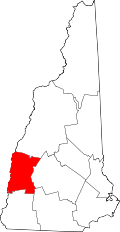
According to the United States Census Bureau, the town has a total area of 39.1 square miles (101.2 km2), of which 38.8 square miles (100.5 km2) are land and 0.2 square miles (0.6 km2) are water, comprising 0.65% of the town. [1] Acworth is drained by the Cold River and its tributaries, except for the northwest corner of town, which drains north to the Little Sugar River. The town lies fully within the Connecticut River watershed. [8] The highest point in Acworth is Gove Hill in the northeast part of town, at 1,939 feet (591 m) above sea level.

The town is crossed by one numbered state highway, New Hampshire Route 123A, which follows the Cold River and passes through the village of South Acworth. Although not numbered routes, the state also maintains a handful of other roads in the town, including Cold River Road, Hill Road, and a portion of Charlestown Road.

Adjacent municipalities

Demographics

Historical population
CensusPop.Note
1790 704
1800 1,37695.5%
1810 1,52310.7%
1820 1,479−2.9%
1830 1,401−5.3%
1840 1,4503.5%
1850 1,251−13.7%
1860 1,180−5.7%
1870 1,050−11.0%
1880 982−6.5%
1890 717−27.0%
1900 594−17.2%
1910 536−9.8%
1920 436−18.7%
1930 4718.0%
1940 4771.3%
1950 418−12.4%
1960 371−11.2%
1970 45923.7%
1980 59028.5%
1990 77631.5%
2000 8367.7%
2010 8916.6%
2020 853−4.3%
U.S. Decennial Census [9]

As of the census [10] of 2000, there were 836 people, 318 households, and 234 families residing in the town. The population density was 21.5 people per square mile (8.3/km2). There were 512 housing units at an average density of 13.2 per square mile (5.1/km2). The racial makeup of the town was 96.77% White, 0.84% African American, 0.84% Native American, 0.24% Asian, and 1.32% from two or more races. Hispanic or Latino of any race were 1.08% of the population.

There were 318 households, out of which 30.8% had children under the age of 18 living with them, 60.7% were married couples living together, 6.0% had a female householder with no husband present, and 26.4% were non-families. 19.8% of all households were made up of individuals, and 7.5% had someone living alone who was 65 years of age or older. The average household size was 2.63 and the average family size was 3.06.

In the town, the population was spread out, with 25.7% under the age of 18, 4.7% from 18 to 24, 24.0% from 25 to 44, 30.4% from 45 to 64, and 15.2% who were 65 years of age or older. The median age was 43 years. For every 100 females, there were 101.4 males. For every 100 females age 18 and over, there were 101.0 males.

The median income for a household in the town was $37,386, and the median income for a family was $41,397. Males had a median income of $29,792 versus $26,912 for females. The per capita income for the town was $18,132. About 10.1% of families and 15.6% of the population were below the poverty line, including 26.6% of those under age 18 and 5.4% of those age 65 or over.

Notable people

Post office in 1907 Post Office, South Acworth, NH.jpg
Post office in 1907

See also

Related Research Articles

<span class="mw-page-title-main">Sullivan County, New Hampshire</span> County in New Hampshire, United States

Sullivan County is a county in the U.S. state of New Hampshire. As of the 2020 census, the population was 43,063, making it the second-least populous county in New Hampshire. Its county seat is Newport.

<span class="mw-page-title-main">Chatham, New Hampshire</span> Town in New Hampshire, United States

Chatham is a town in Carroll County, New Hampshire, United States. The population was 341 at the 2020 census. It is located in the White Mountains, and except for the southeastern corner, all of Chatham is in the White Mountain National Forest. The town is home to the Cold River national forest campgrounds.

<span class="mw-page-title-main">Alstead, New Hampshire</span> Town in New Hampshire, United States

Alstead is a town in Cheshire County, New Hampshire, United States. The population was 1,864 at the 2020 census. Alstead is home to Feuer State Forest.

<span class="mw-page-title-main">Gilsum, New Hampshire</span> Town in New Hampshire, United States

Gilsum is a town in Cheshire County, New Hampshire, United States. The population was 752 at the 2020 census. Home to Bear's Den Natural Area, Gilsum includes Gilsum Lower Village.

<span class="mw-page-title-main">Marlow, New Hampshire</span> Town in New Hampshire, United States

Marlow is a town in Cheshire County, New Hampshire, United States. The population was 749 at the 2020 census. Marlow is home to Honey Brook State Forest.

<span class="mw-page-title-main">Walpole, New Hampshire</span> Town in New Hampshire, United States

Walpole is a town in Cheshire County, New Hampshire, United States. The population was 3,633 at the 2020 census.

<span class="mw-page-title-main">Dummer, New Hampshire</span> Town in New Hampshire, United States

Dummer is a town in Coös County, New Hampshire, United States. The population was 306 at the 2020 census. It is part of the Berlin, NH–VT micropolitan statistical area. Dummer is home to the Pontook Reservoir, popular with canoeists, kayakers and birdwatchers. In the western part of Dummer lies the village of Paris.

<span class="mw-page-title-main">Errol, New Hampshire</span> Town in New Hampshire, United States

Errol is a town in Coös County, New Hampshire, United States. The population was 298 at the 2020 census. It is located north of the White Mountains along Route 16 at its intersection of Route 26. It has a municipal airport with a single, unpaved runway.

<span class="mw-page-title-main">Northumberland, New Hampshire</span> Town in New Hampshire, United States

Northumberland is a town located in western Coös County, New Hampshire, United States, north of Lancaster. It is part of the Berlin, NH–VT micropolitan statistical area. As of the 2020 census, the town population was 2,126, of whom 1,068 lived in the village of Groveton.

<span class="mw-page-title-main">Benton, New Hampshire</span> Town in New Hampshire, United States

Benton is a town in Grafton County, New Hampshire, United States. The population was 374 at the 2020 census. Located in the White Mountains, Benton is largely surrounded by the White Mountain National Forest. The town is crossed by the Appalachian Trail.

<span class="mw-page-title-main">Campton, New Hampshire</span> Town in New Hampshire, United States

Campton is a town in Grafton County, New Hampshire, United States. The population was 3,343 at the 2020 census. Campton, which includes the villages of Blair, Campton Hollow, Lower Campton and West Campton, is home to Blair State Forest and Livermore Falls State Forest. It is located in the foothills of the White Mountains, and parts of the White Mountain National Forest are in the northeast and northwest.

<span class="mw-page-title-main">Dorchester, New Hampshire</span> Town in New Hampshire, United States

Dorchester is a town in Grafton County, New Hampshire, United States. The population was 339 at the 2020 census.

<span class="mw-page-title-main">Francestown, New Hampshire</span> Town in New Hampshire, United States

Francestown is a town in Hillsborough County, New Hampshire, United States. The population was 1,610 at the 2020 census. The village of Francestown, population 201 in 2020, is in the center of the town.

<span class="mw-page-title-main">Langdon, New Hampshire</span> Place in New Hampshire, United States

Langdon is a town in Sullivan County, New Hampshire, United States. The population was 651 at the 2020 census.

<span class="mw-page-title-main">Lempster, New Hampshire</span> Place in New Hampshire, United States

Lempster is a town in Sullivan County, New Hampshire, United States. The population was 1,118 at the 2020 census. Settlements include the town center and the village of East Lempster.

<span class="mw-page-title-main">Unity, New Hampshire</span> Place in New Hampshire, United States

Unity is a town in Sullivan County, New Hampshire, United States. The population was 1,518 at the 2020 census, down from 1,671 at the 2010 census. The town includes the villages of Unity, East Unity, Quaker City, and West Unity.

<span class="mw-page-title-main">Washington, New Hampshire</span> Place in New Hampshire, United States

Washington is a town in Sullivan County, New Hampshire, United States. The population was 1,192 at the 2020 census. Situated in a hilly, rocky, forested area, and with 26 lakes and ponds, Washington is a picturesque resort area. It is home to Pillsbury State Park.

<span class="mw-page-title-main">Wentworth, New Hampshire</span> Town in New Hampshire, United States

Wentworth is a town in Grafton County, New Hampshire, United States. The population was 845 at the 2020 census, down from 911 at the 2010 census. The town is home to Plummer's Ledge Natural Area, and part of the White Mountain National Forest is in the northeast. The town has a picturesque common, presided over by a Federal-style church and bordered by antique homes.

<span class="mw-page-title-main">Charlestown (CDP), New Hampshire</span> Census-designated place in New Hampshire, United States

Charlestown is a census-designated place (CDP) and the main village in the town of Charlestown, Sullivan County, New Hampshire, United States. The population of the CDP was 1,078 at the 2020 census, out of 4,806 in the entire town.

<span class="mw-page-title-main">Charlestown, New Hampshire</span> Place in New Hampshire, United States

Charlestown is a town in Sullivan County, New Hampshire, United States. The population was 4,806 at the 2020 census, down from 5,114 at the 2010 census. The town is home to Hubbard State Forest and the headquarters of the Student Conservation Association.

References

  1. 1 2 "2021 U.S. Gazetteer Files – New Hampshire". United States Census Bureau. Retrieved January 6, 2022.
  2. "Acworth town, Sullivan County, New Hampshire: 2020 DEC Redistricting Data (PL 94-171)". U.S. Census Bureau. Retrieved January 6, 2022.
  3. "Census - Geography Profile: Acworth town, Sullivan County, New Hampshire" . Retrieved December 24, 2021.
  4. 1 2 A. J. Coolidge & J. B. Mansfield, A History and Description of New England; Boston, Massachusetts 1859
  5. Statistics and Gazetteer of New-Hampshire (1875)
  6. Encyclopedia of New Hampshire ISBN   978-0-403-09601-5 p. 441
  7. "New Hampshire Employment Security Community Profile: Acworth". Archived from the original on June 5, 2009. Retrieved August 29, 2006.
  8. Foster, Debra H.; Batorfalvy, Tatianna N.; Medalie, Laura (1995). Water Use in New Hampshire: An Activities Guide for Teachers. U.S. Department of the Interior and U.S. Geological Survey.
  9. "Census of Population and Housing". Census.gov. Retrieved June 4, 2016.
  10. "U.S. Census website". United States Census Bureau . Retrieved January 31, 2008.

Further reading