Marlow, New Hampshire

Last updated

Marlow, New Hampshire
Town
Murray Hall, Marlow, NH.jpg
Main Street in 1907
Cheshire-Marlow-NH.png
Coordinates: 43°06′57″N72°11′49″W / 43.11583°N 72.19694°W / 43.11583; -72.19694
Country United States
State New Hampshire
County Cheshire
Incorporated 1761
Communities
  • Marlow
  • Baker Corner
  • Gee Mill
  • Marlow Hill
  • Marlow Junction
Government
   Board of Selectmen
  • Robert Allen, Chair
  • Sandy Pierre
  • John Luke
Area
[1]
  Total26.4 sq mi (68.5 km2)
  Land26.0 sq mi (67.3 km2)
  Water0.5 sq mi (1.2 km2)  1.78%
Elevation
1,161 ft (354 m)
Population
 (2020) [2]
  Total749
  Density29/sq mi (11.1/km2)
Time zone UTC-5 (Eastern)
  Summer (DST) UTC-4 (Eastern)
ZIP code
03456
Area code 603
FIPS code 33-45700
GNIS feature ID0873660
Website www.marlownh.gov

Marlow is a town in Cheshire County, New Hampshire, United States. The population was 749 at the 2020 census. [2] Marlow is home to Honey Brook State Forest.

Contents

History

The town was first granted in 1753 by colonial Governor Benning Wentworth as "Addison", after Joseph Addison, writer and for a time under-secretary of state for England. Addison had signed the appointment papers making the governor's father, John Wentworth, lieutenant-governor of New Hampshire in 1717. As a result of the French and Indian War, few original grantees settled here, so it was regranted on October 7, 1761, to William Noyes and 69 others, the majority from Lyme, Connecticut. The town was named after Marlow, England, located on the River Thames in Buckinghamshire. [3]

Marlow bears many marks of glacial action, and minerals are still found here. A woodworking industry once used the water power of the Ashuelot River to produce tools, furniture and wooden buckets from lumber cut nearby. By 1859, when the population was 708, there were seven sawmills, a gristmill, a carriage shop, a tin shop, and two tanneries. Although the town's undulating surface is somewhat rocky, farmers produced hay, grain and vegetables. [3]

Marlow was the original home of PC Connection, now just called 'Connection'.
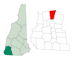
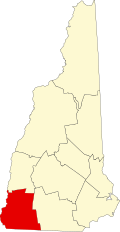
Geography

According to the United States Census Bureau, the town has a total area of 26.4 square miles (68.5 km2), of which 26.0 square miles (67.3 km2) are land and 0.46 square miles (1.2 km2) are water, comprising 1.78% of the town. Marlow is drained by the Ashuelot River, part of the Connecticut River watershed. The town's highest point is in its northeastern corner, at the summit of Huntley Mountain, where the elevation reaches 1,978 feet (603 m) above sea level.

Marlow is served by state routes 10, 123, and a small portion of the northern segment of Route 123A. Route 10 leads north to Newport and south to Keene, Route 123 leads east to Stoddard and west to Alstead, and Route 123A leads northwest from Route 10 into the town of Acworth.

Adjacent municipalities

Demographics

Historical population
CensusPop.Note
1790 313
1800 54373.5%
1810 5664.2%
1820 5975.5%
1830 6458.0%
1840 626−2.9%
1850 70813.1%
1860 81314.8%
1870 716−11.9%
1880 701−2.1%
1890 584−16.7%
1900 488−16.4%
1910 425−12.9%
1920 401−5.6%
1930 330−17.7%
1940 288−12.7%
1950 33014.6%
1960 3506.1%
1970 39011.4%
1980 54239.0%
1990 65019.9%
2000 74714.9%
2010 742−0.7%
2020 7490.9%
U.S. Decennial Census [2] [4]

As of the census [5] of 2000, there were 747 people, 292 households, and 221 families residing in the town. The population density was 28.8 inhabitants per square mile (11.1/km2). There were 396 housing units at an average density of 15.3 per square mile (5.9/km2). The racial makeup of the town was 98.80% White, 0.13% Native American, and 1.07% from two or more races. Hispanic or Latino of any race were 1.07% of the population.

There were 292 households, out of which 33.2% had children under the age of 18 living with them, 67.1% were married couples living together, 5.5% had a female householder with no husband present, and 24.0% were non-families. 17.1% of all households were made up of individuals, and 6.8% had someone living alone who was 65 years of age or older. The average household size was 2.56 and the average family size was 2.89.

In the town, the population was spread out, with 24.9% under the age of 18, 5.9% from 18 to 24, 27.6% from 25 to 44, 28.5% from 45 to 64, and 13.1% who were 65 years of age or older. The median age was 40 years. For every 100 females, there were 105.8 males. For every 100 females age 18 and over, there were 102.5 males.

The median income for a household in the town was $45,000, and the median income for a family was $47,813. Males had a median income of $29,653 versus $22,273 for females. The per capita income for the town was $18,810. About 2.7% of families and 4.1% of the population were below the poverty line, including 5.1% of those under age 18 and 4.9% of those age 65 or over.

Notable people

Related Research Articles

<span class="mw-page-title-main">Sullivan County, New Hampshire</span> County in New Hampshire, United States

Sullivan County is a county in the U.S. state of New Hampshire. As of the 2020 census, the population was 43,063, making it the second-least populous county in New Hampshire. Its county seat is Newport.

<span class="mw-page-title-main">Cheshire County, New Hampshire</span> County in New Hampshire, United States

Cheshire County is a county in the southwestern corner of the U.S. state of New Hampshire. As of the 2020 census, the population was 76,458. Its county seat is the city of Keene. Cheshire was one of the five original counties of New Hampshire, and is named for the county of Cheshire in England. It was organized in 1771 at Keene. Sullivan County was created from the northern portion of Cheshire County in 1827.

<span class="mw-page-title-main">Alstead, New Hampshire</span> Town in New Hampshire, United States

Alstead is a town in Cheshire County, New Hampshire, United States. The population was 1,864 at the 2020 census. Alstead is home to Feuer State Forest.

<span class="mw-page-title-main">Fitzwilliam, New Hampshire</span> Town in New Hampshire, United States

Fitzwilliam is a town in Cheshire County, New Hampshire, United States. The population was 2,351 at the 2020 census. Fitzwilliam is home to Rhododendron State Park, a 16-acre (6.5 ha) grove of native rhododendrons that bloom in mid-July.

<span class="mw-page-title-main">Gilsum, New Hampshire</span> Town in New Hampshire, United States

Gilsum is a town in Cheshire County, New Hampshire, United States. The population was 752 at the 2020 census. Home to Bear's Den Natural Area, Gilsum includes Gilsum Lower Village.

<span class="mw-page-title-main">Nelson, New Hampshire</span> Town in New Hampshire, United States

Nelson is a town in Cheshire County, New Hampshire, United States. The population was 629 at the 2020 census, down from 729 at the 2010 census. Nelson includes the village of Munsonville.

<span class="mw-page-title-main">Stoddard, New Hampshire</span> Town in New Hampshire, United States

Stoddard is a town in Cheshire County, New Hampshire, United States. The population was 1,374 at the 2020 census, up from 1,232 at the 2010 census.

<span class="mw-page-title-main">Sullivan, New Hampshire</span> Town in New Hampshire, United States

Sullivan is a town in Cheshire County, New Hampshire, United States. The population was 658 at the 2020 census. It includes the villages of East Sullivan and Ellisville.

<span class="mw-page-title-main">Surry, New Hampshire</span> Town in New Hampshire, United States

Surry is a town in Cheshire County, New Hampshire, United States. The population was 820 at the 2020 census, up from 732 at the 2010 census.

<span class="mw-page-title-main">Swanzey, New Hampshire</span> Town in New Hampshire, United States

Swanzey is a town in Cheshire County, New Hampshire, United States. The population was 7,270 at the 2020 census. In addition to the town center, Swanzey includes the villages of East Swanzey, West Swanzey, North Swanzey and Westport.

<span class="mw-page-title-main">Troy, New Hampshire</span> Town in New Hampshire, United States

Troy is a town in Cheshire County, New Hampshire, United States. The population was 2,130 at the 2020 census. It is situated west of Mount Monadnock.

<span class="mw-page-title-main">Errol, New Hampshire</span> Town in New Hampshire, United States

Errol is a town in Coös County, New Hampshire, United States. The population was 298 at the 2020 census. It is located north of the White Mountains along Route 16 at its intersection of Route 26. It has a municipal airport with a single, unpaved runway.

<span class="mw-page-title-main">Epsom, New Hampshire</span> Town in New Hampshire, United States

Epsom is a town in Merrimack County, New Hampshire, United States. The population was 4,834 at the 2020 census.

<span class="mw-page-title-main">Acworth, New Hampshire</span> Town in New Hampshire, United States

Acworth is a town in Sullivan County, New Hampshire, United States. At the 2020 census, the town had a total population of 853.

<span class="mw-page-title-main">Langdon, New Hampshire</span> Place in New Hampshire, United States

Langdon is a town in Sullivan County, New Hampshire, United States. The population was 651 at the 2020 census.

<span class="mw-page-title-main">Lempster, New Hampshire</span> Place in New Hampshire, United States

Lempster is a town in Sullivan County, New Hampshire, United States. The population was 1,118 at the 2020 census. Settlements include the town center and the village of East Lempster.

<span class="mw-page-title-main">Washington, New Hampshire</span> Place in New Hampshire, United States

Washington is a town in Sullivan County, New Hampshire, United States. The population was 1,192 at the 2020 census. Situated in a hilly, rocky, forested area, and with 26 lakes and ponds, Washington is a picturesque resort area. It is home to Pillsbury State Park.

<span class="mw-page-title-main">Marlborough, New Hampshire</span> Town in New Hampshire, United States

Marlborough is a town in Cheshire County, New Hampshire, United States. The population was 2,096 at the 2020 census. The town is home to the Kensan-Devan Wildlife Sanctuary at Meetinghouse Pond.

<span class="mw-page-title-main">Winchester, New Hampshire</span> Town in New Hampshire, United States

Winchester is a town in Cheshire County, New Hampshire, United States. The population was 4,150 at the 2020 census. The primary community in the town, where 1,606 people resided at the 2020 census, is defined by the U.S. Census Bureau as the Winchester census-designated place (CDP). The town also includes the village of Ashuelot and part of Pisgah State Park.

<span class="mw-page-title-main">New Hampshire Route 123</span> State highway in southwestern New Hampshire, US

New Hampshire Route 123 is a 63.055-mile-long (101.477 km) secondary north–south state highway in southwestern New Hampshire. The southern terminus of the route is at the Massachusetts state line in Mason where, as Mason Road, the road continues as an unnumbered local road in the town of Townsend. The northern terminus, as signed, is at the Connecticut River, where the highway continues west for 0.313 miles (0.504 km) to U.S. Route 5 in Westminster, Vermont, as Vermont Route 123. Route logs, however, place the terminus at New Hampshire Route 12 in Walpole.

References

  1. "2021 U.S. Gazetteer Files – New Hampshire". United States Census Bureau. Retrieved November 4, 2021.
  2. 1 2 3 "Marlow town, Cheshire County, New Hampshire: 2020 DEC Redistricting Data (PL 94-171)". U.S. Census Bureau. Retrieved November 4, 2021.
  3. 1 2 Coolidge, Austin J.; John B. Mansfield (1859). A History and Description of New England. Boston, Massachusetts: A.J. Coolidge. pp.  573–574. coolidge mansfield history description new england 1859.
  4. "Census of Population and Housing". Census.gov. Retrieved June 4, 2016.
  5. "U.S. Census website". United States Census Bureau . Retrieved January 31, 2008.