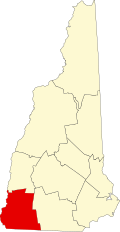
Swanzey, New Hampshire

Last updated

Swanzey, New Hampshire
Town
Old Covered Bridge, West Swanzey, NH.jpg
Swanzey Town Seal.png
Motto(s): 
"Bridging Tradition and Change"
Cheshire-Swanzey-NH.png
Coordinates: 42°52′11″N72°16′54″W / 42.86972°N 72.28167°W / 42.86972; -72.28167
Country United States
State New Hampshire
County Cheshire
Incorporated 1753
Villages
Government
   Board of Selectmen
  • Kenneth P. Colby Jr., Chair
  • Sylvester Karasinski
  • Bill Hutwelker
  Town AdministratorMichael T. Branley
Area
[1]
  Total45.3 sq mi (117.4 km2)
  Land45.0 sq mi (116.5 km2)
  Water0.3 sq mi (0.9 km2)  0.79%
Elevation
492 ft (150 m)
Population
 (2020) [2]
  Total7,270
  Density162/sq mi (62.4/km2)
Time zone UTC-5 (Eastern)
  Summer (DST) UTC-4 (Eastern)
ZIP codes
03446 (Swanzey)
03431 (Keene/North Swanzey)
03469 (West Swanzey)
Area code 603
FIPS code 33-75700
GNIS feature ID0873735
Website www.swanzeynh.gov

Swanzey is a town in Cheshire County, New Hampshire, United States. The population was 7,270 at the 2020 census. [2] In addition to the town center, Swanzey includes the villages of East Swanzey, West Swanzey, North Swanzey and Westport.

Contents

History

First granted in 1733 as "Lower Ashuelot", Swanzey was one of the fort towns established by Governor Jonathan Belcher of Massachusetts, which then claimed the territory. The town was the site of many battles during King George's War, and in 1747 it was abandoned for three years. It was regranted to 62 proprietors on July 2, 1753, by Governor Benning Wentworth as "Swanzey", most probably because some early settlers had a connection to Swansea in Wales. [3] Situated on the Ashuelot River and connected by the Ashuelot Railroad, West Swanzey developed as a textile mill town, and East Swanzey produced wooden buckets for generations. By 1859, the population was 2,106. [4]

The town features four covered bridges, and was the home of theatrical trouper Denman Thompson, who gained a national reputation by his portrayal of the Yankee farmer, "Joshua Whitcomb", star of his stage play The Old Homestead. Residents restage Thompson's melodrama every summer at a natural outdoor amphitheater called the Potash Bowl. [5]

Because he vacationed in Swanzey during several summers, the town has claimed to be the location of a tree that inspired poet Joyce Kilmer (1886–1918) to write the popular 1913 poem "Trees". However, family accounts and documents establish that the poem was written in Mahwah, New Jersey. [6] [7] [8]

Geography

According to the United States Census Bureau, the town has a total area of 45.3 square miles (117.4 km2), of which 45.0 square miles (116.5 km2) are land and 0.35 square miles (0.9 km2) are water, comprising 0.79% of the town. Swanzey is drained by the Ashuelot River, a southwest-flowing tributary of the Connecticut River. The town's highest point is the summit of Franklin Mountain at 1,423 feet (434 m), on the border with Winchester.

The town is crossed by New Hampshire Route 10, New Hampshire Route 12 and New Hampshire Route 32.

Adjacent municipalities

Demographics

Historical population
CensusPop.Note
1790 1,157
1800 1,2719.9%
1810 1,40010.1%
1820 1,71622.6%
1830 1,8165.8%
1840 1,755−3.4%
1850 2,10620.0%
1860 1,798−14.6%
1870 1,626−9.6%
1880 1,6612.2%
1890 1,600−3.7%
1900 1,570−1.9%
1910 1,6565.5%
1920 1,593−3.8%
1930 2,06629.7%
1940 2,2629.5%
1950 2,80624.0%
1960 3,62629.2%
1970 4,25417.3%
1980 5,18321.8%
1990 6,23620.3%
2000 6,8009.0%
2010 7,2306.3%
2020 7,2700.6%
U.S. Decennial Census [2] [9]

As of the census of 2010, there were 7,230 people, 2,957 households, and 1,978 families residing in the town. There were 3,205 housing units, of which 248, or 7.7%, were vacant. The racial makeup of the town was 96.0% white, 0.3% African American, 0.2% Native American, 1.7% Asian, 0.03% Native Hawaiian or Pacific Islander, 0.4% some other race, and 1.4% from two or more races. 1.5% of the population were Hispanic or Latino of any race. [10]

Of the 2,957 households, 28.0% had children under the age of 18 living with them, 51.0% were headed by married couples living together, 10.5% had a female householder with no husband present, and 33.1% were non-families. 24.0% of all households were made up of individuals, and 9.1% were someone living alone who was 65 years of age or older. The average household size was 2.45, and the average family size was 2.88. [10]

In the town, 20.4% of the population were under the age of 18, 7.9% were from 18 to 24, 24.6% from 25 to 44, 32.2% from 45 to 64, and 14.8% were 65 years of age or older. The median age was 43.0 years. For every 100 females, there were 94.8 males. For every 100 females age 18 and over, there were 94.4 males. [10]

For the period 2011–2015, the estimated median annual income for a household was $57,632, and the median income for a family was $68,371. Male full-time workers had a median income of $50,017 versus $42,778 for females. The per capita income for the town was $33,749. 14.2% of the population and 10.5% of families were below the poverty line. 39.0% of the population under the age of 18 and 4.9% of those 65 or older were living in poverty. [11]

Education

Sites of interest

Notable people

Related Research Articles

<span class="mw-page-title-main">Cheshire County, New Hampshire</span> County in New Hampshire, United States

Cheshire County is a county in the southwestern corner of the U.S. state of New Hampshire. As of the 2020 census, the population was 76,458. Its county seat is the city of Keene. Cheshire was one of the five original counties of New Hampshire, and is named for the county of Cheshire in England. It was organized in 1771 at Keene. Sullivan County was created from the northern portion of Cheshire County in 1827.

<span class="mw-page-title-main">Gilford, New Hampshire</span> Town in New Hampshire, United States

Gilford is a town in Belknap County, New Hampshire, United States. The population was 7,699 at the 2020 census, up from 7,126 at the 2010 census. Situated on Lake Winnipesaukee, Gilford is home to Governors Island, Ellacoya State Beach, Belknap Mountain State Forest, Gunstock Mountain Resort, and the Bank of New Hampshire Pavilion, a seasonal outdoor concert venue. The lakeside village of Glendale lies within Gilford's borders.

<span class="mw-page-title-main">Chesterfield, New Hampshire</span> Town in New Hampshire, United States

Chesterfield is a town in Cheshire County, New Hampshire, United States. The population was 3,552 at the 2020 census. It includes the villages of Spofford and West Chesterfield. Chesterfield is home to Spofford Lake, Chesterfield Gorge Natural Area, and parts of Pisgah State Park and Wantastiquet Mountain State Forest.

<span class="mw-page-title-main">Fitzwilliam, New Hampshire</span> Town in New Hampshire, United States

Fitzwilliam is a town in Cheshire County, New Hampshire, United States. The population was 2,351 at the 2020 census. Fitzwilliam is home to Rhododendron State Park, a 16-acre (6.5 ha) grove of native rhododendrons that bloom in mid-July.

<span class="mw-page-title-main">Gilsum, New Hampshire</span> Town in New Hampshire, United States

Gilsum is a town in Cheshire County, New Hampshire, United States. The population was 752 at the 2020 census. Home to Bear's Den Natural Area, Gilsum includes Gilsum Lower Village.

<span class="mw-page-title-main">Marlow, New Hampshire</span> Town in New Hampshire, United States

Marlow is a town in Cheshire County, New Hampshire, United States. The population was 749 at the 2020 census. Marlow is home to Honey Brook State Forest.

<span class="mw-page-title-main">Nelson, New Hampshire</span> Town in New Hampshire, United States

Nelson is a town in Cheshire County, New Hampshire, United States. The population was 629 at the 2020 census, down from 729 at the 2010 census. Nelson includes the village of Munsonville.

<span class="mw-page-title-main">Richmond, New Hampshire</span> Town in New Hampshire, United States

Richmond is a town in Cheshire County, New Hampshire, United States. The population was 1,197 at the 2020 census.

<span class="mw-page-title-main">Rindge, New Hampshire</span> Town in New Hampshire, United States

Rindge is a town in Cheshire County, New Hampshire, United States. The population was 6,476 at the 2020 census, up from 6,014 at the 2010 census. Rindge is home to Franklin Pierce University, the Cathedral of the Pines and part of Annett State Forest.

<span class="mw-page-title-main">Stoddard, New Hampshire</span> Town in New Hampshire, United States

Stoddard is a town in Cheshire County, New Hampshire, United States. The population was 1,374 at the 2020 census, up from 1,232 at the 2010 census.

<span class="mw-page-title-main">Sullivan, New Hampshire</span> Town in New Hampshire, United States

Sullivan is a town in Cheshire County, New Hampshire, United States. The population was 658 at the 2020 census. It includes the villages of East Sullivan and Ellisville.

<span class="mw-page-title-main">Surry, New Hampshire</span> Town in New Hampshire, United States

Surry is a town in Cheshire County, New Hampshire, United States. The population was 820 at the 2020 census, up from 732 at the 2010 census.

<span class="mw-page-title-main">Troy, New Hampshire</span> Town in New Hampshire, United States

Troy is a town in Cheshire County, New Hampshire, United States. The population was 2,130 at the 2020 census. It is situated west of Mount Monadnock.

<span class="mw-page-title-main">West Swanzey, New Hampshire</span> Census-designated place in New Hampshire, United States

West Swanzey is a census-designated place (CDP) in the town of Swanzey within Cheshire County, New Hampshire, United States. The population was 1,281 at the 2020 census. It is the largest village in the town of Swanzey.

<span class="mw-page-title-main">Westmoreland, New Hampshire</span> Town in New Hampshire, United States

Westmoreland is a town in Cheshire County, New Hampshire, United States. The population was 1,706 at the 2020 census, down from 1,874 at the 2010 census. Westmoreland is historically an agricultural town, with much arable farmland.

<span class="mw-page-title-main">Hinsdale, New Hampshire</span> Town in New Hampshire, United States

Hinsdale is a town in Cheshire County, New Hampshire, United States. The population was 3,948 at the 2020 census. Hinsdale is home to part of Pisgah State Park in the northeast, and part of Wantastiquet Mountain State Forest in the northwest.

<span class="mw-page-title-main">Jaffrey, New Hampshire</span> Town in New Hampshire, United States

Jaffrey is a town in Cheshire County, New Hampshire, United States. The population was 5,320 at the 2020 census.

<span class="mw-page-title-main">Marlborough, New Hampshire</span> Town in New Hampshire, United States

Marlborough is a town in Cheshire County, New Hampshire, United States. The population was 2,096 at the 2020 census. The town is home to the Kensan-Devan Wildlife Sanctuary at Meetinghouse Pond.

<span class="mw-page-title-main">Winchester (CDP), New Hampshire</span> Census-designated place in New Hampshire, United States

Winchester is a census-designated place (CDP) and the main village in the town of Winchester in Cheshire County, New Hampshire, United States. The population of the CDP was 1,606 at the 2020 census, compared to 4,150 in the entire town.

<span class="mw-page-title-main">Winchester, New Hampshire</span> Town in New Hampshire, United States

Winchester is a town in Cheshire County, New Hampshire, United States. The population was 4,150 at the 2020 census. The primary community in the town, where 1,606 people resided at the 2020 census, is defined by the U.S. Census Bureau as the Winchester census-designated place (CDP). The town also includes the village of Ashuelot and part of Pisgah State Park.

References

  1. "2021 U.S. Gazetteer Files – New Hampshire". United States Census Bureau. Retrieved November 5, 2021.
  2. 1 2 3 "Swanzey town, Cheshire County, New Hampshire: 2020 DEC Redistricting Data (PL 94-171)". U.S. Census Bureau. Retrieved November 5, 2021.
  3. Read, Benjamin (1892). The History of Swanzey, New Hampshire, from 1734 to 1890. Salem, Massachusetts: Salem Press. p.  52.
  4. Coolidge, Austin J.; John B. Mansfield (1859). A History and Description of New England. Boston, Massachusetts: A.J. Coolidge. pp.  661–663. coolidge mansfield history description new england 1859.
  5. New Hampshire Economic and Labor Market Information Bureau Profile
  6. Federal Writers' Project for the Works Progress Administration of the State of New Hampshire. New Hampshire: A Guide to the Granite State (Boston: Houghton Mifflin & Co., 1938), 103.
  7. Kelly, Mike. "Did Mahwah's trees inspire Joyce Kilmer's famous poem?" in The Bergen Record (26 January 2013). Retrieved 18 June 2013.
  8. Associated Press. "Doomed Oak Said Kilmer Poem Source" in The Berkshire Eagle (16 September 1963), 8.
  9. "Census of Population and Housing". Census.gov. Retrieved June 4, 2016.
  10. 1 2 3 "Profile of General Population and Housing Characteristics: 2010 Census Summary File 1 (DP-1): Swanzey town, Cheshire County, New Hampshire". U.S. Census Bureau, American Factfinder. Archived from the original on February 14, 2020. Retrieved October 27, 2017.
  11. "Selected Economic Characteristics: 2011-2015 American Community Survey 5-Year Estimates (DP03): Swanzey town, Cheshire County, New Hampshire". U.S. Census Bureau, American Factfinder. Archived from the original on February 13, 2020. Retrieved October 27, 2017.