Walpole (CDP), New Hampshire

Last updated

Walpole, New Hampshire
Walpole NH Westminster St 2019.jpg
Westminster Street in the center of Walpole
USA New Hampshire location map.svg
Red pog.svg
Walpole
Usa edcp location map.svg
Red pog.svg
Walpole
Coordinates: 43°4′46″N72°25′32″W / 43.07944°N 72.42556°W / 43.07944; -72.42556
Country United States
State New Hampshire
County Cheshire
Town Walpole
Area
[1]
  Total1.23 sq mi (3.18 km2)
  Land1.22 sq mi (3.15 km2)
  Water0.01 sq mi (0.03 km2)
Elevation
397 ft (121 m)
Population
 (2020)
  Total573
  Density470.83/sq mi (181.77/km2)
Time zone UTC-5 (Eastern (EST))
  Summer (DST) UTC-4 (EDT)
ZIP code
03608
Area code 603
FIPS code 33-78340
GNIS feature ID2629744

Walpole is a census-designated place (CDP) and the central village in the town of Walpole in Cheshire County, New Hampshire, United States. The population of the CDP was 573 at the 2020 census, [2] compared to 3,633 in the entire town.

Contents

Geography

The CDP is in the west-center part of the town of Walpole, on the east side of the valley of the Connecticut River. The western edge of the CDP follows New Hampshire Route 12, from the outlet of Mill Pond in the north to an unnamed brook south of South Street in the south. The CDP extends southeast to Prospect Hill Road as far as Watkins Hill Road and Maple Grove Road, while the eastern border of the CDP follows North Road and an unnamed brook back to Mill Pond. [3]

Route 12 leads north 4.5 miles (7.2 km) to North Walpole, across the Connecticut River from Bellows Falls, Vermont, and 11 miles (18 km) to Charlestown, while to the south it leads 17 miles (27 km) to Keene. New Hampshire Route 123 leaves Route 12 just west of the town center and leads west across the Connecticut to Westminster, Vermont.

According to the U.S. Census Bureau, the Walpole CDP has a total area of 1.2 square miles (3.2 km2), of which 0.01 square miles (0.03 km2), or 0.86%, are water. [4]

Demographics

Historical population
CensusPop.Note
2010 605
2020 573−5.3%
U.S. Decennial Census [5]

As of the census of 2010, there were 605 people, 315 households, and 163 families residing in the CDP. There were 346 housing units, of which 31, or 9.0%, were vacant. The racial makeup of the town was 97.2% White, 0.3% African American, 0.0% Native American, 0.8% Asian, 0.0% Pacific Islander, 0.0% some other race, and 1.7% from two or more races. 1.3% of the population were Hispanic or Latino of any race. [6]

Of the 315 households in the CDP, 15.6% had children under the age of 18 living with them, 42.9% were headed by married couples living together, 7.0% had a female householder with no husband present, and 48.3% were non-families. 39.4% of all households were made up of individuals, and 18.4% were someone living alone who was 65 years of age or older. The average household size was 1.92, and the average family size was 2.54. [6]

13.1% of people in the CDP were under the age of 18, 6.3% were from 18 to 24, 18.1% were from 25 to 44, 35.6% were from 45 to 64, and 26.9% were 65 years of age or older. The median age was 53.0 years. For every 100 females, there were 79.5 males. For every 100 females age 18 and over, there were 80.1 males. [6]

For the period 2011-15, the estimated median annual income for a household was $46,061, and the median income for a family was $85,278. The per capita income for the CDP was $35,659. [7]

Related Research Articles

<span class="mw-page-title-main">Walpole, New Hampshire</span> Town in New Hampshire, United States

Walpole is a town in Cheshire County, New Hampshire, United States. The population was 3,633 at the 2020 census.

<span class="mw-page-title-main">Woodsville, New Hampshire</span> Census-designated place in New Hampshire, United States

Woodsville is a census-designated place (CDP) and the largest village in the town of Haverhill in Grafton County, New Hampshire, United States, along the Connecticut River at the mouth of the Ammonoosuc River. The population was 1,431 at the 2020 census. Although North Haverhill is now the county seat of Grafton County, the village of Woodsville has traditionally been considered the county seat, as the county courthouse was originally located there. The county buildings are now located halfway between Woodsville and the village of North Haverhill to the south.

<span class="mw-page-title-main">Meredith (CDP), New Hampshire</span> Census-designated place in New Hampshire, United States

Meredith is a census-designated place (CDP) and the main village in the town of Meredith in Belknap County, New Hampshire, United States. The population was 2,527 at the 2020 census, out of 6,662 in the entire town of Meredith.

<span class="mw-page-title-main">Hinsdale (CDP), New Hampshire</span> Census-designated place in New Hampshire, United States

Hinsdale is a census-designated place (CDP) and the main village in the town of Hinsdale in Cheshire County, New Hampshire, United States. The population of the CDP was 1,485 at the 2020 census, out of 3,948 in the entire town of Hinsdale.

<span class="mw-page-title-main">Marlborough (CDP), New Hampshire</span> Census-designated place in New Hampshire, United States

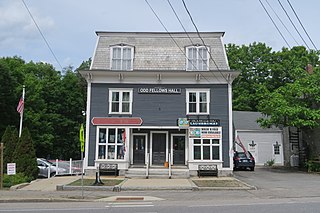
Marlborough is a census-designated place (CDP) and the main village in the town of Marlborough in Cheshire County, New Hampshire, United States. The population of the CDP was 1,066 at the 2020 census, out of 2,096 in the entire town.

<span class="mw-page-title-main">Winchester (CDP), New Hampshire</span> Census-designated place in New Hampshire, United States

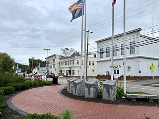
Winchester is a census-designated place (CDP) and the main village in the town of Winchester in Cheshire County, New Hampshire, United States. The population of the CDP was 1,606 at the 2020 census, compared to 4,150 in the entire town.

Lancaster is a census-designated place (CDP) and the main village in the town of Lancaster in Coos County, New Hampshire, United States. The population of the CDP was 1,941 at the 2020 census, out of 3,218 in the entire town of Lancaster.

Hanover is a census-designated place (CDP) and the main village in the town of Hanover in Grafton County, New Hampshire, United States. The population of the CDP was 9,078 at the 2020 census, out of 11,870 in the entire town. The CDP includes the campus of Dartmouth College.

Littleton is a census-designated place (CDP) and the main village in the town of Littleton in Grafton County, New Hampshire, United States. The population of the CDP was 4,467 at the 2020 census, out of 6,005 in the entire town.

<span class="mw-page-title-main">Exeter (CDP), New Hampshire</span> Census-designated place in New Hampshire, United States

Exeter is a census-designated place (CDP) and the main village in the town of Exeter, Rockingham County, New Hampshire, United States. The population of the CDP was 10,109 at the 2020 census, out of 16,049 in the entire town.

<span class="mw-page-title-main">Raymond (CDP), New Hampshire</span> Census-designated place in New Hampshire, United States

Raymond is a census-designated place (CDP) and the main village in the town of Raymond, Rockingham County, New Hampshire, United States. The population of the CDP was 3,738 at the 2020 census, out of 10,684 in the entire town.

<span class="mw-page-title-main">Charlestown (CDP), New Hampshire</span> Census-designated place in New Hampshire, United States

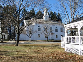
Charlestown is a census-designated place (CDP) and the main village in the town of Charlestown, Sullivan County, New Hampshire, United States. The population of the CDP was 1,078 at the 2020 census, out of 4,806 in the entire town.

<span class="mw-page-title-main">West Stewartstown, New Hampshire</span> Census-designated place in New Hampshire, United States

West Stewartstown is a census-designated place in the town of Stewartstown in Coös County, New Hampshire, United States. It had a population of 263 at the 2020 census, down from 386 at the 2010 census.

<span class="mw-page-title-main">Bartlett (CDP), New Hampshire</span> Census-designated place in New Hampshire, United States

Bartlett is a census-designated place (CDP) and the main village in the town of Bartlett in Carroll County, New Hampshire, United States. The population was 351 at the 2020 census, out of 3,200 in the entire town of Bartlett.

<span class="mw-page-title-main">Belmont (CDP), New Hampshire</span> Census-designated place in New Hampshire, United States

Belmont is a census-designated place (CDP) and the main village in the town of Belmont in Belknap County, New Hampshire, United States. The population was 1,285 at the 2020 census, out of 7,314 in the entire town of Belmont.

<span class="mw-page-title-main">Newfields (CDP), New Hampshire</span> Census-designated place in New Hampshire, United States

Newfields is a census-designated place (CDP) and the main village within the town of Newfields, Rockingham County, New Hampshire, United States. The population of the CDP was 378 at the 2020 census, out of 1,769 in the entire town.

New Hampton is a census-designated place (CDP) and the main village in the town of New Hampton in Belknap County, New Hampshire, United States. The population was 373 at the 2020 census, out of 2,377 people in the entire town of New Hampton.

<span class="mw-page-title-main">Bennington (CDP), New Hampshire</span> Census-designated place in New Hampshire, United States

Bennington is a census-designated place (CDP) and the main village in the town of Bennington in Hillsborough County, New Hampshire, United States. The population of the CDP was 338 at the 2020 census, out of 1,501 in the entire town.

<span class="mw-page-title-main">Colebrook (CDP), New Hampshire</span> Census-designated place in New Hampshire, United States

Colebrook is a census-designated place (CDP) and the main village in the town of Colebrook, Coös County, New Hampshire, United States. The population of the CDP was 1,201 at the 2020 census, out of 2,084 in the entire town. The CDP population had dropped from 1,394 at the 2010 census.

<span class="mw-page-title-main">North Walpole, New Hampshire</span> Census-designated place in New Hampshire, United States

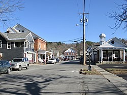
North Walpole is a census-designated place (CDP) in the town of Walpole in Cheshire County, New Hampshire, United States. It had a population of 785 at the 2020 census, making it the largest village in the town of Walpole.

References

  1. "ArcGIS REST Services Directory". United States Census Bureau. Retrieved September 20, 2022.
  2. "Walpole CDP, New Hampshire: 2020 DEC Redistricting Data (PL 94-171)". U.S. Census Bureau. Retrieved November 5, 2021.
  3. "TIGERweb: Walpole CDP, New Hampshire". Geography Division, U.S. Census Bureau. Retrieved January 25, 2021.
  4. "2021 U.S. Gazetteer Files – New Hampshire". United States Census Bureau. Retrieved November 5, 2021.
  5. "Decennial Census Official Publications". Census.gov. Retrieved March 4, 2024.
  6. 1 2 3 "Profile of General Population and Housing Characteristics: 2010 Census Summary File 1 (DP-1): Walpole CDP, New Hampshire". U.S. Census Bureau, American Factfinder. Archived from the original on February 13, 2020. Retrieved August 29, 2017.
  7. "Selected Economic Characteristics: 2011-2015 American Community Survey 5-Year Estimates (DP03): Walpole CDP, New Hampshire". U.S. Census Bureau, American Factfinder. Archived from the original on February 13, 2020. Retrieved August 29, 2017.