Troy (CDP), New Hampshire

Last updated

Troy, New Hampshire
Chandler and Co, Troy NH.jpg
Chandler & Co.
USA New Hampshire location map.svg
Red pog.svg
Troy
Usa edcp location map.svg
Red pog.svg
Troy
Coordinates: 42°49′26″N72°10′53″W / 42.82389°N 72.18139°W / 42.82389; -72.18139
Country United States
State New Hampshire
County Cheshire
Town Troy
Area
[1]
  Total1.28 sq mi (3.30 km2)
  Land1.28 sq mi (3.30 km2)
  Water0.00 sq mi (0.00 km2)
Elevation
1,014 ft (309 m)
Population
 (2020)
  Total1,108
  Density868.34/sq mi (335.34/km2)
Time zone UTC-5 (Eastern (EST))
  Summer (DST) UTC-4 (EDT)
ZIP code
03465
Area code 603
FIPS code 33-77300
GNIS feature ID2629742

Troy is a census-designated place (CDP) and the main village in the town of Troy in Cheshire County, New Hampshire, United States. The population of the CDP was 1,108 at the 2020 census, [2] compared to 2,130 in the entire town. The center of the CDP is the Troy Village Historic District.

Contents

Geography

The CDP is in the center of the town of Troy, in the valley of the South Branch Ashuelot River, where it is joined by Rockwood Brook and Nester Brook. It is part of the Connecticut River watershed. The CDP extends north up Marlboro Road as far as its crossing of the South Branch. The western side of the CDP encompasses the residences on Old Whitcomb Road and Deacon's Lane, then turns down Milind Lane to High Street and Richmond Road. It then turns southeast down an unnamed brook to Nester Brook, which it follows east to Rockwood Brook just south of the village center. The CDP border runs south up Rockwood Brook, then cuts east, south of Memorial Drive, to Main Street (a dead-end road), which it follows south to a power line near the Fitzwilliam town line. The eastern side of the CDP runs north along the South Branch of the Ashuelot all the way to Monadnock Street near the center of town, then follows Dort Street before cutting back to the South Branch again and the former railroad line back to Marlboro Road. [3]

New Hampshire Route 12 is the main road through the community, leading northwest 9 miles (14 km) to Keene and southeast 12 miles (19 km) to Winchendon, Massachusetts.

According to the U.S. Census Bureau, the Troy CDP has a total area of 1.3 square miles (3.3 km2), all of it land, except for streams. [4]

Demographics

Historical population
CensusPop.Note
2010 1,221
2020 1,108−9.3%
U.S. Decennial Census [5]

As of the census of 2010, there were 1,221 people, 491 households, and 308 families residing in the CDP. There were 528 housing units, of which 37, or 7.0%, were vacant. The racial makeup of the town was 96.5% White, 0.9% African American, 1.3% Native American, 1.0% Asian, 0.0% Pacific Islander, 0.0% some other race, and 0.3% from two or more races. 1.1% of the population were Hispanic or Latino of any race. [6]

Of the 491 households in the CDP, 34.4% had children under the age of 18 living with them, 44.6% were headed by married couples living together, 13.6% had a female householder with no husband present, and 37.3% were non-families. 28.5% of all households were made up of individuals, and 8.9% were someone living alone who was 65 years of age or older. The average household size was 2.49, and the average family size was 3.06. [6]

25.6% of people in the CDP were under the age of 18, 8.7% were from 18 to 24, 28.8% were from 25 to 44, 25.8% were from 45 to 64, and 11.0% were 65 years of age or older. The median age was 34.7 years. For every 100 females, there were 97.6 males. For every 100 females age 18 and over, there were 92.2 males. [6]

For the period 2011-15, the estimated median annual income for a household was $55,677, and the median income for a family was $56,500. Male full-time workers had a median income of $46,679 versus $27,283 for females. The per capita income for the CDP was $29,768. 13.1% of the population and 10.1% of families were below the poverty line, along with 31.2% of people under the age of 18 and 10.8% of people 65 or older. [7]

Related Research Articles

<span class="mw-page-title-main">Troy, New Hampshire</span> Town in New Hampshire, United States

Troy is a town in Cheshire County, New Hampshire, United States. The population was 2,130 at the 2020 census. It is situated west of Mount Monadnock.

<span class="mw-page-title-main">West Swanzey, New Hampshire</span> Census-designated place in New Hampshire, United States

West Swanzey is a census-designated place (CDP) in the town of Swanzey within Cheshire County, New Hampshire, United States. The population was 1,281 at the 2020 census. It is the largest village in the town of Swanzey.

<span class="mw-page-title-main">South Hooksett, New Hampshire</span> Census-designated place in New Hampshire, United States

South Hooksett is a census-designated place (CDP) within the town of Hooksett in Merrimack County, New Hampshire, United States. The population was 5,888 at the 2020 census. It is a suburban area adjacent to the city of Manchester, New Hampshire's largest city, and includes a mix of housing developments and large retail stores.

<span class="mw-page-title-main">Tilton Northfield, New Hampshire</span> Census-designated place in New Hampshire, United States

Tilton Northfield is a census-designated place (CDP) representing two adjacent villages in the towns of Tilton in Belknap County and Northfield in Merrimack County in the U.S. state of New Hampshire. The CDP encompasses the town centers of both Tilton and Northfield, located on either side of the Winnipesaukee River. The population was 3,324 at the 2020 census.

<span class="mw-page-title-main">Hinsdale (CDP), New Hampshire</span> Census-designated place in New Hampshire, United States

Hinsdale is a census-designated place (CDP) and the main village in the town of Hinsdale in Cheshire County, New Hampshire, United States. The population of the CDP was 1,485 at the 2020 census, out of 3,948 in the entire town of Hinsdale.

<span class="mw-page-title-main">Marlborough (CDP), New Hampshire</span> Census-designated place in New Hampshire, United States

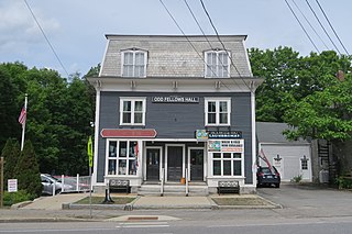
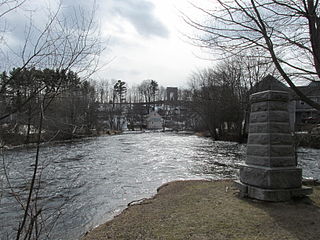
Marlborough is a census-designated place (CDP) and the main village in the town of Marlborough in Cheshire County, New Hampshire, United States. The population of the CDP was 1,066 at the 2020 census, out of 2,096 in the entire town.

<span class="mw-page-title-main">Marlborough, New Hampshire</span> Town in New Hampshire, United States

Marlborough is a town in Cheshire County, New Hampshire, United States. The population was 2,096 at the 2020 census. The town is home to the Kensan-Devan Wildlife Sanctuary at Meetinghouse Pond.

<span class="mw-page-title-main">Winchester (CDP), New Hampshire</span> Census-designated place in New Hampshire, United States

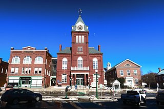
Winchester is a census-designated place (CDP) and the main village in the town of Winchester in Cheshire County, New Hampshire, United States. The population of the CDP was 1,606 at the 2020 census, compared to 4,150 in the entire town.

<span class="mw-page-title-main">Winchester, New Hampshire</span> Town in New Hampshire, United States

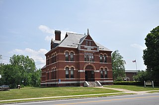
Winchester is a town in Cheshire County, New Hampshire, United States. The population was 4,150 at the 2020 census. The primary community in the town, where 1,606 people resided at the 2020 census, is defined by the U.S. Census Bureau as the Winchester census-designated place (CDP). The town also includes the village of Ashuelot and part of Pisgah State Park.

Hanover is a census-designated place (CDP) and the main village in the town of Hanover in Grafton County, New Hampshire, United States. The population of the CDP was 9,078 at the 2020 census, out of 11,870 in the entire town. The CDP includes the campus of Dartmouth College.

Lisbon is a census-designated place (CDP) and the main village in the town of Lisbon in Grafton County, New Hampshire, United States. The population of the CDP was 965 at the 2020 census, out of 1,621 in the entire town.

<span class="mw-page-title-main">Plymouth (CDP), New Hampshire</span> Census-designated place in New Hampshire, United States

Plymouth is a census-designated place (CDP) and the main village in the town of Plymouth in Grafton County, New Hampshire, United States. Its population was 4,730 at the 2020 census, out of 6,682 in the entire town. The CDP includes the campus of Plymouth State University.

<span class="mw-page-title-main">Milford (CDP), New Hampshire</span> Census-designated place in New Hampshire, United States

Milford is a census-designated place (CDP) and the main village in the town of Milford, Hillsborough County, New Hampshire, United States. The population of the CDP was 9,212 at the 2020 census, out of 16,131 in the entire town.

<span class="mw-page-title-main">Londonderry (CDP), New Hampshire</span> Census-designated place in New Hampshire, United States

Londonderry is a census-designated place (CDP) within the town of Londonderry in Rockingham County, New Hampshire, United States. The population of the CDP was 11,645 at the 2020 census, out of 25,826 in the entire town.

<span class="mw-page-title-main">Newport (CDP), New Hampshire</span> Census-designated place in New Hampshire, United States

Newport is a census-designated place (CDP) comprising the main village and surrounding rural land in the town of Newport, Sullivan County, New Hampshire, United States. The population of the CDP was 4,735 at the 2020 census, out of 6,299 in the entire town.

<span class="mw-page-title-main">North Woodstock, New Hampshire</span> Census-designated place in New Hampshire, United States

North Woodstock is a census-designated place (CDP) and the primary village in the town of Woodstock in Grafton County, New Hampshire, United States. It had a population of 739 at the 2020 census.

<span class="mw-page-title-main">Newfields (CDP), New Hampshire</span> Census-designated place in New Hampshire, United States

Newfields is a census-designated place (CDP) and the main village within the town of Newfields, Rockingham County, New Hampshire, United States. The population of the CDP was 378 at the 2020 census, out of 1,769 in the entire town.

<span class="mw-page-title-main">Hancock (CDP), New Hampshire</span> Census-designated place in New Hampshire, United States

Hancock is a census-designated place (CDP) and the main village in the town of Hancock in Hillsborough County, New Hampshire, United States. The population of the CDP was 213 at the 2020 census, out of 1,731 in the entire town.

Lincoln is a census-designated place (CDP) and the main village in the town of Lincoln in Grafton County, New Hampshire, United States. The population of the CDP was 969 at the 2020 census, out of 1,631 in the entire town.

<span class="mw-page-title-main">Walpole (CDP), New Hampshire</span> Census-designated place in New Hampshire, United States

Walpole is a census-designated place (CDP) and the central village in the town of Walpole in Cheshire County, New Hampshire, United States. The population of the CDP was 573 at the 2020 census, compared to 3,633 in the entire town.

References

  1. "ArcGIS REST Services Directory". United States Census Bureau. Retrieved September 20, 2022.
  2. "Troy CDP, New Hampshire: 2020 DEC Redistricting Data (PL 94-171)". U.S. Census Bureau. Retrieved November 5, 2021.
  3. "TIGERweb: Troy CDP, New Hampshire". Geography Division, U.S. Census Bureau. Retrieved January 25, 2021.
  4. "2021 U.S. Gazetteer Files – New Hampshire". United States Census Bureau. Retrieved November 5, 2021.
  5. "Decennial Census Official Publications". Census.gov. Retrieved March 4, 2024.
  6. 1 2 3 "Profile of General Population and Housing Characteristics: 2010 Census Summary File 1 (DP-1): Troy CDP, New Hampshire". U.S. Census Bureau, American Factfinder. Archived from the original on February 13, 2020. Retrieved August 29, 2017.
  7. "Selected Economic Characteristics: 2011-2015 American Community Survey 5-Year Estimates (DP03): Troy CDP, New Hampshire". U.S. Census Bureau, American Factfinder. Archived from the original on February 13, 2020. Retrieved August 29, 2017.