
Troy is a town in Cheshire County, New Hampshire, United States. The population was 2,130 at the 2020 census. It is situated in southwestern New Hampshire, west of Mount Monadnock.
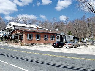
The South Coventry Historic District is a historic district encompassing the historic village center of South Coventry in the town of Coventry, Connecticut. The village, settled in the early 18th century, has served as Coventry's civic center, and also served as an economic center, with textile mills operating in the 19th century. The district was listed on the National Register of Historic Places in 1991.

The South Glastonbury Historic District is a historic district in Glastonbury, Connecticut, United States. It encompasses the historic village center of South Glastonbury, which was first settled in the 17th century. The district was listed on the National Register of Historic Places in 1984, and enlarged in 2009 to include properties further along Main Street as far as Chestnut Hill Road. Locals refer to it as SoG.

The Williamsburg Center Historic District is a historic district on Massachusetts Route 9 in Williamsburg, Massachusetts. It encompasses the traditional center of the town, which was settled in the 18th century and grew to prosperity in the mid-19th century. It was listed on the National Register of Historic Places in 1980.

The Goffstown Main Street Historic District is a historic district encompassing the historic 19th-century center of Goffstown, New Hampshire. Most of the district's 23 buildings lie on Main Street, in a 0.5-mile (0.80 km) running north from the Piscataquog River to North Mast Street. The district also includes properties on Depot Street and Church Street, west of Main Street. It was listed on the National Register of Historic Places in 2007.

The East Jaffrey Historic District is a historic district running roughly along NH Route 124 through Jaffrey, New Hampshire. It encompasses what is now the economic and civic heart of the town, centered on the Jaffrey Mills and the crossing of the Contoocook River by Route 124. It extends as far west as St. Patrick's Church beyond Charlonne Street and as far east as the US Post Office building at Route 124 and Ellison Street. To the north it extends along Peterborough Street to Christian Court, and to the south it extends along River Street and School Street to their junction. The district includes early 19th-century residential structures, as well as industrial buildings and housing associated with the Jaffrey Mills which arose in the mid-19th century. The district was added to the National Register of Historic Places in 2002.

The Downtown Concord Historic District encompasses most of the commercial heart of downtown Concord, New Hampshire, United States. Incorporated in 1734, Concord became the state capital in 1808 and the seat of Merrimack County in 1823. Economic growth followed, due in part to these government institutions and also to the rise of industry along the Merrimack River, which flows through the city east of the downtown area, and the arrival in the 1840s of the railroad. The New Hampshire State House was built in 1819 south of the traditional center of the city, and the commercial heart of the city began to take shape along the First New Hampshire Turnpike south of the State House. The district was listed on the National Register of Historic Places in 2000.
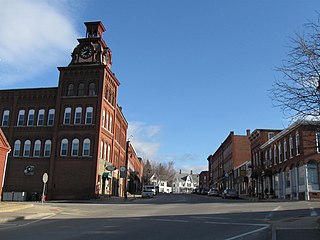
The Suncook Village Commercial–Civic Historic District encompasses the civic and commercial heart of Suncook, New Hampshire, a village on the Suncook River in Pembroke and Allenstown. The civic district is a 3-acre (1.2 ha) area on the Pembroke side of the river, adjacent to the Pembroke Mill, a site that had seen industrial use since the 18th century. The district includes 21 commercial buildings, 19 of which are historically significant. The district was listed on the National Register of Historic Places in 2005.
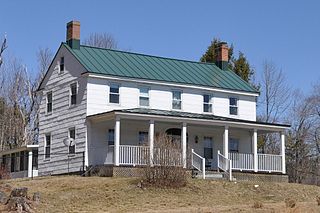
The Capt. Samuel Allison House is a historic house on New Hampshire Route 101, overlooking Howe Reservoir, in Dublin, New Hampshire. Built about 1825 by a locally prominent mill owner, it is a good local example of Federal style residential architecture. The house was listed on the National Register of Historic Places in 1983.

The Central Square Historic District of Bristol, New Hampshire, encompasses the central commercial district of the town. The square is a four-sided space near the junction of six roadways in the center of Bristol, just north of the Newfound River and west of the Pemigewasset River. The district includes all of the buildings that are arrayed around the square, as well as one contemporary commercial building located just south of the Newfound River on South Main Street. The district was listed on the National Register of Historic Places in 1983.
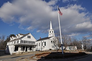
The Dublin Village Historic District encompasses the historic village center of Dublin, New Hampshire. Dublin's center developed in the 19th century after its original village center was abandoned due to harsher winter conditions nearer Dublin Pond. The district extends along Main Street from its junction with Lake Street in the west to the junction with Old County Road in the east, and includes sections of Old Common Road, Harrisville Road, and Church Street. The district was listed on the National Register of Historic Places in 1983.
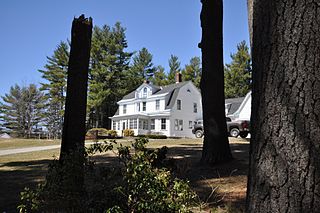
Foothill Farm is a historic farmhouse on Old Troy Road in Dublin, New Hampshire, United States. Built about 1914 as part of the large Amory summer estate, it is a distinctive local example of Dutch Colonial Revival architecture. The house was listed on the National Register of Historic Places in 1983.

The Jaffrey Center Historic District encompasses the traditional civic heart of the small town of Jaffrey, New Hampshire. The district lies to the west of the Jaffrey's main business district, extending along Main Street from Harkness Road to the Jaffrey Common, and along Thorndike Pond Road northward from Main Street. It includes the town's oldest civic buildings, and was its main center until the mills of East Jaffrey eclipsed it. The district was listed on the National Register of Historic Places in 1975.
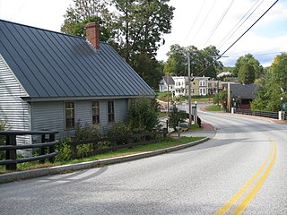
The Enfield Village Historic District encompasses the historic 19th century village center of Enfield, New Hampshire. The district was listed on the National Register of Historic Places in 2010. Multiple buildings of the district were added to the New Hampshire State Register of Historic Places in 2012.

The Bennington Village Historic District of Bennington, New Hampshire encompasses the 19th-century center of the village. Growth of the village followed a typical pattern for rural New Hampshire towns, based in this case around the growth in the early 19th century of the paper industry, which continues to be a significant economic force in the community. The district is centered on the junctions of Main, Center, and School Streets with Bible Hill Road and Francestown Road. The district was listed on the National Register of Historic Places in 2010.

The Exeter Waterfront Commercial Historic District encompasses the historic commercial and residential waterfront areas of Exeter, New Hampshire. The district extends along the north side of Water Street, roughly from Main Street to Front Street, and then along both sides of Water and High streets to the latter's junction with Portsmouth Street. It also includes properties on Chestnut Street on the north side of the Squamscott River. This area was where the early settlement of Exeter took place in 1638, and soon developed as a shipbuilding center. The district was listed on the National Register of Historic Places in 1980. It was enlarged in 1986 to include the mill complex of the Exeter Manufacturing Company on Chestnut Street.
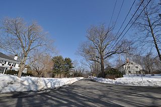
The Jewell Town District of South Hampton, New Hampshire, encompasses a colonial-era industrial village with a history dating to 1687. It is centered at the junction of West Whitehall and Jewell Streets, which is just south of a bend in the Powwow River, the source of the power for the mills that were built here. The area was settled in 1687 by Thomas Jewell, and by the early 19th century included a variety of mills as well as a bog iron works. The district now includes only remnants of its industrial past, and features a collection of 18th and early-19th century residential architecture. The district was listed on the National Register of Historic Places in 1983.

The Lower Village District encompasses a historic industrial area down the Sugar River a short way from the historic center of Claremont, New Hampshire. The area was developed beginning in the 1830s by the Claremont Mill Company, and extends on either side of the river roughly from the Main Street crossing in the west to the junction of Main and Central Streets.

The Monadnock Mills are a historic mill complex in Claremont, New Hampshire. They extend along the southern bank of the Sugar River on both sides of Water Street, between the Broad Street bridge to the east, and the junction of Main and Water Streets in the west, where they abut the industrial area formerly associated with the Sullivan Machinery Company; there also a small number of surviving elements on the north side of the river opposite this area. The complex represents the surviving elements of what was once the largest manufacturing complex in the upper Connecticut River watershed area, and one of its oldest. The mills were listed on the National Register of Historic Places in 1979. Many of its buildings have been repurposed to other uses.

The Newmarket Industrial and Commercial Historic District encompasses the heart of a distinctive 19th century mill town, Newmarket, New Hampshire. Its mill complex is regionally distinctive for its extensive use of stone from an early date, and the town is relatively well-preserved due to a significant economic decline after the mills closed in 1920. The district was listed on the National Register of Historic Places in 1980. The Stone School, listed in 1978, is a contributing resource.


