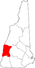
Cornish Flat, New Hampshire | |
---|---|
Coordinates: 43°29′50″N72°16′46″W / 43.49722°N 72.27944°W | |
Country | United States |
State | New Hampshire |
County | Sullivan |
Town | Cornish |
Elevation | 837 ft (255 m) |
Time zone | UTC-5 (Eastern (EST)) |
• Summer (DST) | UTC-4 (EDT) |
ZIP code | 03746 |
Area code | 603 |
GNIS feature ID | 866351 [1] |
Cornish Flat is an unincorporated community in the town of Cornish in Sullivan County, New Hampshire, United States.
The village is located in the northeastern corner of Cornish, at the southern end of a valley floor which is bordered westerly by Cornish Stage Road, easterly by New Hampshire Route 120, and whose northerly end is in the town of Plainfield. The headwaters of Blow-me-down Brook gather in a swampy lowland at the valley's north end formed by the confluence of Notch, Leavitt, Wine, and Penniman brooks entering the valley from the uplands of Corbin Park (a private game preserve) to the east and southeast, and by seasonal streams from the west side of the valley. Route 120 connects the village with Claremont to the south and Meriden and Lebanon to the north.
The village green has a life-size Union soldier statue elevated on a plinth carved in granite with the names of Cornish Civil War dead. Adjacent are a cast-iron memorial to World War I and granite steles commemorating World War II, the Korean War and Vietnam. A Memorial Day eulogy and parade begin here, led by the local Boy Scout troop. The old meeting house on the green has a spire and mostly reliable clock, whose bell tolls hourly. Recent upgrades to the meeting house windows do not meet National Park Service standards for historical preservation, but make the building more usable and energy efficient.[ citation needed ]
The local industry includes Dingee Machine, which outfits and repairs fire trucks and equipment, situated next to the #2 Cornish Fire Station on Route 120. Other businesses include Cornish General Store and the Cornish Flat post office, as well as the family-owned GMC dairy farm, an Angus beef farm neighboring it with substantial feed corn acreage.
The village has a separate ZIP code (03746) from the rest of the town of Cornish.
Branford is a shoreline town located on Long Island Sound in New Haven County, Connecticut, United States, about 6 miles (10 km) east of downtown New Haven. The town is part of the South Central Connecticut Planning Region. Branford borders East Haven on the West,Guilford on the East and to the north is North Branford. Branford is home to one of the Best 8th grade youth football teams in the SYFC.The population was 28,273 at the 2020 census.
Acton is a town in Middlesex County, Massachusetts, United States, approximately 21 miles (34 km) west-northwest of Boston along Massachusetts Route 2 west of Concord and about ten miles (16 km) southwest of Lowell. The population was 24,021 in April 2020, according to the United States Census Bureau. It is bordered by Westford and Littleton to the north, Concord and Carlisle to the east, Stow, Maynard, and Sudbury to the south and Boxborough to the west. Acton became an incorporated town in 1735. The town employs the Open Town Meeting form of government with a town manager and an elected, five-member select board. Acton was named the 11th Best Place To Live among small towns in the country by Money Magazine in 2015, and the 16th best in 2009 and in 2011. The local high school, Acton-Boxborough Regional High School, was named a Blue Ribbon School by the U.S. Department of Education in 2009.
Colebrook is a town in Coös County, New Hampshire, United States. The population was 2,084 at the time of the 2020 census, down from 2,301 at the 2010 census. Situated in the Great North Woods Region, it is bounded on the west by the Connecticut River and home to Beaver Brook Falls Natural Area.
Mont Vernon is a town in Hillsborough County, New Hampshire, United States. The population was 2,584 at the 2020 census, up from 2,409 at the 2010 census.
Allenstown is a town in Merrimack County, New Hampshire, United States. The population was 4,707 at the 2020 census, up from 4,322 at the 2010 census. Allenstown includes a portion of the village of Suncook. Just over one-half of the town's area is covered by Bear Brook State Park.
Claremont is the only city in Sullivan County, New Hampshire, United States. The population was 12,949 at the 2020 census.
Cornish is a town in Sullivan County, New Hampshire, United States. The population was 1,616 at the 2020 census. Cornish has four covered bridges. Each August, it is home to the Cornish Fair.
Plainfield is a town in Sullivan County, New Hampshire, United States. At the time of the 2020 census, the town had a population of 2,459. The town is home to the Helen Woodruff Smith Bird Sanctuary and Annie Duncan State Forest.
Conway is a town in Carroll County, New Hampshire, United States. It is the most populous community in the county, with a population of 9,822 at the 2020 census, down from 10,115 at the 2010 census. The town is on the southeastern edge of the White Mountain National Forest. There are five villages in the town: Conway, North Conway, Center Conway, Redstone and Kearsarge. Additionally, it shares a portion of the village of Intervale with the neighboring town of Bartlett.
Brattleboro, originally Brattleborough, is a town in Windham County, Vermont, United States, located about 10 miles (16 km) north of the Massachusetts state line at the confluence of Vermont's West River and the Connecticut. With a 2022 Census population of 12,106, it is the most populous municipality abutting Vermont's eastern border with New Hampshire, which is the Connecticut River.
New Milton is a market town in southwest Hampshire, England. To the north is in the New Forest and to the south the coast at Barton-on-Sea. The town is equidistant between Lymington and Christchurch, 6 miles (9.7 km) away.
Mount Ascutney is a mountain in the U.S. state of Vermont. At 3,144 feet (958 m), it is the highest peak in Windsor County. Mount Ascutney is a monadnock that rises abruptly from the surrounding lowlands. For example, the Windsor Trail is 2.7 miles (4.3 km) to the summit with 2,514 feet (766 m) of elevation gain and an overall 18% grade. Particularly noteworthy are the mountain's granite outcrops, one of which, near the summit, serves as a launching point for hang-gliders.
Gleadless is a suburb and parish within the City of Sheffield, it lies five km south east of the city centre. It is bordered by the adjoining suburbs of Gleadless Valley to the west, Frecheville to the east and Intake to the north. The land to the south is the rural area of North East Derbyshire district which is outside the city boundary. Gleadless was formerly a country hamlet, then village before becoming part of the expanding city of Sheffield in 1921. The word Gleadless comes from the Old English language and means either "forest clearings haunted by a kite" or "bright clearing".
Saint-Gaudens National Historical Park in Cornish, New Hampshire, preserves the home, gardens, and studios of Augustus Saint-Gaudens (1848–1907), one of America's foremost sculptors. The house and grounds of the National Historic Site served as his summer residence from 1885 to 1897, his permanent home from 1900 until his death in 1907, and the center of the Cornish Art Colony. There are three hiking trails that explore the park's natural areas. Original sculptures are on exhibit, along with reproductions of his greatest masterpieces. It is located on Saint-Gaudens Road in Cornish, 0.5 miles (0.80 km) off New Hampshire Route 12A.
Blow-me-down Brook is a 12.8-mile (20.6 km) long stream located in western New Hampshire in the United States. It is a tributary of the Connecticut River, which flows to Long Island Sound.
Redstone is an unincorporated community within the town of Conway in Carroll County, New Hampshire, United States. It is located on the road from Center Conway to North Conway at the base of Rattlesnake Mountain. From the late 19th century until circa 1950, Redstone was known for its quarry of "red" granite which was mined extensively.
The Merrimack Valley is a bi-state region along the Merrimack River in the U.S. states of New Hampshire and Massachusetts. The Merrimack is one of the larger waterways in New England and has helped to define the livelihood and culture of those living along it for millennia.
The First Baptist Church of Cornish is a historic church on Meeting House Road at NH 120 in Cornish Flat, New Hampshire. Built in 1803, it is the town's oldest surviving church building, and is one of the state's oldest surviving Baptist churches. It was listed on the National Register of Historic Places in 1978.
Breakneck Brook, sometimes Breakneck Valley Brook, is a 1.7-mile-long (2.8 km) tributary of the Hudson River located entirely in the Putnam County town of Philipstown, New York, United States. It rises at Surprise Lake and flows southwest towards the Hudson from there, mostly through Hudson Highlands State Park. The name comes from Breakneck Ridge to its north.