Chatham, New Hampshire

Last updated

Chatham, New Hampshire
Town
Chatham NH Congr Church.jpg
Chatham Congregational Church in Chatham village
Carroll-Chatham-NH.png
Coordinates: 44°09′49″N71°00′40″W / 44.16361°N 71.01111°W / 44.16361; -71.01111
Country United States
State New Hampshire
County Carroll
Incorporated 1767
Villages
  • Chatham
  • North Chatham
  • South Chatham
Government
   Board of Selectmen
  • Jason Eastman, Chair
  • Riley Pitman
  • Bill Briggs
Area
[1]
  Total57.3 sq mi (148.3 km2)
  Land56.7 sq mi (146.9 km2)
  Water0.5 sq mi (1.4 km2)  0.96%
Elevation
521 ft (159 m)
Population
 (2020) [2]
  Total341
  Density6.0/sq mi (2.3/km2)
Time zone UTC-5 (Eastern)
  Summer (DST) UTC-4 (Eastern)
ZIP code
03813
Area code 603
FIPS code 33-11780
GNIS feature ID0873563
Website chathamnh.org

Chatham is a town in Carroll County, New Hampshire, United States. The population was 341 at the 2020 census. [2] It is located in the White Mountains, and except for the southeastern corner, all of Chatham is in the White Mountain National Forest. The town is home to the Cold River national forest campgrounds.

Contents

History

Chatham was granted to Peter Livins and others on February 7, 1767, [3] by colonial Governor Benning Wentworth. The town was named in honor of William Pitt, Earl of Chatham and Prime Minister of Great Britain, who had recently led Britain to victory in the Seven Years War. Chatham was regranted in 1770 by his nephew, Governor John Wentworth, to a group including Samuel Langdon, president of Harvard College and creator of the "Blanchard Map" of the North Country. Part of Conway was annexed in 1829.

Geography

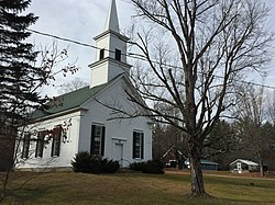
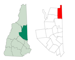
According to the United States Census Bureau, the town has a total area of 57.3 square miles (148.3 km2), of which 56.7 sq mi (146.9 km2) are land and 0.54 sq mi (1.4 km2), or 0.96%, are water. [1] The highest point in Chatham is the summit of South Baldface, with an elevation of 3,547 feet (1,081 m) above sea level. Sable Mountain, elevation 3,519 ft (1,073 m), is in the west, and Robbins Ridge crosses the center of Chatham from east to west. Upper Kimball Pond is in the southeast, and Basin Pond in the northeast. Chatham lies fully within the Saco River watershed. [4]

An article in Statistics and Gazetteer of New-Hampshire (1875) stated,

"Carter's Mountain rises so high between this town and Jackson as to prevent the opening of a highway, and the people of the respective towns, in their intercourse, are obliged to pass through a portion of Maine. Kiarsarge [sic], in the south-west corner of the town, has...upon the summit...a commodious house for the accommodation of visitors. The views from this mountain are grand and very extensive. In the north-west corner is Baldface Mountain. Teams can be driven nearly to its summit. From the crest of this mountain the Tip-Top House on Mount Washington can be seen, also the ocean." [3]

"Kiarsarge" (now Kearsarge North) and Baldface are now accessible only by hiking trails, and the summit of Kearsarge North has a lookout tower but no other structures. The views are still as extensive as before. Access to the town of Jackson continues to be partially through Maine, by taking Maine State Route 113 south to the Fryeburg area, then traveling west through Conway. Route 113, leading north, crosses into New Hampshire in the North Chatham part of town, then curves back into Maine to cross the mountains in Evans Notch and descend north to U.S. Route 2 in Gilead, Maine.

Chatham is a pene-enclave, functionally accessible to neighboring New Hampshire towns only by traveling through Maine first.

Adjacent municipalities

Demographics

Historical population
CensusPop.Note
1790 58
1800 183215.5%
1810 2019.8%
1820 29848.3%
1830 41940.6%
1840 52324.8%
1850 516−1.3%
1860 489−5.2%
1870 445−9.0%
1880 421−5.4%
1890 329−21.9%
1900 267−18.8%
1910 209−21.7%
1920 2299.6%
1930 168−26.6%
1940 1849.5%
1950 177−3.8%
1960 150−15.3%
1970 134−10.7%
1980 18941.0%
1990 26841.8%
2000 260−3.0%
2010 33729.6%
2020 3411.2%
U.S. Decennial Census [2] [5]

As of the census [6] of 2000, there were 260 people, 107 households, and 71 families residing in the town. The population density was 4.6 inhabitants per square mile (1.8/km2). There were 253 housing units at an average density of 4.5 per square mile (1.7/km2). The racial makeup of the town was 98.08% White, 1.15% from other races, and 0.77% from two or more races.

There were 107 households, out of which 29.0% had children under the age of 18 living with them, 57.0% were married couples living together, 5.6% had a female householder with no husband present, and 33.6% were non-families. 27.1% of all households were made up of individuals, and 8.4% had someone living alone who was 65 years of age or older. The average household size was 2.43 and the average family size was 2.94.

In the town, the population was spread out, with 24.6% under the age of 18, 4.2% from 18 to 24, 30.0% from 25 to 44, 30.4% from 45 to 64, and 10.8% who were 65 years of age or older. The median age was 41 years. For every 100 females, there were 106.3 males. For every 100 females age 18 and over, there were 106.3 males.

The median income for a household in the town was $37,188, and the median income for a family was $40,156. Males had a median income of $22,188 versus $20,313 for females. The per capita income for the town was $15,317. About 13.3% of families and 15.4% of the population were below the poverty line, including 23.9% of those under the age of eighteen and none of those 65 or over.

Related Research Articles

<span class="mw-page-title-main">Carroll County, New Hampshire</span> County in New Hampshire, United States

Carroll County is a county in the U.S. state of New Hampshire. As of the 2020 census, the population was 50,107, making it the third-least populous county in New Hampshire. Its county seat is Ossipee. The county was created in 1840 and organized at Ossipee from towns removed from Strafford County. It was named in honor of Charles Carroll of Carrollton, who had died in 1832, the last surviving signer of the United States Declaration of Independence.

<span class="mw-page-title-main">Oxford County, Maine</span> County in Maine, United States

Oxford County is a county in the state of Maine, United States. As of the 2020 Census, the county had a population of 57,777. Its county seat is the town of Paris. The county was formed on March 4, 1805, by the Massachusetts General Court in the Maine District from northerly portions of York and Cumberland counties. It borders the Canadian province of Quebec. Part of Oxford County is included in the Lewiston-Auburn, Maine metropolitan New England City and Town Area while a different part of Oxford County is included in the Portland-South Portland-Biddeford, Maine metropolitan New England City and Town Area.

<span class="mw-page-title-main">Lovell, Maine</span> Town in the state of Maine, United States

Lovell is a town in Oxford County, Maine, United States. The population was 1,104 at the 2020 census. Lovell is the site of Kezar Lake, a resort area.

<span class="mw-page-title-main">Bartlett, New Hampshire</span> Town in New Hampshire, United States

Bartlett is a town in Carroll County, New Hampshire, United States. The population was 3,200 at the 2020 census, up from 2,788 at the 2010 census. Bartlett includes the unincorporated community of Glen as well as portions of the communities of Kearsarge and Intervale, which the town shares with the neighboring town of Conway. It is set in the White Mountains and is surrounded by the White Mountain National Forest. It is home to the Attitash Mountain Resort and the Story Land theme park.

<span class="mw-page-title-main">Eaton, New Hampshire</span> Town in New Hampshire, United States

Eaton is a town in Carroll County, New Hampshire, United States. The population was 405 at the 2020 census. Eaton includes the villages of Eaton Center and Snowville.

<span class="mw-page-title-main">Freedom, New Hampshire</span> Town in New Hampshire, United States

Freedom is a town located in Carroll County, New Hampshire, United States. The population was 1,689 at the 2020 census, up from 1,489 at the 2010 census. The town's eastern boundary runs along the Maine state border. Ossipee Lake, with a resort and camps, is in the southwest of the town.

<span class="mw-page-title-main">Jackson, New Hampshire</span> Town in New Hampshire, United States

Jackson is a town in Carroll County, New Hampshire, United States. The population was 1,028 at the 2020 census, up from 816 at the 2010 census. Jackson is a resort area in the White Mountains. Parts of the White Mountain National Forest are in the west, north and east.

<span class="mw-page-title-main">North Conway, New Hampshire</span> Census-designated place in New Hampshire, United States

North Conway is a census-designated place (CDP) and village in eastern Carroll County, New Hampshire, United States. The population was 2,116 at the 2020 census. A year-round resort area, North Conway is the second-largest village within the town of Conway, after the village of Conway proper. North Conway maintains its own fire station, post office and public library, sharing its other services with Conway. The White Mountain National Forest is to the west and north. The area is home to Cathedral Ledge, Echo Lake State Park, and Cranmore Mountain Resort. North Conway is known for its large number of outlet shops.

<span class="mw-page-title-main">Wakefield, New Hampshire</span> Town in New Hampshire, United States

Wakefield is a town in Carroll County, New Hampshire, United States. The population was 5,201 at the 2020 census. The town includes the villages of Wakefield Corner, East Wakefield, North Wakefield, Sanbornville, Union, Woodman and Province Lake. Wakefield Corner, popular with tourists, is a picturesque hilltop village of antique buildings. The state of Maine forms the eastern border of Wakefield.

<span class="mw-page-title-main">Shelburne, New Hampshire</span> Town in New Hampshire, United States

Shelburne is a town in Coös County, New Hampshire, United States. The population was 353 at the 2020 census. It is located in the White Mountains, and part of the White Mountain National Forest is in the south. Shelburne is home to Leadmine State Forest. The Appalachian Trail crosses the town.

<span class="mw-page-title-main">Danbury, New Hampshire</span> Town in New Hampshire, United States

Danbury is a town in Merrimack County, New Hampshire, United States. The population was 1,250 at the 2020 census.

<span class="mw-page-title-main">Epsom, New Hampshire</span> Town in New Hampshire, United States

Epsom is a town in Merrimack County, New Hampshire, United States. The population was 4,834 at the 2020 census.

<span class="mw-page-title-main">Warner, New Hampshire</span> Town in New Hampshire, United States

Warner is a town in Merrimack County, New Hampshire, United States. The population was 2,937 at the 2020 census. The town is home to Magdalen College of the Liberal Arts, Rollins State Park and Mount Kearsarge State Forest.

<span class="mw-page-title-main">Wilmot, New Hampshire</span> Town in New Hampshire, United States

Wilmot is a town in Merrimack County, New Hampshire, United States. The population was 1,407 at the 2020 census. The town includes the communities of Wilmot, Wilmot Flat, and North Wilmot.

<span class="mw-page-title-main">Goshen, New Hampshire</span> Place in New Hampshire, United States

Goshen is a town in Sullivan County, New Hampshire, United States. The population was 796 at the 2020 census.

<span class="mw-page-title-main">Conway (CDP), New Hampshire</span> Census-designated place in New Hampshire, United States

Conway is a census-designated place (CDP) and the primary village in the town of Conway in Carroll County, New Hampshire, United States. The population was 3,576 at the 2020 census. It is the most populous community in the town of Conway, ahead of North Conway.

<span class="mw-page-title-main">Conway, New Hampshire</span> Town in New Hampshire, United States

Conway is a town in Carroll County, New Hampshire, United States. It is the most populous community in the county, with a population of 9,822 at the 2020 census, down from 10,115 at the 2010 census. The town is on the southeastern edge of the White Mountain National Forest. There are five villages in the town: Conway, North Conway, Center Conway, Redstone and Kearsarge. Additionally, it shares a portion of the village of Intervale with the neighboring town of Bartlett.

<span class="mw-page-title-main">Whitefield, New Hampshire</span> Town in New Hampshire, United States

Whitefield is a town in Coös County, New Hampshire, United States, in the White Mountains Region. The population was 2,490 at the 2020 census. Situated on the northern edge of the White Mountains, Whitefield is home to the Mount Washington Regional Airport and the White Mountains Regional High School.

<span class="mw-page-title-main">Gorham, New Hampshire</span> Town in New Hampshire, United States

Gorham is a town in Coös County, New Hampshire, United States. The population was 2,698 at the 2020 census. Gorham is located in the White Mountains, and parts of the White Mountain National Forest are in the south and northwest. Moose Brook State Park is in the west. Tourism is a principal business. It is part of the Berlin, NH-VT Micropolitan Statistical Area.

<span class="mw-page-title-main">Fryeburg, Maine</span> Town in the state of Maine, United States

Fryeburg is a town in Oxford County, Maine, United States. The population was 3,369 at the 2020 census. Fryeburg is home to Fryeburg Academy, a semi-private preparatory school, and the International Musical Arts Institute. The town is also site of the Fryeburg Fair, which each October attracts approximately 300,000 visitors.

References

  1. 1 2 "2020 U.S. Gazetteer Files – New Hampshire". United States Census Bureau. Retrieved October 29, 2021.
  2. 1 2 3 "Chatham town, Carroll County, New Hampshire: 2020 DEC Redistricting Data (PL 94-171)". U.S. Census Bureau. Retrieved October 29, 2021.
  3. 1 2 Article in Statistics and Gazetteer of New-Hampshire (1875)
  4. Foster, Debra H.; Batorfalvy, Tatianna N.; Medalie, Laura (1995). Water Use in New Hampshire: An Activities Guide for Teachers. U.S. Department of the Interior and U.S. Geological Survey.
  5. "Census of Population and Housing". Census.gov. Retrieved June 4, 2016.
  6. "U.S. Census website". United States Census Bureau . Retrieved January 31, 2008.