East Pepperell, Massachusetts

Last updated
East Pepperell, Massachusetts
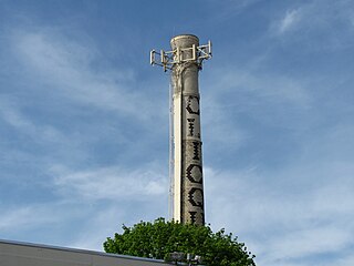
Ice Cream Shop, Railroad Square, East Pepperell, MA.jpg
Ice cream shop in Railroad Square
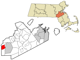
Middlesex County Massachusetts incorporated and unincorporated areas East Pepperell highlighted.svg
Location in Middlesex County in Massachusetts
Coordinates: 42°40′1″N71°33′51″W / 42.66694°N 71.56417°W / 42.66694; -71.56417
CountryUnited States
State Massachusetts
County Middlesex
Town Pepperell
Area
[1]
  Total1.45 sq mi (3.76 km2)
  Land1.42 sq mi (3.67 km2)
  Water0.04 sq mi (0.10 km2)
Elevation
226 ft (69 m)
Population
 (2020) [2]
  Total2,120
  Density1,497.18/sq mi (578.09/km2)
Time zone UTC-5 (Eastern (EST))
  Summer (DST) UTC-4 (EDT)
ZIP code
01463 (Pepperell)
Area code 978
FIPS code 25-20310
GNIS feature ID0611110

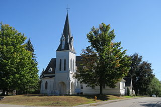
East Pepperell is a village and census-designated place (CDP) in the town of Pepperell in Middlesex County, Massachusetts, United States. The population was 2,120 at the 2020 census. [2]

Contents

History

Lithograph of East Pepperell from 1886 by L.R. Burleigh with list of landmarks East Pepperell, Mass. (2674526496).jpg
Lithograph of East Pepperell from 1886 by L.R. Burleigh with list of landmarks

Like the town of Pepperell, East Pepperell is named for Sir William Pepperrell, [3] a Massachusetts colonial soldier who led the Siege of Louisbourg during King George's War.

Geography

East Pepperell is located in northern Middlesex County at 42°40′1″N71°33′51″W / 42.66694°N 71.56417°W / 42.66694; -71.56417 (42.666956, -71.564063), [4] in the east part of the town of Pepperell. It is separated from the main village of Pepperell to the west by the Nashua River. East Pepperell is bordered to the northeast by the town of Dunstable and to the south by the town of Groton.

Massachusetts Route 113 passes through the village, leading west into Pepperell village and east 15 miles (24 km) to Lowell.

According to the United States Census Bureau, the East Pepperell CDP has a total area of 1.45 square miles (3.8 km2), of which 0.04 square miles (0.10 km2), or 2.55%, are water. [1]

Demographics

Historical population
CensusPop.Note
1990 2,296
2000 2,034−11.4%
2010 2,0591.2%
2020 2,1203.0%
U.S. Decennial Census [5]

As of the census [6] of 2000, there were 2,034 people, 714 households, and 566 families residing in the CDP. The population density was 557.0/km2 (1,437.7/mi2). There were 722 housing units at an average density of 197.7/km2 (510.3/mi2). The racial makeup of the CDP was 96.21% White, 0.84% African American, 0.20% Native American, 0.39% Asian, 0.69% from other races, and 1.67% from two or more races. Hispanic or Latino of any race were 1.18% of the population.

There were 714 households, out of which 43.4% had children under the age of 18 living with them, 58.5% were married couples living together, 17.4% had a female householder with no husband present, and 20.6% were non-families. 16.1% of all households were made up of individuals, and 4.1% had someone living alone who was 65 years of age or older. The average household size was 2.85 and the average family size was 3.18.

In the CDP, the age distribution of the population shows 29.7% under the age of 18, 8.6% from 18 to 24, 31.1% from 25 to 44, 23.4% from 45 to 64, and 7.2% who were 65 years of age or older. The median age was 34 years. For every 100 females, there were 95.8 males. For every 100 females age 18 and over, there were 90.0 males.

The median income for a household in the CDP was $55,272, and the median income for a family was $57,391. Males had a median income of $38,897 versus $31,129 for females. The per capita income for the CDP was $20,759. None of the families and 1.8% of the population were living below the poverty line, including no under eighteens and 25.6% of those over 64.

Related Research Articles

<span class="mw-page-title-main">East Harwich, Massachusetts</span> Census-designated place in Massachusetts, United States

East Harwich is a census-designated place (CDP) and village in the town of Harwich in Barnstable County, Massachusetts, United States. The population was 4,872 at the 2010 census.

<span class="mw-page-title-main">North Seekonk, Massachusetts</span> Census-designated place in Massachusetts, United States

North Seekonk is a census-designated place (CDP) in the town of Seekonk in Bristol County, Massachusetts, United States. The population was 2,643 at the 2010 census.

<span class="mw-page-title-main">Cochituate, Massachusetts</span> Census-designated place in Massachusetts, United States

Cochituate is a census-designated place (CDP) in the town of Wayland in Middlesex County, Massachusetts, United States. The population was 6,927 at the 2020 census, out of 13,943 in the entire town of Wayland.

<span class="mw-page-title-main">Littleton Common, Massachusetts</span> Census-designated place in Massachusetts, United States

Littleton Common is a census-designated place (CDP) in the town of Littleton in Middlesex County, Massachusetts, United States. The population was 3,065 at the 2020 census, up from 2,789 in 2010.

<span class="mw-page-title-main">West Concord, Massachusetts</span> CDP in Massachusetts, United States

West Concord is an unincorporated village and census-designated place (CDP) in the town of Concord in Middlesex County, Massachusetts, United States. The population was 6,028 at the 2010 census.

<span class="mw-page-title-main">East Douglas, Massachusetts</span> CDP in Massachusetts, United States

East Douglas is a census-designated place (CDP) in the town of Douglas in Worcester County, Massachusetts, United States. The population was 2,557 at the 2010 census.

<span class="mw-page-title-main">La Paloma, Texas</span> Census-designated place in Texas, United States

La Paloma is a census-designated place (CDP) in Cameron County, Texas, United States. The population was 2,903 at the 2010 census, up from 354 at the 2000 census, when it was drawn to cover a much smaller area. It is part of the Brownsville–Harlingen Metropolitan Statistical Area. La Paloma means "the dove" in Spanish.

<span class="mw-page-title-main">Lenox (CDP), Massachusetts</span> Census-designated place in Massachusetts, United States

Lenox, also known as Lenox Center, is a census-designated place (CDP) in the town of Lenox in Berkshire County, Massachusetts, United States. The population was 1,675 at the 2010 census, out of 5,025 in the entire town of Lenox.

<span class="mw-page-title-main">Belchertown (CDP), Massachusetts</span> Census-designated place in Massachusetts, United States

Belchertown is a census-designated place (CDP) comprising the central village in the town of Belchertown in Hampshire County, Massachusetts, United States. The population was 2,899 at the 2010 census, out of a total town population of 14,649. It is part of the Springfield, Massachusetts Metropolitan Statistical Area.

<span class="mw-page-title-main">Ayer (CDP), Massachusetts</span> Census-designated place in Massachusetts, United States

Ayer is a census-designated place (CDP) and the primary settlement in the town of Ayer in Middlesex County, Massachusetts, United States. The population of the CDP was 2,986 at the 2020 census, out of 8,479 in the entire town.

<span class="mw-page-title-main">Medfield (CDP), Massachusetts</span> CDP in Massachusetts, United States

Medfield is a census-designated place (CDP) in the town of Medfield in Norfolk County, Massachusetts, United States. The population was 6,483 at the 2010 census.

<span class="mw-page-title-main">Walpole (CDP), Massachusetts</span> Census-designated place in Massachusetts, United States

Walpole is a small census-designated place (CDP) located within the much larger town of Walpole in Norfolk County, Massachusetts, United States. Walpole Town as it is called by the US Census Bureau, also includes a much larger population. The population of the Census Designated Place was 5,918 at the 2010 census.

<span class="mw-page-title-main">Oxford (CDP), Massachusetts</span> CDP in Massachusetts, United States

Oxford is a census-designated place (CDP) in the town of Oxford in Worcester County, Massachusetts, United States. The population was 6,103 at the 2010 census.

<span class="mw-page-title-main">Groton (CDP), Massachusetts</span> Census-designated place in Massachusetts, United States

Groton is a census-designated place (CDP) comprising the main village in the town of Groton in Middlesex County, Massachusetts, United States. The population of the CDP was 1,353 at the 2020 census, out of 11,315 in the entire town of Groton.

<span class="mw-page-title-main">Hudson (CDP), Massachusetts</span> Census-designated place in Massachusetts, United States

Hudson is a census-designated place (CDP) comprising the densely developed central part of the town of Hudson in Middlesex County, Massachusetts, United States. The population of the CDP was 15,749 at the 2020 census, out of 20,092 in the entire town.

<span class="mw-page-title-main">Pepperell (CDP), Massachusetts</span> Census-designated place in Massachusetts, United States

Pepperell is a census-designated place (CDP) in the town of Pepperell in Middlesex County, Massachusetts, United States. The population was 2,504 at the 2010 census.

<span class="mw-page-title-main">Shirley (CDP), Massachusetts</span> Census-designated place in Massachusetts, United States

Shirley is a census-designated place (CDP) in the town of Shirley in Middlesex County, Massachusetts, United States. The population was 1,441 at the 2010 census.

<span class="mw-page-title-main">Townsend (CDP), Massachusetts</span> Census-designated place in Massachusetts, United States

Townsend is a census-designated place (CDP) in the town of Townsend in Middlesex County, Massachusetts, United States. The population was 1,128 at the 2010 census.

<span class="mw-page-title-main">Bellingham (CDP), Massachusetts</span> CDP in Massachusetts, United States

Bellingham is a census-designated place (CDP) in the town of Bellingham in Norfolk County, Massachusetts, United States. The population was 4,854 at the 2010 census.

<span class="mw-page-title-main">Dover (CDP), Massachusetts</span> CDP in Massachusetts, United States

Dover is a census-designated place (CDP) in the town of Dover in Norfolk County, Massachusetts, United States. The population was 2,265 at the 2010 census.

References

  1. 1 2 "2022 U.S. Gazetteer Files: Massachusetts". United States Census Bureau. Retrieved June 12, 2023.
  2. 1 2 "P1. Race – East Pepperell CDP, Massachusetts: 2020 DEC Redistricting Data (PL 94-171)". U.S. Census Bureau. Retrieved June 12, 2023.
  3. Gannett, Henry (1905). The Origin of Certain Place Names in the United States. Govt. Print. Off. pp.  113.
  4. "US Gazetteer files: 2010, 2000, and 1990". United States Census Bureau. 2011-02-12. Retrieved 2011-04-23.
  5. "Census of Population and Housing". Census.gov. Retrieved June 4, 2016.
  6. "U.S. Census website". United States Census Bureau . Retrieved 2008-01-31.