North Lakeville, Massachusetts

Last updated

North Lakeville, Massachusetts
The Reservoir, North Lakeville MA.jpg
The Reservoir
Plymouth County Massachusetts incorporated and unincorporated areas North Lakeville highlighted.svg
Location in Plymouth County in Massachusetts
Coordinates: 41°51′55″N70°56′42″W / 41.86528°N 70.94500°W / 41.86528; -70.94500
Country United States
State Massachusetts
County Plymouth
Area
[1]
  Total5.17 sq mi (13.40 km2)
  Land5.04 sq mi (13.07 km2)
  Water0.13 sq mi (0.34 km2)
Elevation
79 ft (24 m)
Population
 (2020)
  Total3,290
  Density652.13/sq mi (251.78/km2)
Time zone UTC-5 (Eastern (EST))
  Summer (DST) UTC-4 (EDT)
FIPS code 25-48220
GNIS feature ID1867308

North Lakeville is a census-designated place (CDP) in the town of Lakeville in Plymouth County, Massachusetts, United States. The population was 2,630 at the 2010 census. [2]

Contents

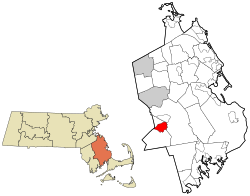
It is roughly bounded by the Middleboro-Lakeville town line to the east, Assawompset Pond to the south, Precinct Street to the southwest, and Rhode Island Road (Route 79) to the north/northwest.

Geography

North Lakeville is located at 41°51′55″N70°56′42″W / 41.86528°N 70.94500°W / 41.86528; -70.94500 (41.865338, -70.944901). [3]

According to the United States Census Bureau, the CDP has a total area of 13.4 km2 (5.2 mi2), of which 13.3 km2 (5.1 mi2) is land and 0.2 km2 (0.1 mi2) (1.16%) is water.

Demographics

Historical population
CensusPop.Note
2020 3,290
U.S. Decennial Census [4]

As of the census [5] of 2000, there were 2,233 people, 821 households, and 640 families residing in the CDP. The population density was 168.1/km2 (435.2/mi2). There were 861 housing units at an average density of 64.8/km2 (167.8/mi2). The racial makeup of the CDP was 96.37% White, 0.22% African American, 0.18% Native American, 1.07% Asian, 0.04% Pacific Islander, 0.90% from other races, and 1.21% from two or more races. Hispanic or Latino of any race were 1.03% of the population.

There were 821 households, out of which 30.6% had children under the age of 18 living with them, 65.5% were married couples living together, 9.1% had a female householder with no husband present, and 22.0% were non-families. 18.0% of all households were made up of individuals, and 9.5% had someone living alone who was 65 years of age or older. The average household size was 2.72 and the average family size was 3.07.

In the CDP, the population was spread out, with 23.3% under the age of 18, 6.5% from 18 to 24, 29.3% from 25 to 44, 25.8% from 45 to 64, and 15.0% who were 65 years of age or older. The median age was 40 years. For every 100 females, there were 92.8 males. For every 100 females age 18 and over, there were 93.7 males.

The median income for a household in the CDP was $11,176, and the median income for a family was $17,026. Males had a median income of $5,094 versus $3,813 for females. The per capita income for the CDP was $4,906. About 72.2% of families and 84.2% of the population were below the poverty line, including 51.0% of those under age 18 and 71.0% of those age 65 or over.

Related Research Articles

<span class="mw-page-title-main">East Harwich, Massachusetts</span> Census-designated place in Massachusetts, United States

East Harwich is a census-designated place (CDP) and village in the town of Harwich in Barnstable County, Massachusetts, United States. The population was 4,872 at the 2010 census.

<span class="mw-page-title-main">Harwich Center, Massachusetts</span> Census-designated place in Massachusetts, United States

Harwich Center is a census-designated place (CDP) in the town of Harwich in Barnstable County, Massachusetts, United States. The population was 1,798 at the 2010 census.

<span class="mw-page-title-main">Yarmouth Port, Massachusetts</span> Census-designated place in Massachusetts, United States

Yarmouth Port is a census-designated place (CDP) in the town of Yarmouth in Barnstable County, Massachusetts, United States. The population was 5,320 at the 2010 census.

<span class="mw-page-title-main">Bliss Corner, Massachusetts</span> Census-designated place in Massachusetts, United States

Bliss Corner is a census-designated place (CDP) in the town of Dartmouth in Bristol County, Massachusetts, United States. The population was 5,280 at the 2010 census.

<span class="mw-page-title-main">Smith Mills, Massachusetts</span> Census-designated place in Massachusetts, United States

Smith Mills is a census-designated place (CDP) in the town of Dartmouth in Bristol County, Massachusetts, United States. The population was 4,760 at the 2010 census.

<span class="mw-page-title-main">Marion Center, Massachusetts</span> Census-designated place in Massachusetts, United States

Marion Center is a census-designated place (CDP) in the town of Marion in Plymouth County, Massachusetts, United States. The population was 1,111 at the 2010 census.

<span class="mw-page-title-main">Middleborough Center, Massachusetts</span> Census-designated place in Massachusetts, United States

Middleborough Center is a census-designated place (CDP) in the town of Middleborough in Plymouth County, Massachusetts, United States. The population was 7,319 at the 2010 census.

<span class="mw-page-title-main">North Pembroke, Massachusetts</span> Census-designated place in Massachusetts, United States

North Pembroke is a census-designated place (CDP) in the town of Pembroke in Plymouth County, Massachusetts, United States. The population was 3,292 at the 2010 census.

<span class="mw-page-title-main">North Plymouth, Massachusetts</span> Census-designated place in Massachusetts, United States

North Plymouth is a census-designated place (CDP) in the town of Plymouth in Plymouth County, Massachusetts, United States. The population was 3,600 at the 2010 census. it is best known as the location of Cordage Park, a small village where the Plymouth Cordage Company was once headquartered. The village is now home to Cordage Commerce Center, a large retail development that consists of offices and stores.

<span class="mw-page-title-main">Wareham Center, Massachusetts</span> Census-designated place in Massachusetts, United States

Wareham Center is a census-designated place (CDP) in the town of Wareham in Plymouth County, Massachusetts, United States. The population was 2,896 at the 2010 census.

<span class="mw-page-title-main">West Wareham, Massachusetts</span> Census-designated place in Massachusetts, United States

West Wareham is a census-designated place (CDP) in the town of Wareham in Plymouth County, Massachusetts, United States. The population was 2,064 at the 2010 census.

<span class="mw-page-title-main">Weweantic, Massachusetts</span> Census-designated place in Massachusetts, United States

Weweantic is a census-designated place (CDP) in the town of Wareham in Plymouth County, Massachusetts, United States. The population was 2,105 at the 2010 census.

<span class="mw-page-title-main">White Island Shores, Massachusetts</span> Census-designated place in Massachusetts, United States

White Island Shores is a census-designated place (CDP) in the town of Wareham in Plymouth County, Massachusetts, United States, along the shores of White Island Pond. The population was 2,106 at the 2010 census.

<span class="mw-page-title-main">Daniel, Wyoming</span> CDP in Wyoming, United States

Daniel is a census-designated place in Sublette County, Wyoming, United States. The population was 150 at the 2010 census.

<span class="mw-page-title-main">Bourne (CDP), Massachusetts</span> Census-designated place in Massachusetts, United States

The village of Bourne is a census-designated place (CDP) in the town of Bourne in Barnstable County, Massachusetts, United States. The population was 1,418 at the 2010 census, out of 19,754 in the town of Bourne as a whole.

<span class="mw-page-title-main">Brewster (CDP), Massachusetts</span> Census-designated place in Massachusetts, United States

Brewster is a census-designated place (CDP) in the town of Brewster in Barnstable County, Massachusetts, United States. The population was 2,000 at the 2010 census, out of 9,820 in the town of Brewster as a whole.

<span class="mw-page-title-main">Bridgewater (CDP), Massachusetts</span> Census-designated place in Massachusetts, United States

Bridgewater was a census-designated place (CDP) in the town of Bridgewater in Plymouth County, Massachusetts, United States. The CDP ceased to exist when Bridgewater was given de facto city status in 2010. The population was 7,841 at the 2010 census.

<span class="mw-page-title-main">Kingston (CDP), Massachusetts</span> Census-designated place in Massachusetts, United States

Kingston is a census-designated place (CDP) in the town of Kingston in Plymouth County, Massachusetts, United States. The population was 5,591 at the 2010 census.

<span class="mw-page-title-main">Hebron (CDP), Wisconsin</span> Census-designated place in Wisconsin, United States

Hebron is a census-designated place (CDP) in the town of Hebron, Jefferson County, Wisconsin, United States. The population was 209 at the 2020 census. It is located on the Bark River.

<span class="mw-page-title-main">Nantucket (CDP), Massachusetts</span> CDP in Massachusetts, United States

Nantucket is a census-designated place (CDP) in the town of Nantucket in Nantucket County, Massachusetts, United States. The population was 7,446 at the 2010 census.

References

  1. "2020 U.S. Gazetteer Files". United States Census Bureau. Retrieved May 21, 2022.
  2. "Profile of General Population and Housing Characteristics: 2010 Demographic Profile Data (DP-1): North Lakeville CDP, Massachusetts". United States Census Bureau . Retrieved March 26, 2012.
  3. "US Gazetteer files: 2010, 2000, and 1990". United States Census Bureau. February 12, 2011. Retrieved April 23, 2011.
  4. "Census of Population and Housing". Census.gov. Retrieved June 4, 2016.
  5. "U.S. Census website". United States Census Bureau . Retrieved January 31, 2008.