Plymouth, Massachusetts | |
|---|---|
 Court Street in Plymouth, facing south | |
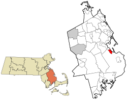 Location within Plymouth County | |
 Plymouth Location within the state of Massachusetts | |
| Coordinates: 41°57′21″N70°40′0″W / 41.95583°N 70.66667°W | |
| Country | United States |
| State | Massachusetts |
| County | Plymouth |
| Area | |
• Total | 3.88 sq mi (10.06 km2) |
| • Land | 2.24 sq mi (5.80 km2) |
| • Water | 1.64 sq mi (4.26 km2) |
| Population (2020) | |
• Total | 7,667 |
| • Density | 3,425.83/sq mi (1,322.53/km2) |
| Time zone | UTC-5 (Eastern (EST)) |
| • Summer (DST) | UTC-4 (EDT) |
| ZIP Code | 02360 (Plymouth) |
| FIPS code | 25-54275 |
Plymouth is a census-designated place (CDP) in the town of Plymouth in Plymouth County, Massachusetts, United States. It is often referred to as Downtown Plymouth or Plymouth Center. The population was 7,667 at the 2020 census. [2]
Contents
Plymouth Center is considered to be the most prominent neighborhood of Plymouth. It is the location of Plymouth's town hall and of the town harbor. In addition, Plymouth Center is home to Plymouth Rock, the Pilgrim Hall Museum, and the Mayflower II .
The geographical locations of North, South, and West Plymouth are named in relation to Plymouth Center.
The post office located at the intersection of Main Street Extension and Leyden Street was the main post office in Plymouth until sometime in the 1970s, when the current main post office located in South Pond was built. The ZIP code for Plymouth Center (officially simply "Plymouth, MA") is 02361. Non-post office box holders in Plymouth Center use the zip code of 02360.


