
Kent is a town in Litchfield County, Connecticut, United States. Located alongside the border with New York, the town's population was 3,019 according to the 2020 census. The town is part of the Northwest Hills Planning Region. Kent is home to three boarding schools: Kent School, the Marvelwood School, and South Kent School. The Schaghticoke Indian Reservation is also located within town borders. The town was also home to former U.S. Secretary of State Henry Kissinger and Family Guy creator Seth MacFarlane.
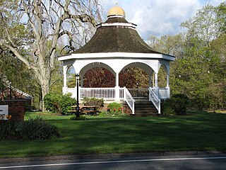
Monroe is a town located in eastern Fairfield County, Connecticut, United States. The population was 18,825 at the 2020 census. The town is part of the Greater Bridgeport Planning Region.

Cornwall is a town in Litchfield County, Connecticut, United States. The population was 1,567 at the 2020 census. The town is part of the Northwest Hills Planning Region.

New Milford is a town in Litchfield County, Connecticut, United States. The town, part of Greater Danbury, as well as the New York Metropolitan Area, has a population of 28,115 as of the 2020 census. New Milford lies 14 miles (23 km) north of Danbury on the banks of the Housatonic River, and shares its border with the northeastern shore of Candlewood Lake. It is the largest town in the state of Connecticut in terms of land area at nearly 63.7 mi2 (164.9822 km2). The town center is listed as a census-designated place (CDP).

The Saugatuck River is a 23.7-mile-long (38.1 km) river in southwestern Connecticut in the United States. It drains part of suburban and rural Fairfield County west of Bridgeport, emptying into Long Island Sound.

Gaylordsville is a village (neighborhood/borough) in the northwest corner of the town of New Milford, Litchfield County, Connecticut, United States. It was listed as a census-designated place (CDP) prior to the 2020 census.

Mount Frissell, 2,454 feet (748 m), which straddles the border of southwest Massachusetts and northwest Connecticut, is part of the Taconic Range. Frissell's south slopes include the highest point in Connecticut, a popular destination for highpointers.
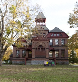
Falls Village is a village and census-designated place in the town of Canaan in Litchfield County, Connecticut, United States. As of the 2010 census it had a population of 538, out of 1,234 in the entire town of Canaan. Because Falls Village is the town center and principal constituent village in Canaan, the entire town is often referred to as "Falls Village". That usage also avoids confusion of the town with Canaan Village in the town of North Canaan, Connecticut, just to the north. Falls Village derives its name from a waterfall, known as Great Falls, on the Housatonic River within the village.

Connecticut's 5th congressional district is a congressional district in the U.S. state of Connecticut. Located in the western part of the state and spanning across parts of Fairfield, Litchfield, New Haven, and Hartford Counties, the district runs from Meriden and New Britain in central Connecticut, westward to Danbury and the surrounding Housatonic Valley, encompassing the Farmington Valley, Upper Naugatuck River Valley, and the Litchfield Hills. The district also includes most of Waterbury.
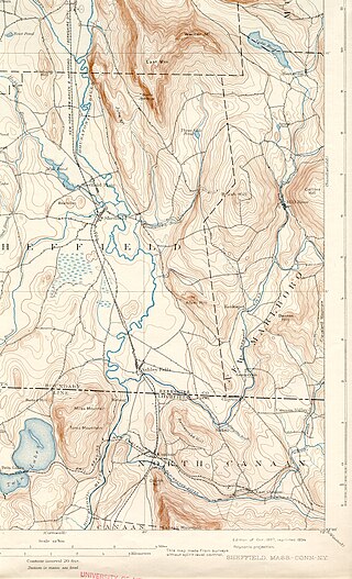
The Konkapot River is a 22.1-mile-long (35.6 km) river in southwestern Massachusetts and northern Connecticut. It is a tributary of the Housatonic River, not to be confused with the smaller Konkapot Brook in Stockbridge. The river was named for Captain John Konkapot, an Indian chief.
Abbott Run is a de facto river in the U.S. state of Massachusetts and Rhode Island. It flows approximately 10 miles (16 km).

Brace Mountain is the peak of a ridge in the southern Taconic Mountains, near the tripoint of the U.S. states of New York, Connecticut and Massachusetts. Its 2,311-foot (704 m) main summit is located in New York; it is the highest point in that state's Dutchess County.

The Pequonnock River is a 16.7-mile-long (26.9 km) waterway in eastern Fairfield County, Connecticut. Its watershed is located in five communities, with the majority of it located within Monroe, Trumbull, and Bridgeport. The river has a penchant for flooding, particularly in spring since the removal of a retention dam in Trumbull in the 1950s. There seems to be a sharp difference of opinion among historians as to just what the Indian word Pequonnock signifies. Some insist it meant cleared field or open ground; others are sure it meant broken ground; while a third group is certain it meant place of slaughter or place of destruction.

The Naugatuck Trail is a 6.8-mile (10.9 km) Blue-Blazed hiking trail "system" in the eastern central-lower Naugatuck River Valley in New Haven County, Connecticut, USA. It is almost entirely contained in the Naugatuck State Forest. The mainline trail is primarily east to west with three short side or spur trails. Composed of four trails, at its western end the trail ends with a section alongside Route 8 and the Naugatuck River. During the 1930s and 1940s, it was much larger. But post–World War II housing developments of the Connecticut Blue-Blazed Trails, led to its drastic reduction.

The Paugussett Trail is a 14-mile (23 km) Blue-Blazed hiking trail "system" in the lower Housatonic River valley in Fairfield County and, today, is entirely in Shelton and Monroe, Connecticut. Much of the trail is in Indian Well State Park and the Town of Monroe's Webb Mountain Park. The mainline trail is primarily southeast to northwest with three short side or spur trails.
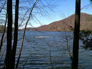
The Lillinonah Trail is a 5.9-mile (9.5 km) Blue-Blazed hiking trail "system" in the lower Housatonic River valley in Fairfield County and, today, is entirely in Newtown. Most of the trail is in the upper block of Paugussett State Forest.

The Zoar Trail is a 6.5-mile (10.5 km) Blue-Blazed hiking trail "system" in the lower Housatonic River valley in Fairfield County, Connecticut and is entirely in the Sandy Hook section of Newtown in the lower block of Paugussett State Forest.

Stepney, also referred to as Stepney Village and Upper Stepney, is a district of the town of Monroe, Connecticut, and on the Connecticut State Register of Historic Places. Consisting of approximately 8 square miles (21 km2), Stepney extends from the Trumbull town line, along Route 25, to the Newtown town line. It was listed as a census-designated place prior to the 2020 census.

Canaan is a town in Litchfield County, Connecticut, United States. The population was 1,080 at the 2020 census, down from 1,234 at the 2010 census. The town is part of the Northwest Hills Planning Region. The town of Canaan is often referred to locally by the name of its principal settlement, Falls Village.
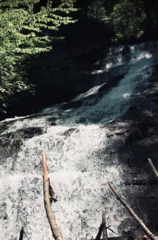
Dean's Ravine Falls is a 50-foot-tall (15 m) waterfall formed along Reed Brook in Canaan, Connecticut. The falls were once a "must-see" spot along the 2,180-mile-long Appalachian Trail, until the trail was rerouted west of the Housatonic River through Sharon, Connecticut in the early 1980s. Today, it can be accessed via The Mohawk Trail from a parking area located at the intersection of Music Mountain Road and Cream Hill Road.


