Westons Mills, New Jersey

Last updated

Westons Mills, New Jersey
2024-04-26 15 40 55 View southwest up Weston's Mill Pond from the spillway near the northeast end of the Mill Pond Trail within Frank G. Helyar Woods at the Rutgers Gardens in New Brunswick, Middlesex County, New Jersey.jpg
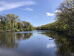
Westons Mill Pond in Westons Mills
Location map of Middlesex County, New Jersey.svg
Red pog.svg
Westons Mills
USA New Jersey location map.svg
Red pog.svg
Westons Mills
Usa edcp location map.svg
Red pog.svg
Westons Mills
Coordinates: 40°29′07″N74°24′45″W / 40.48528°N 74.41250°W / 40.48528; -74.41250
Country Flag of the United States.svg United States
State Flag of New Jersey.svg New Jersey
County Middlesex
City and Township New Brunswick and East Brunswick
Elevation
[1]
39 ft (12 m)
GNIS feature ID881750 [1]

Westons Mills or Westons Mill is an unincorporated community located along the border of East Brunswick and New Brunswick in Middlesex County, New Jersey, United States. [2] It is the location of Westons Mill Pond.

1876 map of New Brunswick's First Ward, showing Weston's Mill at the bend in Lawrence Brook. NewBrunswickNJFirstWard1876.tiff
1876 map of New Brunswick's First Ward, showing Weston's Mill at the bend in Lawrence Brook.

See also

References

  1. 1 2 "Westons Mills". Geographic Names Information System . United States Geological Survey, United States Department of the Interior.
  2. Locality Search, State of New Jersey. Accessed February 15, 2015.