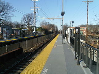
Avenel is an unincorporated community and census-designated place (CDP) located within Woodbridge Township, in Middlesex County, in the U.S. state of New Jersey. Avenel is approximately 25 miles (40 km) southwest of Midtown Manhattan along the North Jersey Coast rail line

Edison is a township located in Middlesex County, in the U.S. state of New Jersey. Situated in North Jersey within the core of the state's Raritan Valley region, Edison is a commercial hub and is a bedroom community of New York City within the New York metropolitan area.

Fords is a census-designated place (CDP) in Woodbridge Township, Middlesex County, New Jersey, in the United States. As of the 2020 census, the CDP's population was 12,941.

Iselin is an unincorporated community and census-designated place (CDP) located within Woodbridge Township, in Middlesex County, in the U.S. state of New Jersey. As of the 2020 United States census, Iselin's population was 20,088, up from 18,695 in 2010.

Woodbridge Township is a township in northern Middlesex County, in the U.S. state of New Jersey. The township is a regional hub of transportation and commerce for central New Jersey and a major bedroom suburb of New York City, within the New York metropolitan area. Located within the core of the Raritan Valley region, Woodbridge Township hosts the junction of the New Jersey Turnpike and the Garden State Parkway, the two busiest highways in the state, and also serves as the headquarters for the New Jersey Turnpike Authority, which operates both highways.
Menlo Park is an unincorporated community within Edison Township in Middlesex County, in the U.S. state of New Jersey.
Menlo Park Terrace is an unincorporated community and census-designated place (CDP) in Woodbridge Township, Middlesex County, New Jersey, United States. As of the 2020 census, its population was 2,806.

Keasbey is a census-designated place (CDP) and unincorporated community in Woodbridge Township, Middlesex County, New Jersey, United States. It is located in the western outskirts of adjacent Perth Amboy. As of the 2020 census, the CDP's population was 3,027. Many Hispanic / Latino families have relocated from Perth Amboy to Keasbey.
Hopelawn is an unincorporated community and census-designated place (CDP) in Woodbridge Township, Middlesex County, New Jersey, United States. As of the 2020 United States census, the population of the CDP was 2,603.
Nixon is an unincorporated community located within Edison Township in Middlesex County, in the U.S. state of New Jersey. It was named after Lewis Nixon, a manufacturer and community leader. Soon after the outbreak of World War I, Nixon established a massive volatile chemicals processing facility there, known as the Nixon Nitration Works. It was the site of the 1924 Nixon Nitration Works disaster, a massive explosion and resulting fire that killed 20 persons and destroyed several square miles around the plant.
Bonhamtown is a section of Edison Township in Middlesex County, New Jersey, United States.

Clara Barton is an unincorporated community located within Edison Township in Middlesex County, in the U.S. state of New Jersey. It takes its name from Clara Barton.
Edgars or Edgar is an unincorporated community located within Woodbridge Township in Middlesex County, in the U.S. state of New Jersey. It approximately includes the area around Woodbridge High School over to Rahway Avenue, south of the Port Reading Railroad. The upper section of Ridgedale Avenue is known as Edgar's Hill. There was a Pennsylvania Railroad stop called Edgars approximately where Prospect Avenue would cross the railway, steps for this are still visible on the western side as of 2016.
New Durham was an unincorporated community and now a neighborhood located within Edison in Middlesex County, New Jersey, United States, south of Dismal Swamp.
Potters was an unincorporated community and now is neighborhood located within Edison Township in Middlesex County, in the U.S. state of New Jersey.

Pumptown is an unincorporated community located within Edison Township in Middlesex County, in the U.S. state of New Jersey.

Piscatawaytown is the oldest neighborhood in Edison in Middlesex County, New Jersey. It was established in the 1660s as the original village in what was then within Piscataway. Piscatawaytown is centered around St. James Church, the Piscatawaytown Burial Ground and the Piscatawaytown Common, near the intersection of Plainfield and Woodbridge Avenues.


