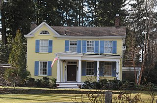
Carteret is a borough in northeastern Middlesex County, in the U.S. state of New Jersey. As of the 2020 United States census, the borough's population reached 25,326, its highest decennial count ever and an increase of 2,482 (+10.9%) from the 2010 census count of 22,844, which in turn reflected an increase of 2,135 (+10.3%) from the 20,709 counted in the 2000 census.

Port Reading is an unincorporated community and census-designated place (CDP) in Woodbridge Township, Middlesex County, New Jersey, United States. As of the 2020 census, the population was 3,921.

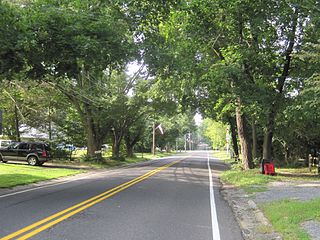
Roosevelt is a borough in western Monmouth County, in the U.S. state of New Jersey. As of the 2020 United States census, the borough's population was 808, a decrease of 74 (−8.4%) from the 2010 census count of 882, which in turn reflected a decline of 51 (−5.5%) from the 933 counted in the 2000 census.

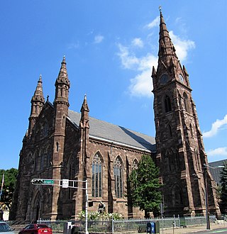
The Cathedral Basilica of the Sacred Heart, the fifth-largest cathedral in North America, is the seat of the Roman Catholic Archdiocese of Newark. Headed by Cardinal Tobin for the archdiocese, it is located in the Lower Broadway neighborhood of Newark, New Jersey. Catholic mass is offered daily and three times on Sunday in English and in Spanish.

The Arthur Kill is a tidal strait in the New York–New Jersey Harbor Estuary between Staten Island, New York and Union and Middlesex counties, New Jersey. It is a major navigational channel of the Port of New York and New Jersey.
New Jersey's 11th congressional district is a suburban district in northern New Jersey. The district includes portions of Essex, Morris, and Passaic Counties. It is centered in Morris County.

Towaco is an unincorporated community and census-designated place (CDP) in the township of Montville, Morris County, New Jersey, United States. As of the 2020 census, it had a population of 5,624.

Carteret High School is a four-year comprehensive public high school that serves students in ninth through twelfth grades from Carteret in Middlesex County, in the U.S. state of New Jersey, as the lone secondary school of the Carteret School District. The school has been accredited by the Middle States Association of Colleges and Schools Commission on Elementary and Secondary Schools since 1929 and is accredited through January 2027.

Downtown Paterson is the main commercial district of Paterson, Passaic County, in the U.S. state of New Jersey. The area is the oldest part of the city, along the banks of the Passaic River and its Great Falls. It is roughly bounded by Interstate 80, Garret Mountain Reservation, Route 19, Oliver Street, and Spruce Street on the south; the Passaic River, West Broadway, Cliff Street, North 3rd Street, Haledon Avenue, and the borough of Prospect Park on the west; and the Passaic River also to the north.
The English Neighborhood was the colonial-era name for the towns in eastern Bergen County, New Jersey, along the Hudson Palisades between the Hudson River and the Hackensack River, particularly around its main tributary, Overpeck Creek. The region had been part of the Dutch New Netherland colony of Bergen, whose main town was located at Bergen Square in modern Jersey City. The name refers to the geography of the region, bergen being the Dutch word for hills. Earlier attempts at settlement at Achter Col and Vriessendael had been compromised in conflicts with the precolonial population, bands of the Lenape known by their exonyms, the Hackensacks and the Tappans.

Arlington is a neighborhood in Kearny in the western part of Hudson County, in the U.S. state of New Jersey.

The Cathedral of St. John the Baptist is a historic Catholic cathedral and parish church located in Paterson, Passaic County, New Jersey, United States. It is the seat of the Roman Catholic Diocese of Paterson. The cathedral was listed on the National Register of Historic Places in 1977.
The Port of Paulsboro is located on the Delaware River and Mantua Creek in and around Paulsboro, in Gloucester County, New Jersey, approximately 78 miles (126 km) from the Atlantic Ocean. Traditionally one of the nation's busiest for marine transfer operations, notably for crude oil and petroleum products, such as jet fuel and asphalt, it is a port of entry with several facilities within a foreign trade zone.
New Dover is an unincorporated community located within Edison Township in Middlesex County, in the U.S. state of New Jersey. The neighborhood began as colonial village that was part of adjacent Woodbridge Township. Along with Bonhamtown, New Durham and Stelton, it is one of the older historical communities of the township.

Ridgefield is a proposed station along NJ Transit's (NJT) Northern Branch Corridor Project extension of Hudson-Bergen Light Rail (HBLR) in Ridgefield, New Jersey.
The Carteret Performing Arts Center is a not-for-profit 50,000-square-foot theater and events center in Carteret, New Jersey that opened in 2021.


