Bonhamtown, New Jersey

Last updated

Bonhamtown, New Jersey
2018-05-20 12 02 32 View south along Middlesex County Route 531 (Main Street) at Morris Avenue in Edison Township, Middlesex County, New Jersey.jpg
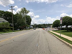
Main Street at Morris Avenue
Location map of Middlesex County, New Jersey.svg
Red pog.svg
Bonhamtown
Location of Bonhamtown in Middlesex County Inset: Location of county within the state of New Jersey
USA New Jersey location map.svg
Red pog.svg
Bonhamtown
Bonhamtown (New Jersey)
Usa edcp location map.svg
Red pog.svg
Bonhamtown
Bonhamtown (the United States)
Coordinates: 40°31′24″N74°21′28″W / 40.52333°N 74.35778°W / 40.52333; -74.35778
Country Flag of the United States.svg  United States
State Flag of New Jersey.svg  New Jersey
County Middlesex
Township Edison
Elevation
[1]
72 ft (22 m)
ZIP code
08837
GNIS feature ID874849 [1]

Bonhamtown is a section of Edison in Middlesex County, in the U.S. state of New Jersey. [2] [3] [4] [5] [6] [7]

Contents

History

The area was named after Nicholas Bonham, a freeholder from the 17th century. Along with New Dover, New Durham, and Stelton, it is one of the older historical communities established before the present-day municipality was incorporated. [8] The historical community of Bonhamtown was originally part of Woodbridge Township. Bonhamtown became part of Raritan Township in 1870 when it was formed from portions of Woodbridge and Piscataway townships. Raritan Township was renamed Edison Township in 1954. [9]

Bonhamtown was the site of the Battle of Punk Hill in March 1777, a skirmish between American militias and regulars facing 3,000 British soldiers that took place during the Forage Wars during the American Revolutionary War. [10]

Geography

Bonhamtown is surrounded by several major roads, which include: Interstate 287, the New Jersey Turnpike, U.S. Route 1, Route 27, and Route 440.

The Bonhamtown Branch of Conrail Shared Assets Operations runs through the area [11] from the Northeast Corridor to Raritan Center, site of the former Raritan Arsenal. [12]

See also

References

  1. 1 2 "Bonhamtown". Geographic Names Information System . United States Geological Survey, United States Department of the Interior.
  2. Locality Search, State of New Jersey. Accessed February 7, 2015.
  3. "Township History". www.edisonnj.org.
  4. "NJDOT Graphic Information System Maps Middlesex" (PDF). New Jersey Department of Transportation. Retrieved March 2, 2020.
  5. Spies, Stacy (2001), Edison, Arcadia Publishing, ISBN   9780738505497
  6. Gordon, Thomas Francis (1834). "A Gazetteer of the State of New Jersey: Comprehending a General View of Its Physical and Moral Condition, Together with a Topographical and Statistical Account of Its Counties, Towns, Villages, Canals, Rail Roads, &c., Accompanied by a Map".
  7. Fleming, Herbert R. (1947). "Map of Middlesex County, New Jersey". Middlesex County (NJ). Retrieved September 8, 2021.
  8. Gannett, Henry (January 28, 1895). "A Geographic Dictionary of New Jersey". U.S. Government Printing Office via Google Books.
  9. Snyder, John P. The Story of New Jersey’s Civil Boundaries, 1606–1968 . Trenton, Bureau of Geology and Topography, 1969. Reprint, New Jersey Geological Survey, 2004. Page 173.
  10. Munn, David C. Battles and Skirmishes in New Jersey of the American Revolution, New Jersey Geological Survey, 1976. Accessed May 27, 2025. "Bonhamtown - March 18, 1777, Gen, William Maxwell attacks the British in an engagement that reaches from Punk Hill at Amboy to Bonhamtown and Metcuhen."
  11. Heiss, Ralph A. (May 10, 2009). The Lehigh Valley Railroad Across New Jersey. Arcadia Publishing. ISBN   9780738565767 via Google Books.
  12. "5. Interior, looking east, from doorway to bay 6 - Raritan Arsenal, Warehouse N-5, 2890 Woodbridge Avenue, Bonhamtown, Middlesex County, NJ". Library of Congress.