Cheesequake, New Jersey

Last updated

Cheesequake, New Jersey
Chiskhakink (Unami)
Cheesequake, NJ.jpg
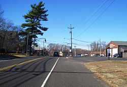
Center of Cheesequake along Route 34
Location map of Middlesex County, New Jersey.svg
Red pog.svg
Cheesequake
USA New Jersey location map.svg
Red pog.svg
Cheesequake
Usa edcp location map.svg
Red pog.svg
Cheesequake
Coordinates: 40°25′29″N74°17′16″W / 40.42472°N 74.28778°W / 40.42472; -74.28778
Country Flag of the United States.svg United States
State Flag of New Jersey.svg New Jersey
County Middlesex
Township Old Bridge
Elevation
[1]
102 ft (31 m)
Time zone UTC−05:00 (Eastern (EST))
  Summer (DST) UTC−04:00 (EDT)
Area codes 732 & 848
GNIS feature ID875383 [1]

Cheesequake is an unincorporated community located within Old Bridge Township in Middlesex County, in the U.S. state of New Jersey. [2] Cheesequake is located along Route 34, south of Cheesequake State Park. [3] [4]

The community's name has been said to be derived from the Lenni Lenape word Cheseh-oh-ke, meaning "upland" [5] or from the word chiskhakink or chickhake, meaning "land that has been cleared." [6] [7]

References

  1. 1 2 "Cheesequake". Geographic Names Information System . United States Geological Survey, United States Department of the Interior.
  2. Locality Search, State of New Jersey. Accessed February 7, 2015.
  3. Middlesex County (PDF) (Map). New Jersey Department of Transportation . Retrieved November 1, 2012.
  4. "Aerial view of Cheesequake" (Map). Google Maps . Retrieved November 22, 2015.
  5. "Cheesequake State Park". NY-NJ-CT Botany. Archived from the original on April 24, 2003. Retrieved November 1, 2012.
  6. Nestor, Sandy. Indian Place Names in America, Volume 1, p. 112. McFarland & Company, 2012. ISBN   9780786493395 Accessed March 26, 2018. "The Lenape Indians inhabited this region for more than 6,000 years. Cheesequake is a Lenape word derived from chickhake, meaning 'land that has been cleared.'"
  7. "At the land that has been cleared - Cheesequake, NJ". The Lenape Talking Dictionary. Retrieved December 13, 2023.