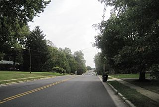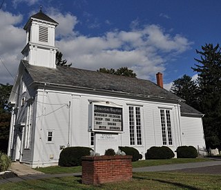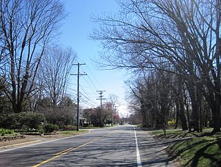
West Windsor is a township in Mercer County, in the U.S. state of New Jersey. Located at the cross-roads between the Delaware Valley region to the southwest and the Raritan Valley region to the northeast, the township is considered to be an outer-ring suburb of New York City in the New York metropolitan area, as defined by the United States Census Bureau. As of the 2020 United States census, the township's population was 29,518, its highest decennial count ever and an increase of 2,353 (+8.7%) from the 27,165 recorded at the 2010 census, which in turn reflected an increase of 5,258 (+24.0%) from the 21,907 counted in the 2000 census.

Plainsboro Township is a township situated in southern Middlesex County, in the U.S. state of New Jersey. Centrally located in the Raritan Valley region, the township is an outer-ring suburb of New York City in the New York metropolitan area, even though it is slightly geographically closer to Center City, Philadelphia than to Midtown Manhattan. As of the 2020 United States census, the township's population was 24,084, its highest decennial count ever and an increase of 1,085 (+4.7%) from the 22,999 recorded at the 2010 census, which in turn reflected an increase of 2,784 (+13.8%) from the 20,215 counted in the 2000 census.

West Freehold is an unincorporated community and census-designated place (CDP) within Freehold Township, in Monmouth County, New Jersey, United States. As of the 2010 United States Census, the CDP's population was 13,613. Due to the community's close proximity to the Battle of Monmouth, West Freehold is home to several important historical structures, which have been preserved in the 'West Freehold Village Historic District'. The historically preserved Monmouth Battlefield, along with the historic villages of Clarksburg, Englishtown, Smithburg and Tennent are a short distance away.

Clarksburg is an unincorporated community located within Millstone Township in Monmouth County, in the U.S. state of New Jersey. The area is served as United States Postal Service ZIP code 08510.

U.S. Route 1 (US 1) is a U.S. Route which parallels the East Coast of the United States, running from Key West, Florida, in the south to Fort Kent, Maine, at the Canadian border in the north. Of the entire length of the route, 66.06 miles (106.31 km) of it runs through New Jersey. It enters the state from Pennsylvania on the Trenton–Morrisville Toll Bridge over the Delaware River in the state capital of Trenton, running through the city on the Trenton Freeway. From here, US 1 continues northeast as a surface divided highway through suburban areas, heading into Middlesex County and passing through New Brunswick and Edison. US 1 merges with US 9 in Woodbridge, and the two routes continue through northern New Jersey as US 1/9 to the George Washington Bridge over the Hudson River in Fort Lee. At this point, the road continues into New York City along with I-95.

Prospertown is an unincorporated community located within the New Jersey townships of Jackson and Plumsted in Ocean County and Upper Freehold in Monmouth County. The community is home to Prospertown Lake and is adjacent to Six Flags Great Adventure, both located on County Route 537. The center of the community is located at the intersection of CR 537, Hawkin Road, and Emleys Hill Road. Most of the area consists of pine forests but there are some homes along the roads in the area.

Penns Neck is an unincorporated community located within West Windsor Township in Mercer County, in the U.S. state of New Jersey. The community developed at the intersection of the Trenton-New Brunswick Turnpike and Washington Road. The Penns Neck Circle and the historic Penns Neck Baptist Church (1812) are both located in Penns Neck. The Princeton Branch rail line, known as the Dinky, has run through the area since 1865, and stopped at Penns Neck station until January 1971.

Cranbury Station is an unincorporated community located within Cranbury Township in Middlesex County, in the U.S. state of New Jersey. The area immediately around the site of the former railroad station along the Camden and Amboy Railroad contains agricultural businesses and small homes. Hightstown-Cranbury Station Road is the main road through the settlement paralleling the railroad and Station Road as a major road heading east and west through the area. Modern warehouses line Station Road and the nearby New Jersey Turnpike west of the station while large housing developments are located east of here in Monroe Township.

Cottrell Corners is an unincorporated community located within Old Bridge Township in Middlesex County, in the U.S. state of New Jersey. Located at the corner of Old Bridge-Matawan Road and Cottrell Road, the area is named for the Cottrell Family who owned an apple farm at the crossroads since before the United States was founded. Though the last parcel of the farmland had originally been sold to a developer in 2002, the Middlesex County Freeholder Board purchased the property and intends to preserve it. In addition to the farm, the area contains stores, a townhouse development, and is the seat of the Old Bridge municipal offices and library.

Little Rocky Hill is an unincorporated community located within South Brunswick in Middlesex County and Franklin Township, Somerset County, in the U.S. state of New Jersey. The community is located atop a small hill east of the borough of Rocky Hill. The Middlesex–Somerset county line runs through the community along Old Road though elsewhere it follows Route 27. Carters Brook runs through the area flowing south.

Union Valley is an unincorporated community located within Monroe Township in Middlesex County, in the U.S. state of New Jersey. Two large age-restricted communities lie within the settlement today, Clearbrook Park and Concordia. Other than those two communities, the only other buildings in the area are medical offices and facilities and some single-family homes along Union Valley Road.

Ardena is an unincorporated community located within Howell Township in Monmouth County, in the U.S. state of New Jersey. The community is located along County Route 524 near Vanderveer Road in the western part of the township. The area consists of about half farmland and half residential developments.

Bergerville is an unincorporated community located within Howell Township in Monmouth County, in the U.S. state of New Jersey. The area was originally developed as a resort bungalow community in the first half of the 20th century.

Charleston Springs is an unincorporated community located within Millstone Township in Monmouth County, in the U.S. state of New Jersey. Stage Coach Road, also designated County Route 524, is the main road that runs through the settlement, with Ely Harmony Road as the intersecting road defining the locality. The Manalapan Brook runs to the west of the center of Charleston Springs and CR 537 runs to the south of the area. The Monmouth County-owned Charleston Springs Golf Course is located one mile (1.6 km) northeast of the center of Charleston Springs on CR 527.

Cooleys Corner is an unincorporated community located within Upper Freehold Township in Monmouth County, in the U.S. state of New Jersey. The site of the settlement is within the Assunpink Wildlife Management Area, a New Jersey Department of Environmental Protection Division of Fish and Wildlife-operated preserved area in Monmouth and Mercer counties along the Assunpink Creek. Before the creation of the Assunpink Lake in the 1970s, the area consisted of farmland located at the intersection of Clarksburg Road and Imlaystown-Hightstown Road. Some farmland is still present in the area but is now mostly used by hunters. The main boat ramp to Assunpink Lake is located along the former Imlaystown-Hightstown Road.

Ely is an unincorporated community located within Millstone Township in Monmouth County, in the U.S. state of New Jersey. The settlement is named for the Ely family that owned property in the area and operated the Charleston Springs hotel. Today, the settlement is located along Stage Coach Road, County Route 524, in the eastern portion of the township. Most of the area consists of large single-family homes though some farmland and the township-owned Brandywine Soccer Complex are located in the near the settlement.

Fairfield is an unincorporated community located within Howell Township in Monmouth County, in the U.S. state of New Jersey. The community is centered on the intersection of County Route 524 (CR 524) and Ketchum Road, where the Colonial Era Our House Tavern is located. The area includes several small businesses, township offices and schools. There are also small farms and residential developments in the area. Fairfield was a stop on the Freehold and Jamesburg Agricultural Railroad.

Navesink Beach is an unincorporated community located within Sea Bright in Monmouth County, in the U.S. state of New Jersey. It is one of the four main built-up areas of Sea Bright and is the northernmost settled area of the borough. Navesink Beach is a former stop on the New Jersey Southern Railroad. The Sea Bright–Monmouth Beach Seawall passes through the neighborhood and Normandie.

Normandie is an unincorporated community located within Sea Bright in Monmouth County, in the U.S. state of New Jersey. The community is one of the four main built-up areas of Sea Bright and is a former stop on the New Jersey Southern Railroad. It is located along Route 36 between the CR 520 drawbridge to Rumson and Sandy Hook on a narrow strip of land between the Shrewsbury River and the Atlantic Ocean. The Sea Bright–Monmouth Beach Seawall passes through the neighborhood and Navesink Beach.

Stone Tavern is an unincorporated community located on the border of Millstone and Upper Freehold townships in Monmouth County, in the U.S. state of New Jersey.


