The Ponds, New Jersey

Last updated

The Ponds, New Jersey
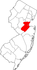
Location map of Middlesex County, New Jersey.svg
Red pog.svg
The Ponds
Location in Middlesex County
USA New Jersey relief location map.svg
Red pog.svg
The Ponds
Location in New Jersey
Usa edcp relief location map.png
Red pog.svg
The Ponds
Location in the United States
Coordinates: 40°20′55″N74°27′49″W / 40.34861°N 74.46361°W / 40.34861; -74.46361
Country Flag of the United States.svg United States
State Flag of New Jersey.svg New Jersey
County Middlesex
Township Monroe
Area
[1]
  Total
0.23 sq mi (0.59 km2)
  Land0.22 sq mi (0.56 km2)
  Water0.01 sq mi (0.03 km2)
Elevation
135 ft (41 m)
Population
 (2020) [2]
  Total
941
  Density4,316.51/sq mi (1,667.55/km2)
Time zone UTC−05:00 (Eastern (EST))
  Summer (DST) UTC−04:00 (EDT)
ZIP Code
Area codes 732/848
FIPS code 34-72726 [3]
GNIS feature ID2806200 [4]

The Ponds is a planned community and census-designated place (CDP) in Monroe Township, Middlesex County, New Jersey, United States. As of the 2020 census, the year it was first listed as a CDP, the population was 941. [2]

Contents

Geography

The community is in southern Middlesex County and the southern part of Monroe Township, bordered to the west by Clearbrook, to the north and east by Concordia, and to the south by Union Valley Road. It is 4 miles (6 km) south of Jamesburg and 5 miles (8 km) northeast of Hightstown.

According to the U.S. Census Bureau, the CDP has an area of 0.23 square miles (0.60 km2), of which 0.01 square miles (0.03 km2), or 4.80%, are water. [1] The community is within the drainage area of Cranbury Brook, which flows west to the Millstone River and is part of the Raritan River watershed.

Demographics

Historical population
CensusPop.Note
2020 941
U.S. Decennial Census [5] [2]

The Ponds first appeared as a census designated place in the 2020 U.S. Census. [6]

References

  1. 1 2 "2023 U.S. Gazetteer Files: New Jersey". United States Census Bureau. Retrieved August 20, 2024.
  2. 1 2 3 "P1. Race – The Ponds CDP, New Jersey: 2020 DEC Redistricting Data (PL 94-171)". U.S. Census Bureau. Retrieved August 20, 2024.
  3. Geographic Codes Lookup for New Jersey, Missouri Census Data Center. Accessed June 9, 2023.
  4. "The Ponds Census Designated Place". Geographic Names Information System . United States Geological Survey, United States Department of the Interior.
  5. "Census of Population and Housing". Census.gov. Retrieved June 4, 2016.
  6. "2020 Geography Changes". United States Census Bureau.