West Carteret, New Jersey

Last updated

West Carteret, New Jersey
Middlesex CR 602 wb in West Carteret, NJ, Dec. 2024.jpg
Westbound Roosevelt Avenue (CR 602) in West Carteret
Location map of Middlesex County, New Jersey.svg
Red pog.svg
West Carteret
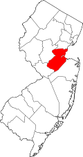
Location of West Carteret in Middlesex County Inset: Location of county within the state of New Jersey
USA New Jersey location map.svg
Red pog.svg
West Carteret
West Carteret (New Jersey)
Usa edcp location map.svg
Red pog.svg
West Carteret
West Carteret (the United States)
Coordinates: 40°35′40″N74°14′47″W / 40.59444°N 74.24639°W / 40.59444; -74.24639
Country Flag of the United States.svg United States
State Flag of New Jersey.svg New Jersey
County Middlesex
Borough Carteret
Elevation
[1]
30 ft (9 m)
GNIS feature ID881691 [1]

West Carteret is an unincorporated community located within Carteret in Middlesex County, in the U.S. state of New Jersey. [2] Joseph Medwick Park is a greenway of parkland along the banks the Rahway River. [3]

References

  1. 1 2 "West Carteret". Geographic Names Information System . United States Geological Survey, United States Department of the Interior.
  2. "West Carteret, Carteret, New Jersey" (Map). Google Maps . Retrieved February 15, 2015.
  3. "Joseph Medwick Park". Archived from the original on January 27, 2020. Retrieved February 5, 2018.