Archaeological excavations along what is now Birch Drive reveal temporary LenapeNative American settlements. The Lenape practiced farming in other parts of Monmouth County much of the year, and they visited the wooded areas in what is now Brielle for hunting and fishing.
The area was originally part of Shrewsbury Township and the first settlers were primarily farmers, and the area became known as Union Landing. In colonial times, salt was an important preservative, and before the American Revolutionary War, most of it was imported from Great Britain. The Union Salt Works opened around the outbreak of the war, and on April 5, 1778, several British Loyalists attacked and burned the salt works and other buildings. A year later, the salt works reopened and continued to operate through the duration of the war.[23][24]
Early in the 19th century, Shrewsbury Township was divided, and the area became part of Howell Township which was further divided in 1851, when the area became part of Wall Township. On July 7, 1881, a group of businessmen purchased several acres of land and formed the Brielle Land Association with the intention of building vacation homes. The quaint riverside charm of the area reminded one of the developers of another pastoral town on a river which he had visited, Brielle, in the Netherlands.[25]
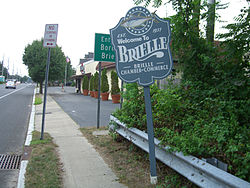
Brielle welcome sign at the border with Manasquan on Union Avenue
According to the United States Census Bureau, the borough had a total area of 2.37 square miles (6.14km2), including 1.76 square miles (4.55km2) of land and 0.61 square miles (1.59km2) of water (25.86%).[2][3]
The borough is primarily a residential community of single homes, with a few condominiums; there are almost no undeveloped lots of land left. There are several businesses located along Union Avenue and Higgins Avenue and some marinas along the Manasquan River. Ripley's Believe It or Not! once stated that Brielle has "16 bars and no churches".[30] It currently has one church, The Church in Brielle (formerly the Dutch Reformed Church) and several restaurants that have liquor licenses, but no full bars. There is also a 140 acres (0.57km2) 18 hole golf course called the Manasquan River Golf Club.
The town has approximately 6.4 kilometers (4.0mi) of waterfront along the Manasquan River, Glimmerglass, and Debbie's Creek, all of which are salt water and tidal. Brielle's borders extend to an 8-acre (32,000m2) island in the Manasquan River.
Manasquan Park is an unincorporated community located within Brielle.[citation needed]
Of the 1,805 households, 33.4% had children under the age of 18; 60.4% were married couples living together; 10.3% had a female householder with no husband present and 26.0% were non-families. Of all households, 22.0% were made up of individuals and 9.9% had someone living alone who was 65 years of age or older. The average household size was 2.64 and the average family size was 3.13.[18]
26.1% of the population were under the age of 18, 5.4% from 18 to 24, 18.7% from 25 to 44, 32.8% from 45 to 64, and 16.9% who were 65 years of age or older. The median age was 44.9 years. For every 100 females, the population had 97.3 males. For every 100 females ages 18 and older there were 91.3 males.[18]
The Census Bureau's 2006–2010 American Community Survey showed that (in 2010 inflation-adjusted dollars) median household income was $98,419 (with a margin of error of +/− $10,635) and the median family income was $108,818 (+/− $11,831). Males had a median income of $84,568 (+/− $8,259) versus $53,041 (+/− $4,411) for females. The per capita income for the borough was $45,445 (+/− $5,694). About none of families and 3.7% of the population were below the poverty line, including none of those under age 18 and 2.9% of those age 65 or over.[36]
2000 census
As of the 2000 United States census[15] there were 4,893 people, 1,938 households, and 1,414 families residing in the borough. The population density was 2,754.4 inhabitants per square mile (1,063.5/km2). There were 2,123 housing units at an average density of 1,195.1 per square mile (461.4/km2). The racial makeup of the borough was 93.05% White, 3.52% African American, 0.06% Native American, 0.67% Asian, 1.61% from other races, and 1.08% from two or more races. Hispanic or Latino of any race were 3.31% of the population.[34][35]
There were 1,938 households, out of which 30.8% had children under the age of 18 living with them, 62.0% were married couples living together, 7.6% had a female householder with no husband present, and 27.0% were non-families. 23.5% of all households were made up of individuals, and 12.0% had someone living alone who was 65 years of age or older. The average household size was 2.52 and the average family size was 3.00.[34][35]
In the borough the population was spread out, with 23.7% under the age of 18, 4.8% from 18 to 24, 24.8% from 25 to 44, 29.0% from 45 to 64, and 17.7% who were 65 years of age or older. The median age was 43 years. For every 100 females, there were 91.4 males. For every 100 females age 18 and over, there were 89.8 males.[34][35]
The median income for a household in the borough was $178,368, and the median income for a family was $172,867. Males had a median income of $98,828 versus $72,156 for females. The per capita income for the borough was $105,785. About 2.6% of families and 3.9% of the population were below the poverty line, including 1.9% of those under age 18 and 5.4% of those age 65 or over.[34][35]
Government
Local government
Brielle Borough Hall, at the corner of Union Avenue and Union Lane
Brielle is governed under the borough form of New Jersey municipal government, which is used in 218 (of the 564) municipalities statewide, making it the most common form of government in New Jersey.[37] The governing body is comprised of a mayor and a borough council, with all positions elected at-large on a partisan basis as part of the November general election. A mayor is elected directly by the voters to a four-year term of office. The borough council includes six members elected to serve three-year terms on a staggered basis, with two seats coming up for election each year in a three-year cycle.[4] The borough form of government used by Brielle is a "weak mayor / strong council" government in which council members act as the legislative body with the mayor presiding at meetings and voting only in the event of a tie. The mayor can veto ordinances subject to an override by a two-thirds majority vote of the council. The mayor makes committee and liaison assignments for council members, and most appointments are made by the mayor with the advice and consent of the council.[38][39][40]
As of 2025[update], the mayor of the Borough of Brielle is Republican Frank A. Garruzzo, whose term of office ends December 31, 2027. Members of the Brielle Borough Council are Eliot Colon (R, 2027), Michael A. Gianforte (R, 2025), Cort W. Gorham (R, 2025), Paul K. Nolan (R, 2027), Timothy A. Shaak (R, 2026) and John V. Visceglia (R, 2026).[5][41][42][43][44]
Eliot Colon was appointed to fill the term expiring in December 2024 that became vacant after Frank A. Garruzzo stepped down to take office as mayor in January 2024.[45]
Federal, state, and county representation
Brielle is located in the 4th Congressional District[46] and is part of New Jersey's 10th state legislative district.[47]
Monmouth County is governed by a Board of County Commissioners composed of five members who are elected at-large to serve three-year terms of office on a staggered basis, with either one or two seats up for election each year as part of the November general election. At an annual reorganization meeting held in the beginning of January, the board selects one of its members to serve as director and another as deputy director.[52]
As of March 2011, there were a total of 3,653 registered voters in Brielle, of which 617 (16.9%) were registered as Democrats, 1,446 (39.6%) were registered as Republicans and 1,590 (43.5%) were registered as Unaffiliated. There were no voters registered to other parties.[87]
United States Gubernatorial election results for Brielle[88]
In the 2012 presidential election, Republican Mitt Romney received 66.7% of the vote (1,893 cast), ahead of Democrat Barack Obama with 32.2% (914 votes), and other candidates with 1.0% (29 votes), among the 2,859 ballots cast by the borough's 3,830 registered voters (23 ballots were spoiled), for a turnout of 74.6%.[89][90] In the 2008 presidential election, Republican John McCain received 61.3% of the vote (1,842 cast), ahead of Democrat Barack Obama with 36.1% (1,085 votes) and other candidates with 1.3% (40 votes), among the 3,003 ballots cast by the borough's 3,824 registered voters, for a turnout of 78.5%.[91] In the 2004 presidential election, Republican George W. Bush received 67.5% of the vote (1,971 ballots cast), outpolling Democrat John Kerry with 31.3% (913 votes) and other candidates with 0.5% (18 votes), among the 2,918 ballots cast by the borough's 3,805 registered voters, for a turnout percentage of 76.7.[92]
In the 2013 gubernatorial election, Republican Chris Christie received 79.1% of the vote (1,533 cast), ahead of Democrat Barbara Buono with 19.4% (376 votes), and other candidates with 1.5% (30 votes), among the 1,963 ballots cast by the borough's 3,852 registered voters (24 ballots were spoiled), for a turnout of 51.0%.[93][94] In the 2009 gubernatorial election, Republican Chris Christie received 70.9% of the vote (1,571 ballots cast), ahead of Democrat Jon Corzine with 22.2% (491 votes), Independent Chris Daggett with 5.8% (129 votes) and other candidates with 0.6% (13 votes), among the 2,215 ballots cast by the borough's 3,664 registered voters, yielding a 60.5% turnout.[95]
United States Senate election results for Brielle1[96]
The Brielle Public Library, which is located at 610 South Street, describes itself as the first library in New Jersey to have offered public access to the Internet.[106]
As of May2010[update], the borough had a total of 27.08 miles (43.58km) of roadways, of which 21.94 miles (35.31km) were maintained by the municipality, 2.66 miles (4.28km) by Monmouth County and 2.48 miles (3.99km) by the New Jersey Department of Transportation.[107]
Mary Catherine Cuff (born 1947), former acting justice of the New Jersey Supreme Court (Judge of the Appellate Division, Temporarily Assigned to the Supreme Court) who served between 2012 and 2016[115]
12History, Borough of Brielle. Accessed January 23, 2025.
↑Delancey, Karen Hammerdorfer. "This day's invasion of Brielle welcome", Asbury Park Press, September 8, 2002. Accessed October 16, 2013. "During the Revolutionary War, Brielle was attacked by some 200 British soldiers who burned down the Union Salt Works and many other buildings."
↑Martin, Patti. "Brielle: Community spirit shines through", Asbury Park Press, November 28, 2003. Accessed January 23, 2025, via Newspapers.com. "On July 7, 1881 a group of businessman formed the Brielle Land Association and purchased 150 acres of farm land. They named the parcel 'Brielle' because a businessman had visited Brielle, Holland, a year before and thought the new Brielle resembled the countryside and coastal towns that dot Europe's lowlands on the North Sea and English Channel."
↑Biese, Alex. "It's a Special Year", Asbury Park Press, April 26, 2007. Accessed July 29, 2012. "Fifty years ago, the borough of Brielle held a dubious distinction. 'There were 17 bars and no churches in Brielle,' said the Rev. Paul Walther, 57, of Brielle."
↑Form of Government, Borough of Brielle. Accessed May 20, 2024. "Brielle operates under a municipal form of government composed of six council members and a mayor, all elected directly by the voters. Council members are elected to three year terms. Each year two seats are up for election. The mayor is elected to a four-year term."
↑Rossics, Anthony. "Council and board of education races uncontested", Star News Group, November 7, 2024. Accessed December 4, 2024. "Colon previously served one year of Mayor Frank Garruzzo’s term, when Garruzzo became mayor in 2023. Colon was appointed to complete the one-year term."
↑Monmouth County Government, Monmouth County, New Jersey. Accessed July 19, 2022. "Monmouth County is governed by five commissioners elected at-large for three-year terms. Each January, the freeholders select one of their members to serve as the director of the board for the year to preside over the meetings and activities of the Board."
↑Brielle Board of Education District Policy 0110 - Identification, Brielle School District. Accessed December 9, 2024. "Purpose: The Board of Education exists for the purpose of providing a thorough and efficient system of free public education in grades Pre-Kindergarten through eight in the Brielle School District. Composition: The Brielle School District is comprised of all the area within the municipal boundaries of Brielle."
↑Manasquan Public Schools 2016-17 Report Card Narrative, New Jersey Department of Education. Accessed December 9, 2024. "As our building began going through necessary physical changes, Manasquan High School maintained its commitment to rich and diverse course offerings. Students from the communities of Avon, Belmar, Brielle, Lake Como, Manasquan, Sea Girt, Spring Lake, and Spring Lake Heights attended MHS in 2016-2017, amassing an enrollment of 960 students."
↑Sending Districts, Manasquan Public Schools. Accessed December 9, 2024. "Manasquan High School receives students from seven different districts: Avon, Brielle, Belmar, Lake Como, Sea Girt, Spring Lake, and Spring Lake Heights."
↑Waggoner, Walter H. "Charles H. Brower Dies At 82; Ex-Chief Of B.B.D.O. Agency", The New York Times, July 26, 1984. Accessed January 23, 2018. "Charles H. Brower, former president and chairman of Batten, Barton, Durstine & Osborn, the advertising agency, died Monday at his home in Brielle, N.J. He was 82 years old."
↑"Monmouth County judge elevated", Asbury Park Press, July 20, 1994. Accessed January 20, 2018. "Mary Catherine Cuff, the presiding judge of the family division of Superior Court in Monmouth County, is being promoted, Supreme Court Chief Justice Robert N. Wilentz announced yesterday.... Cuff, 46, of Brielle, is one of four judges being elevated to fill two new slots and two vacancies created by retirements in the Appellate Division of Superior Court."
↑Stanmyre, Matthew. "Gerry Matthews, hidden coaching gem at Stockton College, racks up wins and miles", NJ Advance Media for NJ.com, December 29, 2013. Accessed February 18, 2016. "Gerry Matthews, winner of more men's college basketball games than any coach in New Jersey history, backs out of his driveway in Brielle on an icy morning early this month to begin the same 58-mile drive to Stockton College he has made countless days since 1985."
↑Geiser, John. "Jaws", Asbury Park Press, June 15, 2001. Accessed January 1, 2001. "Capt Frank Mundus the legendary shark hunter who once lived in Brielle and fished in Shore area waters for sharks..."
↑Staff. "Ex-Actor Killed In Action; Sgt. Nelson Rae an Army Casualty in Belgium, Parents Learn", The New York Times, January 27, 1945. Accessed July 29, 2012. "Brielle, NJ, Jan. 26-Sgt. Nelson Rae, former radio and musical comedy player who was last featured as a vocalist in the Broadway production of Pal Joey, has been killed in action on the Belgian front, according to a War Department message received here by his parents, Mr. and Mrs. William Rae, today."
This page is based on this Wikipedia article Text is available under the CC BY-SA 4.0 license; additional terms may apply. Images, videos and audio are available under their respective licenses.


