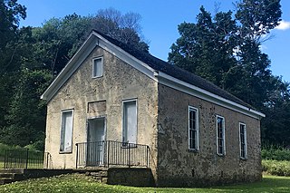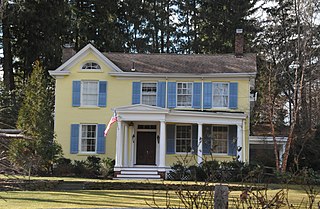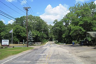
Flanders is an unincorporated community and census-designated place (CDP) located within Mount Olive Township, in southwestern Morris County, in the U.S. state of New Jersey. Flanders is served by the United States Postal Service as ZIP Code 07836.
Augusta is an unincorporated community located within Frankford Township, in Sussex County, New Jersey, United States. As of the 2010 United States Census, the population for the ZIP Code Tabulation Area 07822 was 887.

Delaware is an unincorporated community and census-designated place (CDP) located along the Delaware River within Knowlton Township in Warren County, New Jersey. It was created as part of the 2010 United States Census. As of the 2010 Census, the CDP's population was 150. The area is served as United States Postal Service ZIP Code 07833.

Towaco is an unincorporated community and census-designated place (CDP) located within Montville Township in Morris County, in the U.S. state of New Jersey. The area is served as United States Postal Service ZIP Code 07082. Its name reflects the Native American history in the area, which identified the locale as TaWagh, meaning "hill", a reference to the terrain of Towaco.
Vauxhall is an unincorporated community and census-designated place (CDP) located within Union Township in Union County, in the U.S. state of New Jersey. Vauxhall borders Millburn, Maplewood and Springfield. The area is served as United States Postal Service ZIP Code 07088.
Hewitt is an unincorporated community and census-designated place (CDP) located within West Milford Township in Passaic County, in the U.S. state of New Jersey. The area is served as United States Postal Service ZIP Code 07421. It is named for Abram Hewitt.

Richland is an unincorporated community and census-designated place (CDP) located within Buena Vista Township in Atlantic County, in the U.S. state of New Jersey. The area is served as United States Postal Service ZIP Code 08350.

Gillette is an unincorporated community and census-designated place (CDP) located within Long Hill Township in Morris County, in the U.S. state of New Jersey. The area is served as United States Postal Service ZIP Code 07933.
New Gretna is an unincorporated community and census-designated place (CDP) located within Bass River Township in Burlington County, in the U.S. state of New Jersey. The area is served as United States Postal Service ZIP Code 08224.

Asbury is an unincorporated community and census-designated place (CDP) located within Franklin Township in Warren County, in the U.S. state of New Jersey, that was created as part of the 2010 United States Census. As of the 2010 Census, the CDP's population was 273.

New Monmouth is an unincorporated community located within Middletown Township in Monmouth County, New Jersey, United States. The area is served as United States Postal Service ZIP code 07748.

Stewartsville is an unincorporated community and census-designated place (CDP) located within Greenwich Township in Warren County, in the U.S. state of New Jersey, that was created as part of the 2010 United States Census. As of the 2010 Census, the CDP's population was 349.
Dorothy is an unincorporated community and census-designated place located in Weymouth Township in Atlantic County, in the U.S. state of New Jersey. The area is served as United States Postal Service ZIP Code 08317.
Great Meadows is an unincorporated community and census-designated place (CDP) located within Independence Township in Warren County, in the U.S. state of New Jersey, that was created as part of the 2010 United States Census. As of the 2010 census, the CDP's population was 303.

Port Murray is an unincorporated community and census-designated place (CDP) located within Mansfield Township in Warren County, in the U.S. state of New Jersey, that was created as part of the 2010 United States Census. As of the 2010 Census, the CDP's population was 129.
Seabrook is an unincorporated community located within Upper Deerfield Township in Cumberland County, in the U.S. state of New Jersey. The area is served as United States Postal Service ZIP code 08302. The unincorporated community and the census-designated Place Seabrook Farms within it are each named after Charles F. Seabrook, a businessman who at one point ran the largest irrigated truck farm in the world in this region.
Monroeville is an unincorporated community located within portions of Elk Township in Gloucester County and Upper Pittsgrove Township in Salem County, New Jersey, United States. The area is served as United States Postal Service ZIP Code 08343. Monroeville is mostly filled with wooded areas and farms.

Harrisonville is an unincorporated community and census-designated place (CDP) located within South Harrison Township, in Gloucester County, in the U.S. state of New Jersey. The area is served as United States Postal Service ZIP Code 08039.

Holmeson is an unincorporated community located within Millstone Township in Monmouth County, New Jersey, United States. As it is located along County Route 537 through which the Monmouth–Ocean county line runs down the center, portions of the community are also located in Jackson Township. Owing to its location near Interstate 195 and Six Flags Great Adventure, the community is mostly made up of gas stations, restaurants, and small businesses though the Jackson Premium Outlets occupies land just south of the community.

Birmingham is an unincorporated community located within Pemberton Township in Burlington County, New Jersey, United States. As of the 2010 United States Census, the ZIP Code Tabulation Area for ZIP Code 08011 had a population of 33. Though sparsely populated, it houses a post office and a Lanxess chemical facility.


