New Monmouth, New Jersey

Last updated
New Monmouth, New Jersey
New Monmouth, NJ.jpg
Location map of Monmouth County, New Jersey.svg
Red pog.svg
New Monmouth, New Jersey
Location of New Monmouth in Monmouth County Inset: Location of county within the state of New Jersey
USA New Jersey location map.svg
Red pog.svg
New Monmouth, New Jersey
New Monmouth, New Jersey (New Jersey)
Usa edcp location map.svg
Red pog.svg
New Monmouth, New Jersey
New Monmouth, New Jersey (the United States)
Coordinates: 40°24′43″N74°06′12″W / 40.41194°N 74.10333°W / 40.41194; -74.10333 Coordinates: 40°24′43″N74°06′12″W / 40.41194°N 74.10333°W / 40.41194; -74.10333
Country Flag of the United States.svg  United States
State Flag of New Jersey.svg  New Jersey
County Monmouth
Township Middletown
Elevation
[1]
36 ft (11 m)
Population
  Total28,030
ZIP code
07748
GNIS feature ID882519 [1]

New Monmouth is an unincorporated community located within Middletown Township in Monmouth County, New Jersey, United States. [3] The area is served as United States Postal Service ZIP code 07748.

As of the 2010 United States Census, the population for ZIP Code Tabulation Area 07748 was 28,030. [2] In the 2000 Census, the ZCTA population was 28,689. [4]

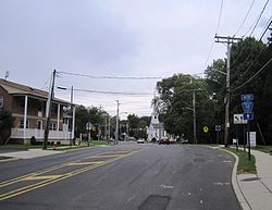
The public New Monmouth Elementary School and the parochial Mater Dei High School are located in New Monmouth. Most of the area is suburban, with single-family houses dotting the landscape. The two major roads that pass through New Monmouth are County Route 516 (Cherry Tree Farm Road and Leonardville Road) and New Monmouth Road (CR 50). [5]

Related Research Articles

<span class="mw-page-title-main">Flanders, New Jersey</span> Populated place in Morris County, New Jersey, US

Flanders is an unincorporated community and census-designated place (CDP) located within Mount Olive Township, in southwestern Morris County, in the U.S. state of New Jersey. Flanders is served by the United States Postal Service as ZIP Code 07836.

Stockholm is an unincorporated community located in the southeastern part of Hardyston Township in Sussex County, New Jersey, United States. Its ZIP Code is 07460. Like many neighboring towns, Stockholm is home to a number of lakes including Deer Trail Lakes, Lake Stockholm, Lake Gerard, Beaver Lake, Lake Tamarack and Summit Lake.

Gladstone is an unincorporated community located within Peapack-Gladstone in Somerset County, New Jersey, United States. The area is served as United States Postal Service ZIP Code 07934.

Linwood is a small unincorporated community in the northern portion of Bay County in the U.S. state of Michigan. The community is on the boundary between Fraser Township on the north and Kawkawlin Township on the south. It is situated with M-13 to the west and the Saginaw Bay of Lake Huron on the east, between Kaiser Tower Road and Elevator Road where Linwood Road becomes Center Street. Bay City is about 12 miles to the south and Linwood is included in the Bay City Metropolitan Statistical Area.

<span class="mw-page-title-main">Towaco, New Jersey</span> Unincorporated community in New Jersey, United States

Towaco is an unincorporated community located within Montville Township in Morris County, New Jersey, United States. The area is served as United States Postal Service ZIP code 07082. Its name reflects the Native American history in the area, which identified the locale as TaWagh, meaning "hill", a reference to the terrain of Towaco.

Hewitt is an unincorporated community located within West Milford Township in Passaic County, New Jersey, United States. The area is served as United States Postal Service ZIP Code 07421. It is named for Abram Hewitt.

<span class="mw-page-title-main">Cliffwood, New Jersey</span> Place in Monmouth County, New Jersey, United States

Cliffwood is an unincorporated community located within Aberdeen Township in Monmouth County, New Jersey, United States. The area is served as United States Postal Service ZIP code 07721.

<span class="mw-page-title-main">Columbus, New Jersey</span> Unincorporated community in New Jersey, United States

Columbus is an unincorporated community located within Mansfield Township in Burlington County, New Jersey, United States. The area is served as United States Postal Service ZIP Code 08022. Most of Mansfield Township's governmental offices are located in and around Columbus. It is also the main business district in the township with many businesses lining the main roads in the area. It is located at the junction of County Route 543 and U.S. Route 206 which is a major highway that heads north and south. US 206 originally passed through the center of Columbus on Atlantic Avenue and New York Avenue until it was moved to a short four-lane bypass of downtown in the late 1950s/early 1960s. The old surface route became state-maintained New Jersey Route 170 but became a county-maintained road in 1986.

<span class="mw-page-title-main">Gillette, New Jersey</span> Place in Morris County, New Jersey, United States

Gillette is an unincorporated community located within Long Hill Township in Morris County, New Jersey, United States. The area is served as United States Postal Service ZIP code 07933.

<span class="mw-page-title-main">Millington, New Jersey</span> Place in Morris County, New Jersey, United States

Millington is an unincorporated community located within Long Hill Township in Morris County, New Jersey, United States.

New Gretna is an unincorporated community located within Bass River Township in Burlington County, New Jersey, United States. The area is served as United States Postal Service ZIP Code 08224.

Dorothy is an unincorporated community and census-designated place located in Weymouth Township in Atlantic County, New Jersey, United States. The area is served as United States Postal Service ZIP code 08317.

Great Meadows is an unincorporated community and census-designated place (CDP) located within Independence Township in Warren County, New Jersey, United States, that was created as part of the 2010 United States Census. As of the 2010 census, the CDP's population was 303.

<span class="mw-page-title-main">Brookside, New Jersey</span> Place in Morris County, New Jersey, United States

Brookside is a historic unincorporated community within Mendham Township in Morris County, New Jersey, United States. It is located approximately 6 mi (9.7 km) west of Morristown. It is close to the Washington Valley Historic District in neighboring Morris Township.

Seabrook is an unincorporated community located within Upper Deerfield Township in Cumberland County, in the U.S. state of New Jersey. The area is served as United States Postal Service ZIP code 08302. The unincorporated community and the census-designated Place Seabrook Farms within it are each named after Charles F. Seabrook, a businessman who at one point ran the largest irrigated truck farm in the world in this region.

Monroeville is an unincorporated community located within portions of Elk Township in Gloucester County and Upper Pittsgrove Township in Salem County, New Jersey, United States. The area is served as United States Postal Service ZIP Code 08343. Monroeville is mostly filled with wooded areas and farms.

<span class="mw-page-title-main">Holmeson, New Jersey</span> Unincorporated community in New Jersey, United States

Holmeson is an unincorporated community located within Millstone Township in Monmouth County, New Jersey, United States. As it is located along County Route 537 through which the Monmouth–Ocean county line runs down the center, portions of the community are also located in Jackson Township. Owing to its location near Interstate 195 and Six Flags Great Adventure, the community is mostly made up of gas stations, restaurants, and small businesses though the Jackson Premium Outlets occupies land just south of the community.

<span class="mw-page-title-main">Birmingham, New Jersey</span> Unincorporated community in New Jersey, United States

Birmingham is an unincorporated community located within Pemberton Township in Burlington County, New Jersey, United States. As of the 2010 United States Census, the ZIP Code Tabulation Area for ZIP Code 08011 had a population of 33. Though sparsely populated, it houses a post office and a Lanxess chemical facility.

Hainesburg is an unincorporated community and census-designated place (CDP) located within Knowlton Township in Warren County, New Jersey, United States. While the community has existed for over a century, the CDP was designated as part of the 2010 United States Census. As of the 2010 Census, the CDP's population was 91.

Allaire is an unincorporated community located within Wall Township in Monmouth County, New Jersey, United States. As of the 2010 United States Census, the ZIP Code Tabulation Area for ZIP Code 07727 had a population of 7,050.

References

  1. 1 2 "New Monmouth". Geographic Names Information System . United States Geological Survey, United States Department of the Interior.
  2. 1 2 DP-1; Profile of General Population and Housing Characteristics: 2010 from the 2010 Demographic Profile Data for ZCTA5 07748 Archived 2020-02-13 at archive.today , United States Census Bureau. Accessed September 13, 2016.
  3. Locality Search, State of New Jersey. Accessed February 27, 2015.
  4. DP-1; Profile of General Demographic Characteristics: 2000 from the Census 2000 Summary File 1 (SF 1) 100-Percent Data for ZCTA5 07748 Archived 2020-02-13 at archive.today United States Census Bureau. Retrieved September 13, 2016.
  5. Google (September 13, 2016). "Aerial view of New Monmouth" (Map). Google Maps . Google. Retrieved September 13, 2016.