Monmouth County is a county located in the central portion of the U.S. state of New Jersey. It is bordered to its west by Mercer and Middlesex Counties, to its south by Ocean County, to its east by the Atlantic Ocean, and to its north by the Raritan Bay. Monmouth County's geographic area comprises 30% water. The county is part of the Jersey Shore region of the state. It has also been categorized under the Central Jersey region, though it was not among the four counties explicitly listed as included in Central Jersey as part of legislation signed into law in 2023.

Colts Neck Township is a township in Monmouth County, in the U.S. state of New Jersey. It is located in the New York Metropolitan Area. As of the 2020 United States census, the township's population was 9,957, a decrease of 185 (−1.8%) from the 2010 census count of 10,142, which in turn reflected a decline of 2,189 (−17.8%) from the 12,331 counted in the 2000 census.

Freehold is a borough in and the county seat of Monmouth County, in the U.S. state of New Jersey. Known for its Victorian era homes and extensive colonial history, the borough is located in the Raritan Valley region within the New York Metropolitan Area, located about 33 miles (53 km) from Manhattan and 17 miles (27 km) from Staten Island. The borough has grown to become a commuter town of New York City. As of the 2020 United States census, the borough's population was 12,538, its highest decennial count ever and an increase of 486 (+4.0%) from the 12,052 recorded at the 2010 census, which in turn reflected an increase of 1,076 (+9.8%) from the 10,976 counted in the 2000 census.

Freehold Township is a township in western Monmouth County, in the U.S. state of New Jersey. Crisscrossed by several major highways, the township is a commercial hub for Central New Jersey and is a suburban bedroom community of New York City, located within the Raritan Valley region of the much larger New York Metropolitan Area. The township is located roughly 38 miles (61 km) away from Manhattan and about 20 miles (32 km) away from Staten Island. As of the 2020 United States census, the township's population was 35,369, a decrease of 815 (−2.3%) from the 36,184 recorded at the 2010 census, which in turn reflected an increase of 4,647 (+14.7%) from the 31,537 counted in the 2000 census.
Howell Township is a township in Monmouth County, in the U.S. state of New Jersey. The township is the largest municipality in the county by total area, comprising about 61.21 square miles (158.5 km2). It is located in the New York metropolitan area and has been a steadily growing bedroom community of New York City. As of the 2020 United States census, the township's population was 53,537, its highest decennial count ever and an increase of 2,462 (+4.8%) from the 2010 census count of 51,075, which in turn reflected an increase of 2,172 (+4.4%) from the 48,903 counted in the 2000 census.
Manalapan Township is a township in western Monmouth County, in the U.S. state of New Jersey. The township is centrally located within the Raritan Valley region and is a part of the New York Metropolitan Area. As of the 2020 United States census, the township's population was 40,905, its highest decennial count ever and an increase of 2,033 (+5.2%) from the 2010 census count of 38,872, which in turn reflected an increase of 5,449 (+16.3%) from the 33,423 counted in the 2000 census.
Marlboro Township is a township in Monmouth County, in the U.S. state of New Jersey. The township is located within the Raritan Valley region and is a part of the New York Metropolitan Area. As of the 2020 United States census, the township's population was 41,502, an increase of 1,311 (+3.3%) from the 2010 census count of 40,191, which in turn reflected an increase of 5,449 (+16.3%) from the 33,423 counted in the 2000 census.
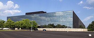
Holmdel Township is a township in Monmouth County, in the U.S. state of New Jersey. Located near Raritan Bay in the Raritan Valley region, the township is a regional commercial hub of Central Jersey, home to Bell Labs and PNC Bank Arts Center, and a bedroom community of New York City in the New York Metropolitan Area.
The Freehold Regional High School District is a public regional school district established in 1953, that serves students in ninth through twelfth grades from eight communities in western Monmouth County, in the U.S. state of New Jersey. The district, with six high schools, is the largest regional high school district in the state, as measured by enrollment. The district serves students from Colts Neck Township, Englishtown, Farmingdale, Freehold Borough, Freehold Township, Howell Township, Manalapan Township and Marlboro Township.

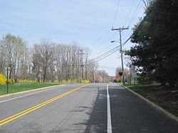
Colts Neck High School is a four-year comprehensive public high school located in Colts Neck Township, in Monmouth County, in the U.S. state of New Jersey, serving students in ninth through twelfth grades and operating as one of the six secondary schools of the Freehold Regional High School District. The school is located at the corner of County Route 537 and Five Points Road. The school serves students from all of Colts Neck Township and from portions of both Howell Township and Marlboro Township. The school has been accredited by the Middle States Association of Colleges and Schools Commission on Elementary and Secondary Schools since 2008.

Marlboro High School is a four-year comprehensive public high school located in Marlboro Township, in Monmouth County, in the U.S. state of New Jersey, serving students in ninth through twelfth grades as one of the six secondary schools of the Freehold Regional High School District (FRHSD). The school serves students from portions of Marlboro Township. Marlboro High School hosts the Business Administration Magnet Program (BAMP), a selective magnet program offered within FRHSD, so there are students attending Marlboro High School from across the county. Students that are a part of the BAMP take advanced classes that are more in-depth than regular classes. The school has been accredited by the Middle States Association of Colleges and Schools Commission on Elementary and Secondary Schools since 1974.
The Marlboro Township School District is a community public school district that serves students in pre-kindergarten through eighth grade in Marlboro Township in Monmouth County, in the U.S. state of New Jersey.
The Colts Neck School District is a comprehensive community public school district serving students in pre-kindergarten through eighth grade in Colts Neck Township in Monmouth County, in the U.S. state of New Jersey.

Adelphia is an unincorporated community located in northern Howell Township, Monmouth County, in the U.S. state of New Jersey. The area is served as United States Postal Service ZIP code 07710. The community borders Freehold Township, and residents who reside in Adelphia use a Freehold mailing address.
Wickatunk is an unincorporated community located within Marlboro Township in Monmouth County, in the U.S. state of New Jersey. Elevation above sea level is 180 feet (55 m). It was founded in 1695 by three Scottish servants from the community of Toponemus. Originally surveyed by George Keith, in a letter he states:
"After some time I may give thee a particular account of all thy land I have surveyed for thee and what I reckon dew for it. John Laing and his family are well and lyke to do well, and so John Sym and his family. Also thou hast thy share laid out at Wickington (Wickatunk).
Bradevelt is an unincorporated community located within the Morganville section of Marlboro Township, in Monmouth County, in the U.S. state of New Jersey. County Route 520 travels through Bradevelt, while Route 79 is located west of the community. The area consists of a mix of businesses along the two main roads, farmland, and the remains of the Marlboro Psychiatric Hospital which is being converted to Big Brook Park. The former Monmouth County Agricultural Railroad runs north and south through Bradevelt. Early to mid 1800s the area was called Hulsetown.

Scobeyville is an unincorporated community located within Colts Neck Township in Monmouth County, in the U.S. state of New Jersey. The settlement is named for the Scobey family which has inhabited the township since the 1700s. The site housed a one-room schoolhouse, a post office, and a general store. It was known for good fishing on the Yellow Brook which has its basin in Scobyville.

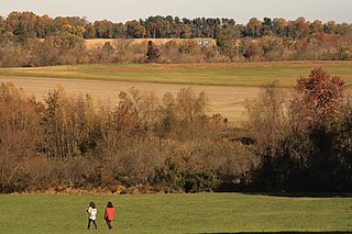
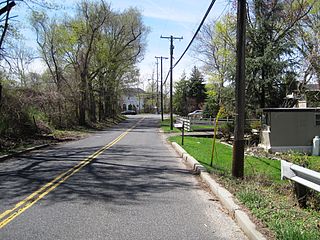
Pleasant Valley is an unincorporated community located within Marlboro Township in Monmouth County, in the U.S. state of New Jersey. The area reportedly received its name from George Washington after he went through the area in 1777. The area is hilly and forested and is dotted by medium to large-sized residences. Pleasant Valley Road and Reids Hill Road are main roads that pass through the area connecting to Routes 34, 79, and 520. A large part of land which makes up Pleasant Valley was originally granted by the King of England in 1665 to the Rev. Obadiah Holmes. In 1690, the area was settled by people of Dutch heritage and the original dominant language in the area was Low Dutch.
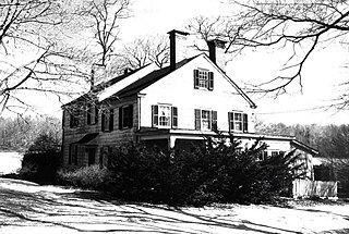
The Colts Neck Inn is a steakhouse located on County Route 537 in what is now Colts Neck Township, New Jersey. Established as the Colts Neck Tavern in 1717, the inn became known as the Colts Neck Hotel before becoming a restaurant. A separate Colts Neck Inn Hotel was incorporated in 1997.
Marlboro Township, New Jersey has a number of historic sites. The Monmouth County Historic Site Inventory (HSI) was started in 1980 by the directors of both the Monmouth County Historical Association and the Monmouth County Park System. This inventory project provided an inventory number to all historic properties in Monmouth County, New Jersey. In addition to property details, this listing provides reference numbers for easy identification. In addition to the park system inventory, the Marlboro Township Historic Commission provides a listing of Historic Commission Landmarks (HCL). These are physical signs placed in historically significant locations. There was also a list presented by the NJ Department of Environmental Protection - Historic Preservation Office (HPO).