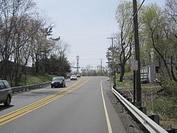
Southbound on CR 527 approaching the CR 537/524 intersection
In 1684, the 2nd Deputy Governor of East Jersey Gawen Lawrie instituted "The Burlington Path", a stagecoach route meant to connect Burlington, the Capital of West Jersey, and Perth Amboy, the Capital of East Jersey.[4] Much of modern day Monmouth Road (County Route 537) coincides in general direction and trajectory with this historic stagecoach route. By the mid 18th century, one of the stagecoach stops listed on the route was the Smithburg Tavern, suggesting that the community had already been rather established by this point.
The Smithburg Tavern was the birthplace of New Jersey politician Joel Parker, a prominent "War Democrat", who would later in life serve two nonconsecutive terms as the 20th Governor of New Jersey; one term from 1863-1866, and another term from 1872-1875. Parker died on January 2, 1888, in Philadelphia[5] and was buried in nearby Maplewood Cemetery, within the center of Freehold Township, New Jersey. His burial place also happens to be located right along the historic "Burlington Path" on what is now West Main Street (County Route 537), adjacent to the Freehold Raceway Mall.
The Smithburg General Store, the only store in the area, operated on the corner opposite the Smithburg Tavern on County Route 537 and Smithburg Road.
The only sawmill in the area, located on County Route 537, produced lumber for building in Smithburg and Freehold. [citation needed]
Some farmers claim Hessians, mercenary German soldiers for the British during the Revolutionary War, either deserted their fighting at the Monmouth Battlefield or lost their way. Their bodies were found on the site of a local farm.[citation needed]
This page is based on this Wikipedia article Text is available under the CC BY-SA 4.0 license; additional terms may apply. Images, videos and audio are available under their respective licenses.